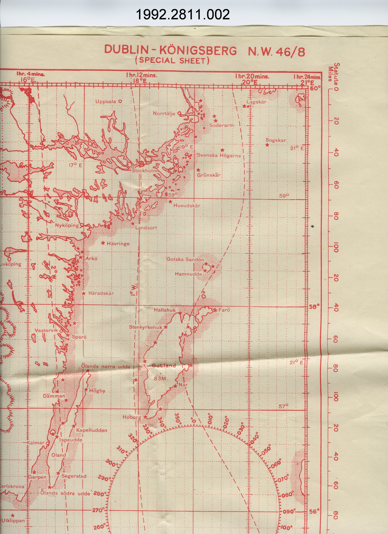
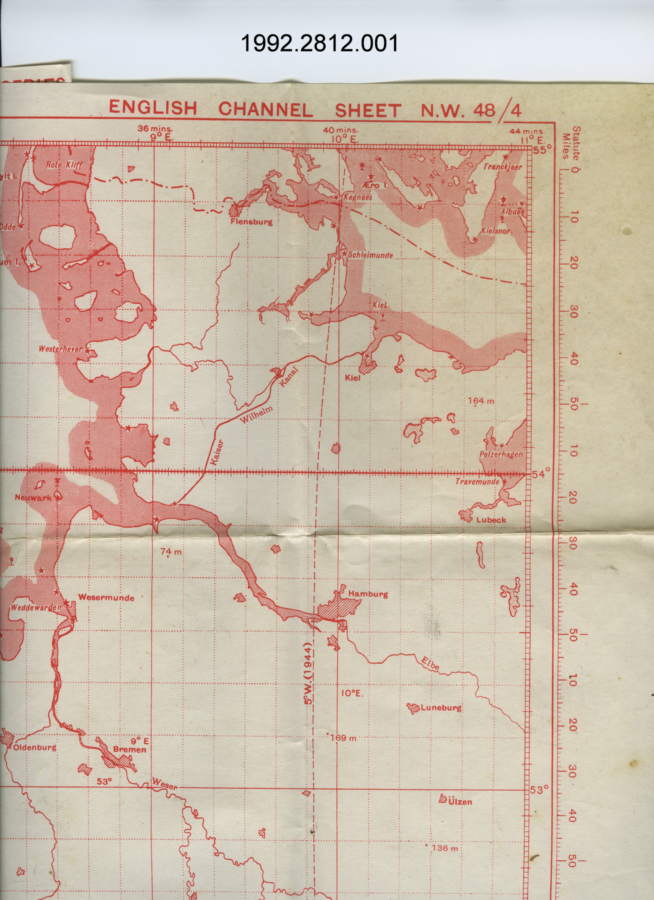
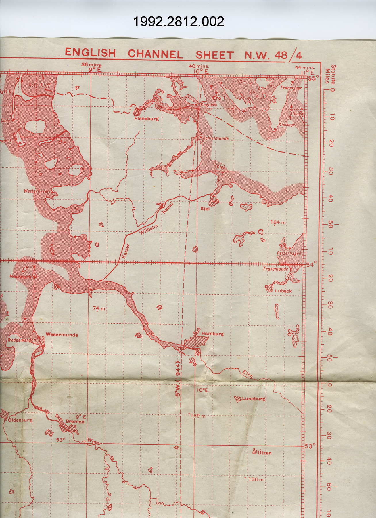
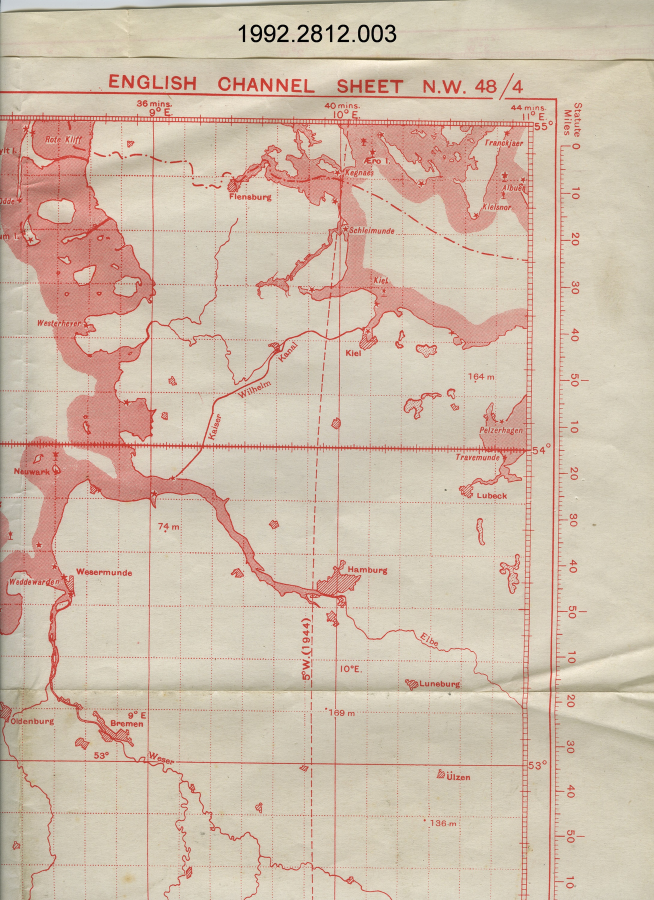
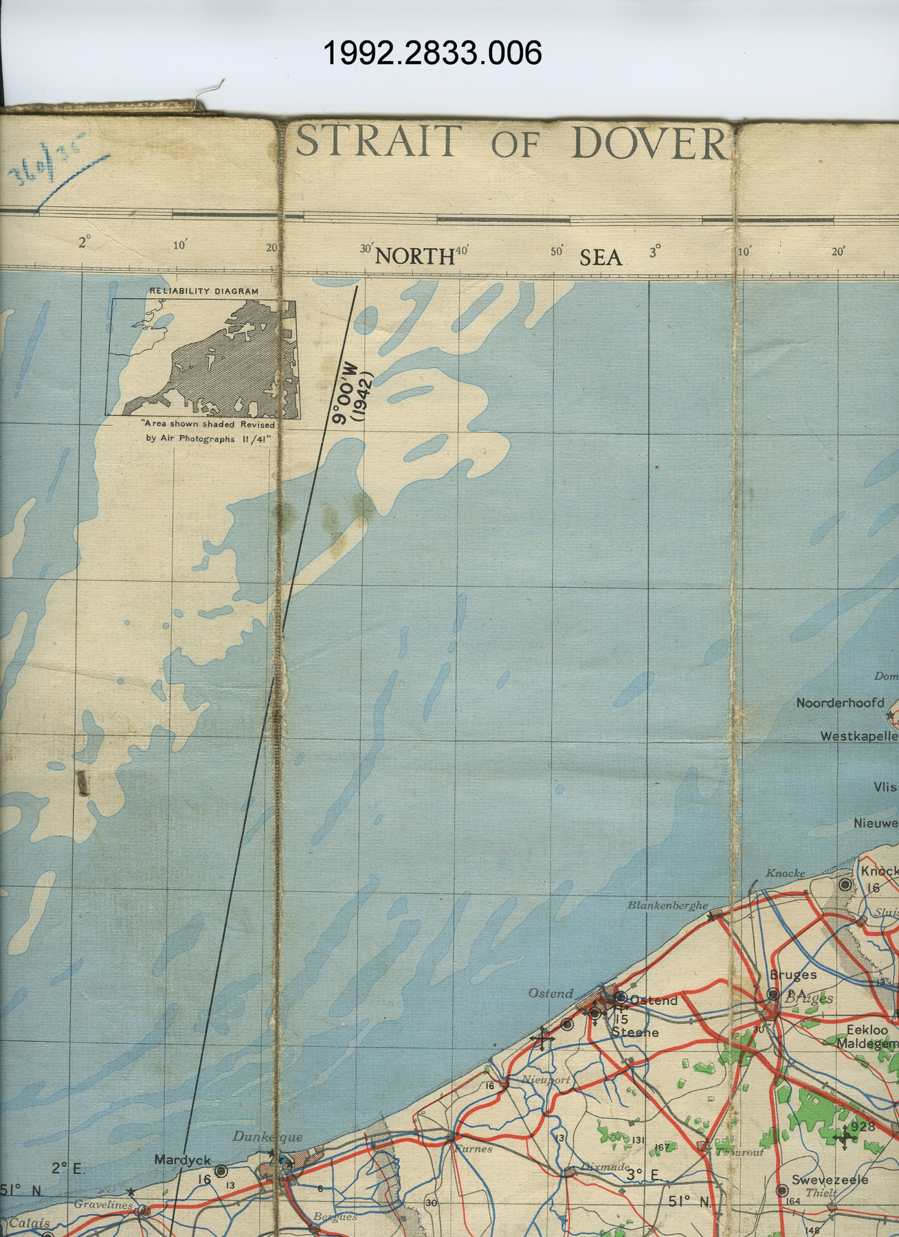
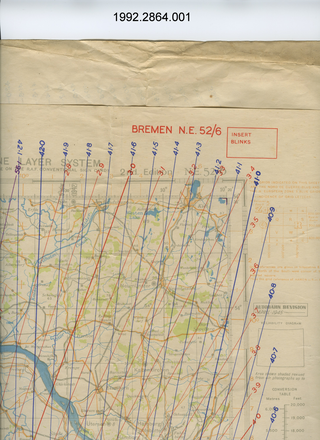
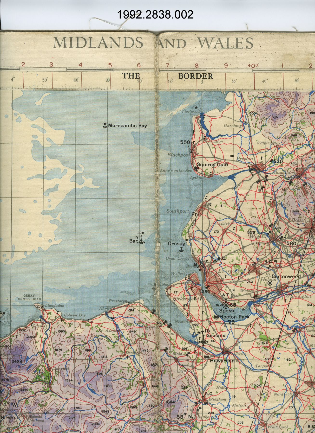
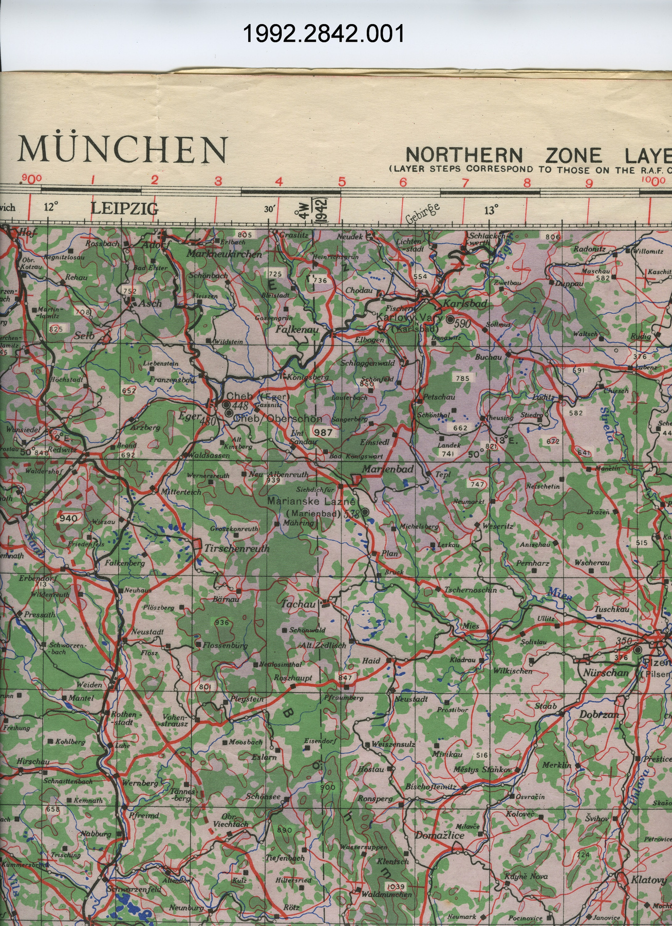
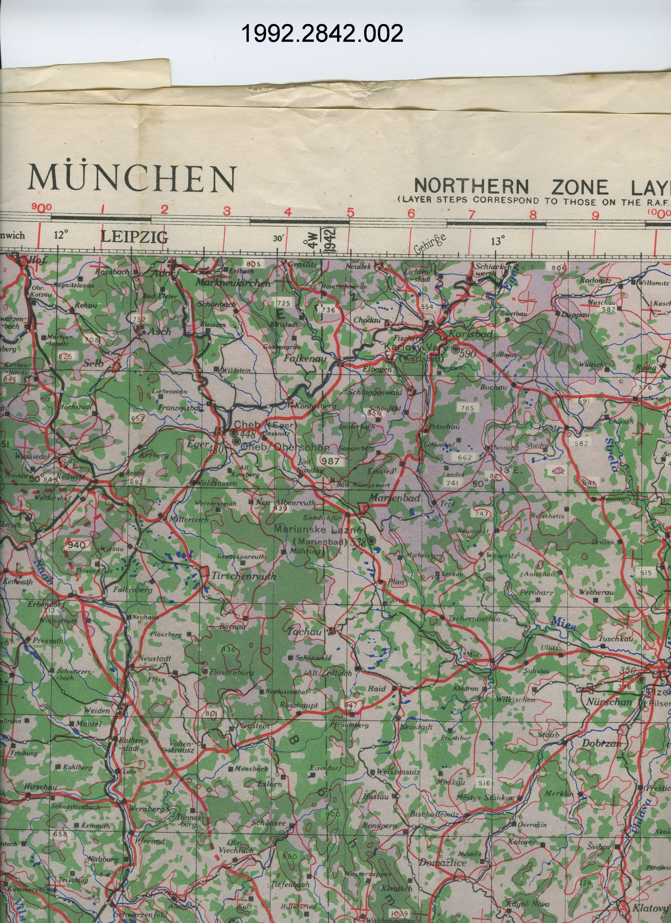
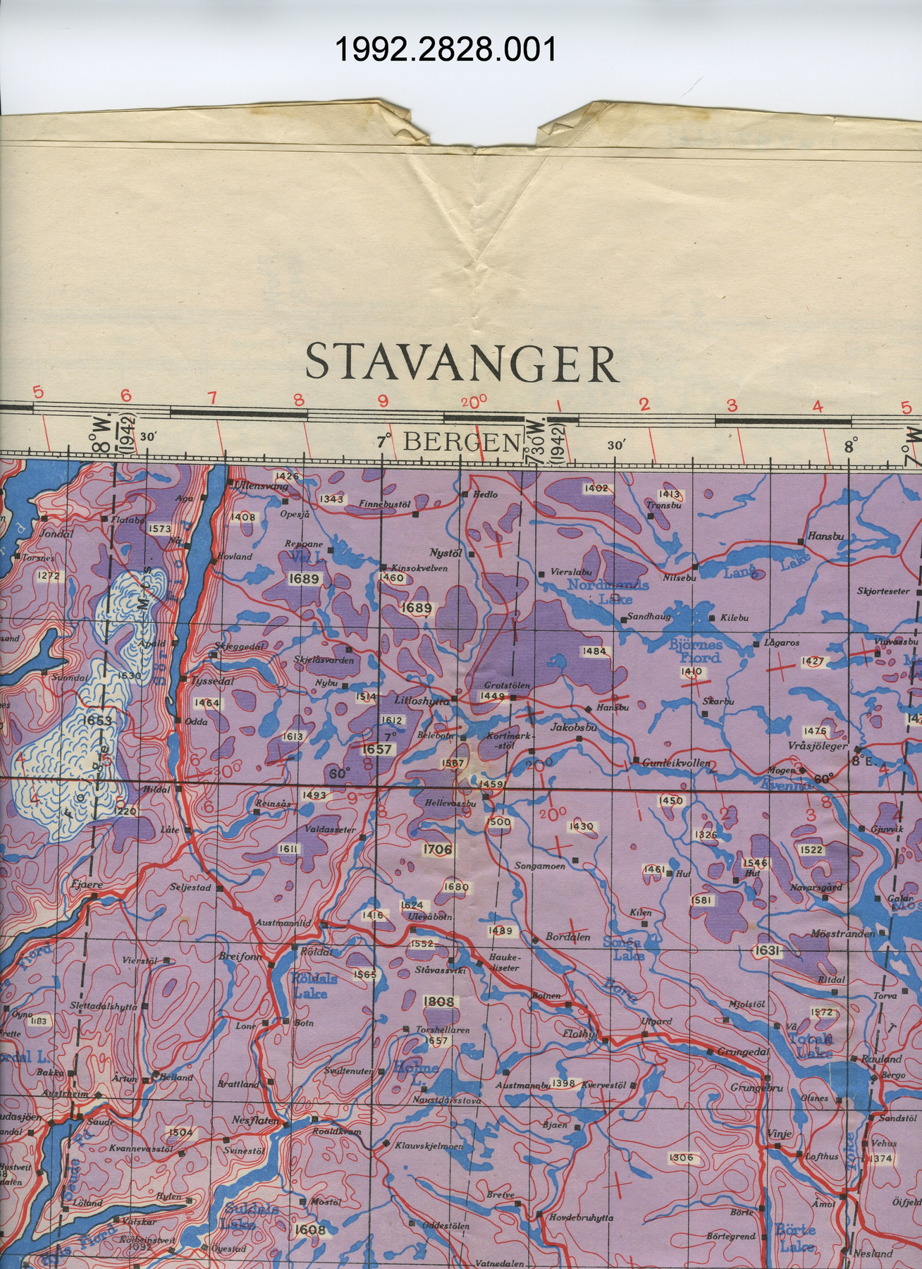
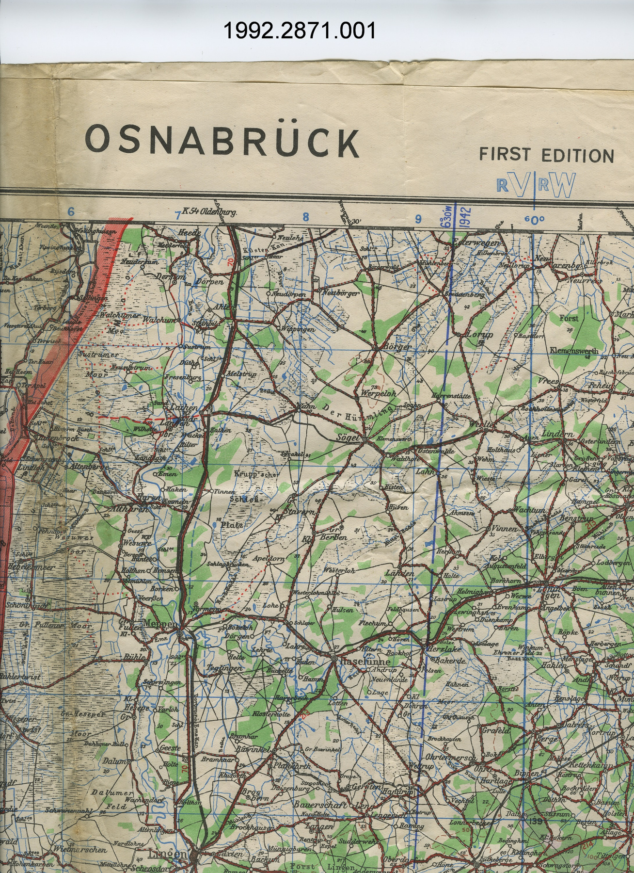
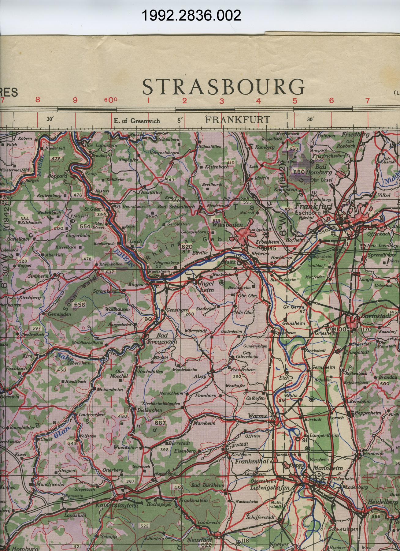
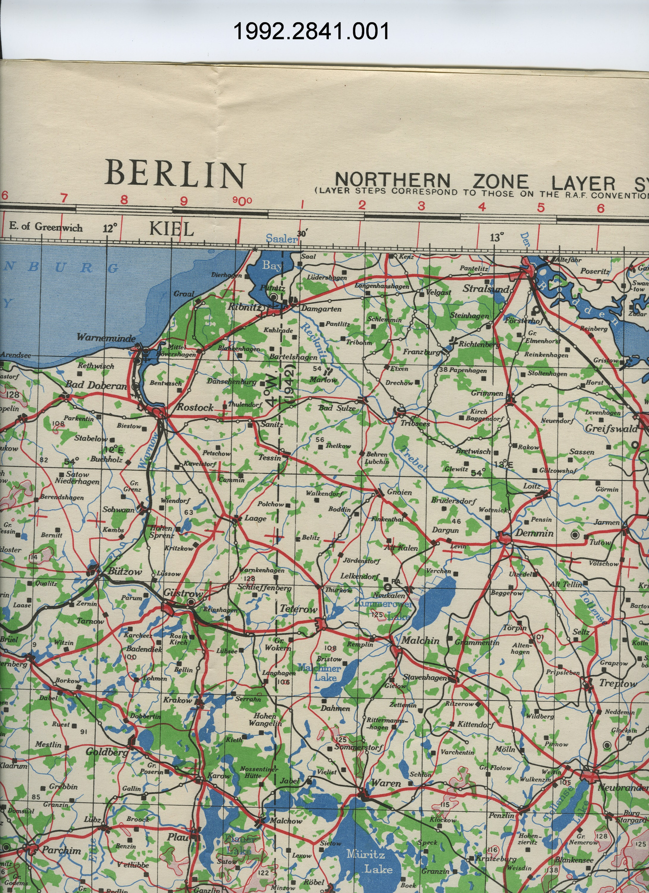
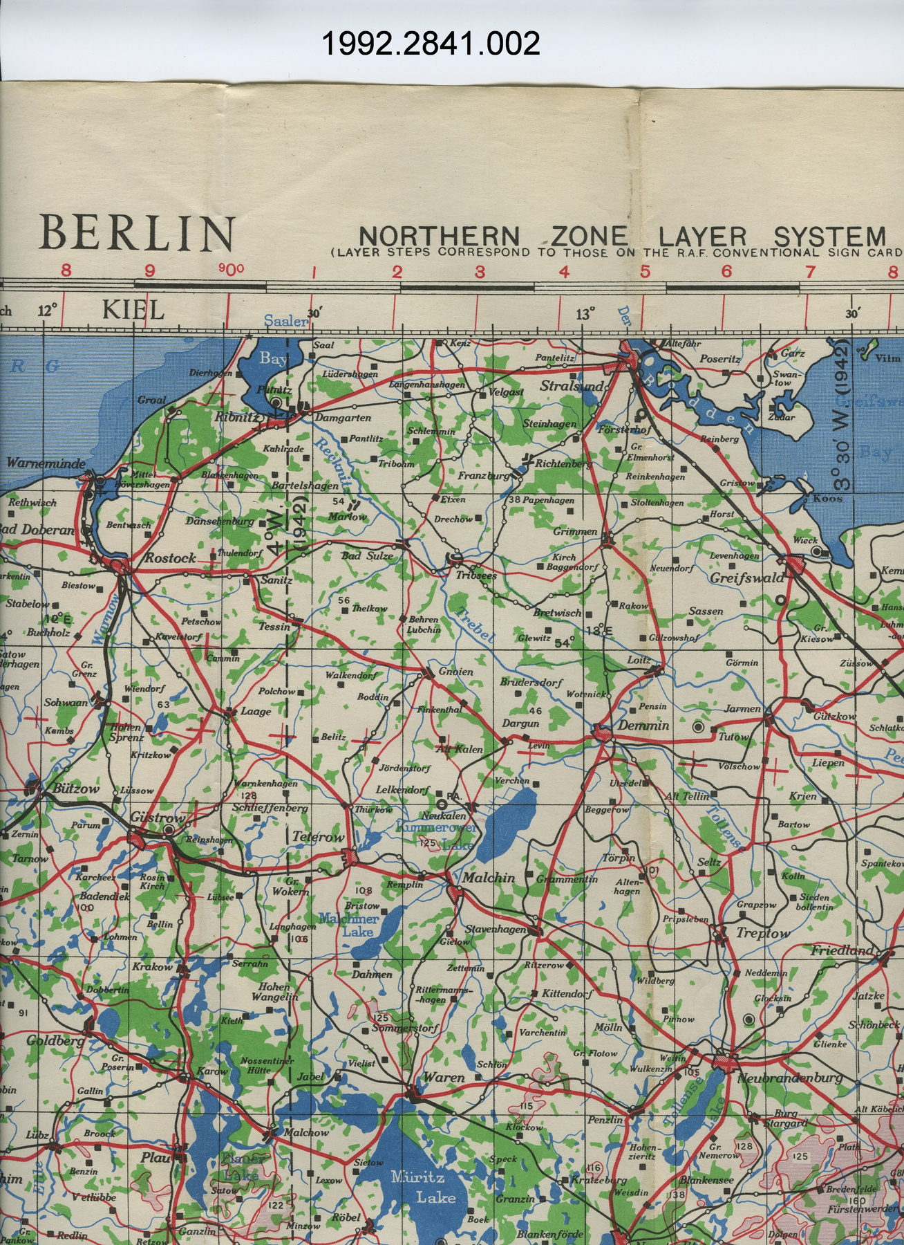
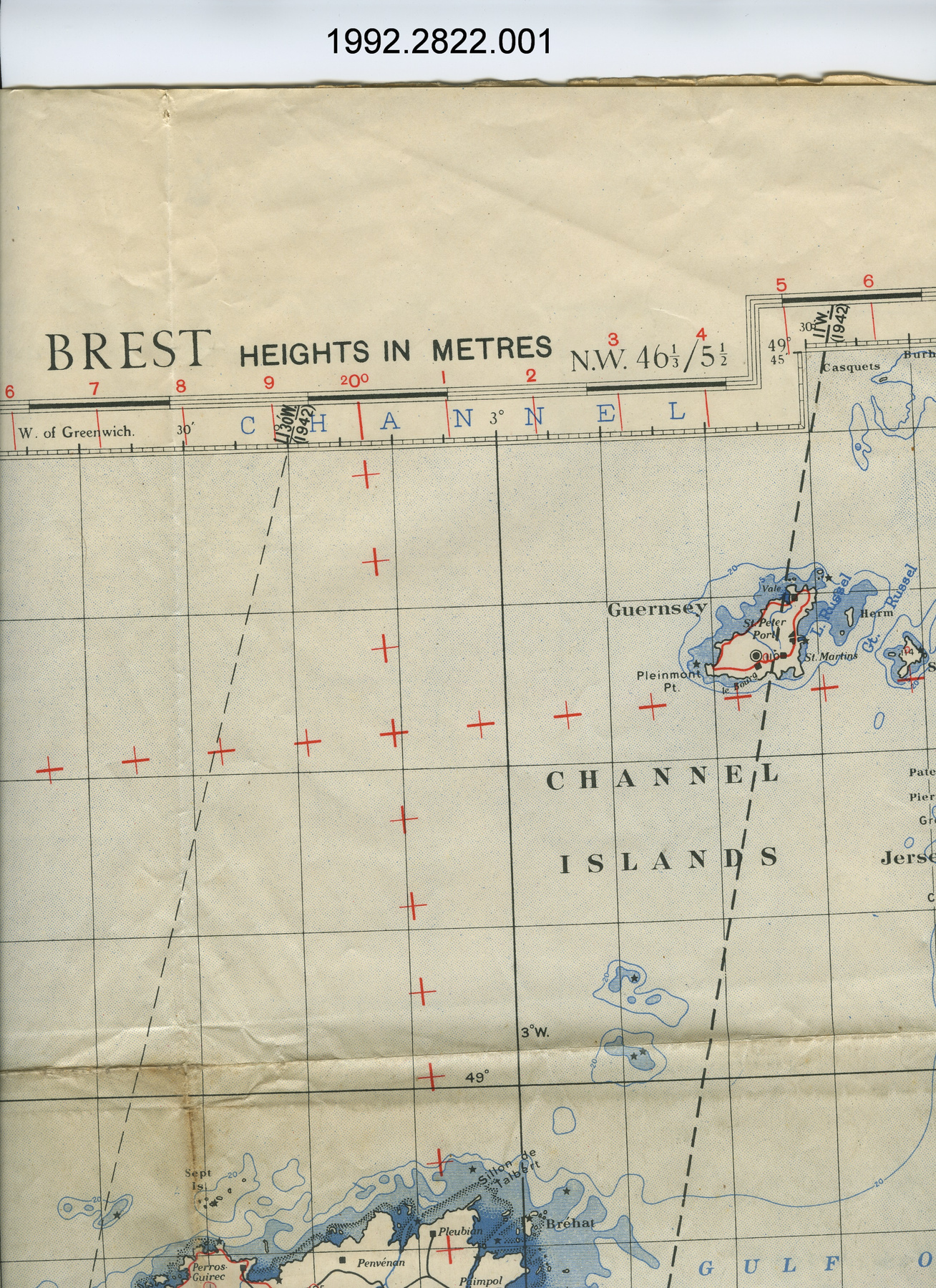
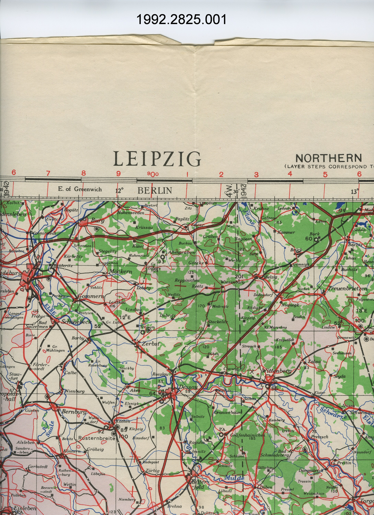
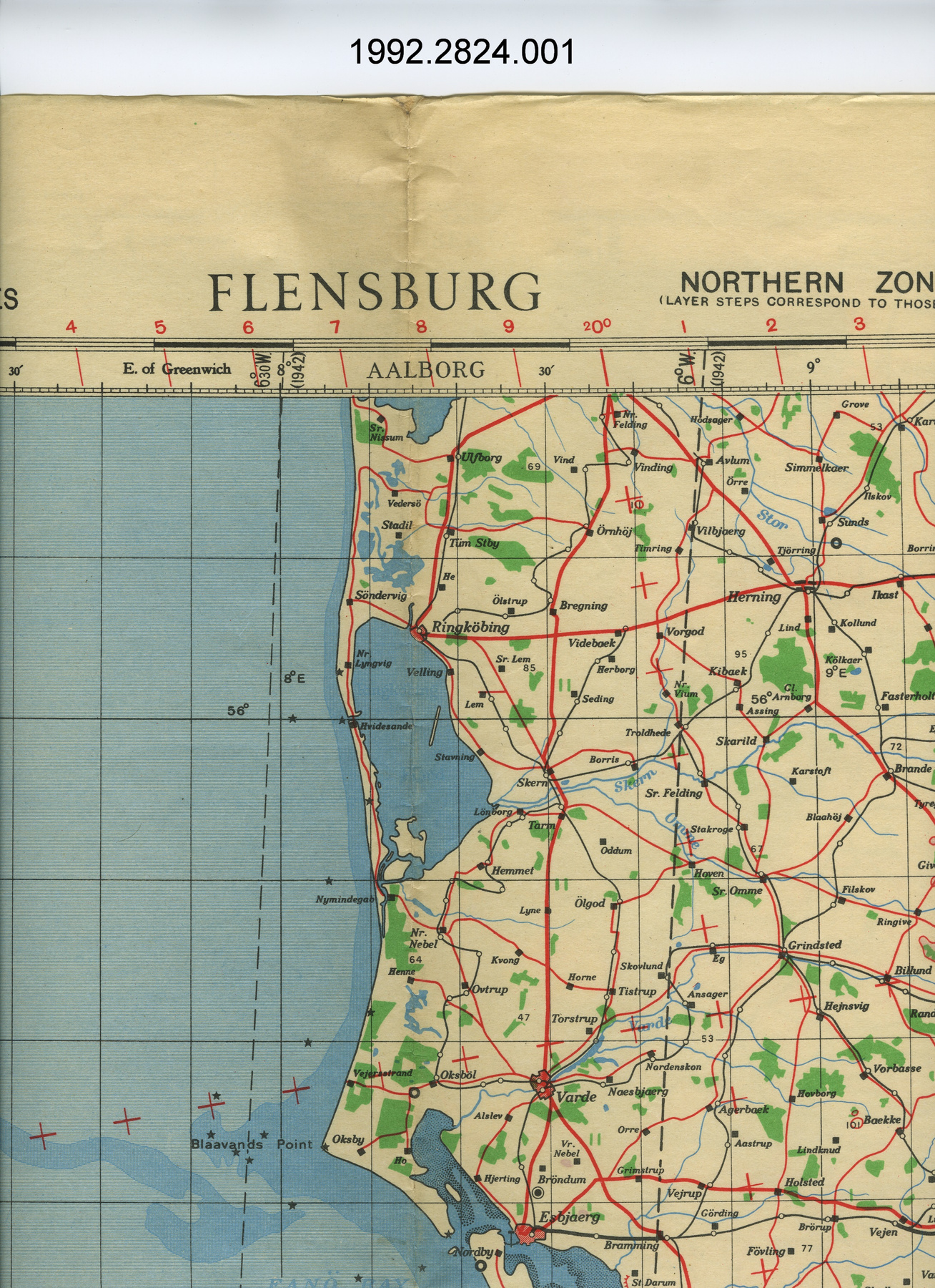
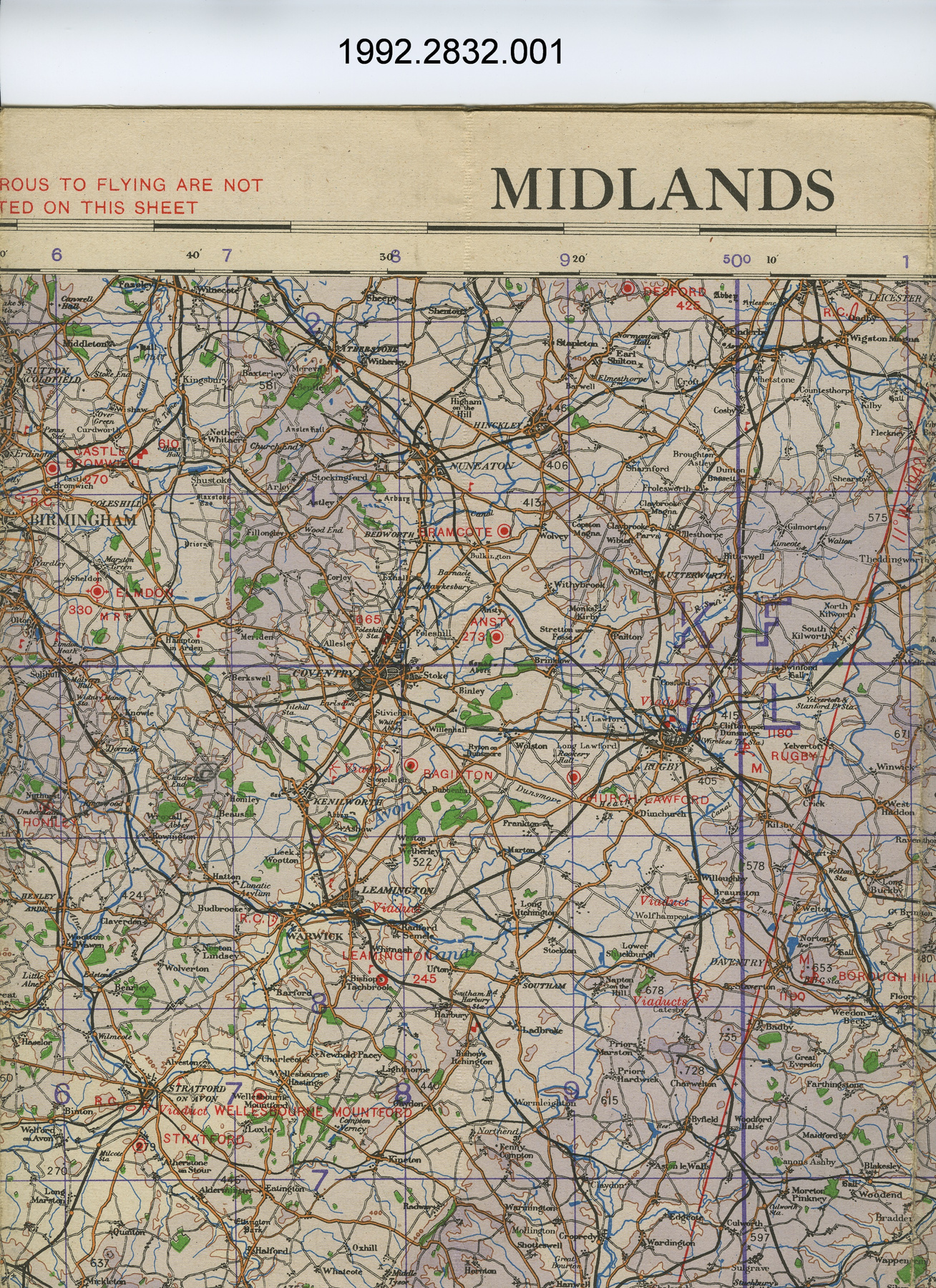
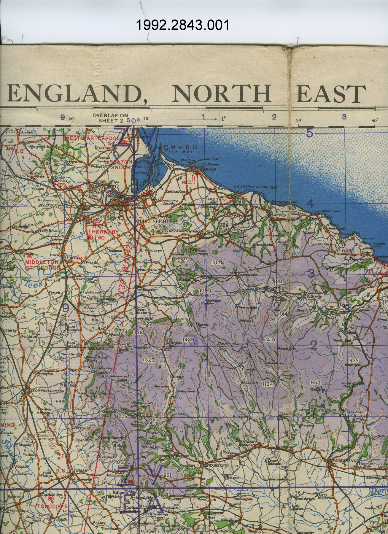
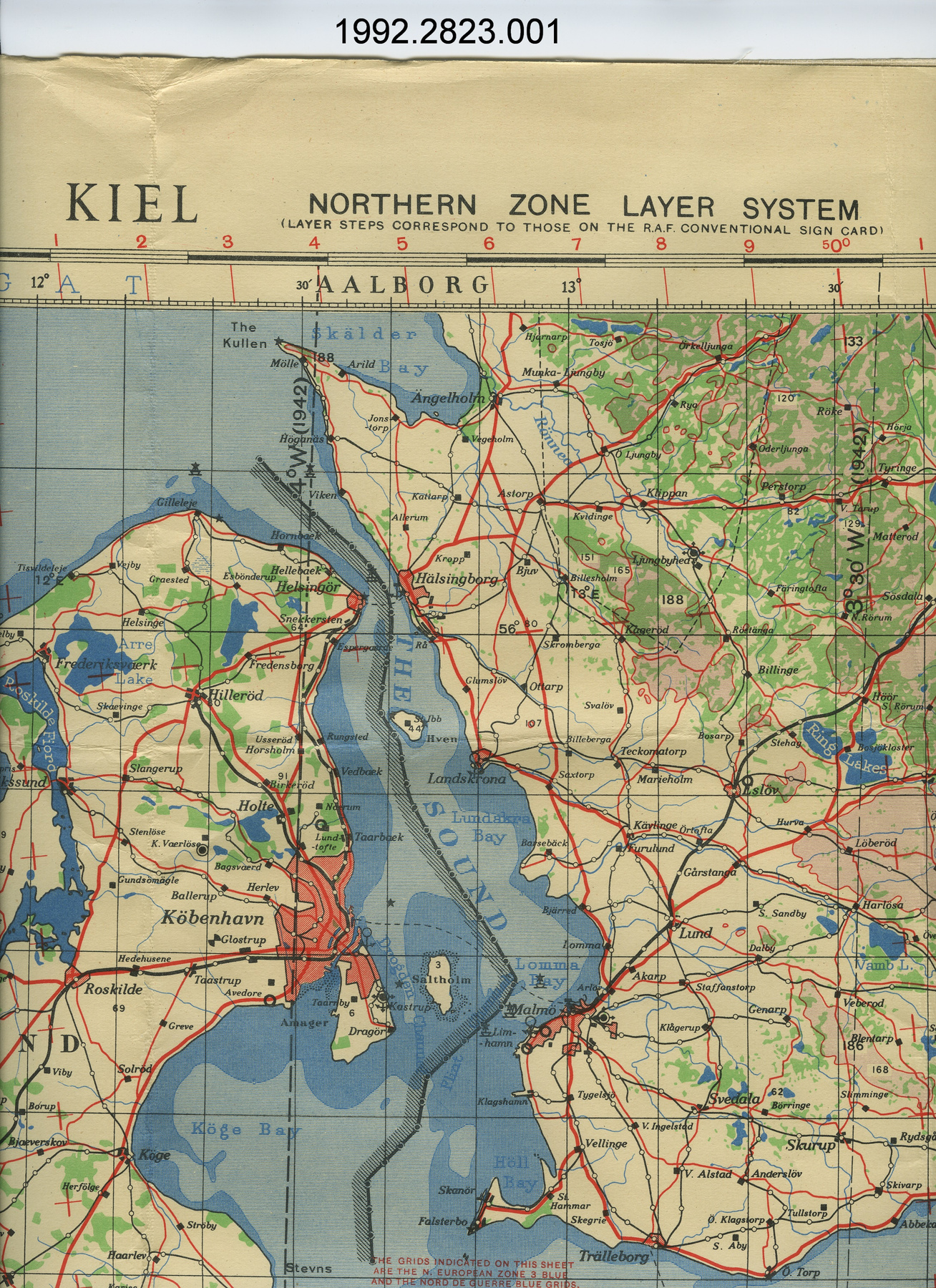
Map
Use this image
Can I reuse this image without permission? Yes
Object images on the Ingenium Collection’s portal have the following Creative Commons license:
Copyright Ingenium / CC BY-NC-ND (Attribution-NonCommercial 4.0 International (CC BY-NC 4.0)
ATTRIBUTE THIS IMAGE
Ingenium,
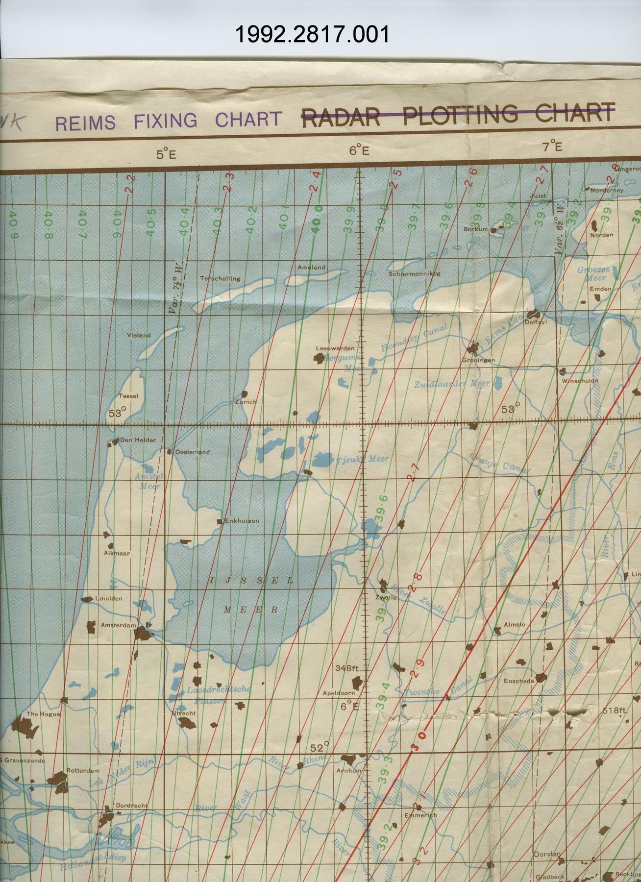
1992.2817.001
Permalink:
Ingenium is releasing this image under the Creative Commons licensing framework, and encourages downloading and reuse for non-commercial purposes. Please acknowledge Ingenium and cite the artifact number.
DOWNLOAD IMAGEPURCHASE THIS IMAGE
This image is free for non-commercial use.
For commercial use, please consult our Reproduction Fees and contact us to purchase the image.
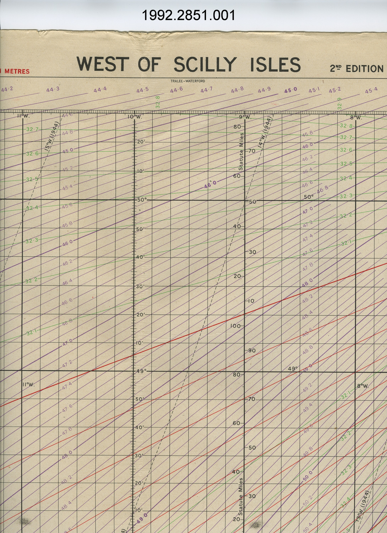
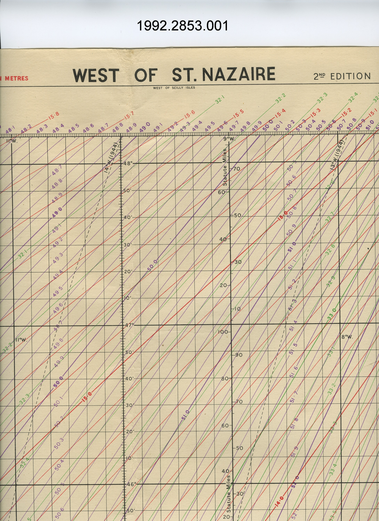
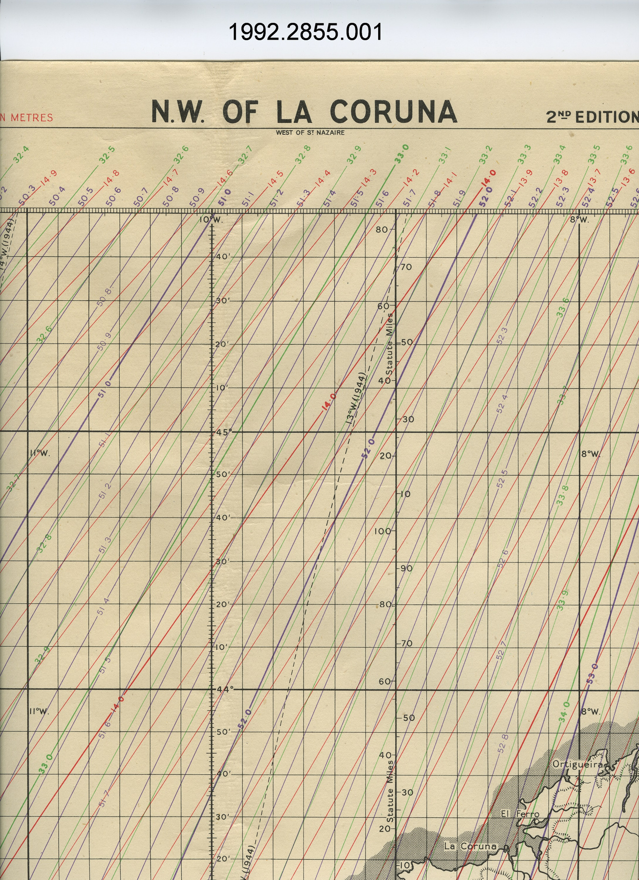
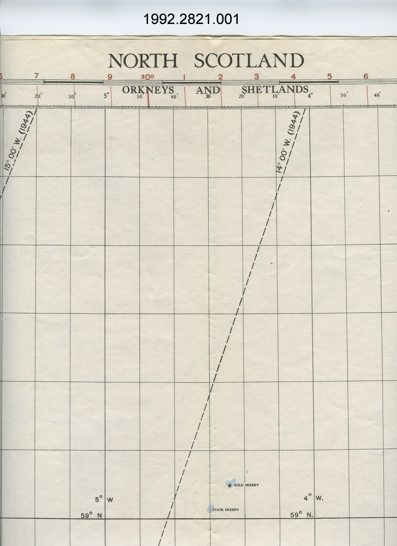
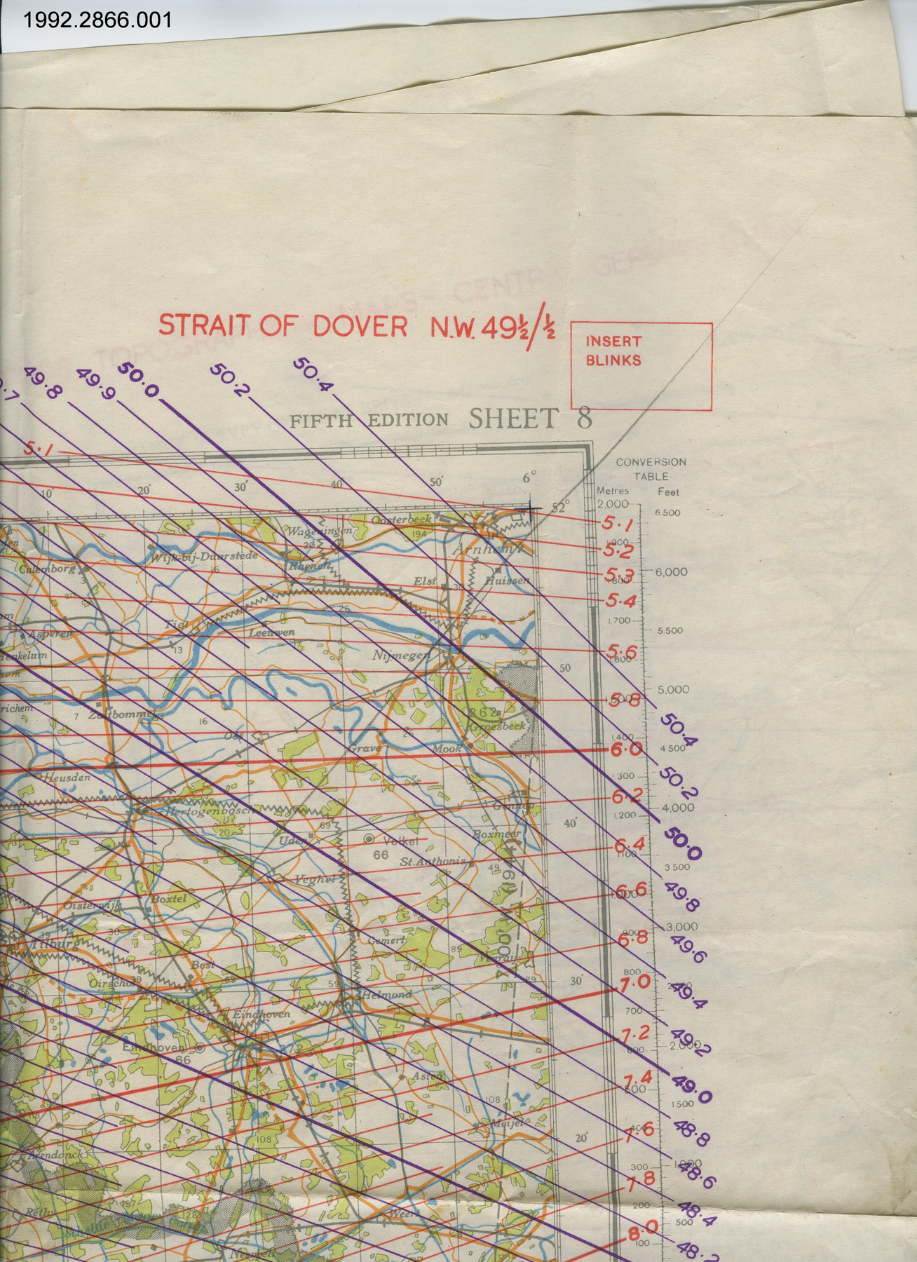
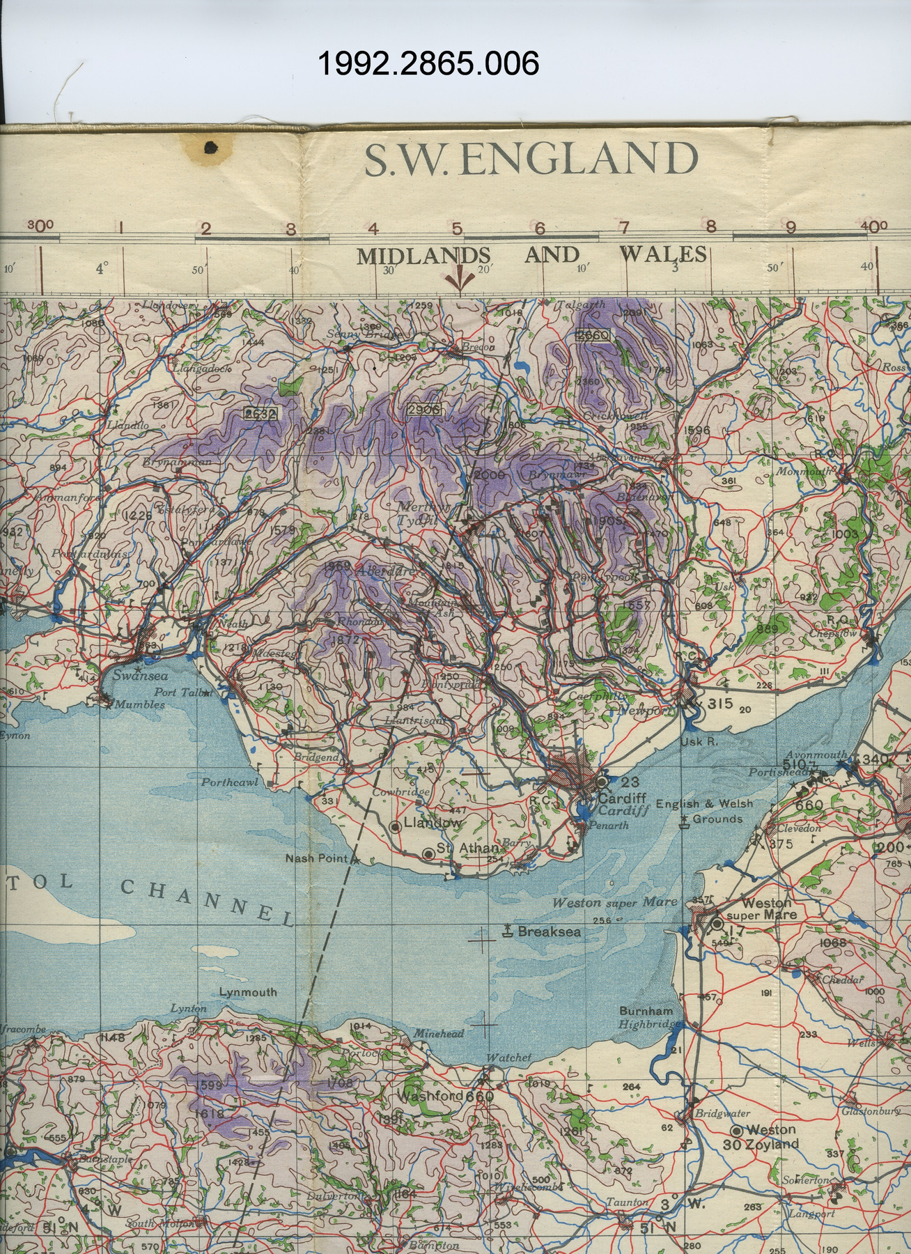
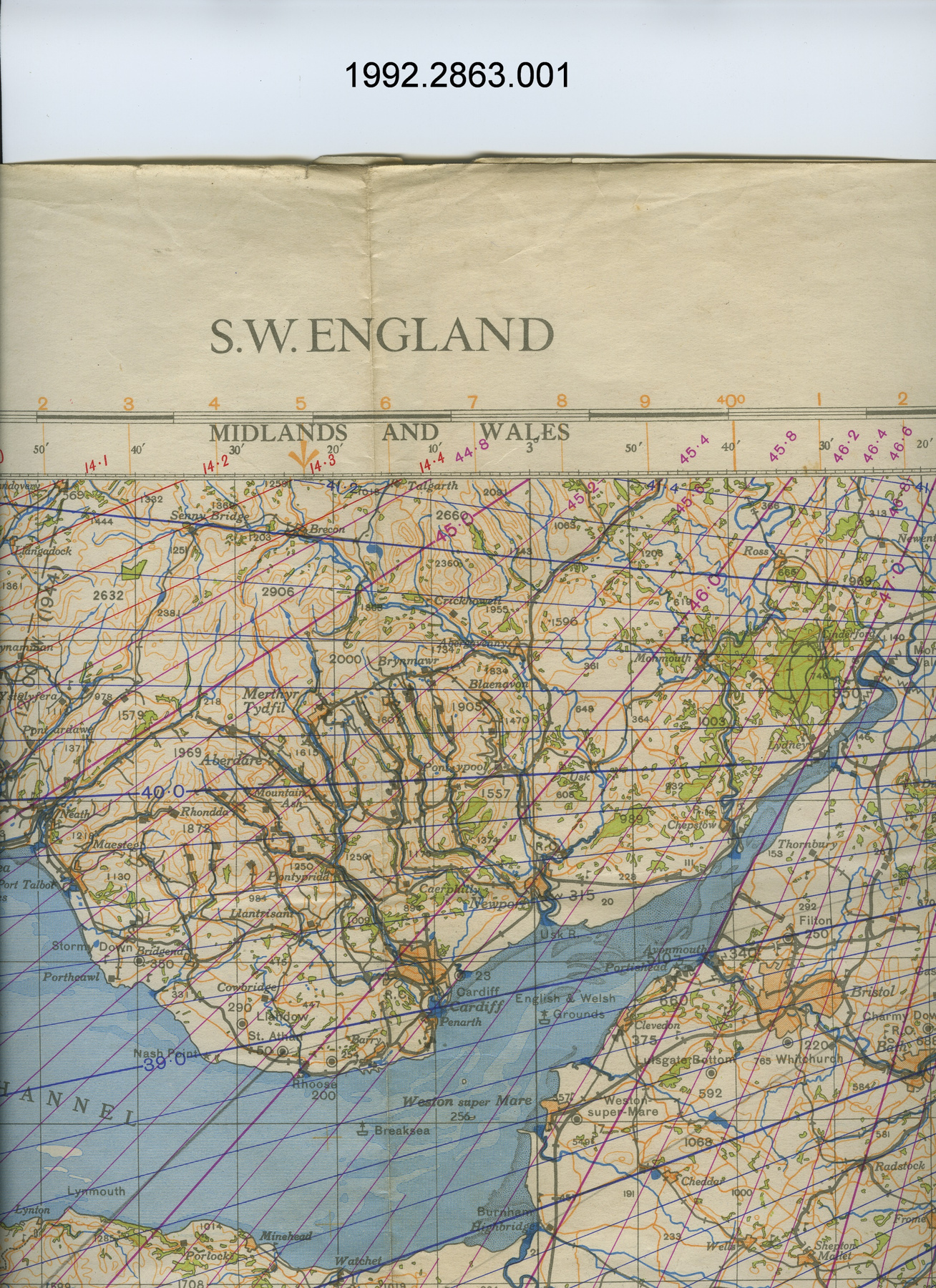
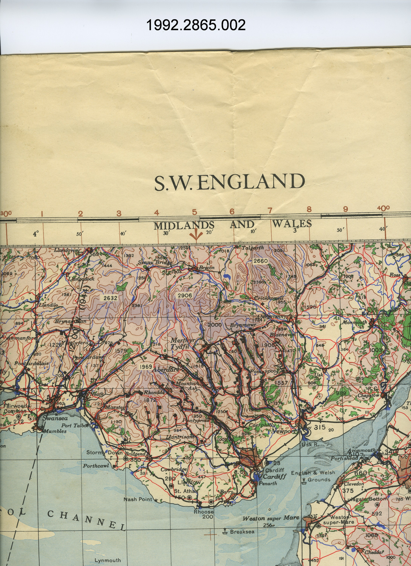
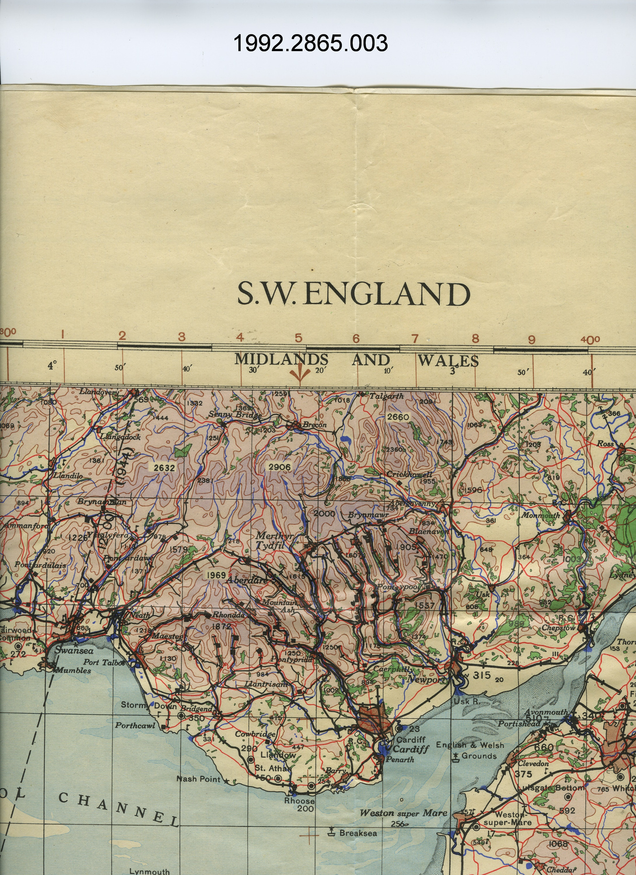
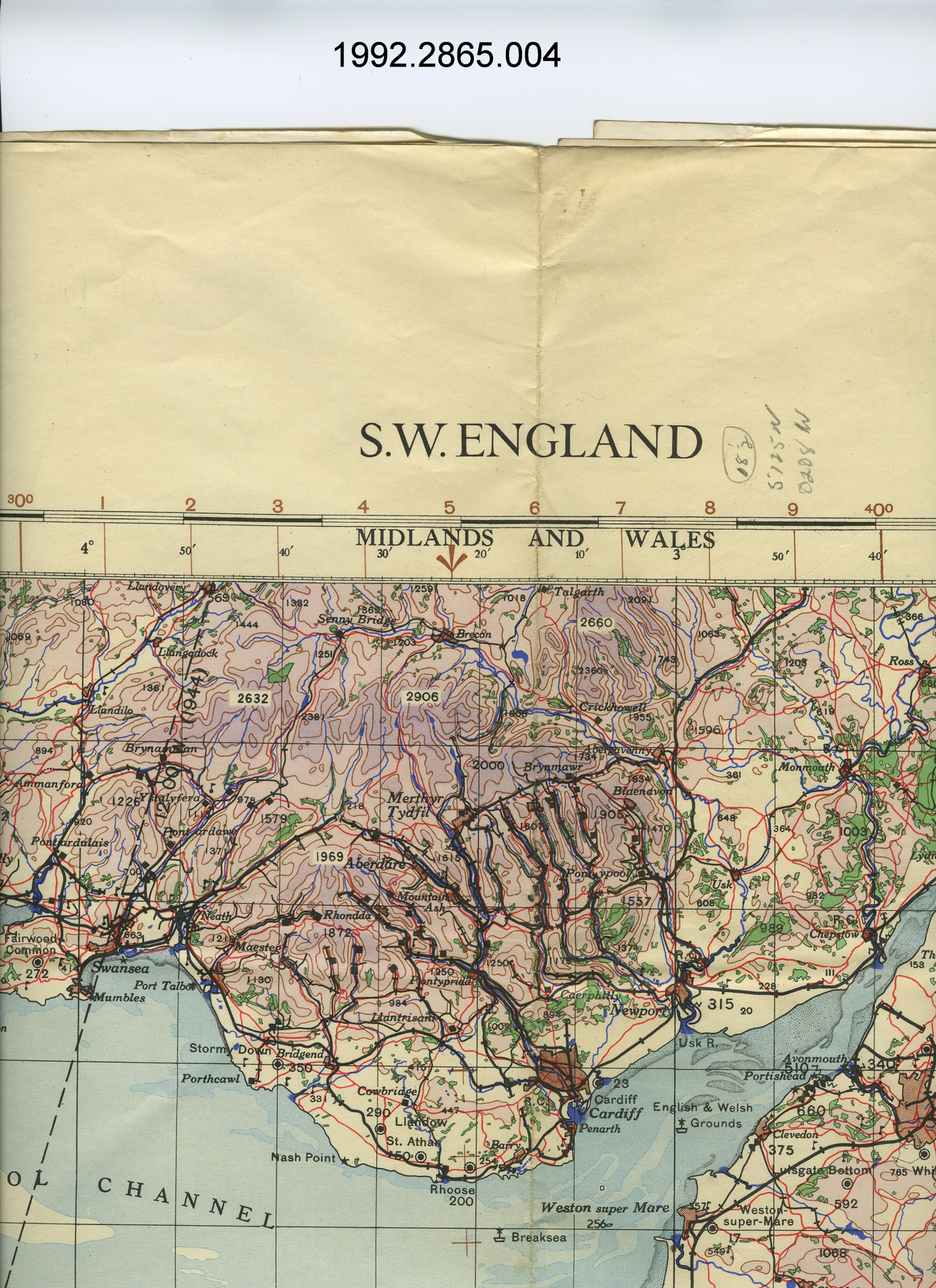
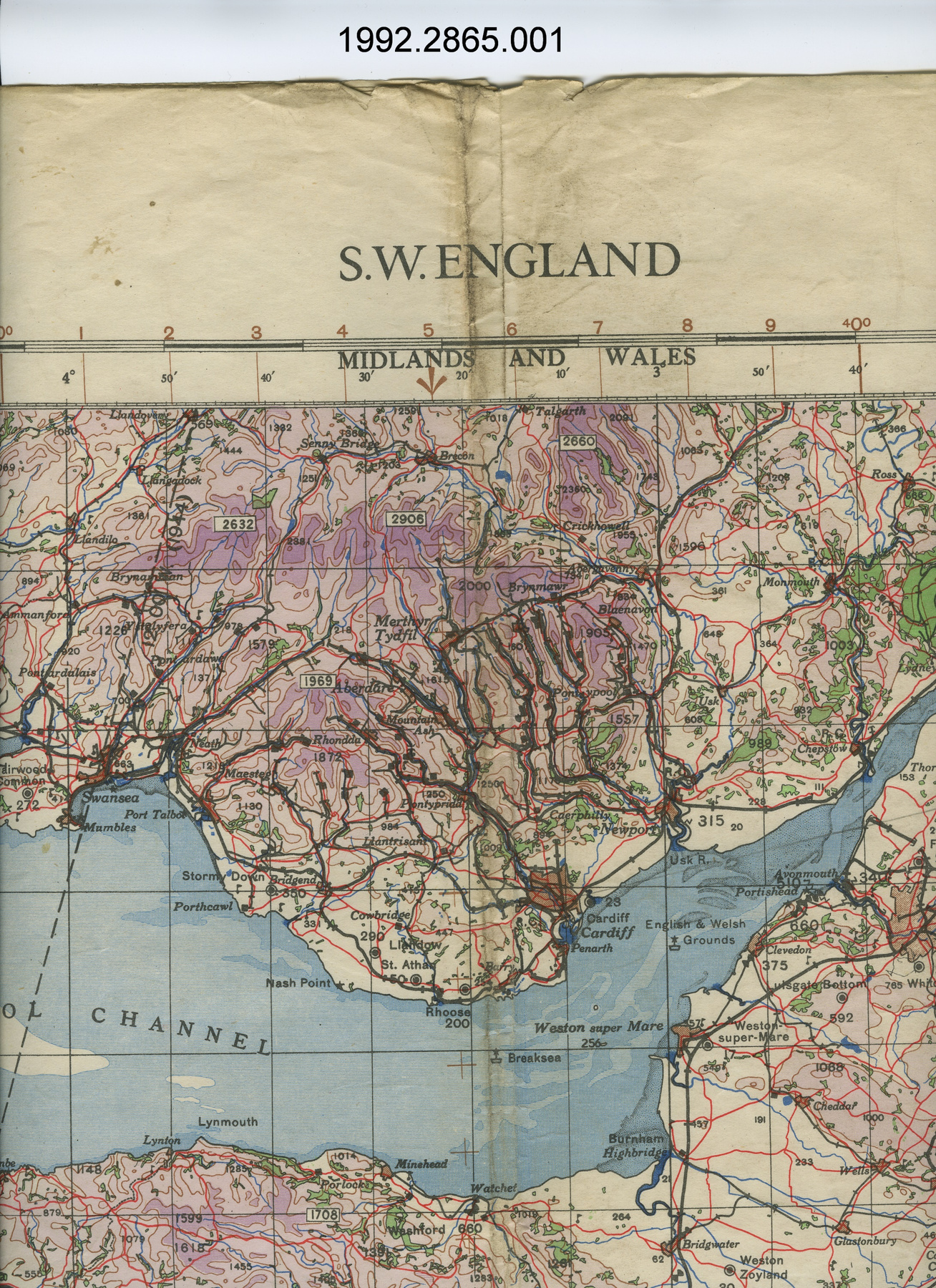
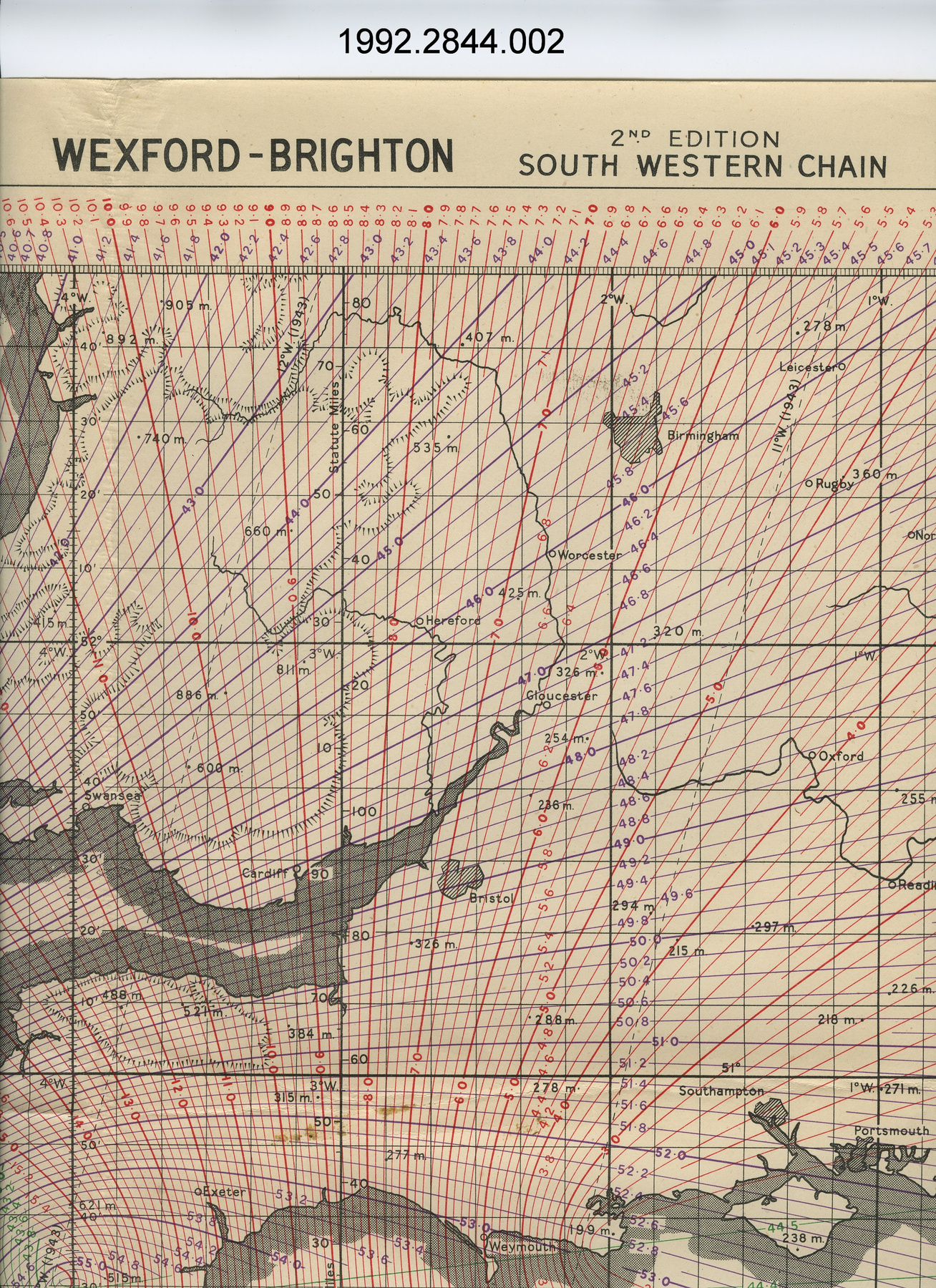
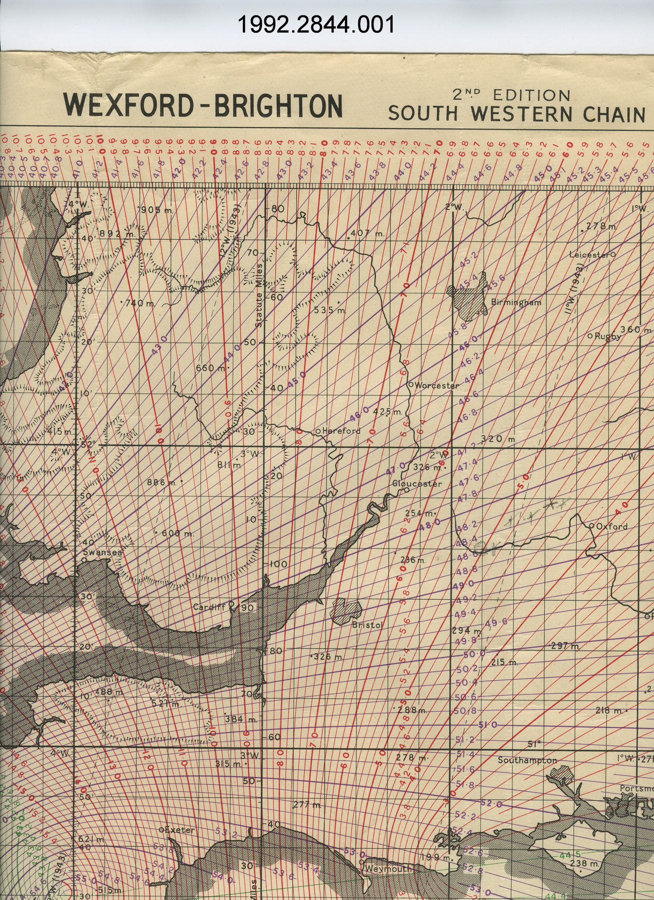
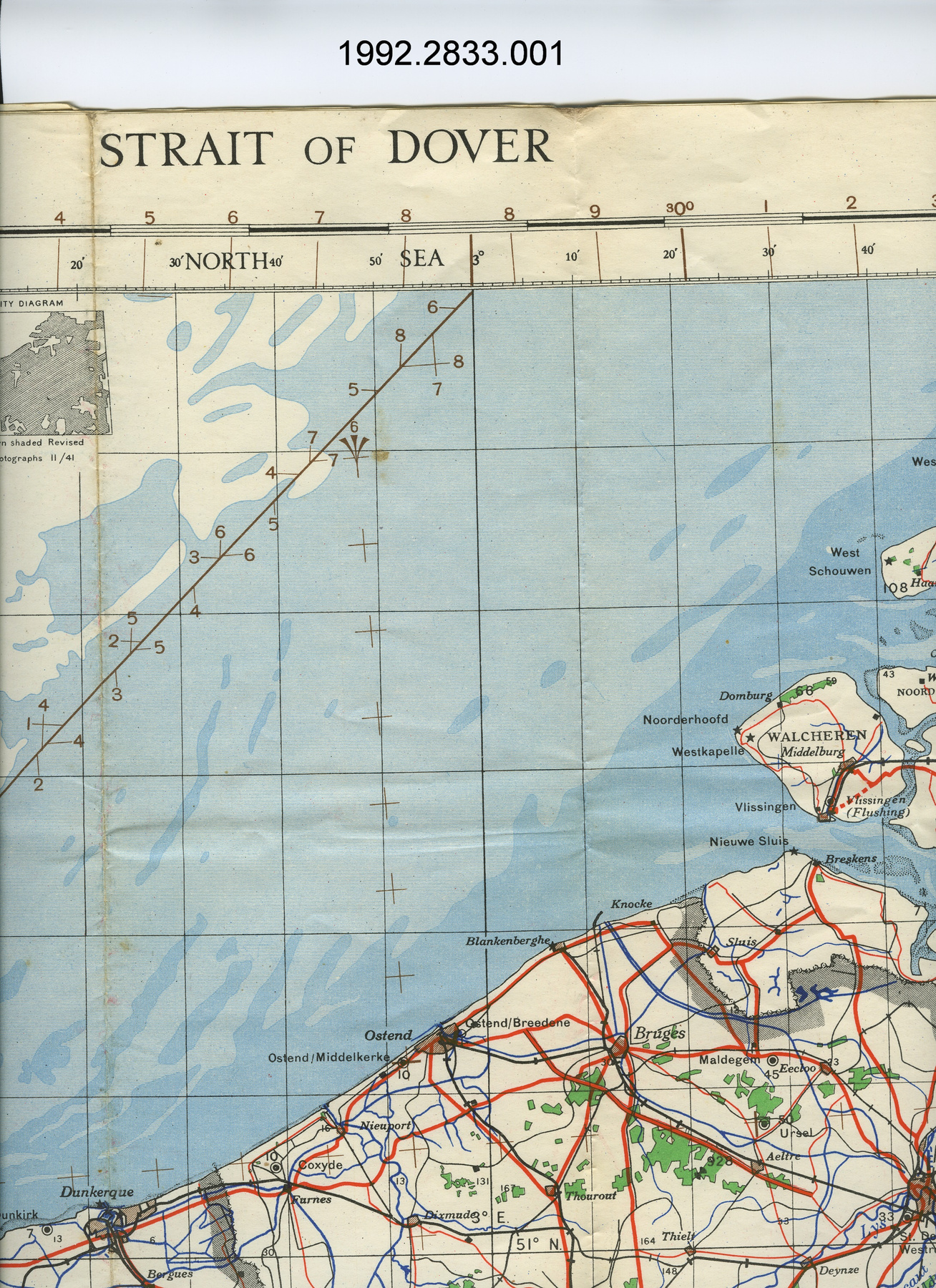
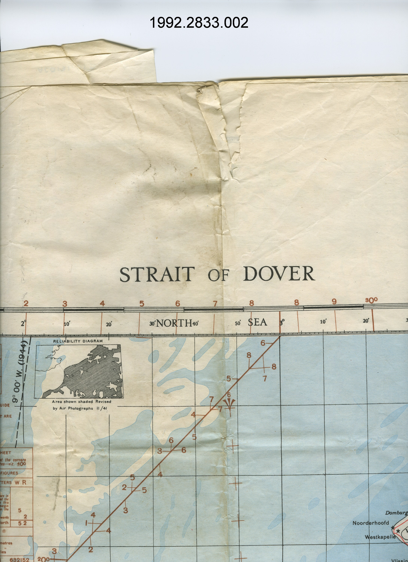
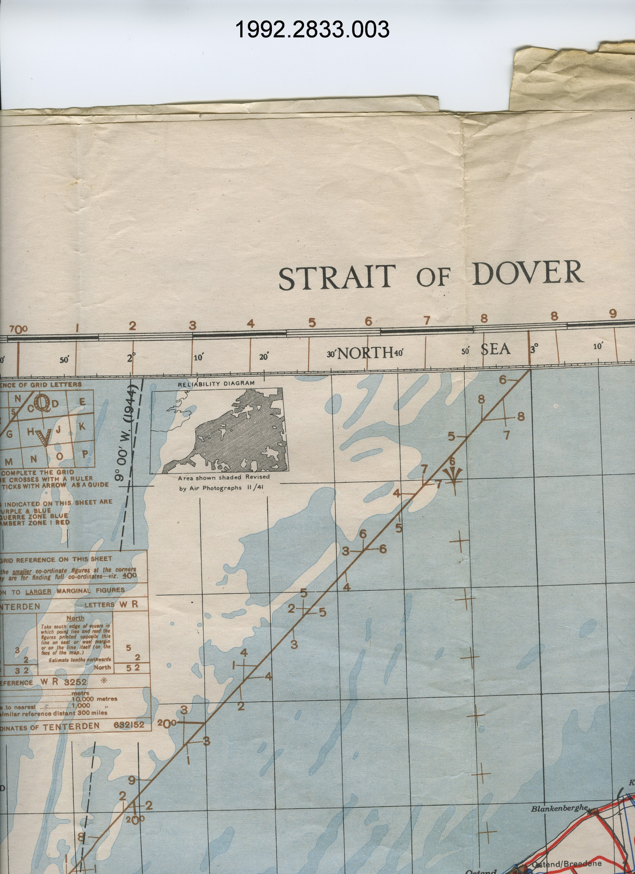
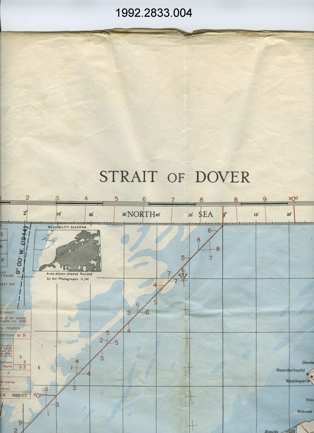
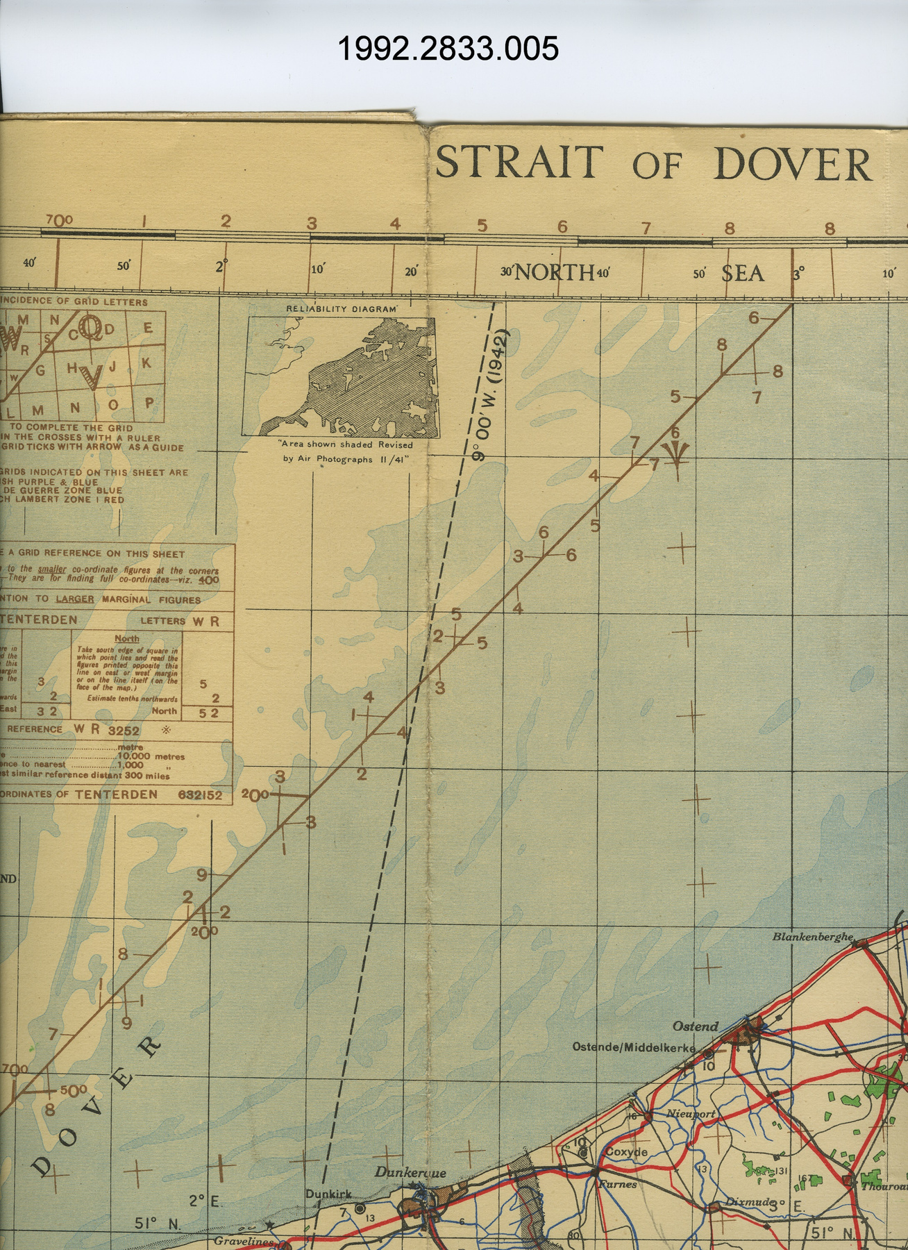
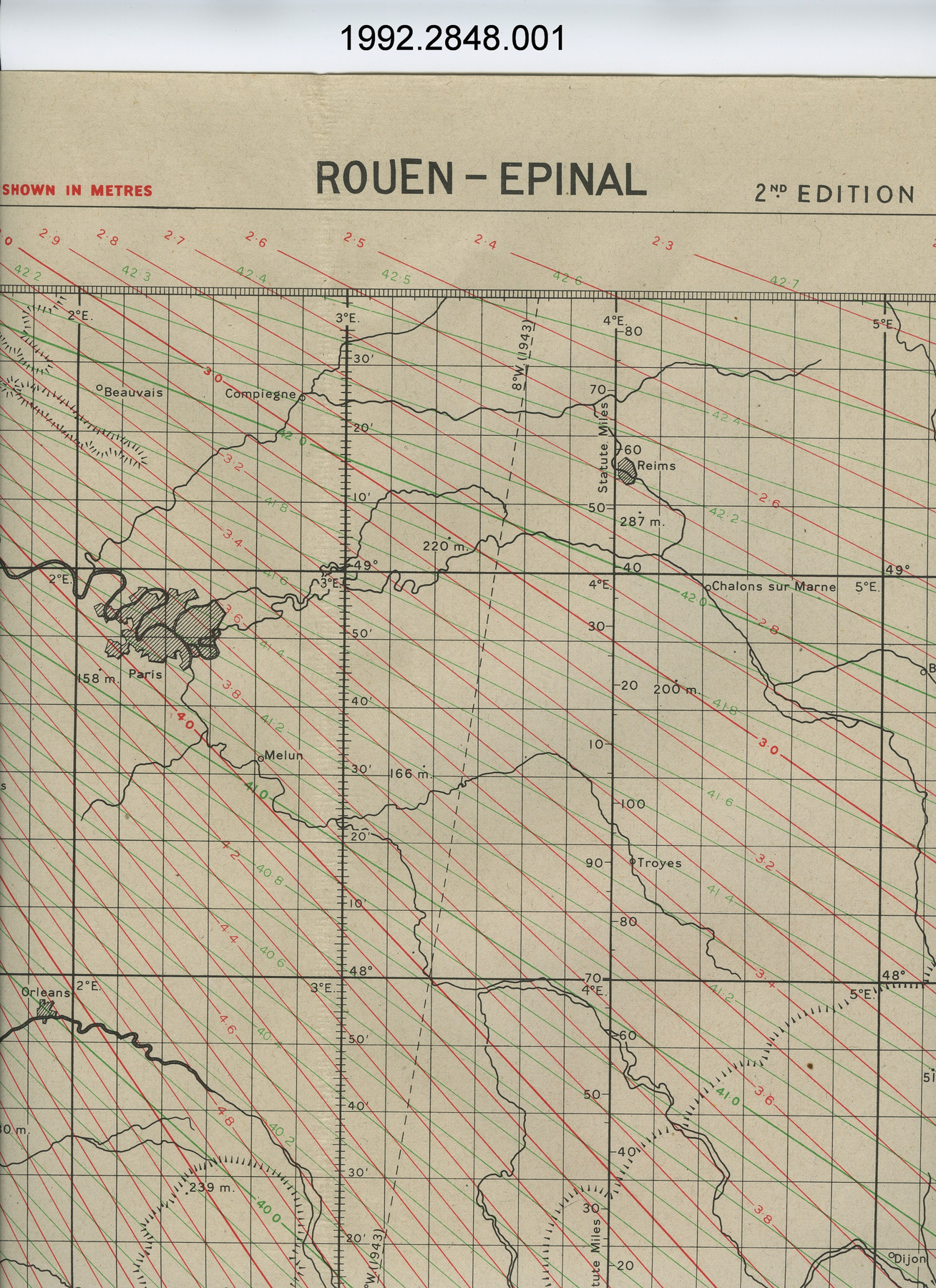
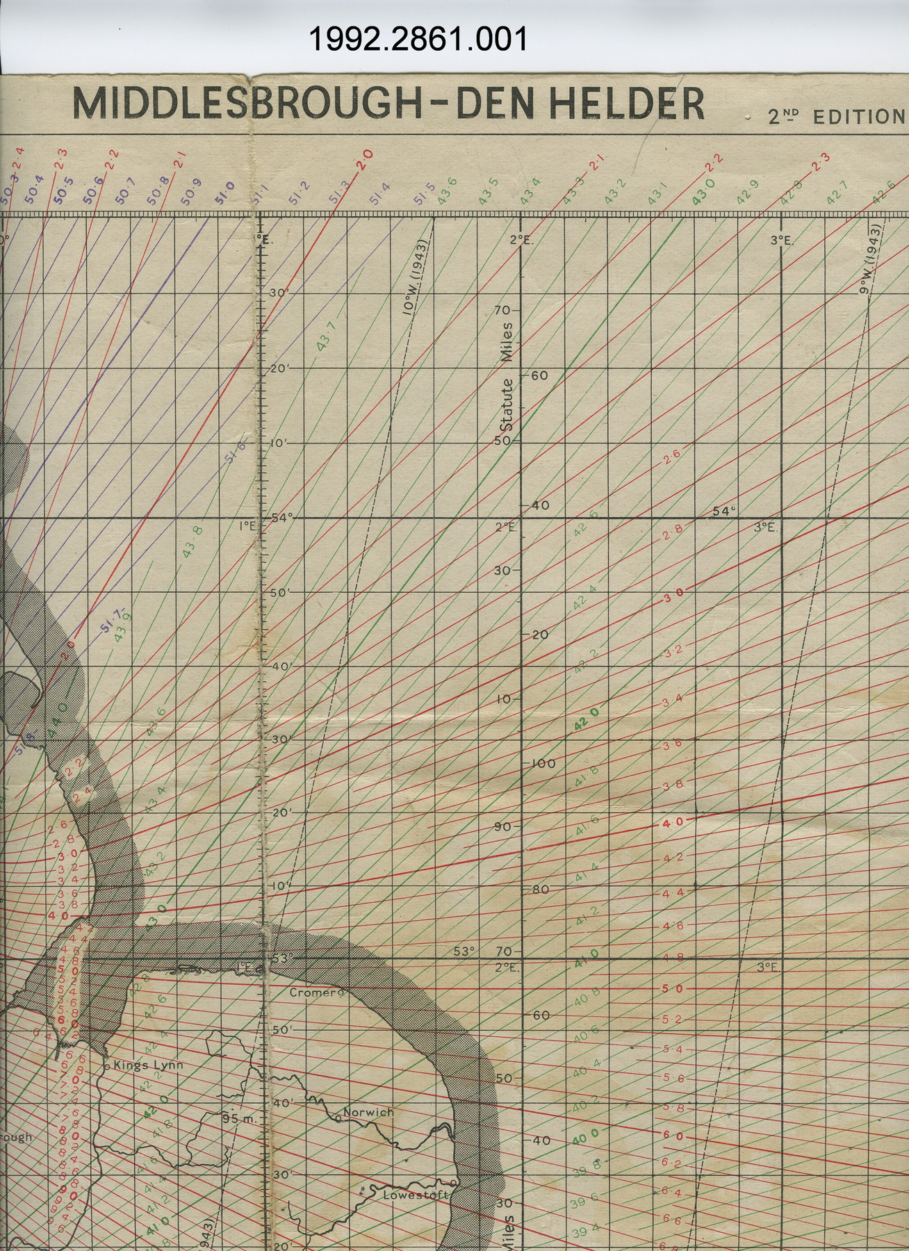
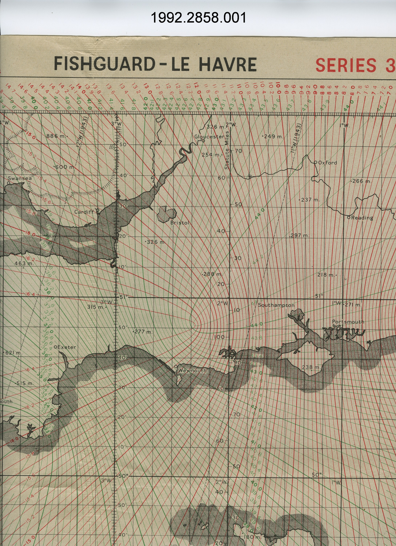
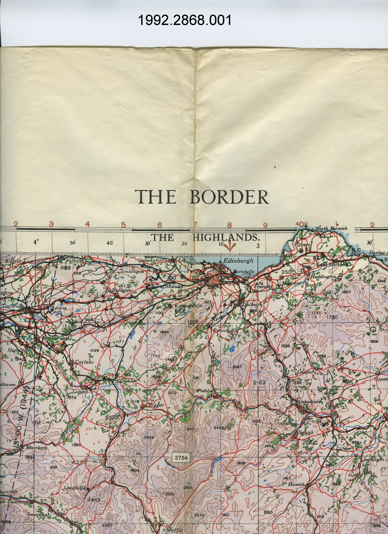
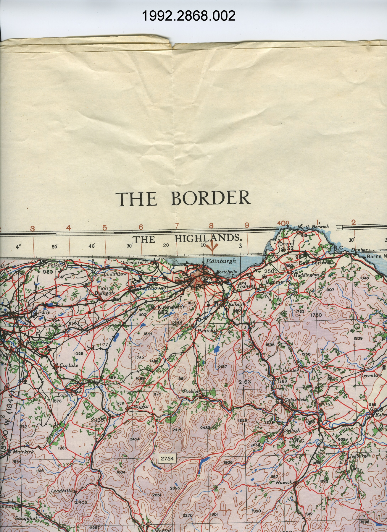
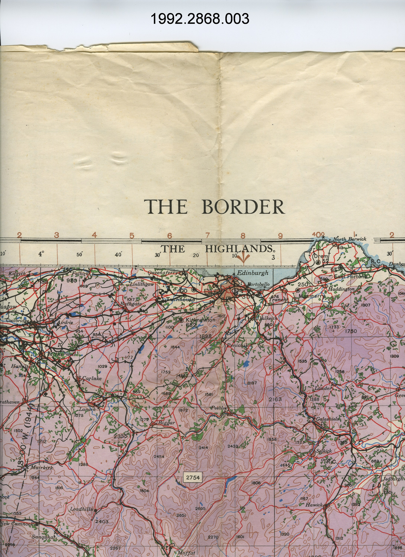
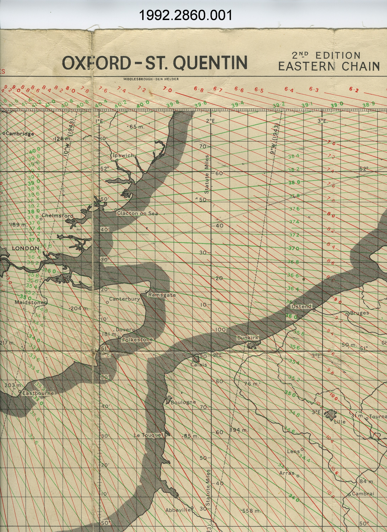
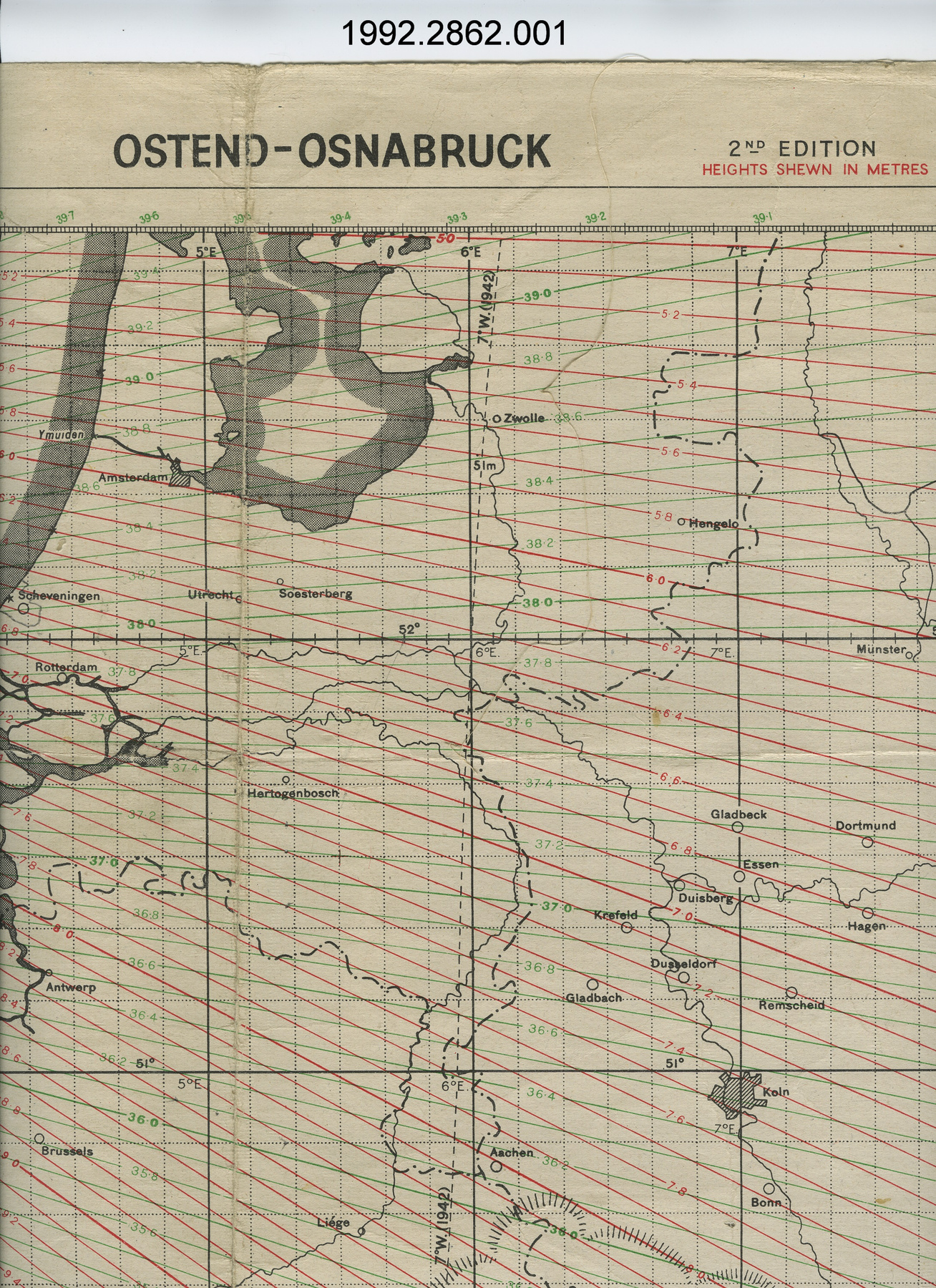
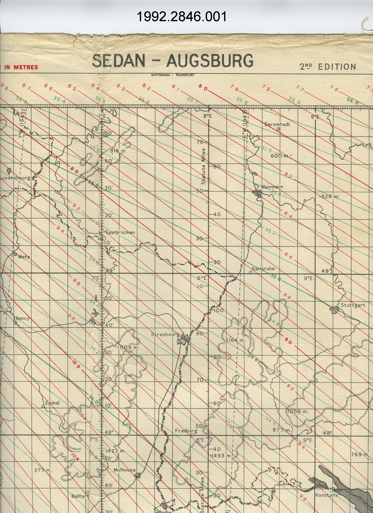
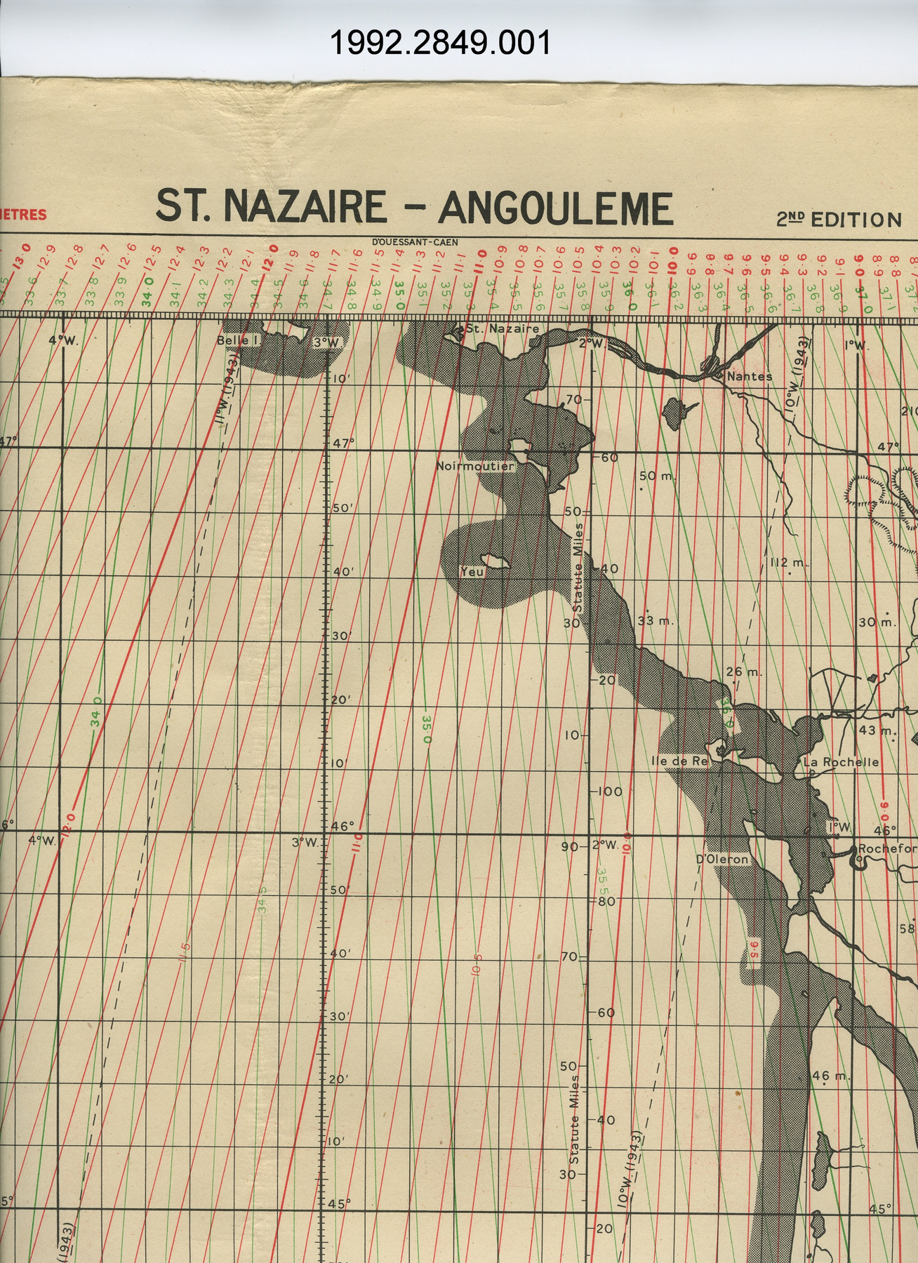
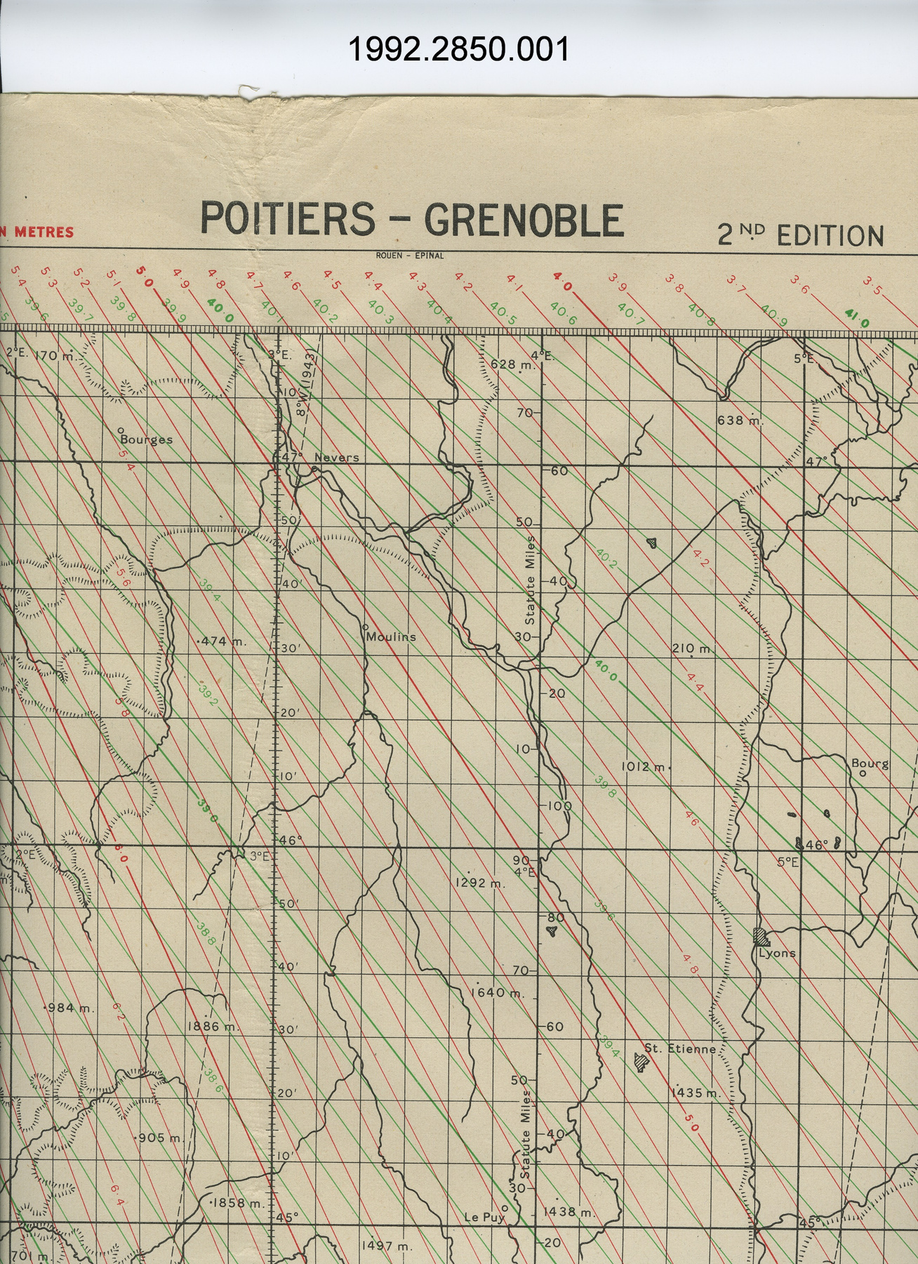
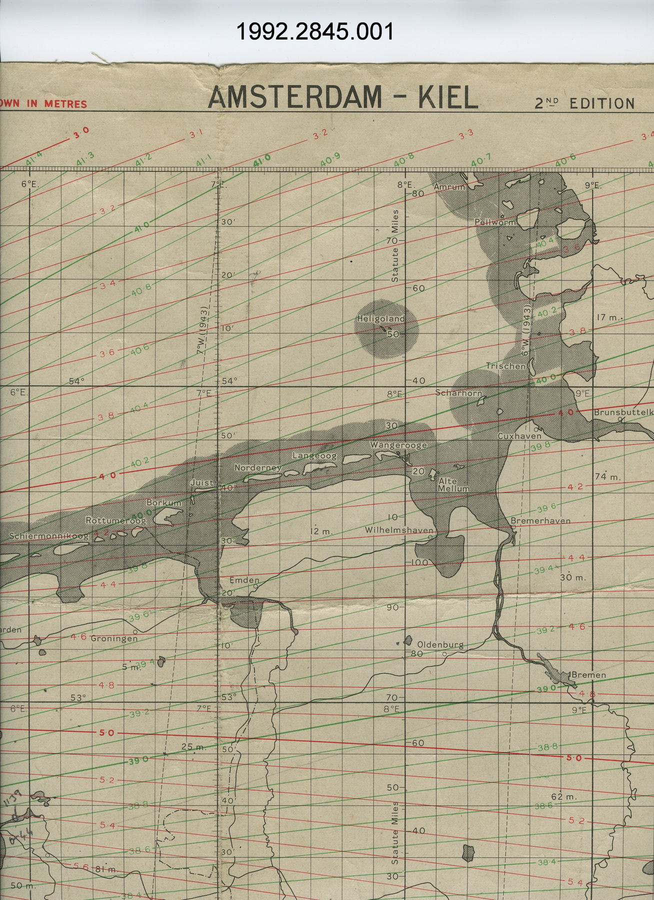
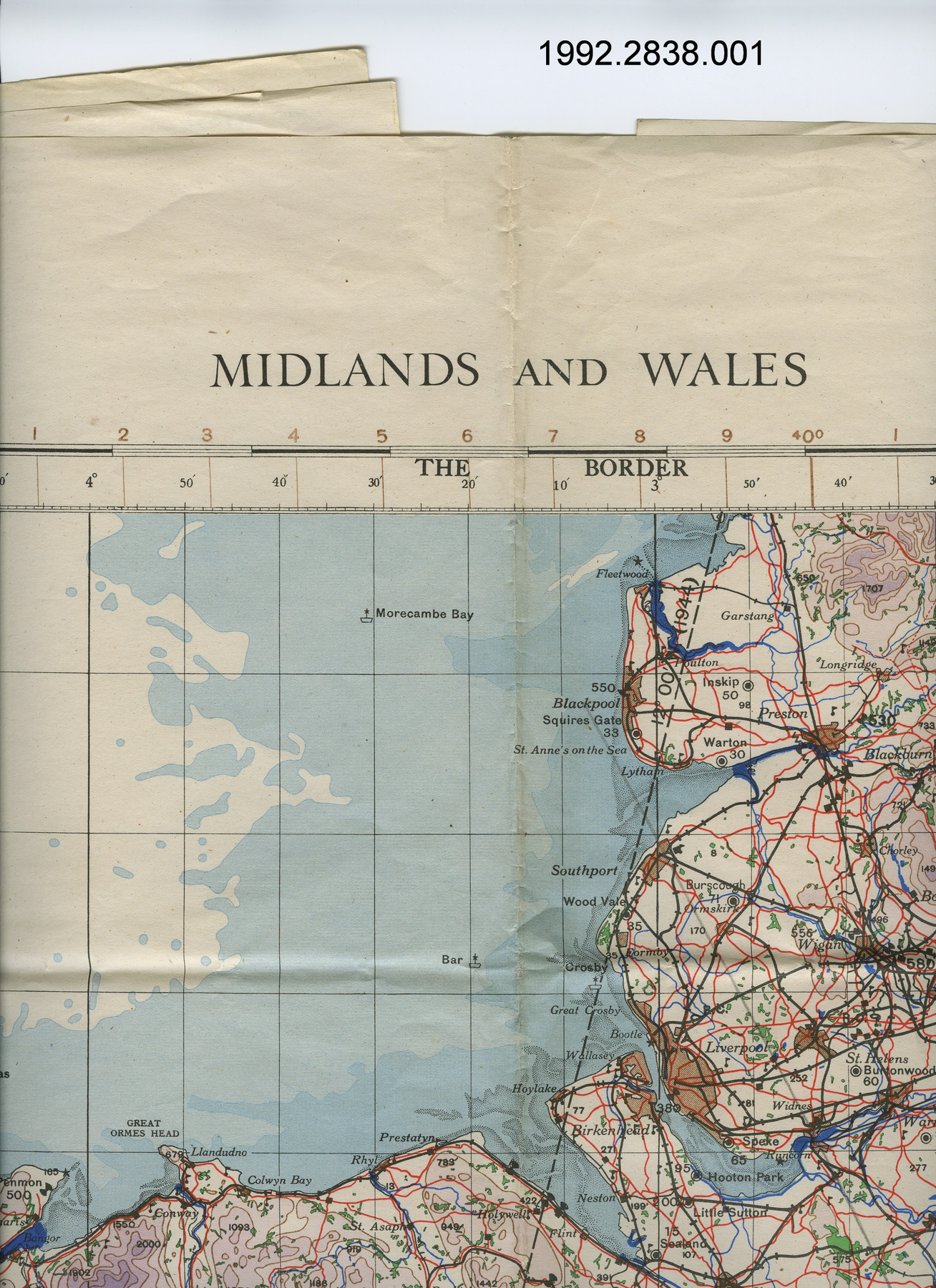
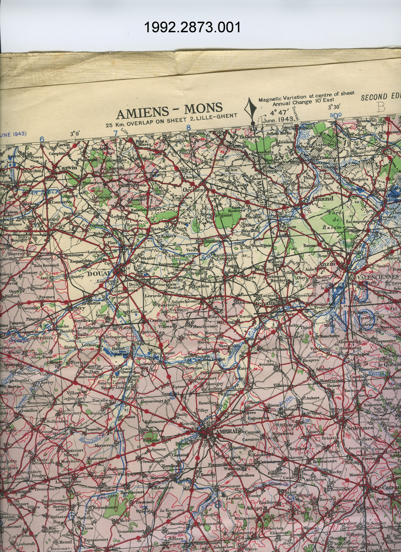
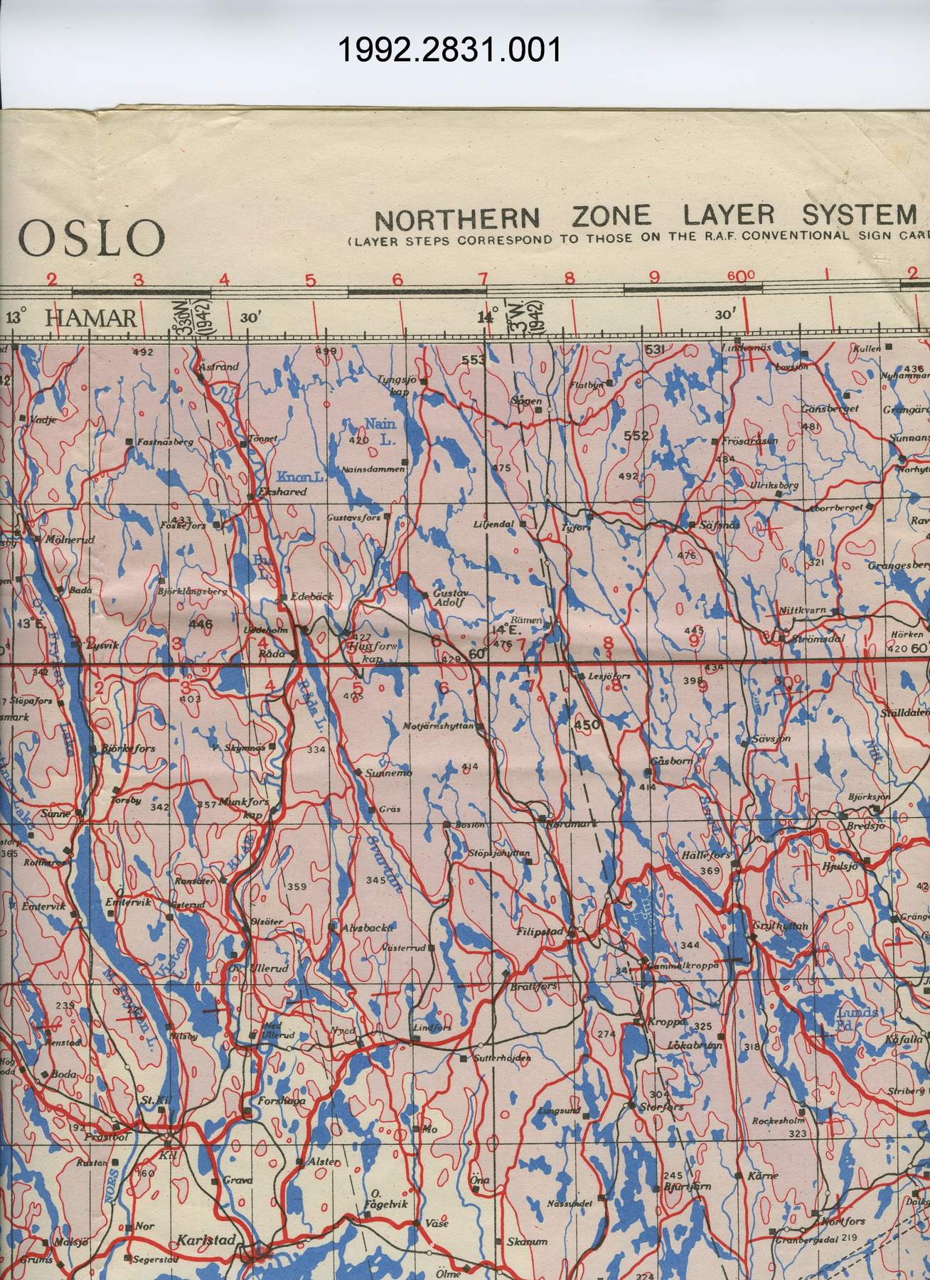
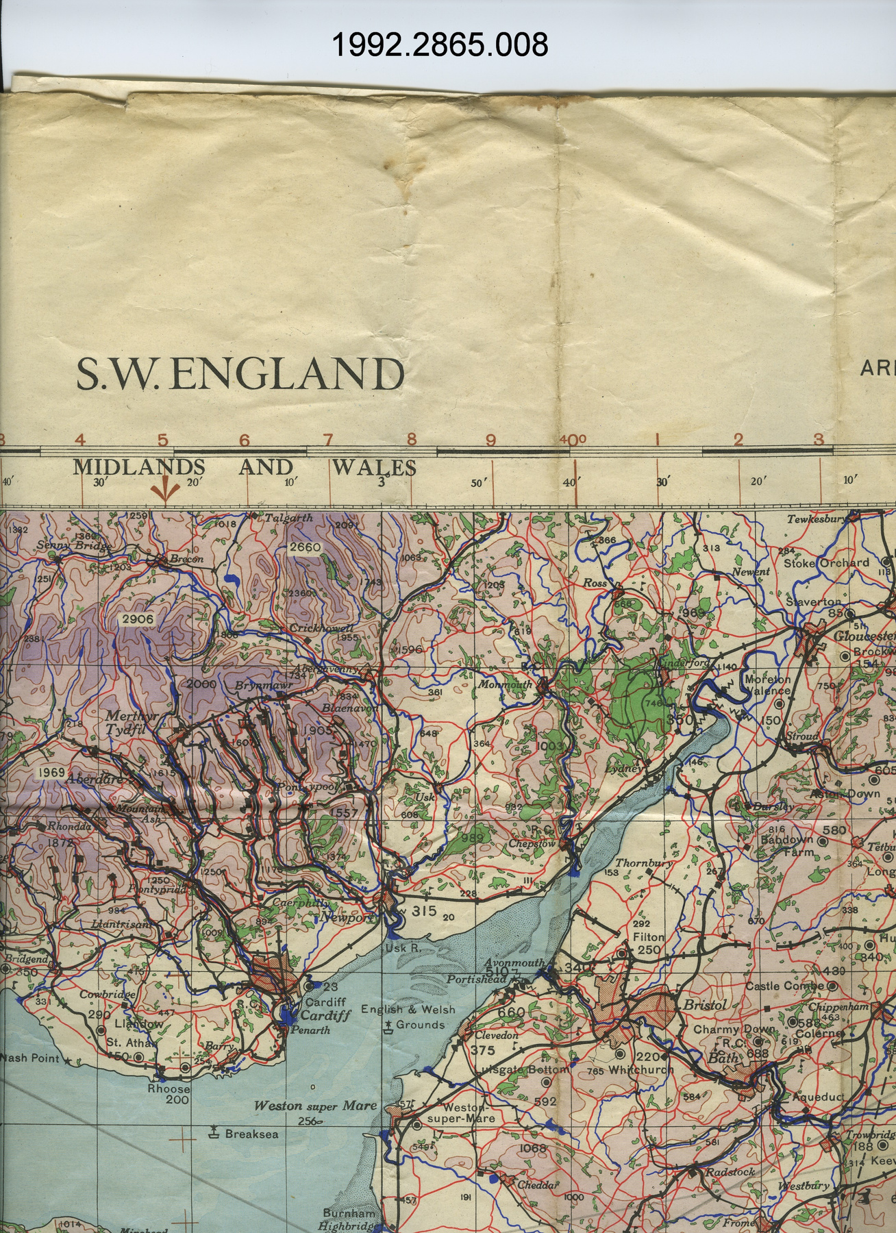
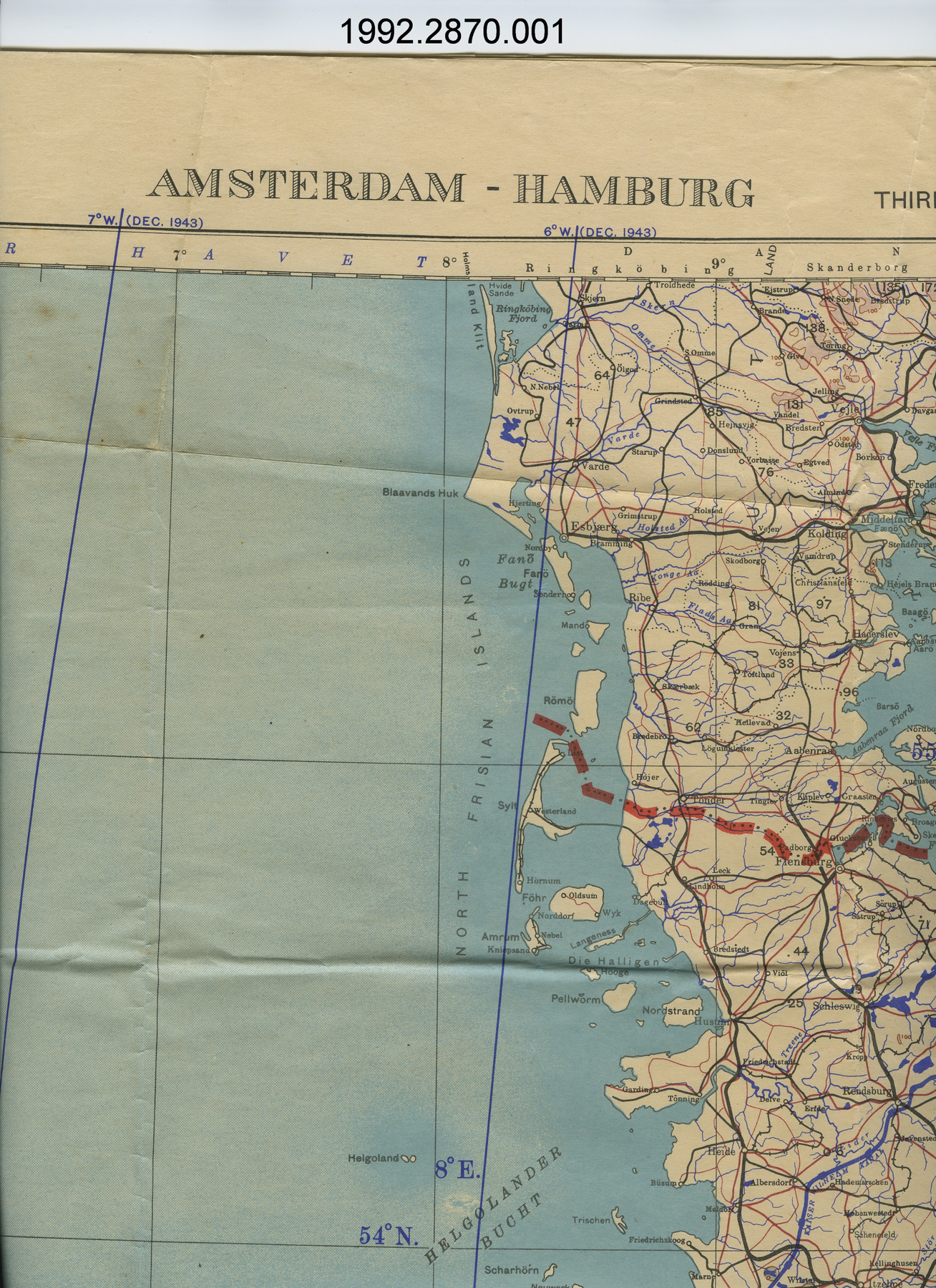
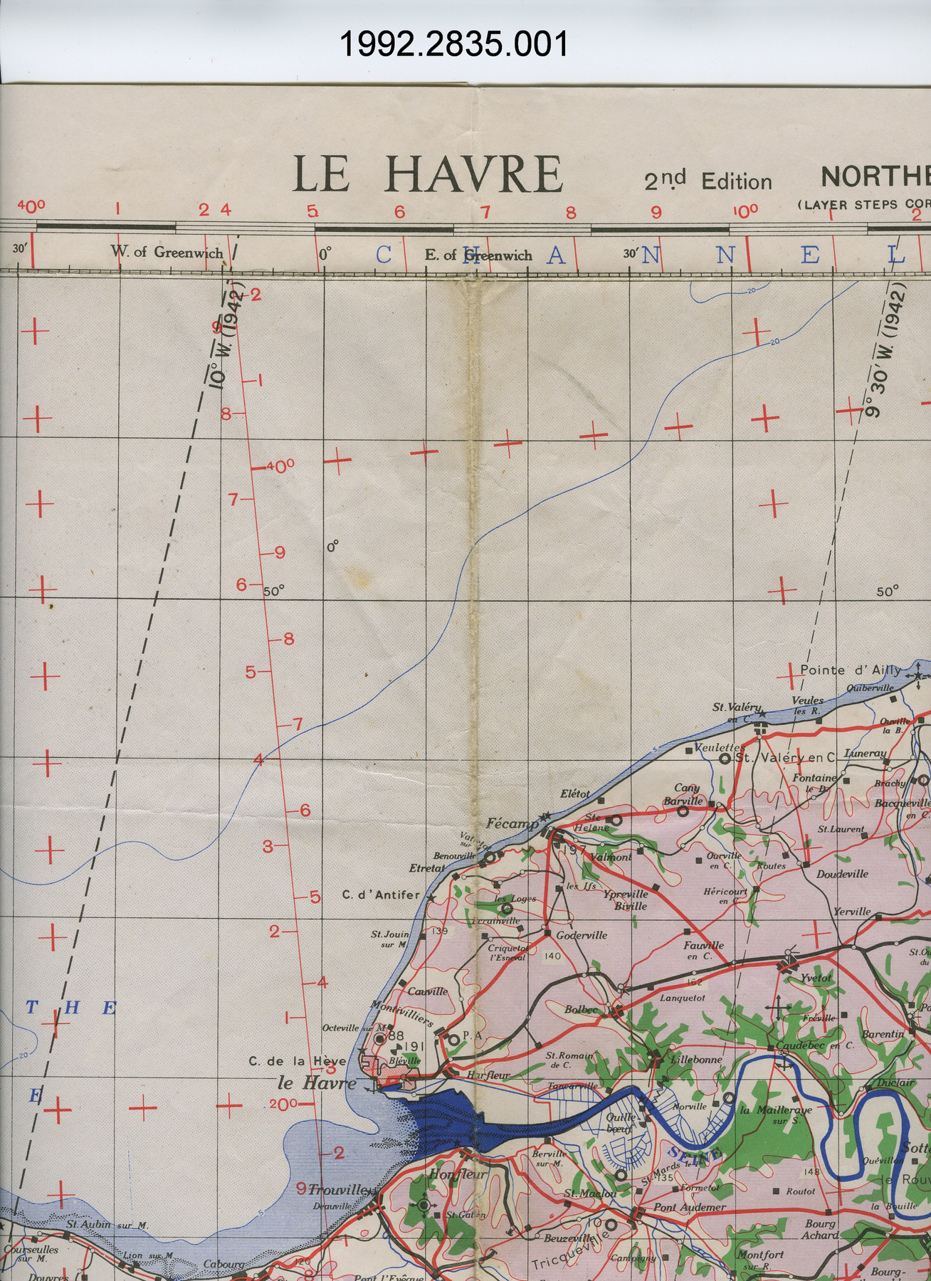
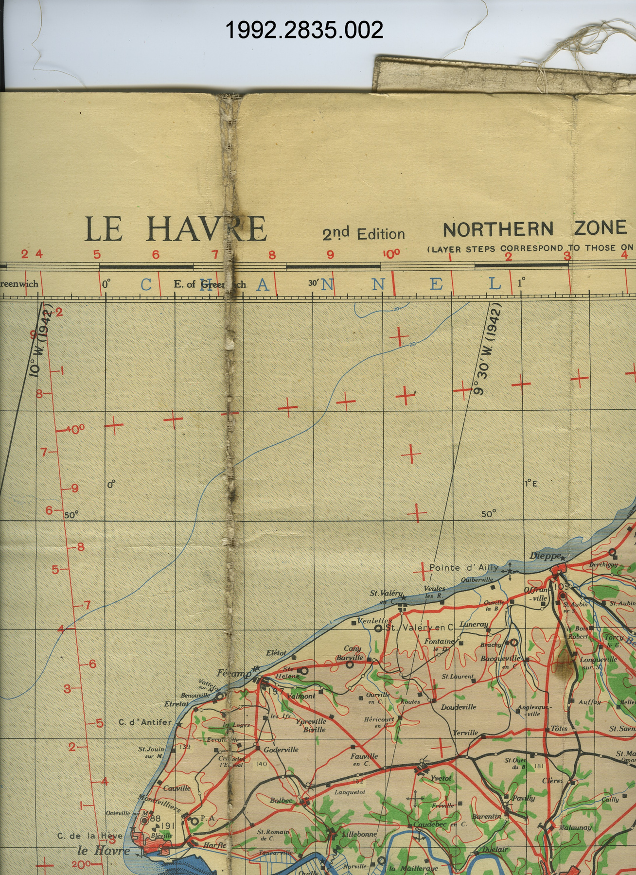
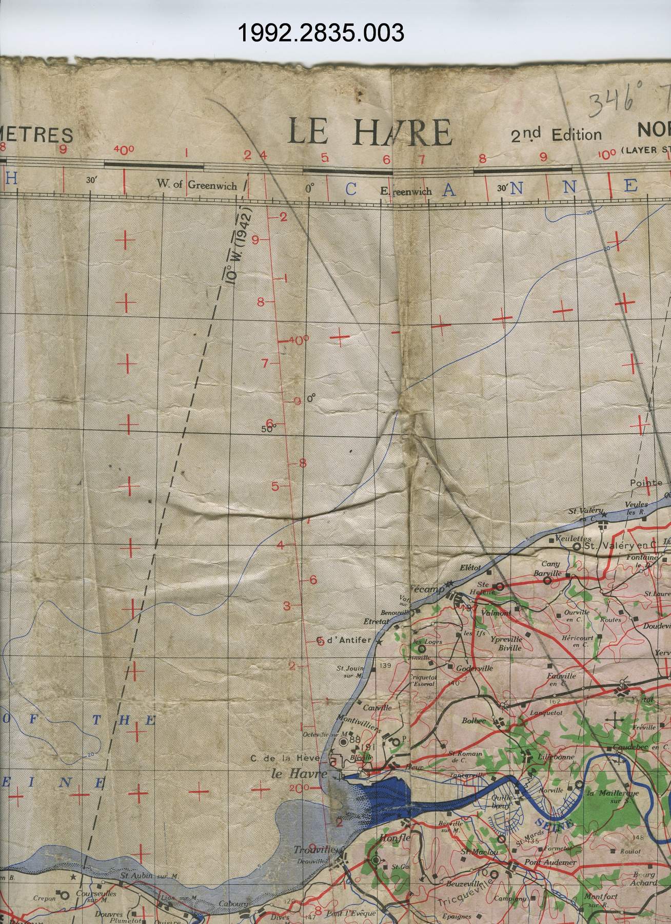
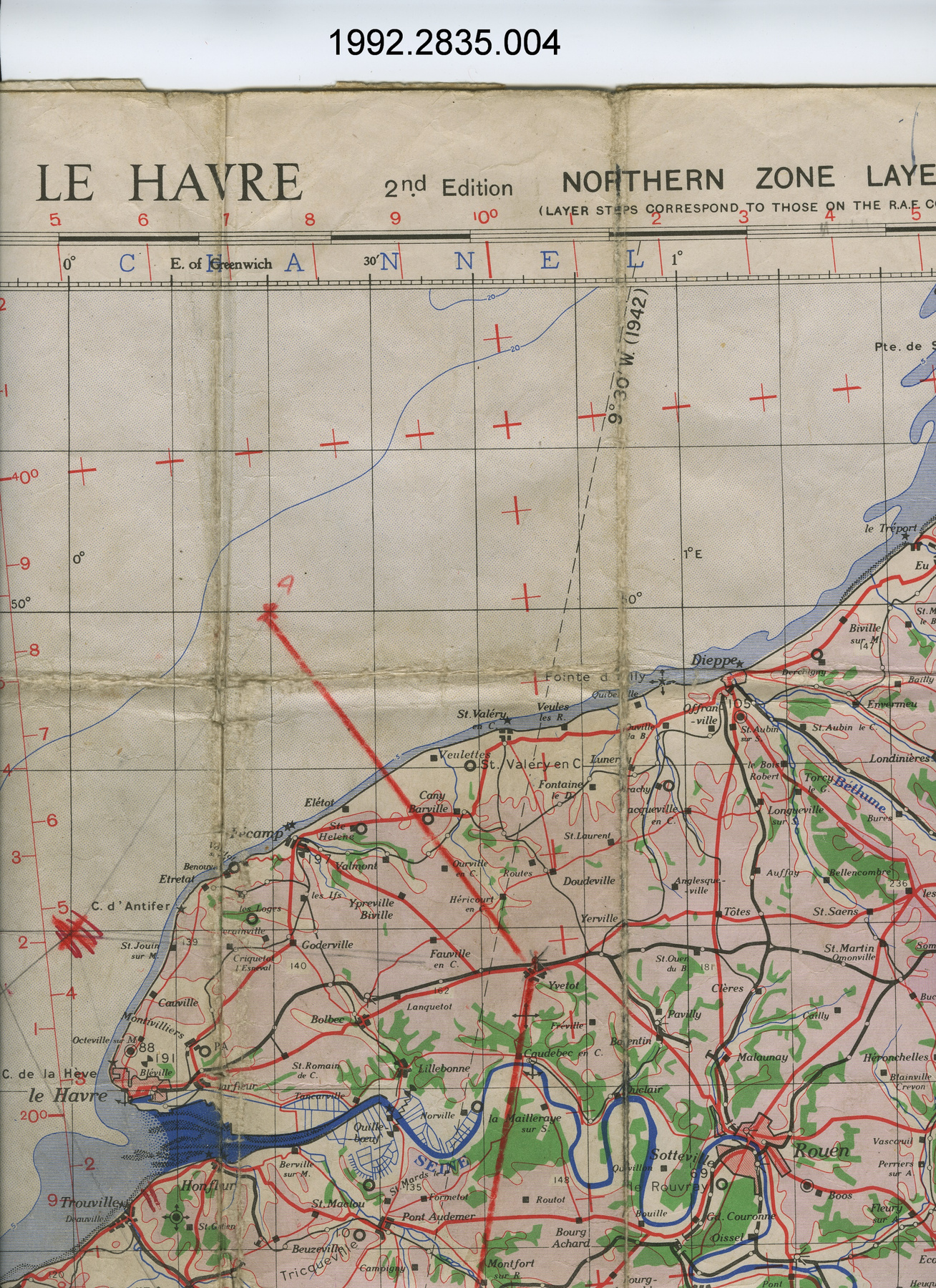
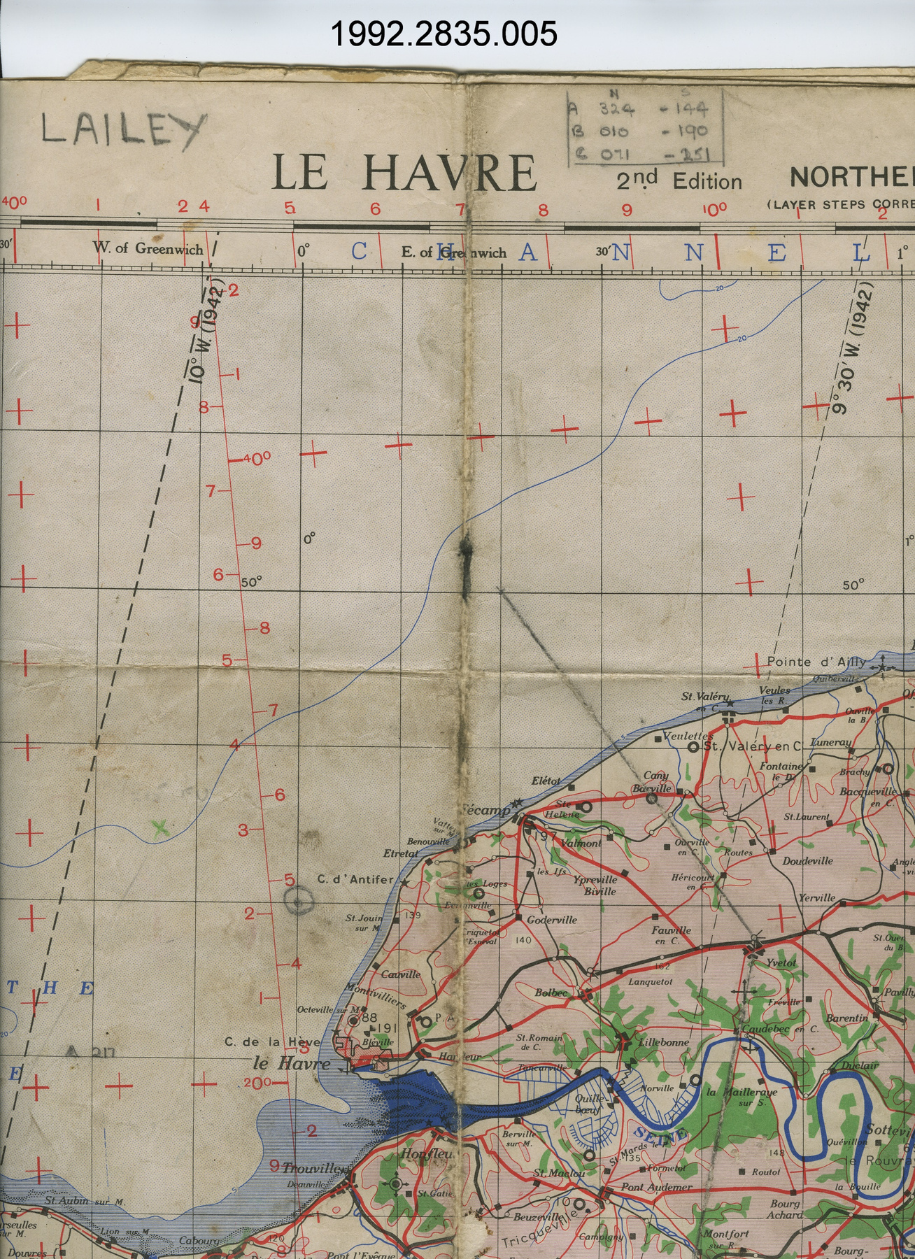
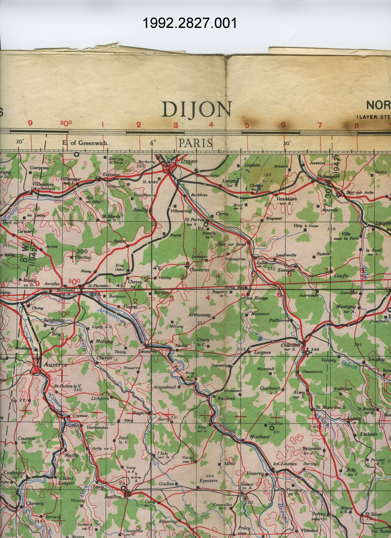
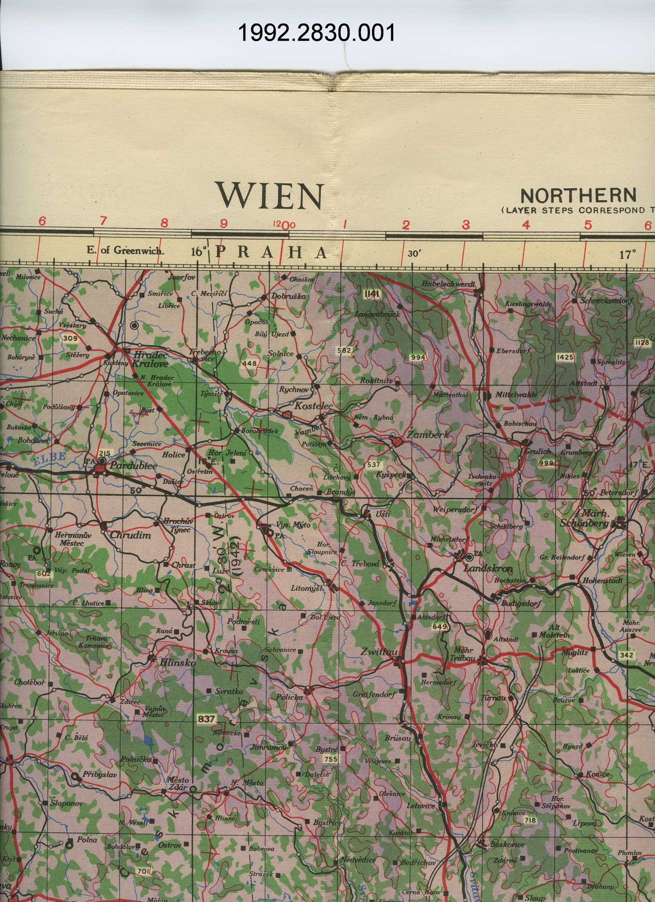
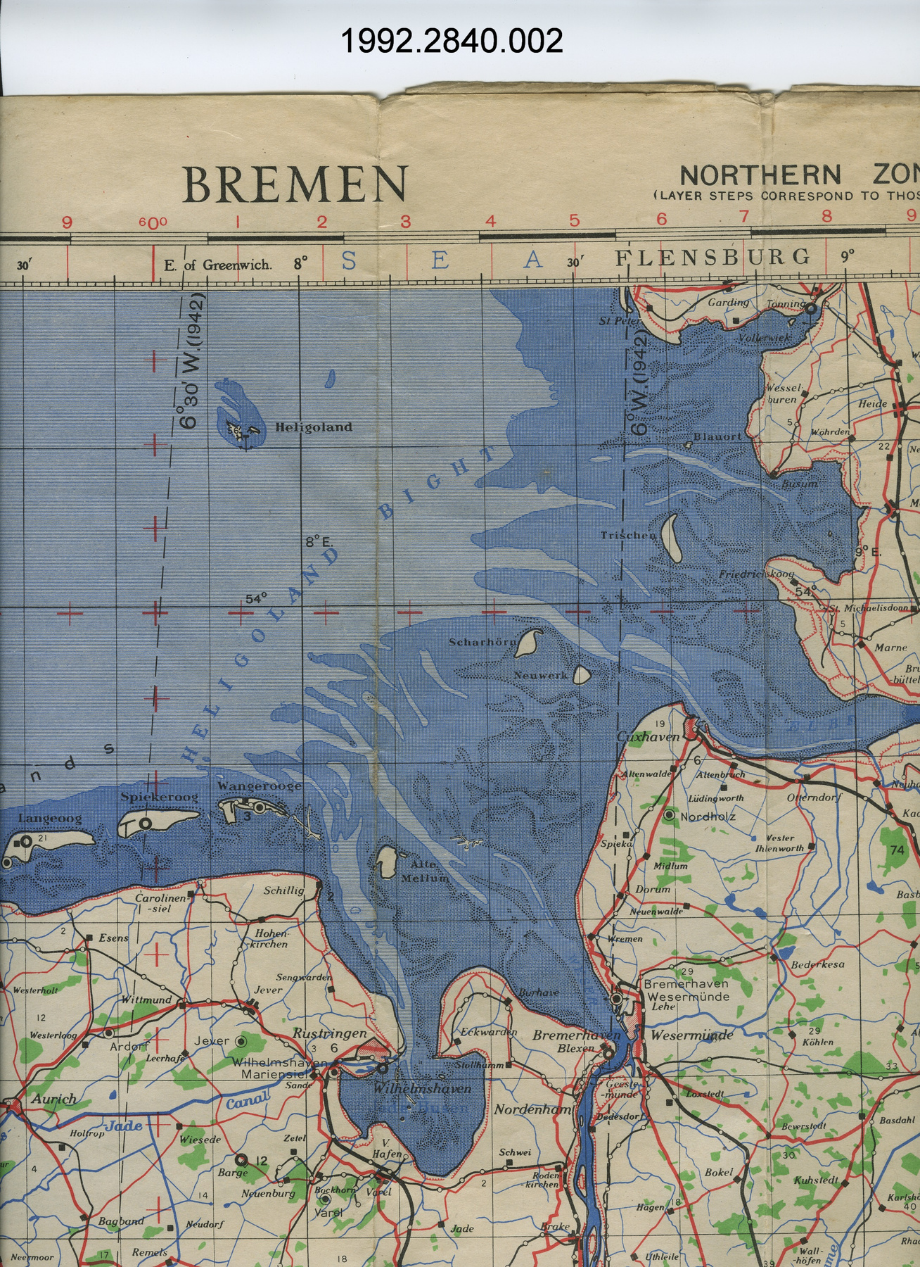
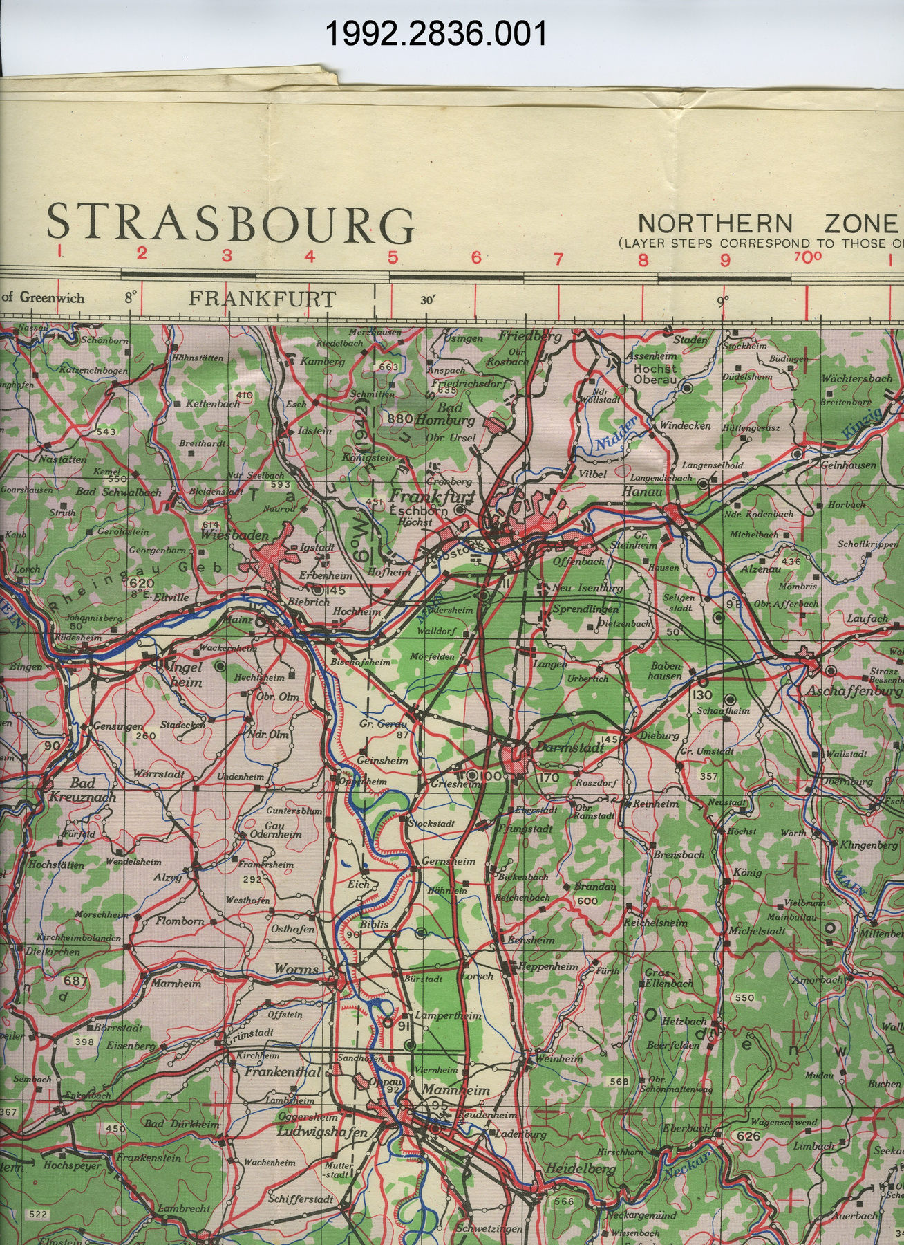
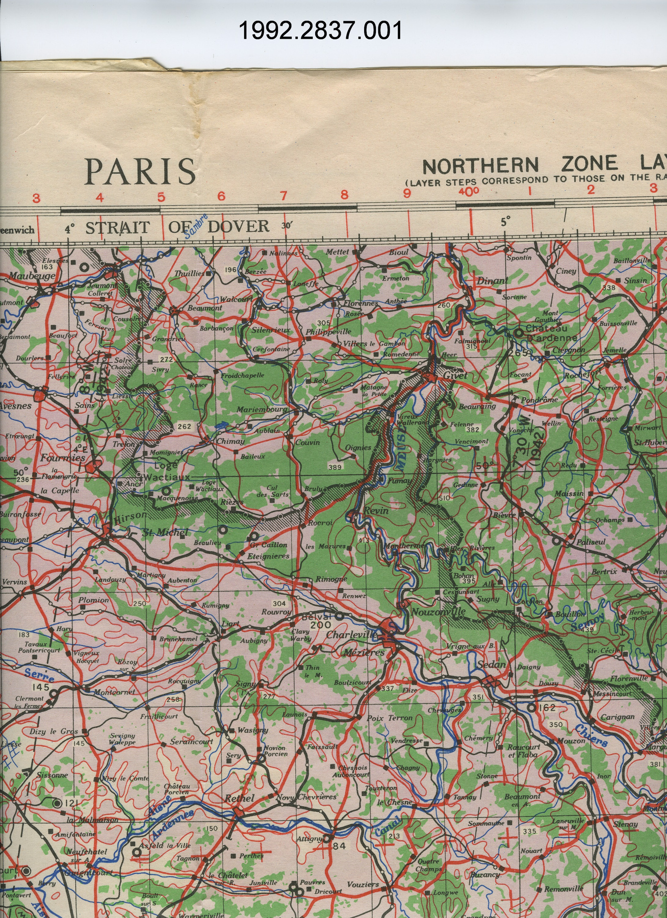
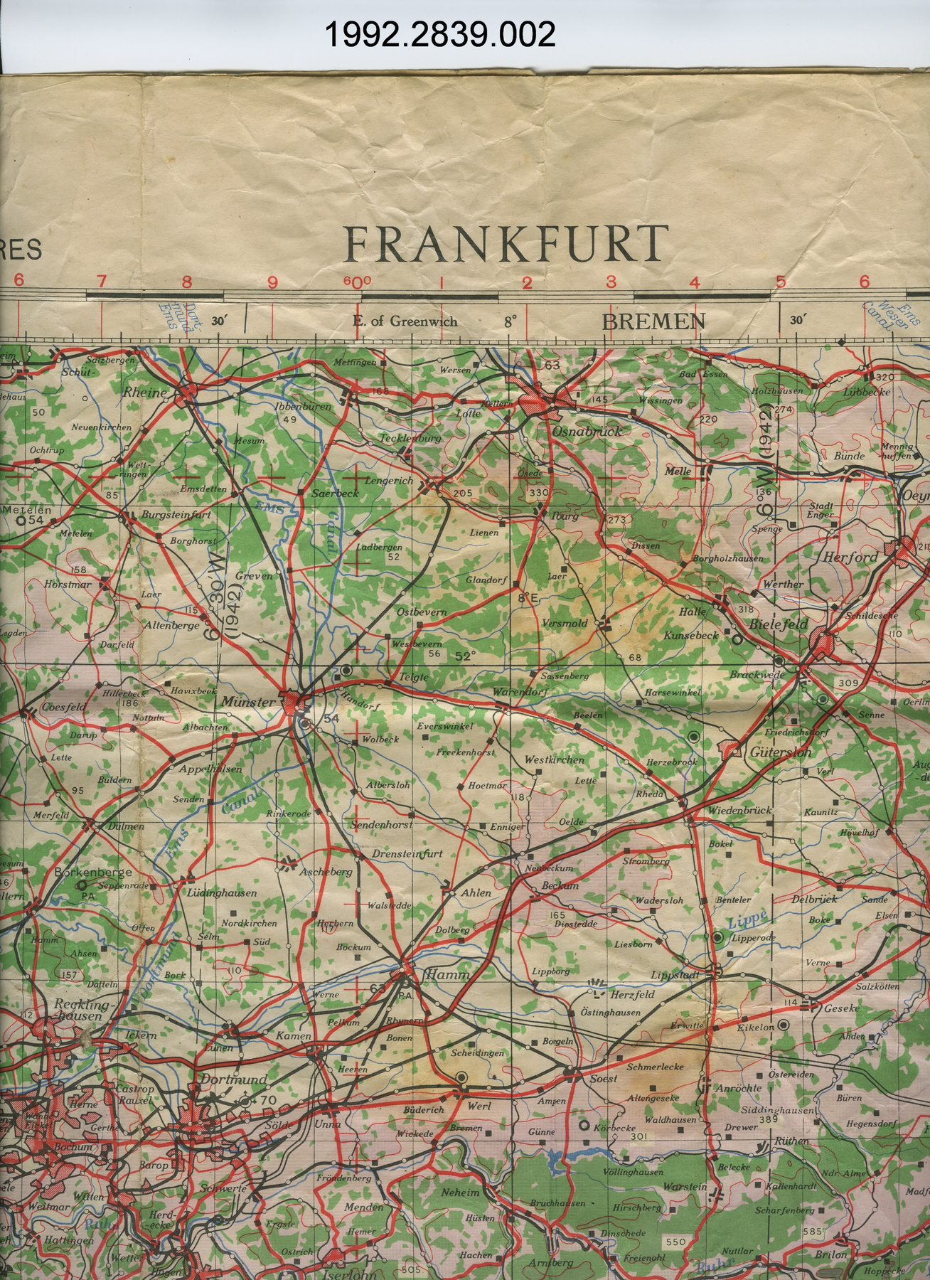
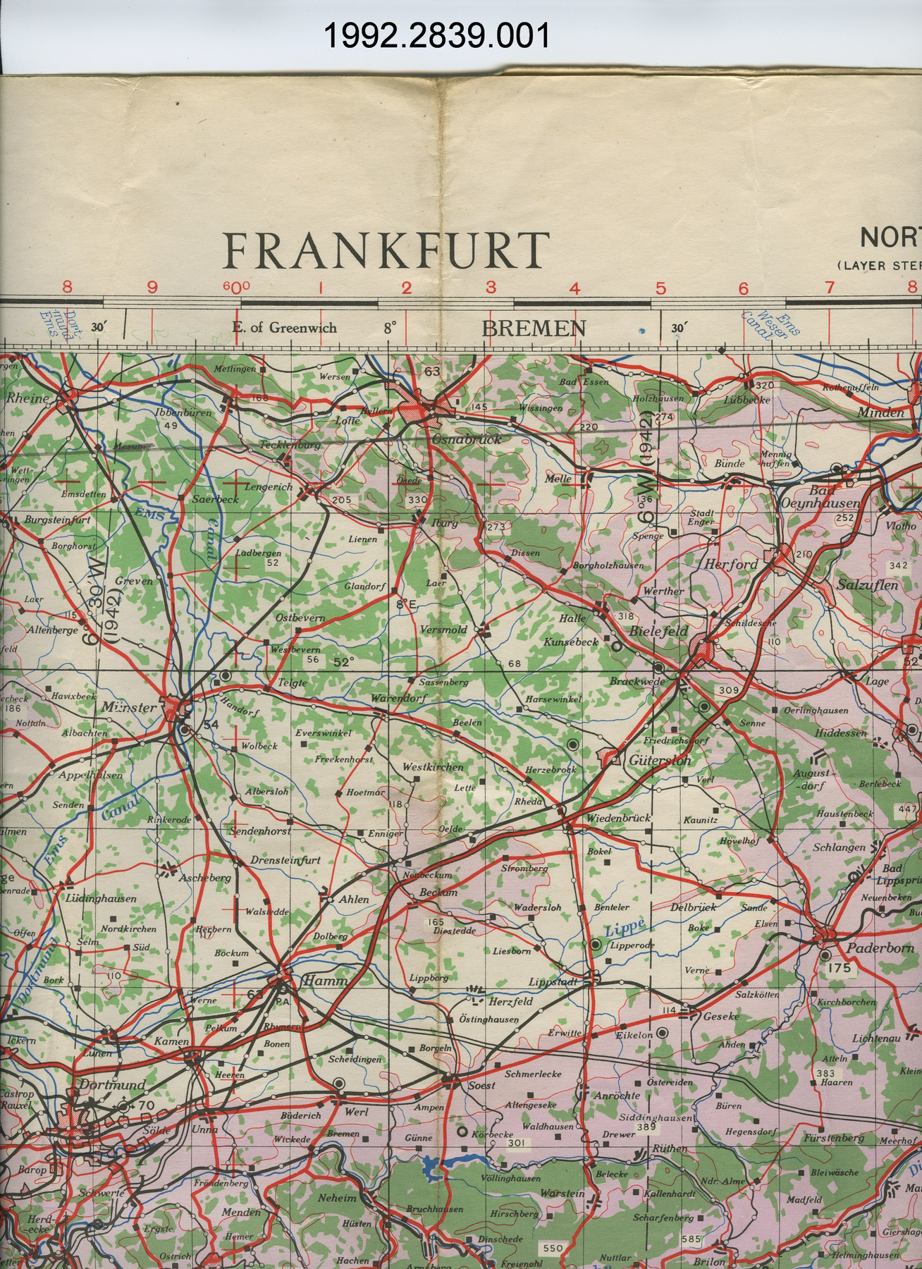
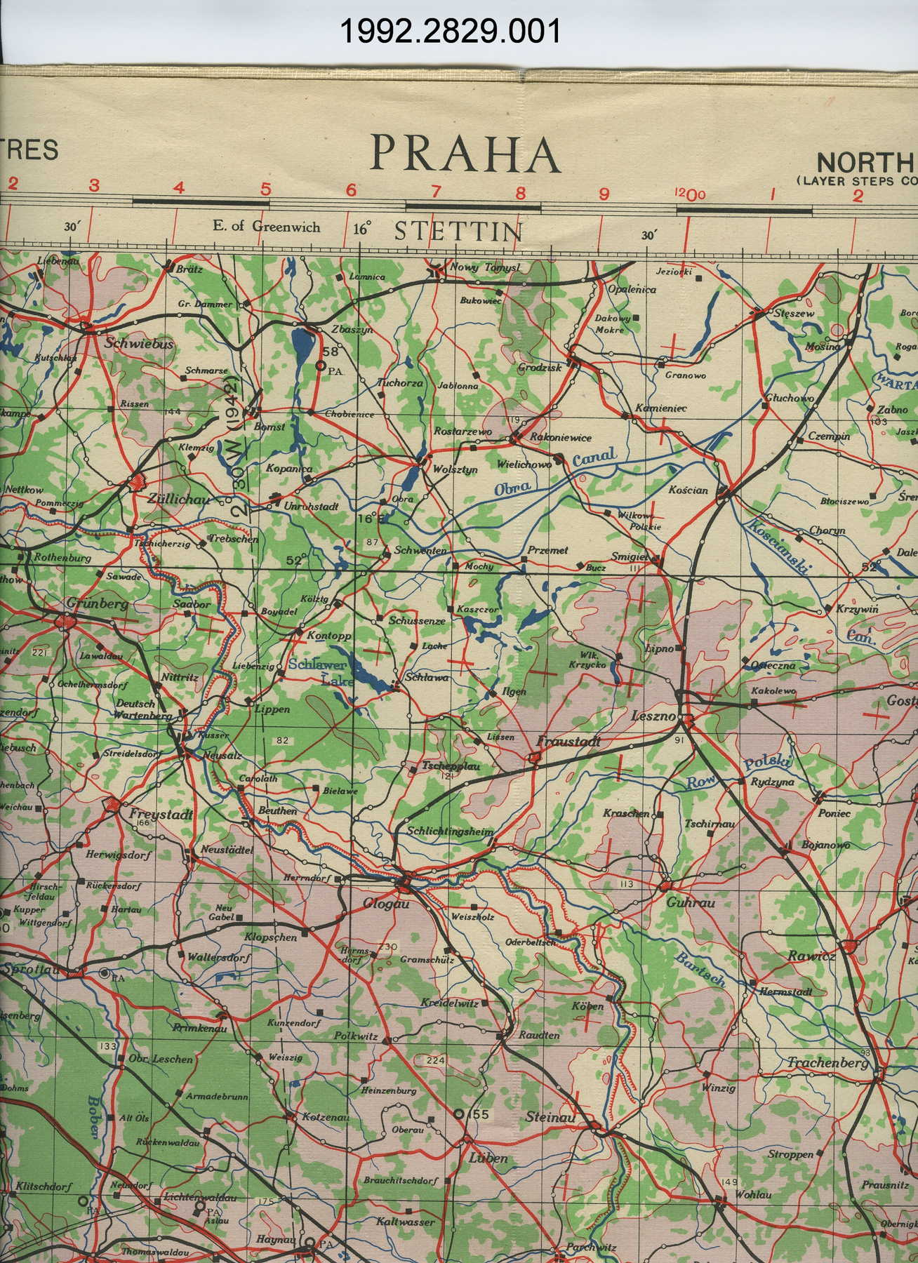
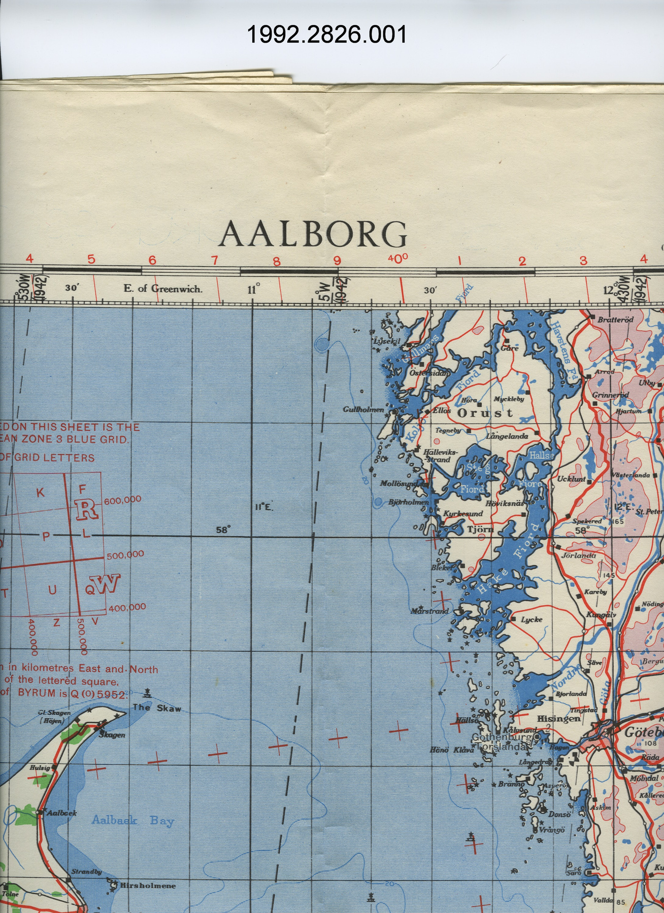
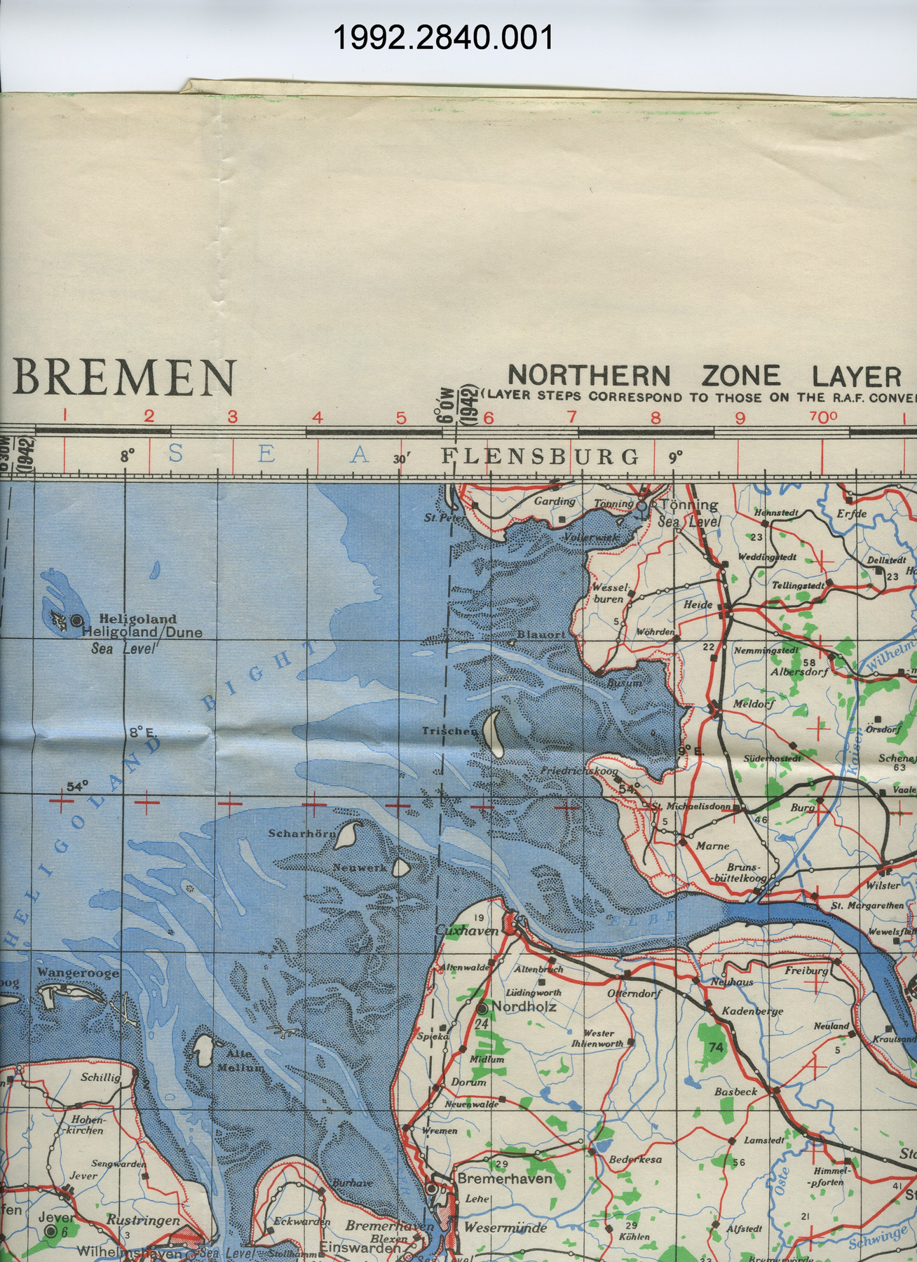
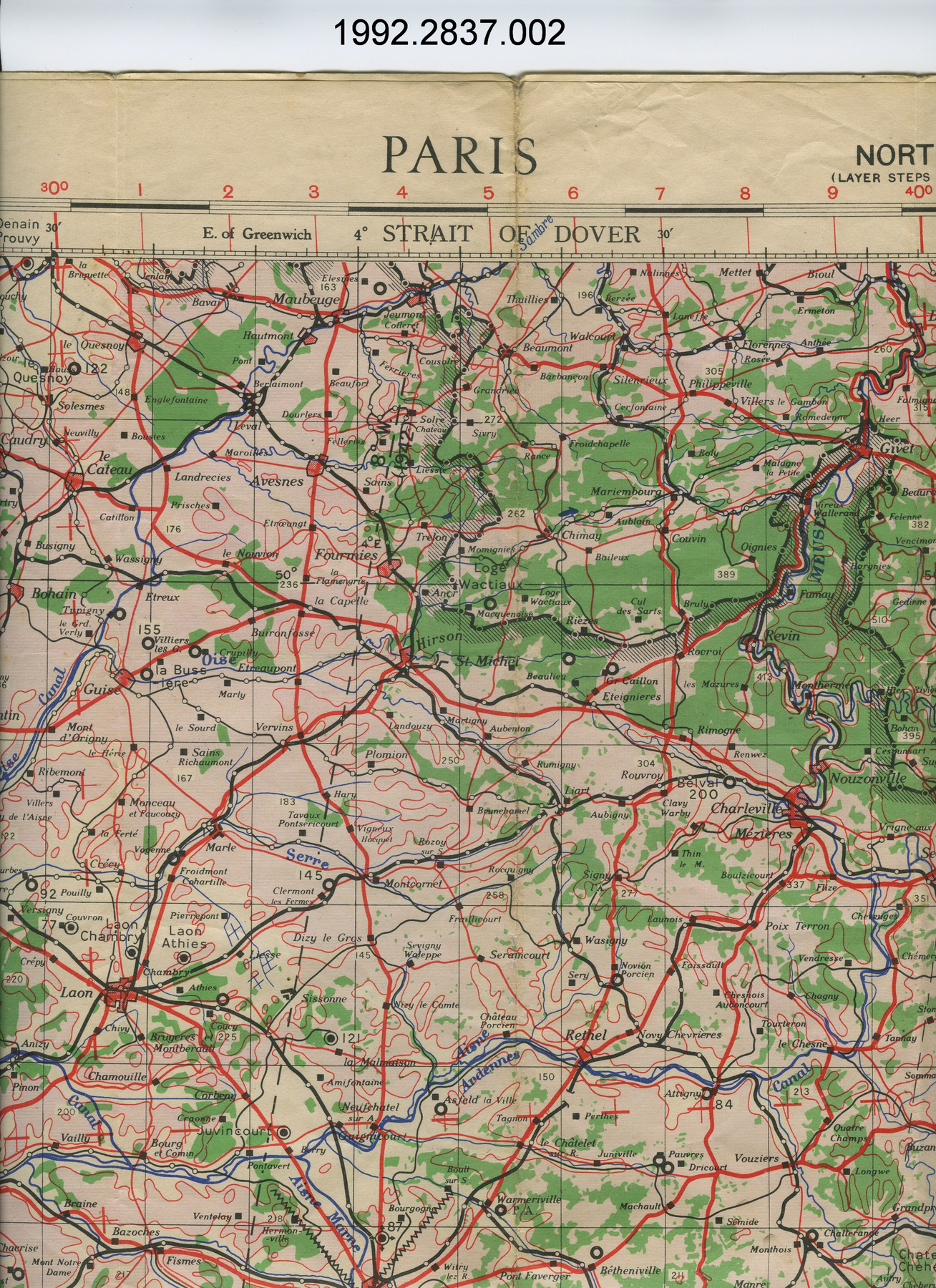
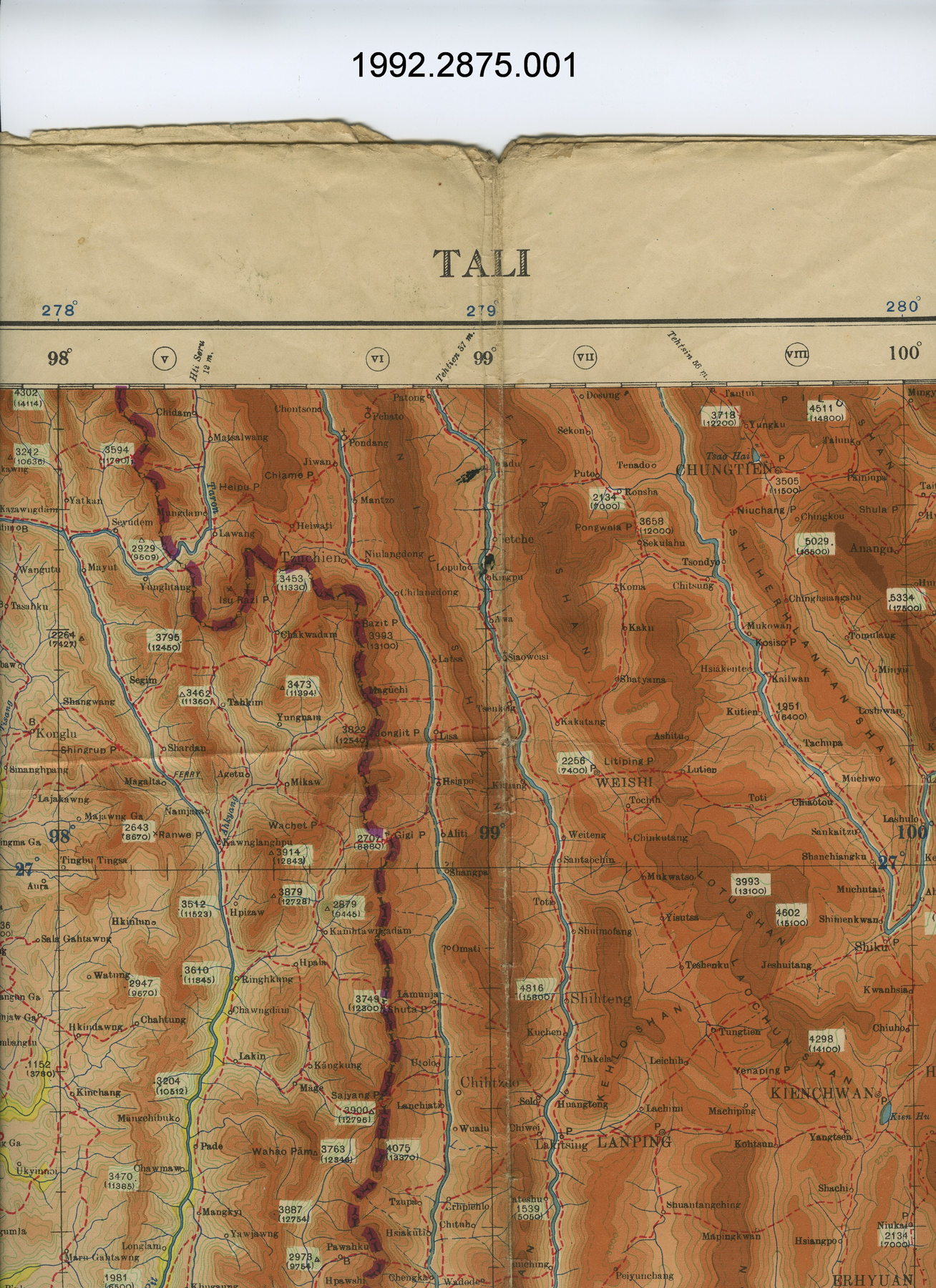
- OBJECT TYPE
- Fixing
- DATE
- 1944
- ARTIFACT NUMBER
- 1992.2817.001
- MANUFACTURER
- Geographical Section, General Staff, War Office
- MODEL
- Reims
- LOCATION
- England
More Information
General Information
- Serial #
- N/A
- Part Number
- 1
- Total Parts
- 1
- AKA
- N/A
- Patents
- N/A
- General Description
- paper
Dimensions
Note: These reflect the general size for storage and are not necessarily representative of the object's true dimensions.
- Length
- 111.6 cm
- Width
- 82.5 cm
- Height
- N/A
- Thickness
- N/A
- Weight
- N/A
- Diameter
- N/A
- Volume
- N/A
Lexicon
- Group
- Aviation
- Category
- Navigation instruments & equipment
- Sub-Category
- N/A
Manufacturer
- AKA
- Defence UK
- Country
- England
- State/Province
- Unknown
- City
- Unknown
Context
- Country
- Europe
- State/Province
- Unknown
- Period
- WWII (1939-1945)/ this map is dated 1944
- Canada
-
many Canadians served as Navigators in RCAF squadrons attached to RAF commands during WWII - Function
-
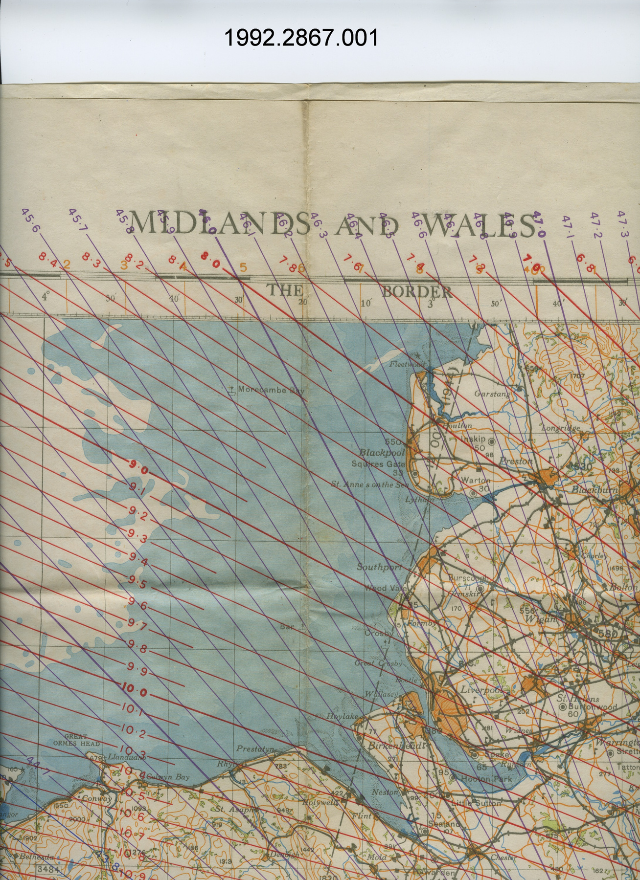
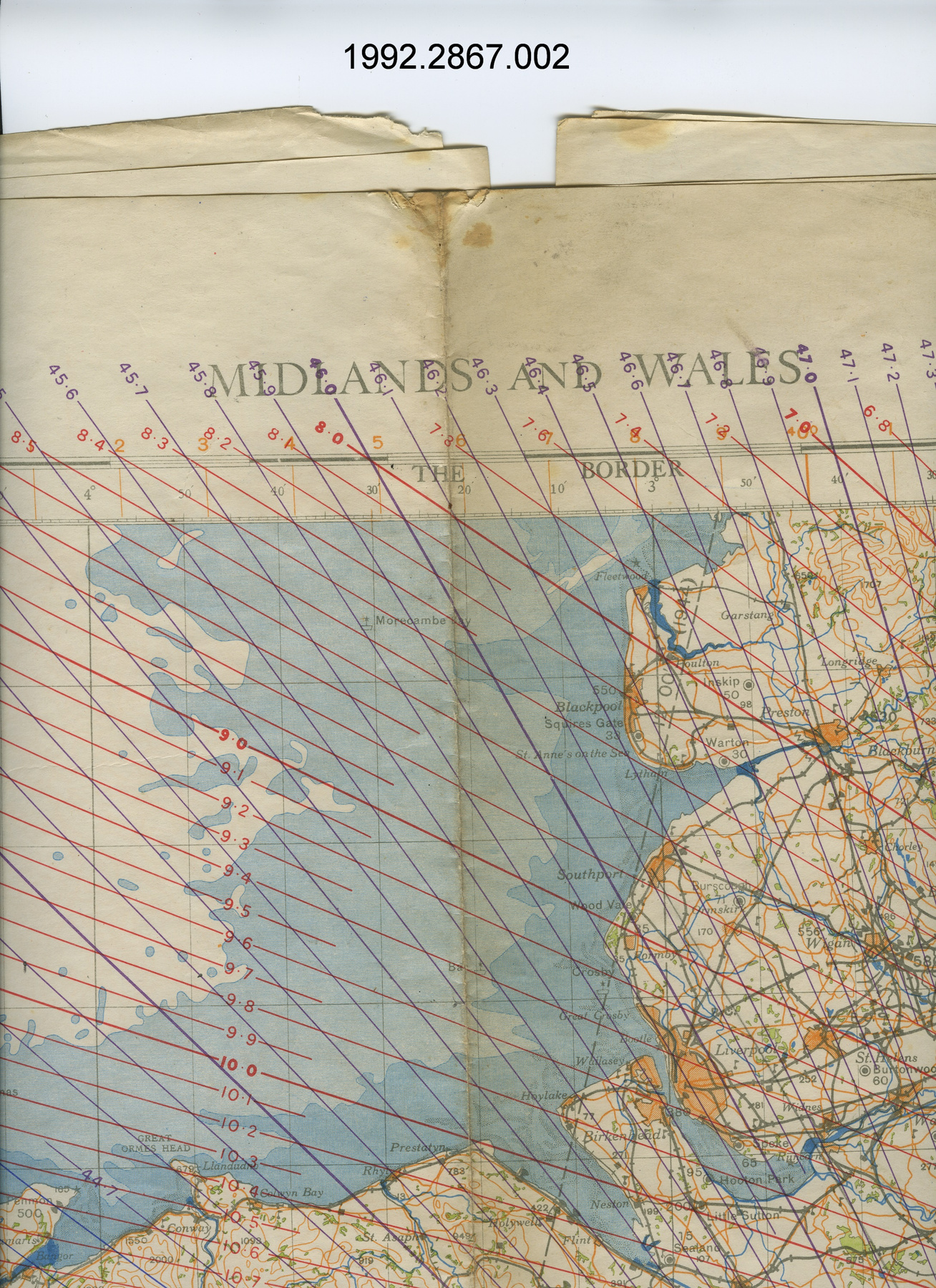
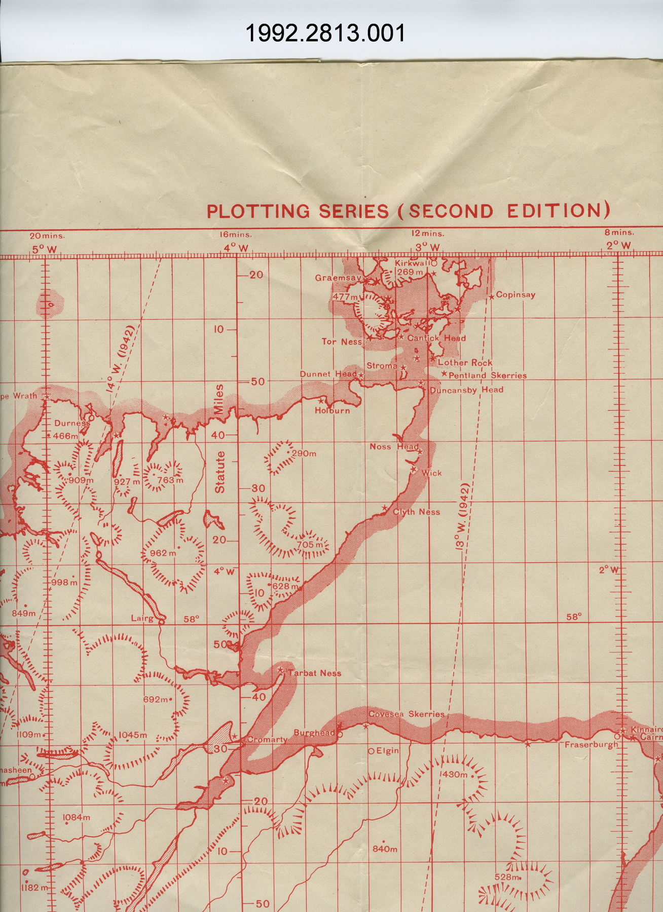
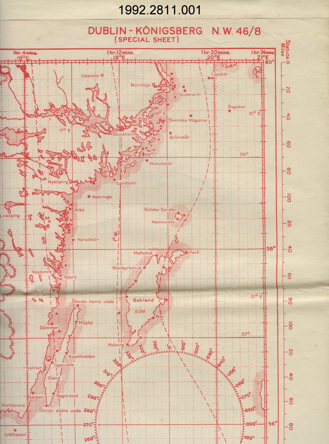
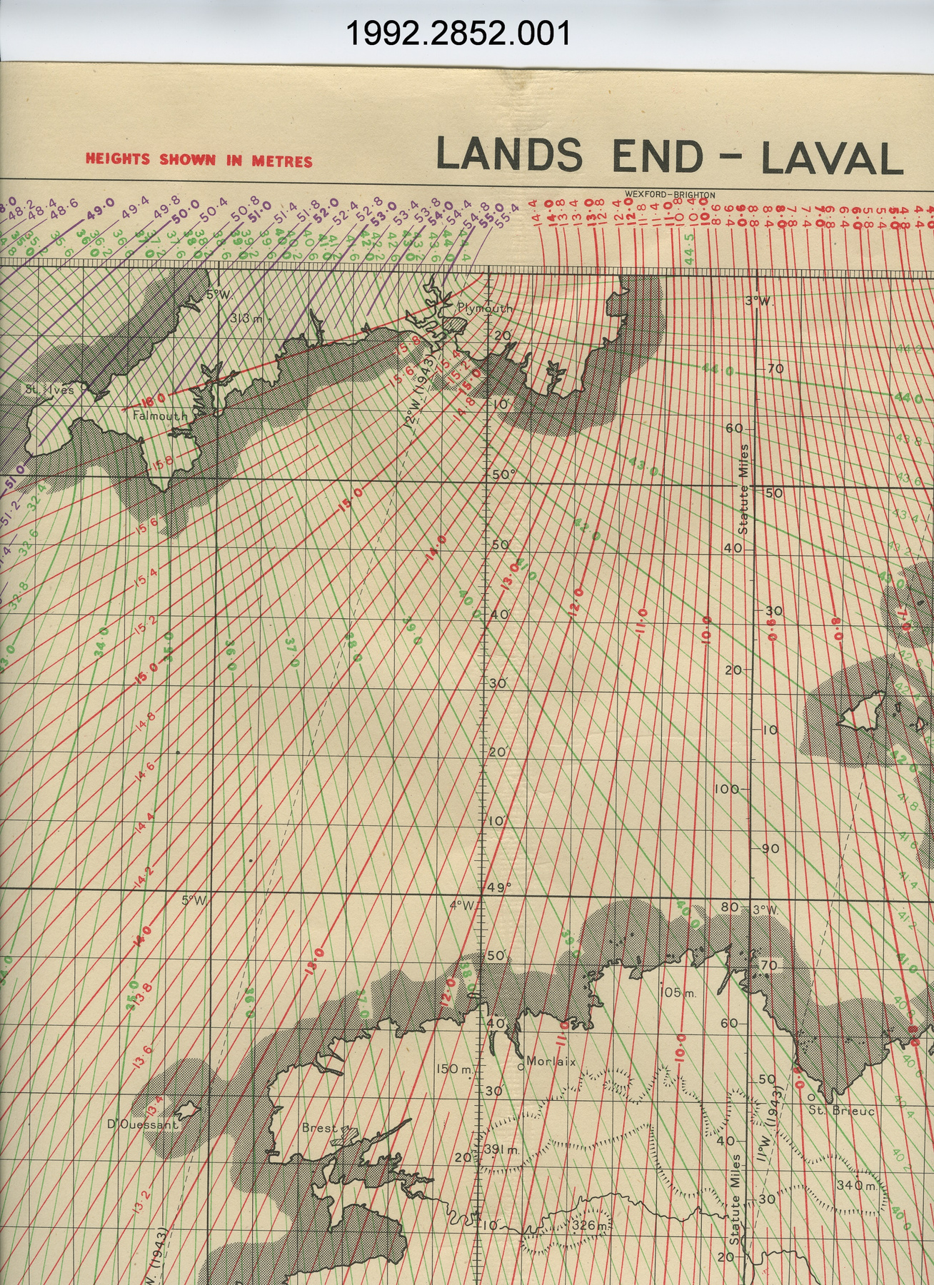
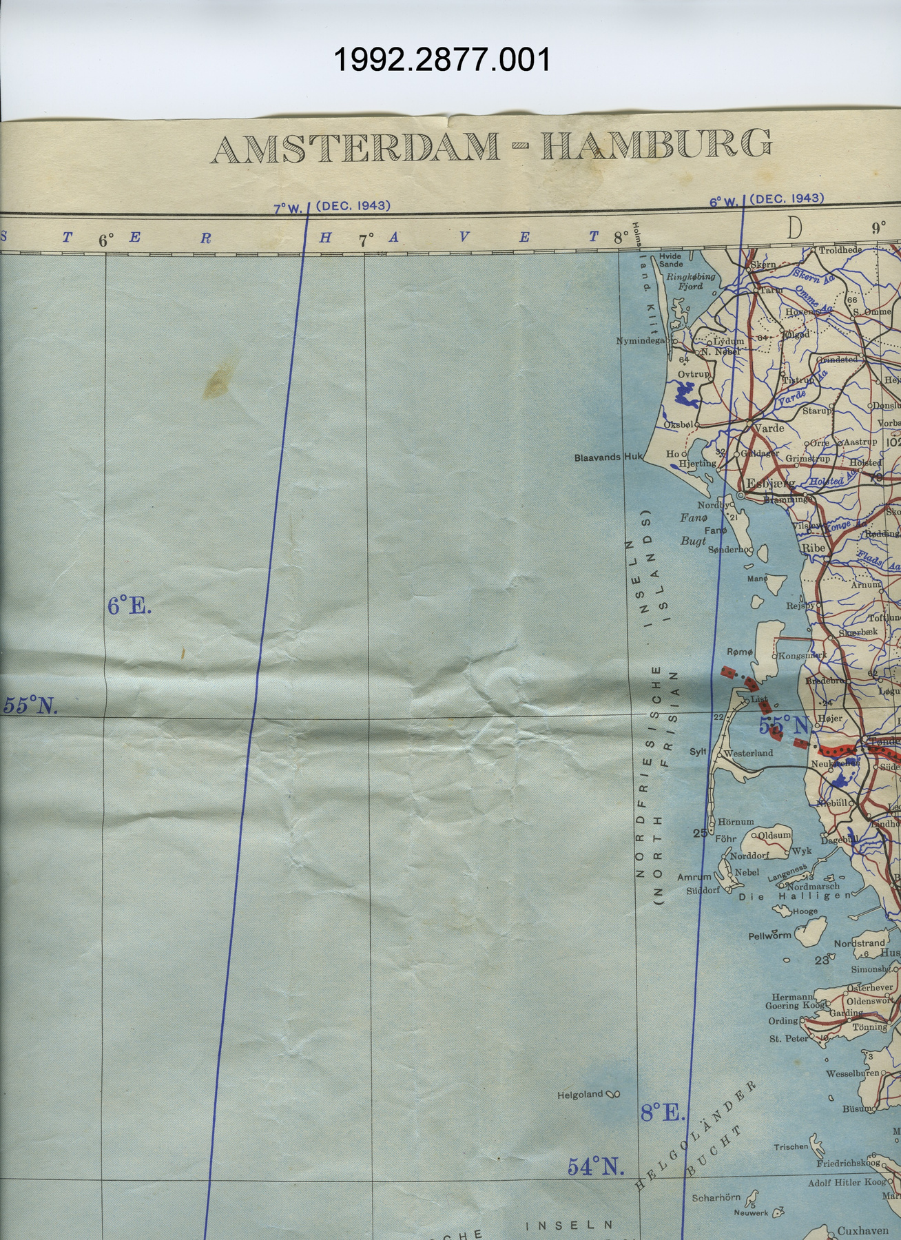
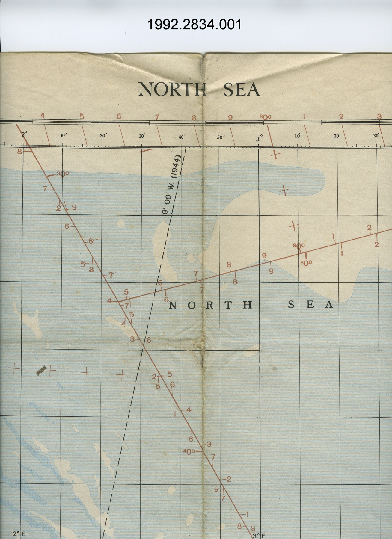
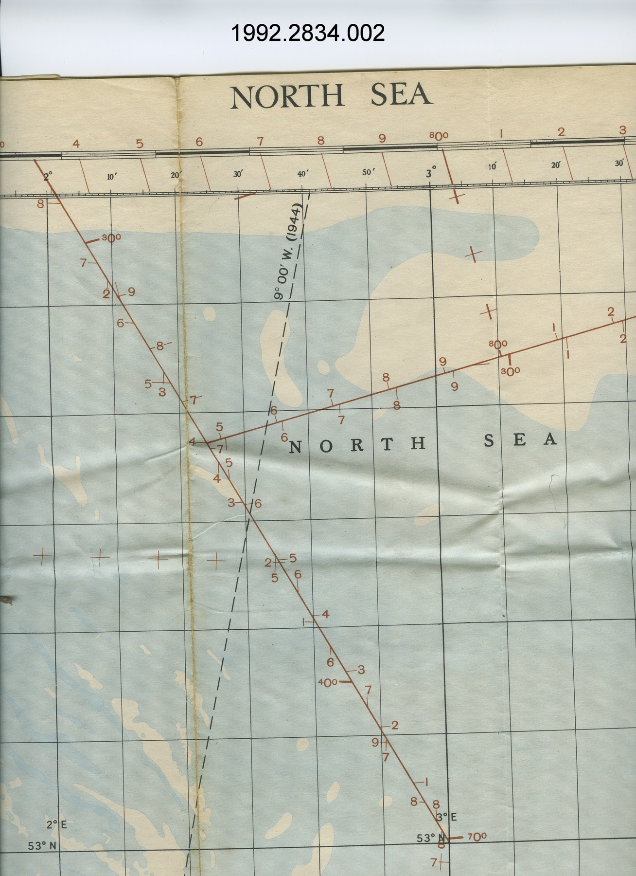
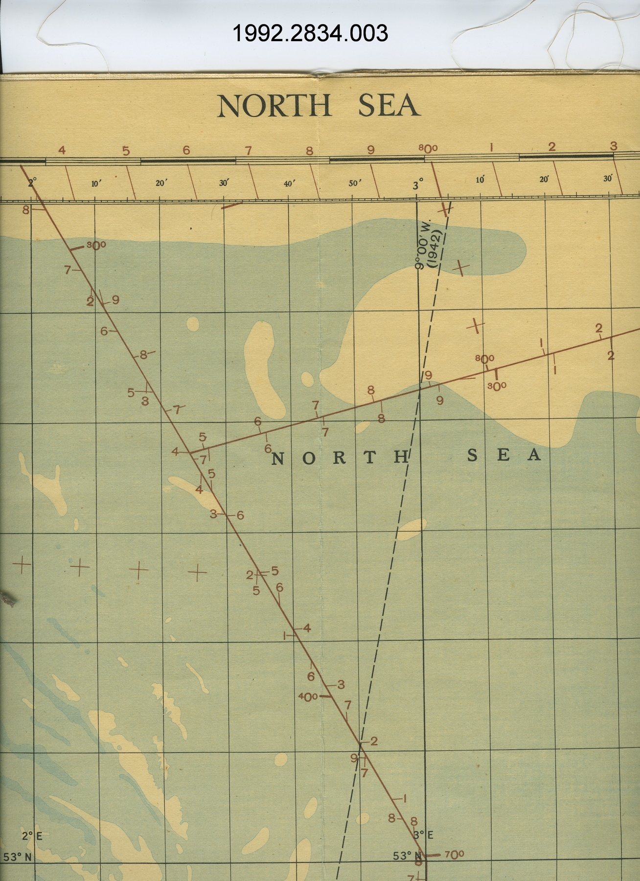
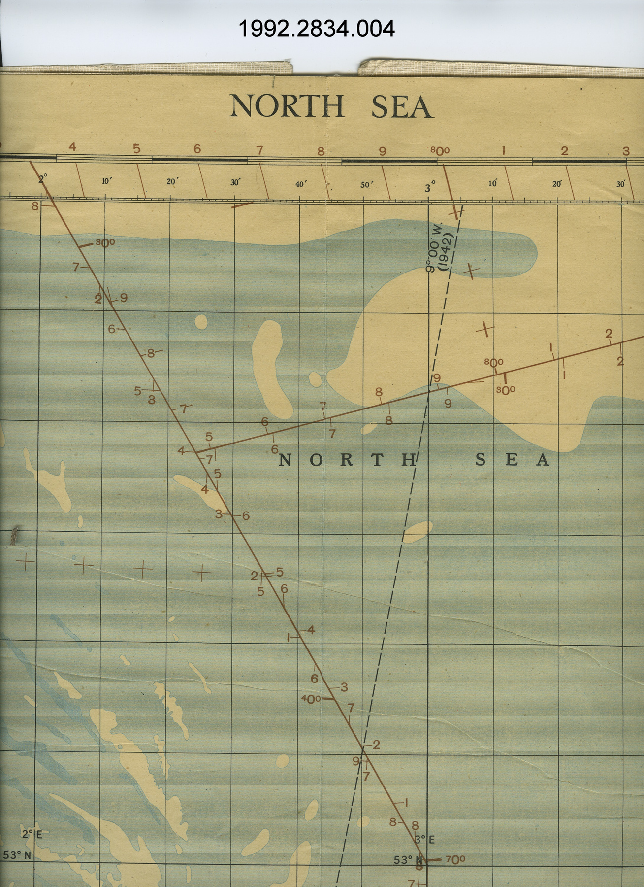
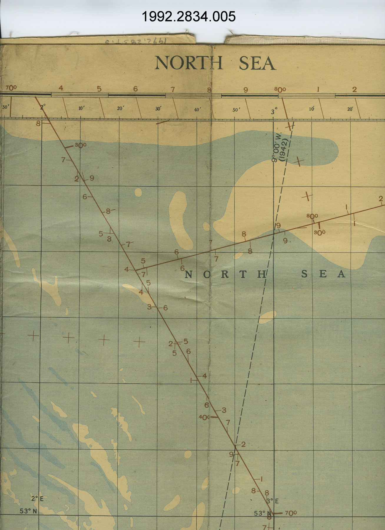
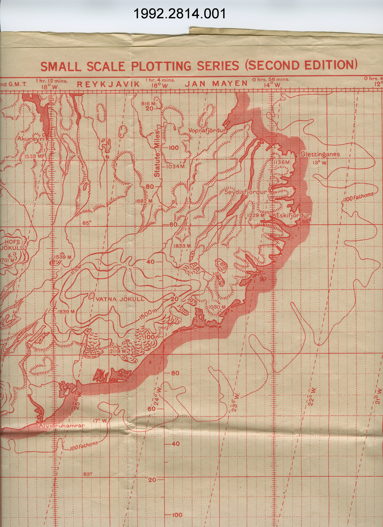
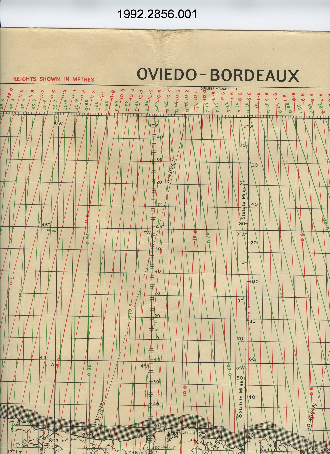
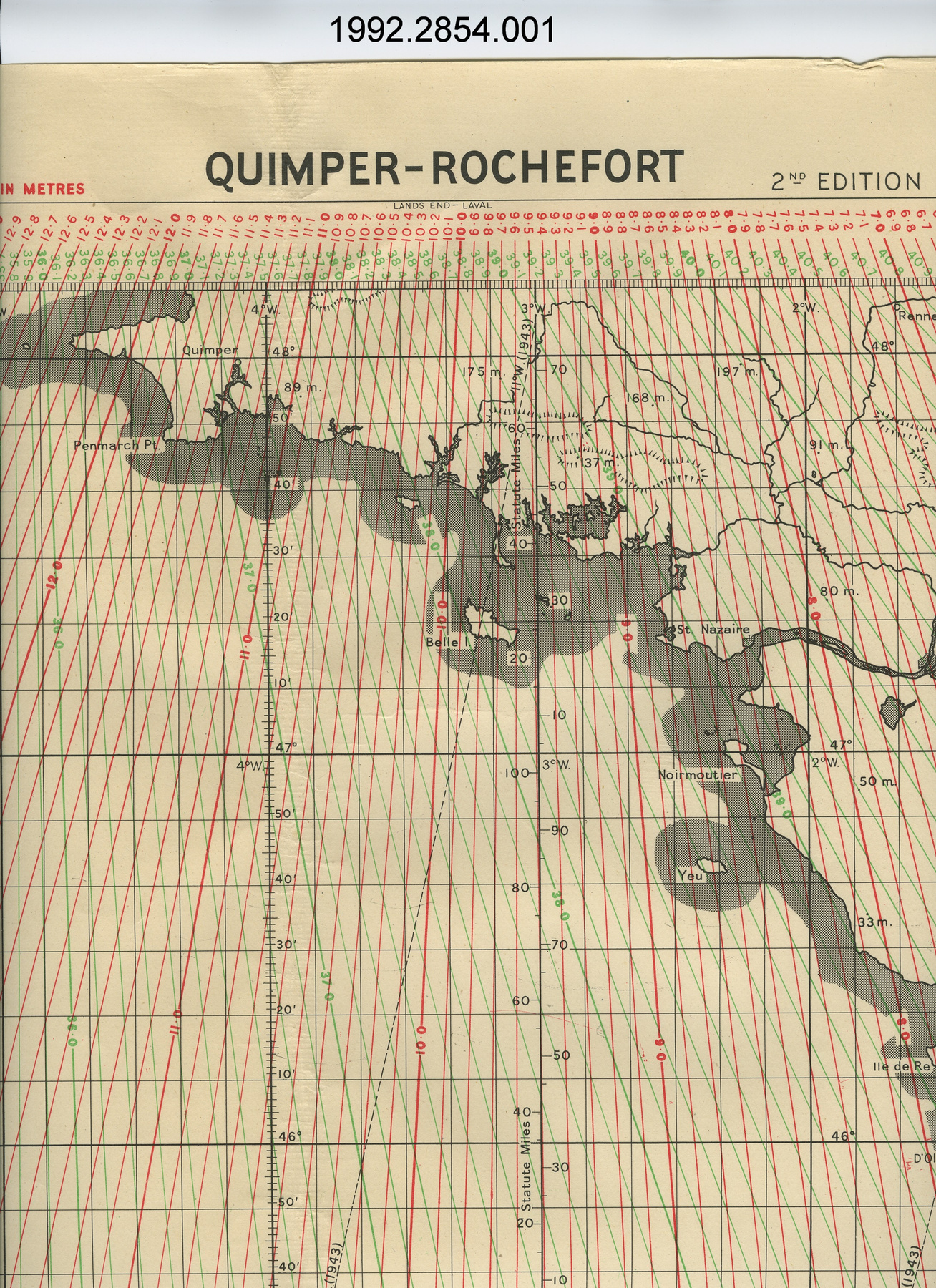
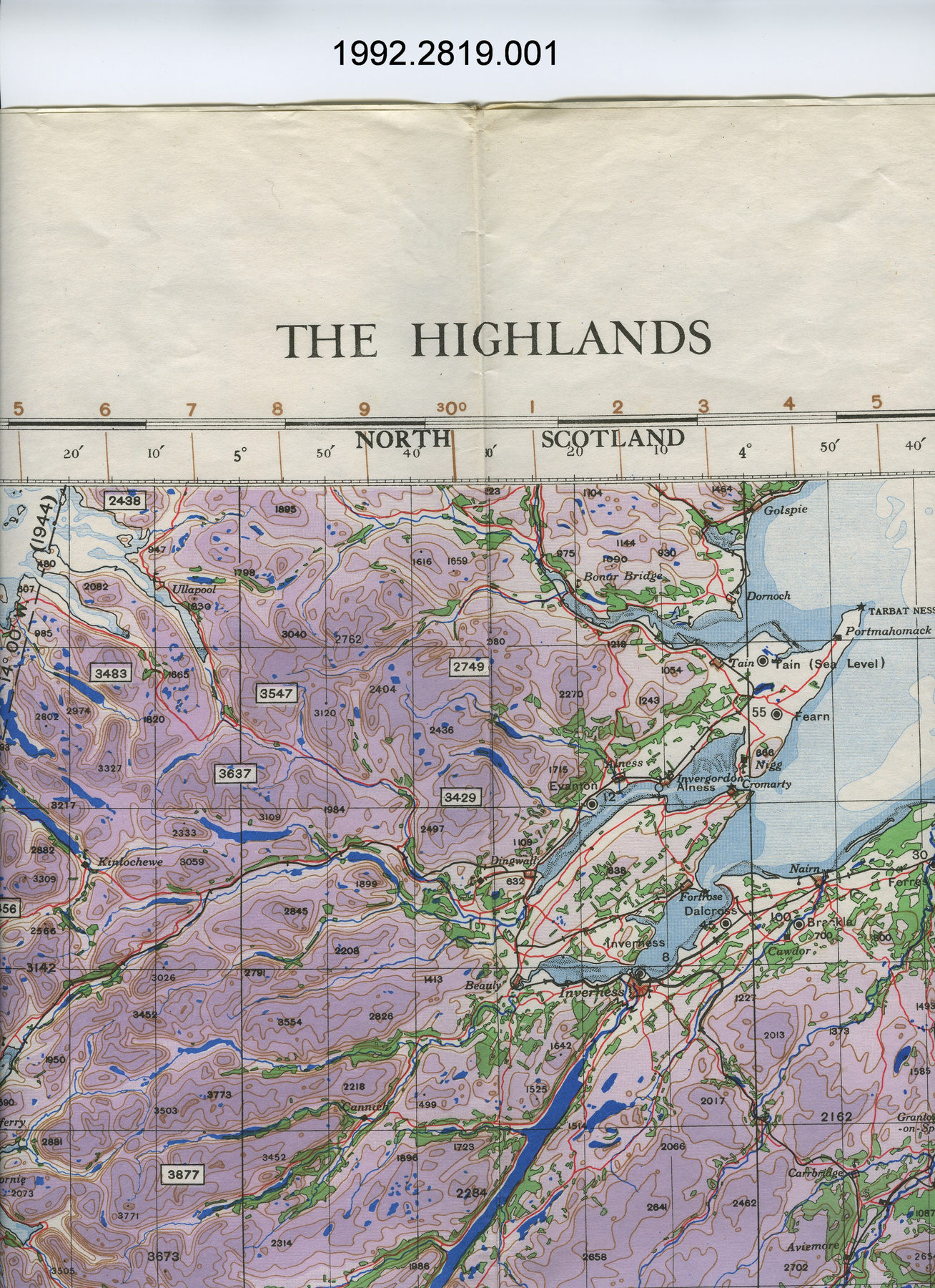
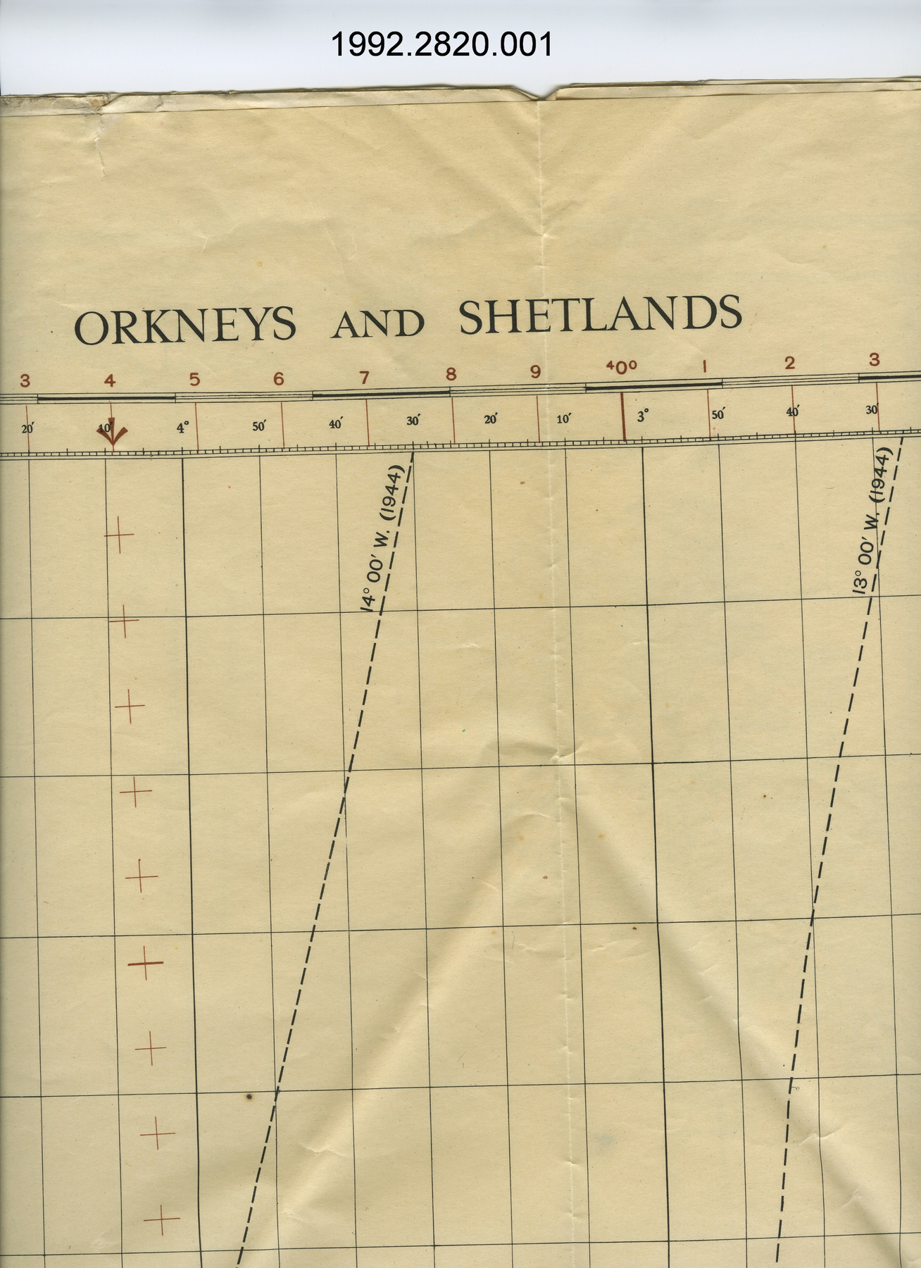
2 dimensional graphic representation of a section of the earth's surface/ fixing position is to calculate by a variety of means the current "fix" or location of an airplane or ship, which is indicated on the fixing chart, so the course can be verified & adusted if necessary - Technical
-
Unknown - Area Notes
-
Unknown
Details
- Markings
- lettering along top above edge of map reads: "Scale 1:1,000,000 REIMS FIXING CHART"; the following lettering has been crossed over in the overprint: "RADAR PLOTTING CHART EDITION OF DECEMBER 1944 LONDON - MUNCHEN"; lettering along bottom below edge of map reads: "G.S.G.S. 4537 A B C/Published by War Office 1944/12,500/5/45.Cr./PROJECTION: CONICAL ORTHOMORPHIC/Scale 1:1,000,000 Compiled and drawn at G.S.G.S. (A.M.) 1944/Photolithographed by O.S. 1944/Computed by A.W.A.S. Drawn at G.S.G.S. (A.M.)"
- Missing
- N/A
- Finish
- colour map on white background; predom. white with brown lines & water in blue
- Decoration
- N/A
CITE THIS OBJECT
If you choose to share our information about this collection object, please cite:
Geographical Section, General Staff, War Office, Map, 1944, Artifact no. 1992.2817, Ingenium – Canada’s Museums of Science and Innovation, http://collection.ingeniumcanada.org/en/id/1992.2817.001/
FEEDBACK
Submit a question or comment about this artifact.
More Like This

1992.2817.001