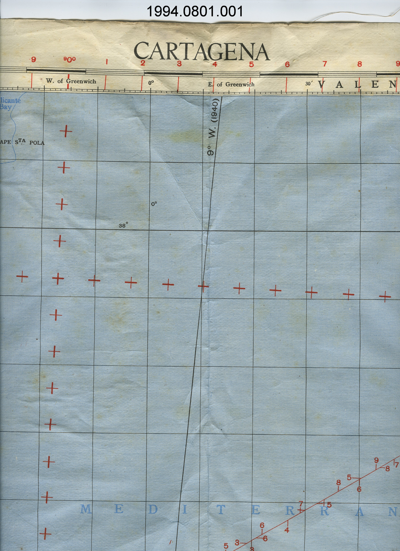
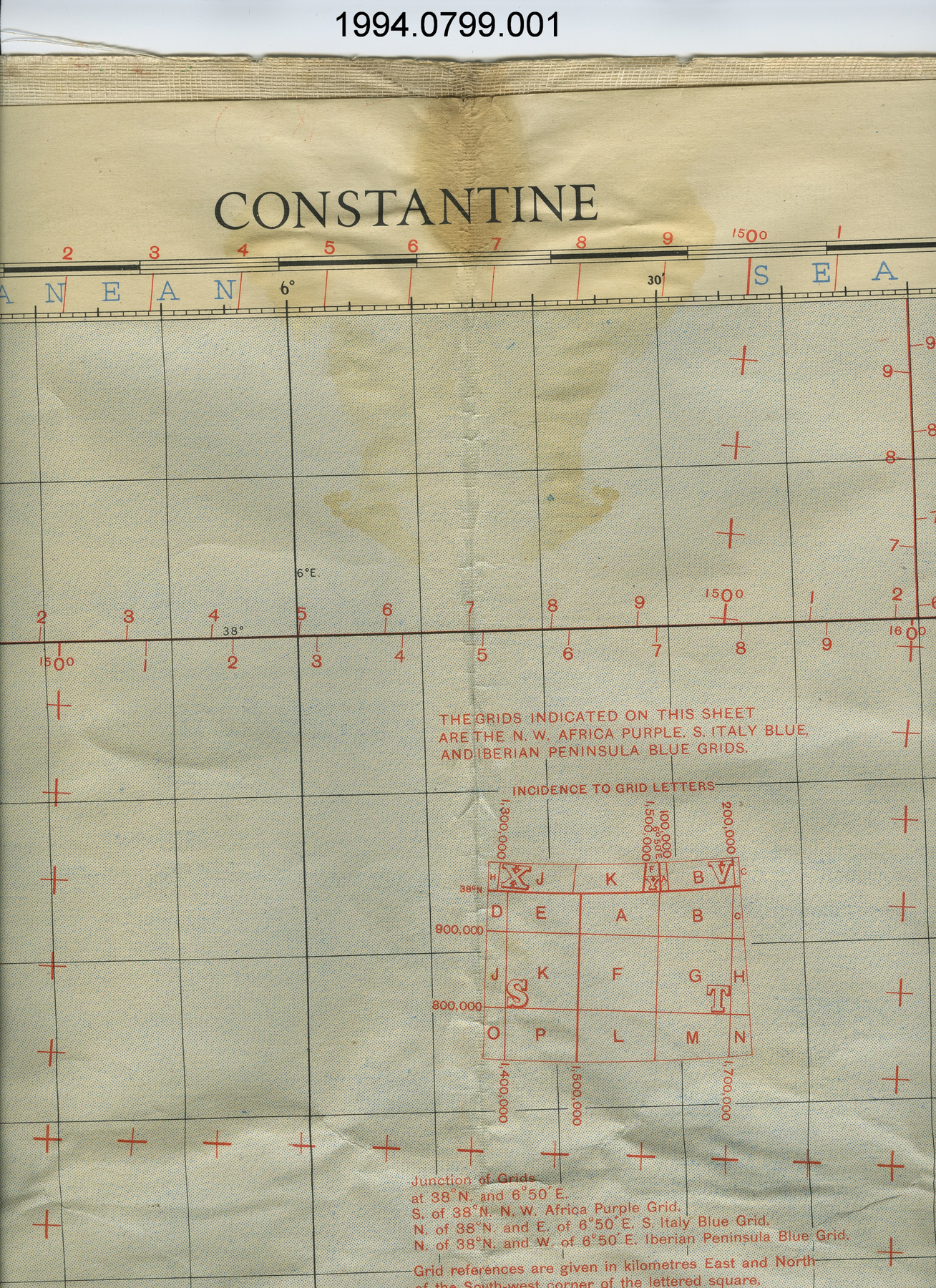
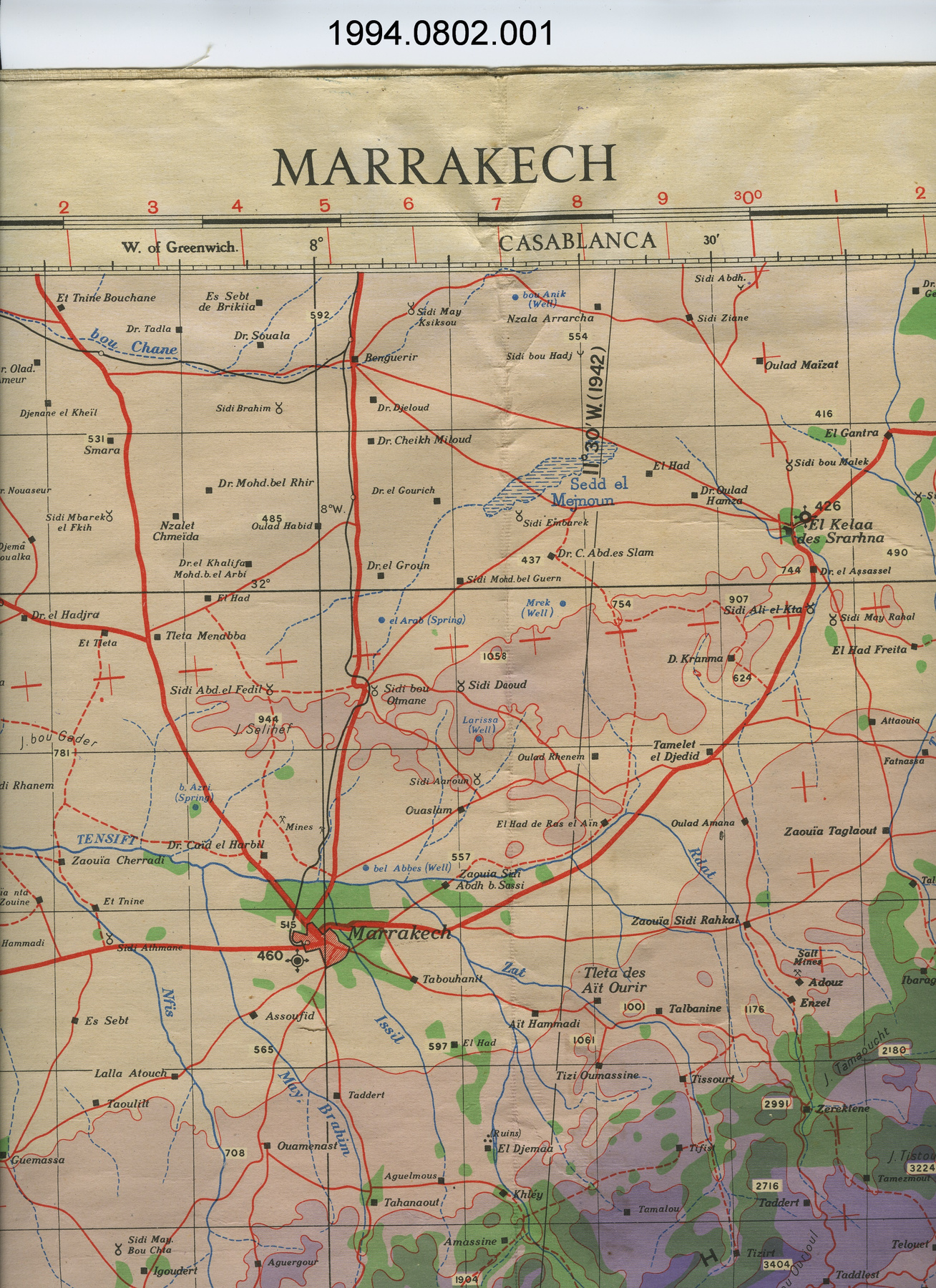
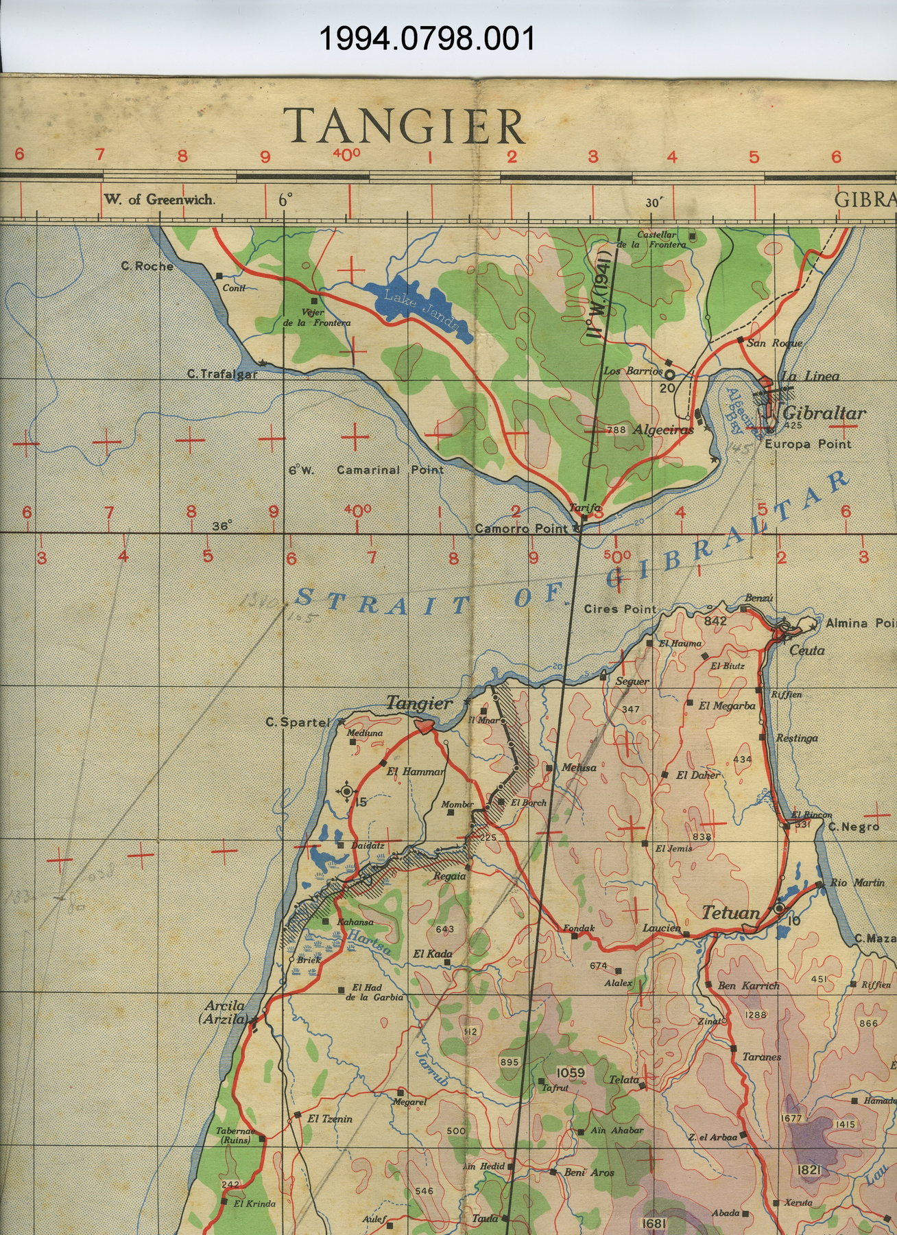
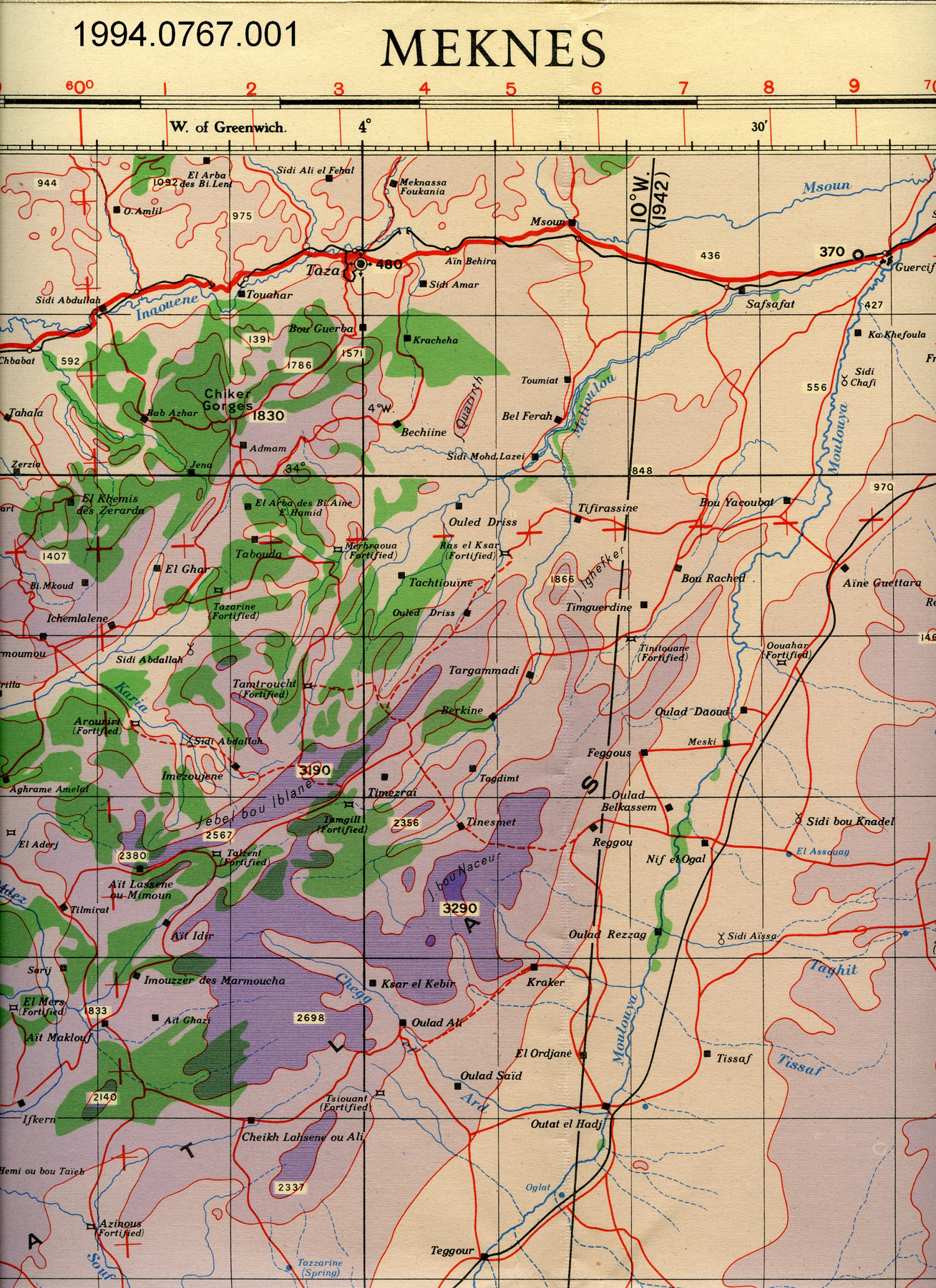
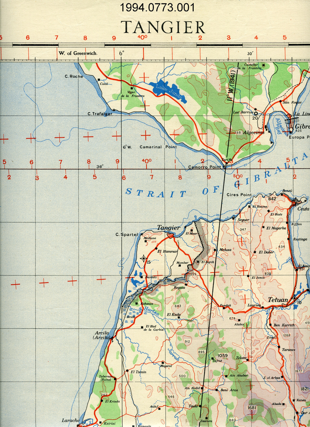
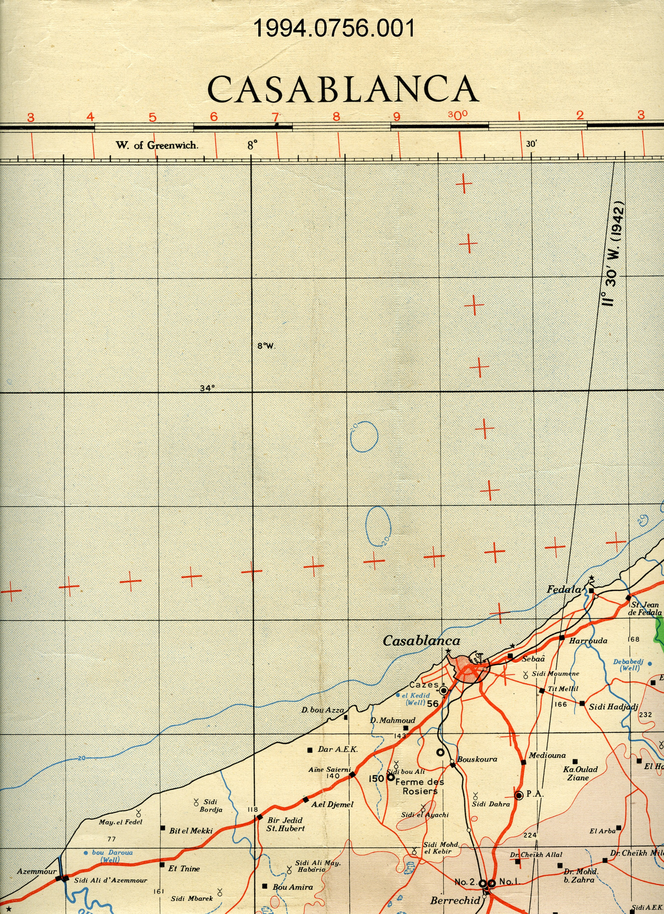
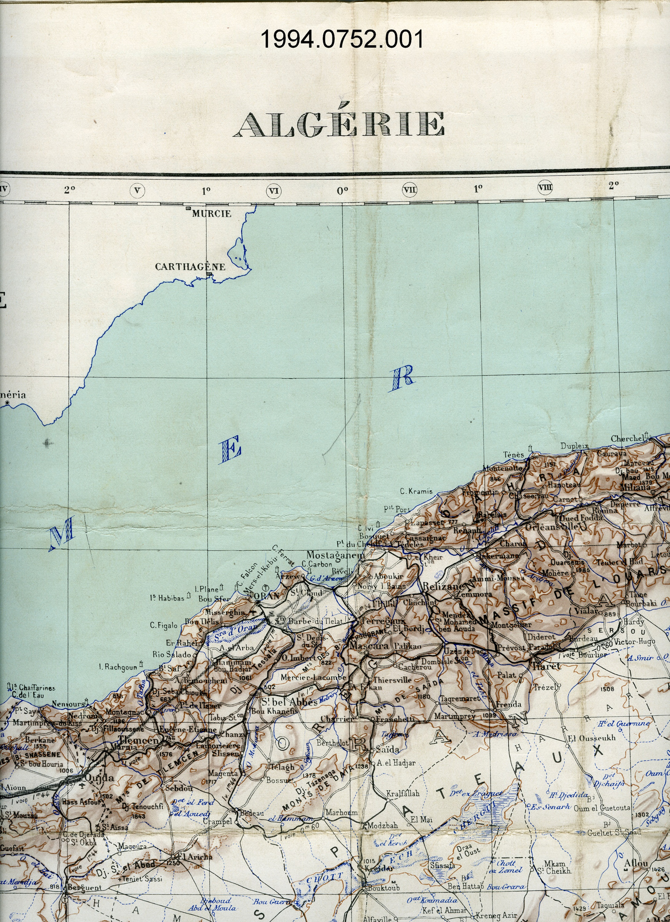
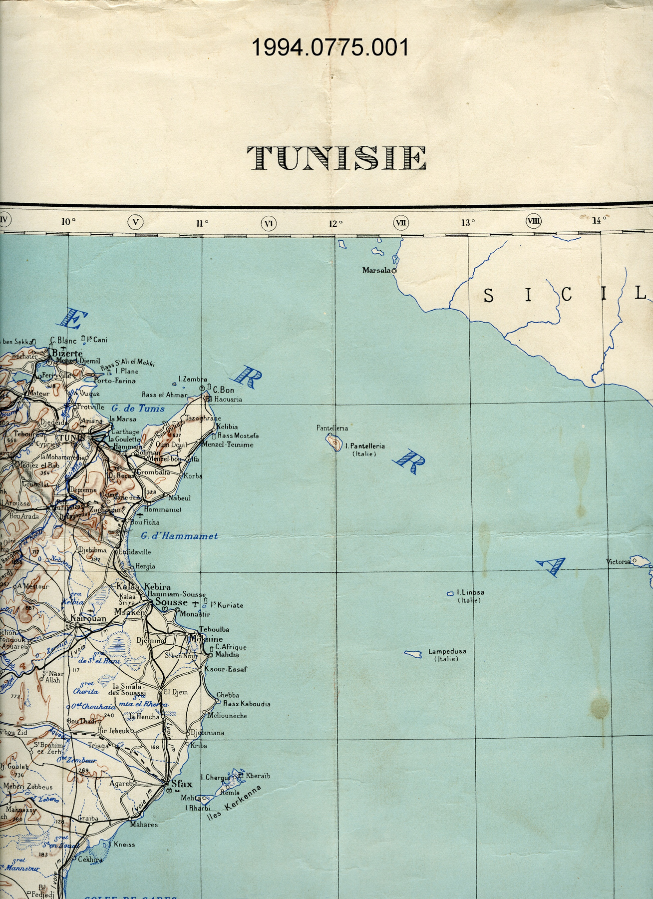
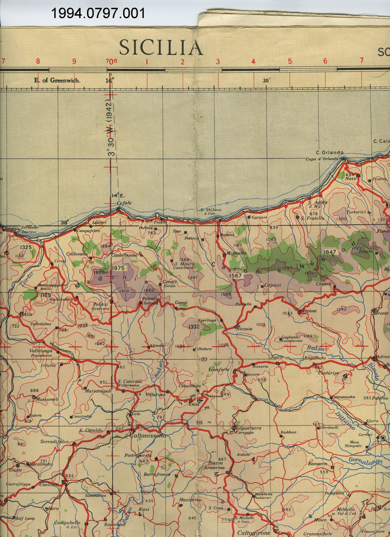
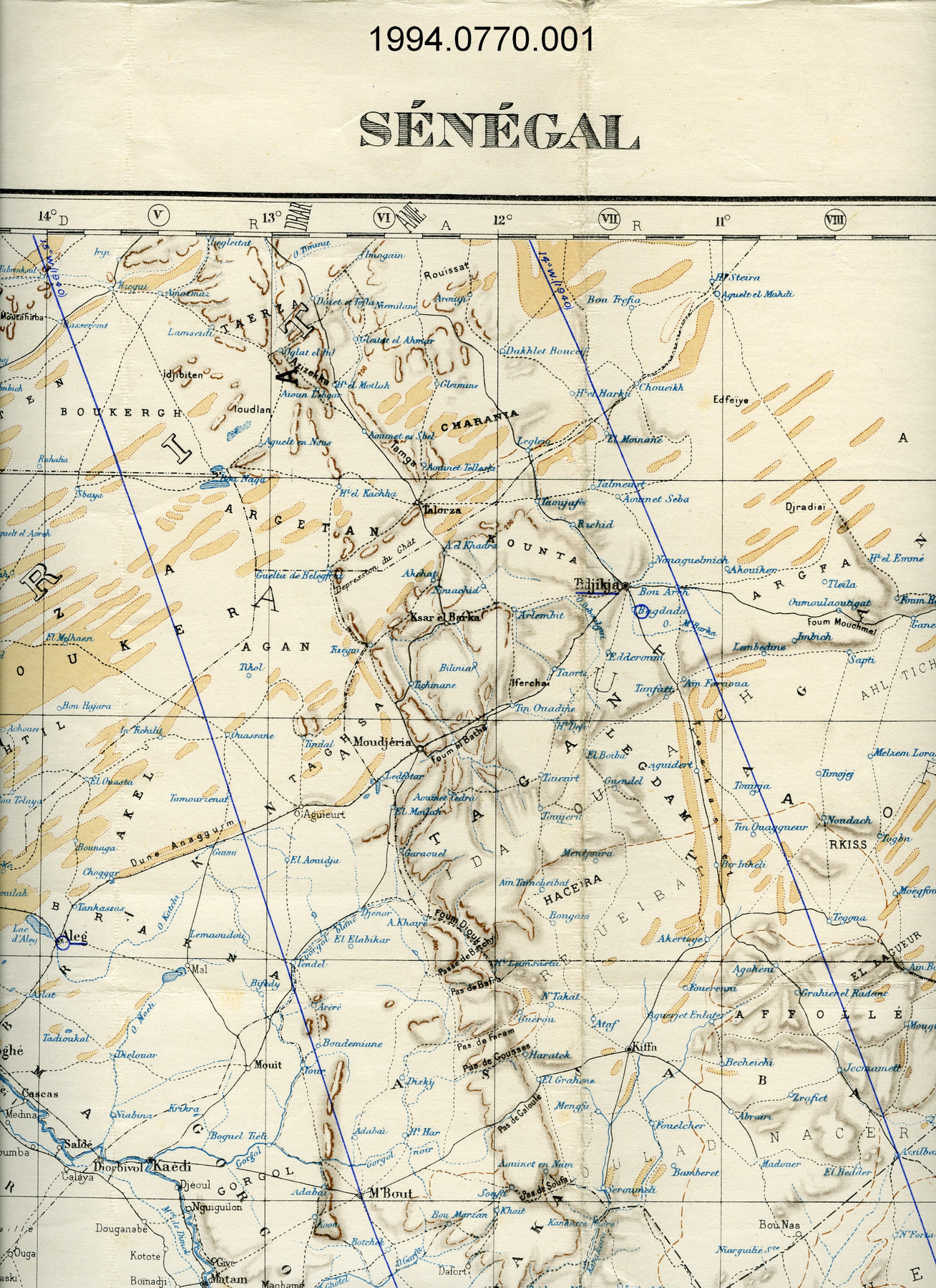
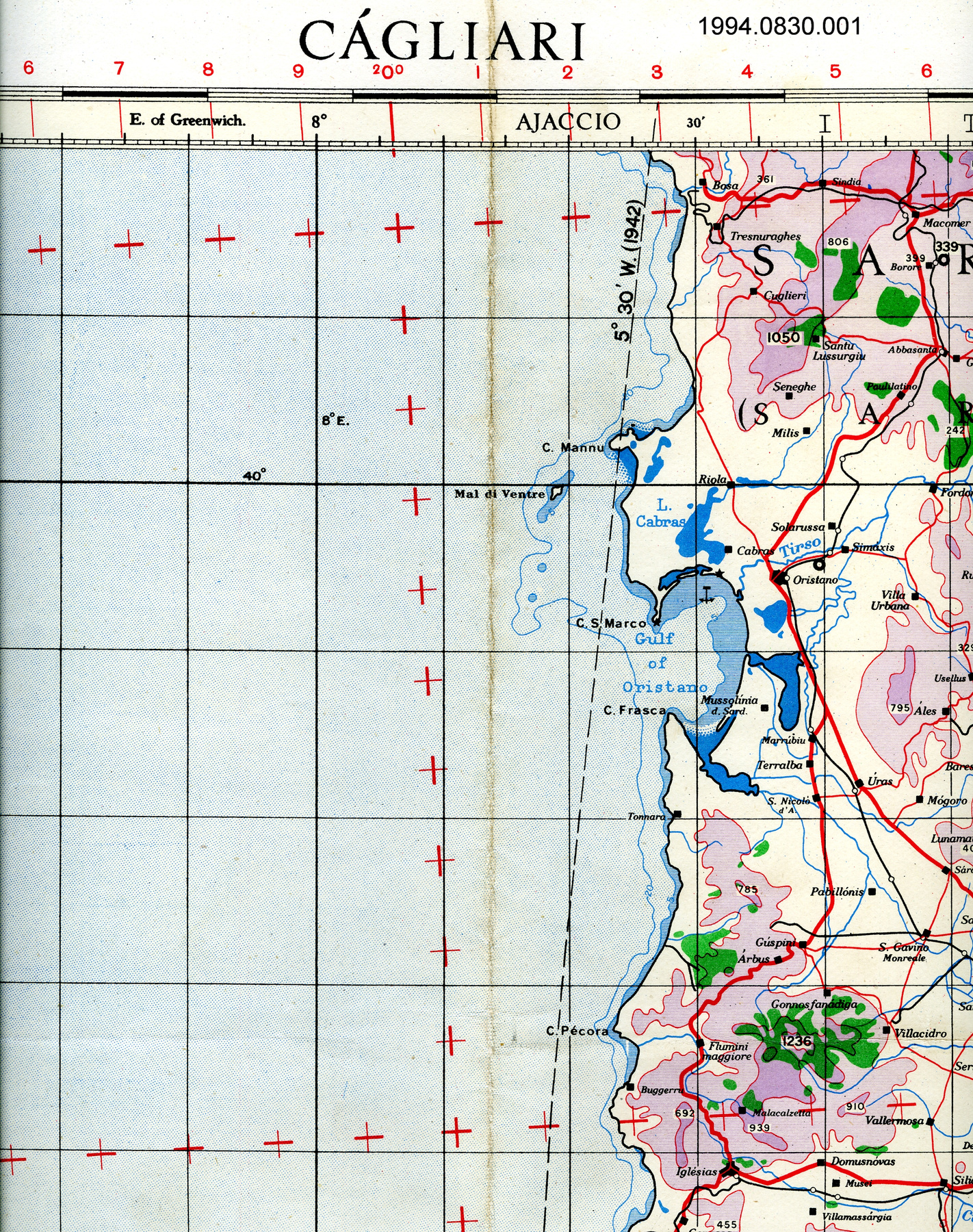
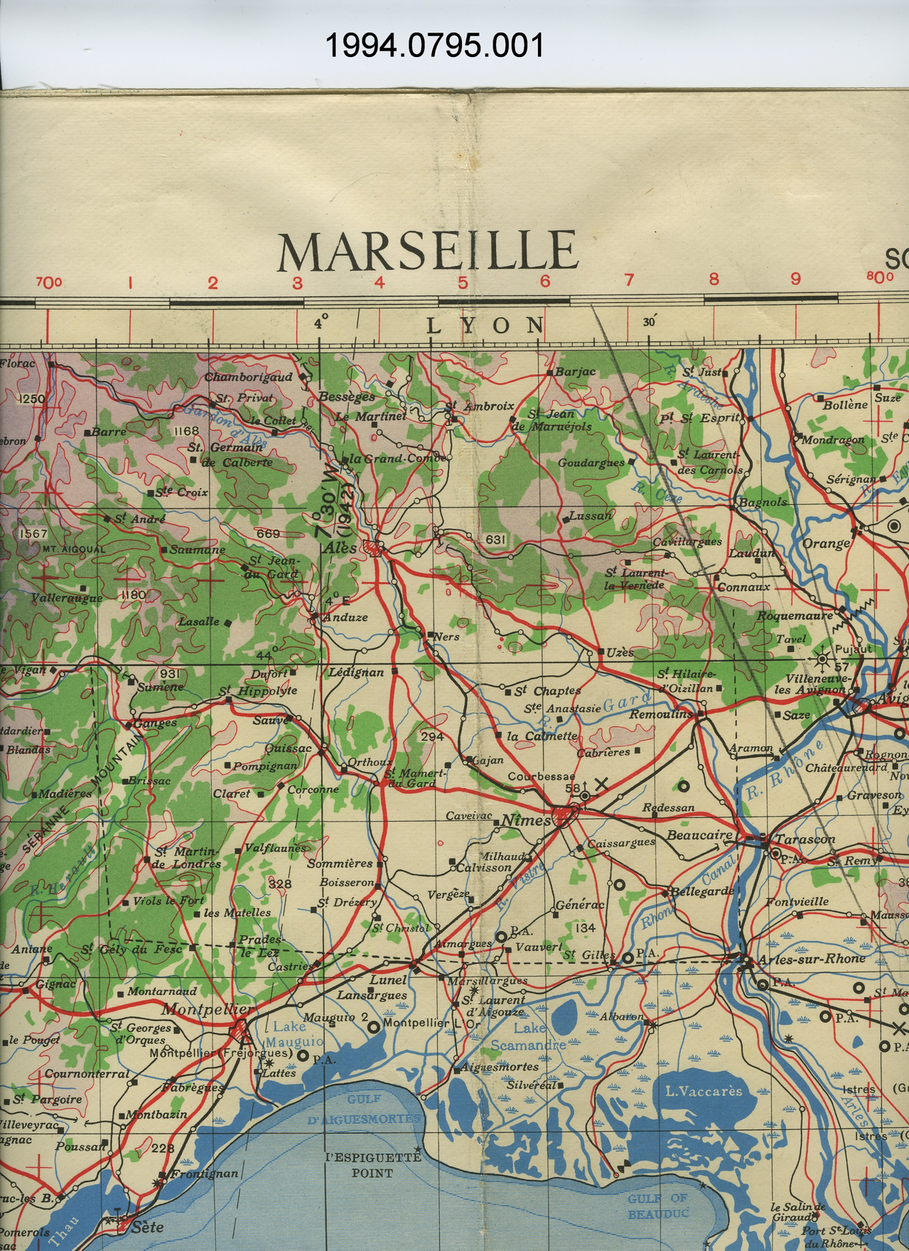
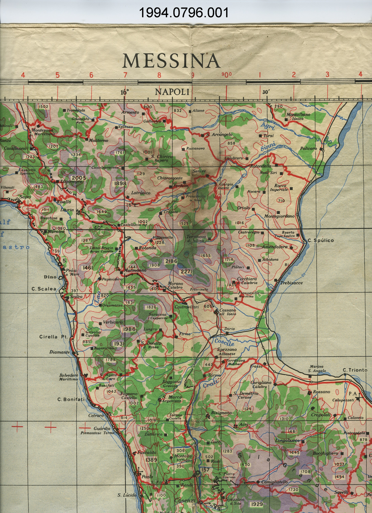
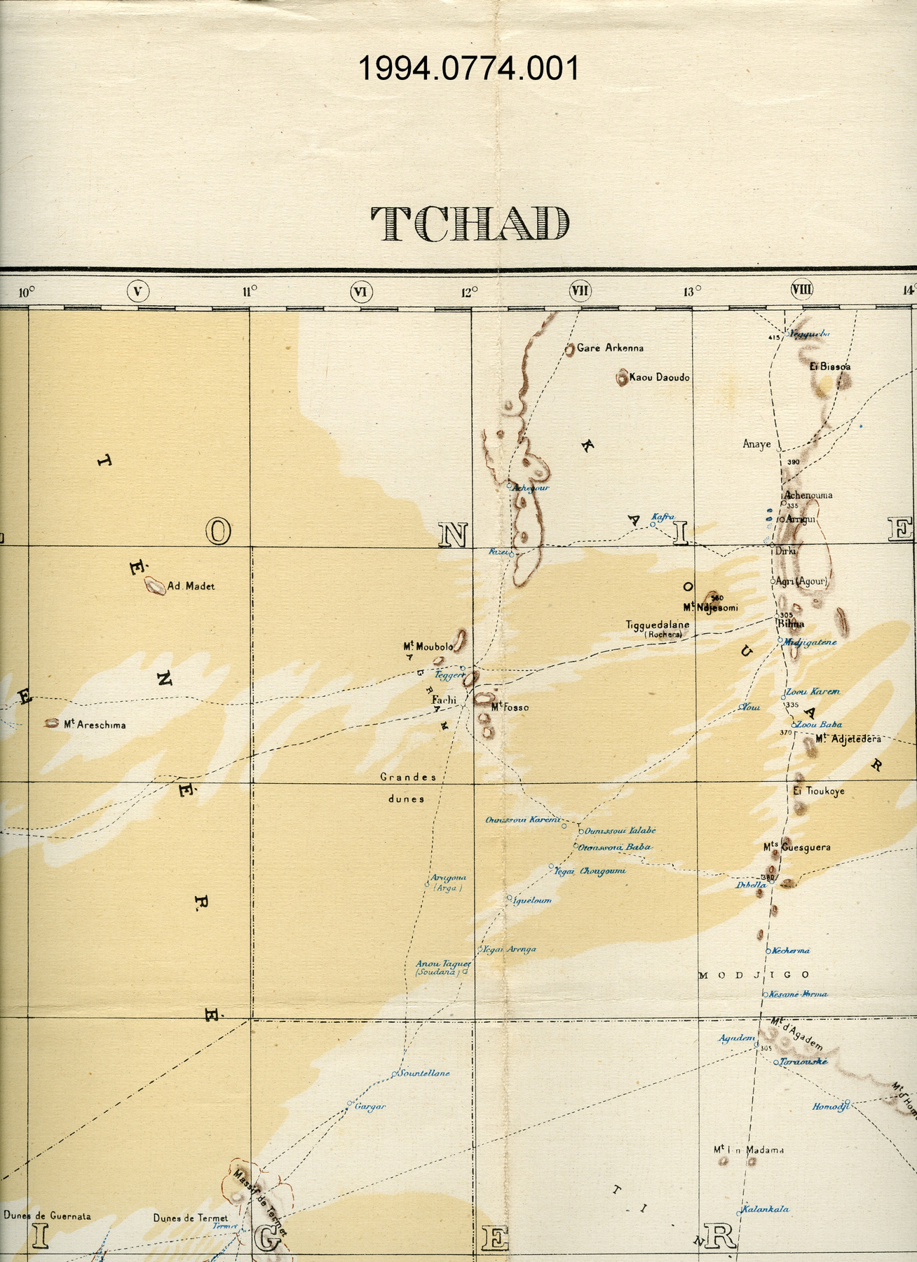
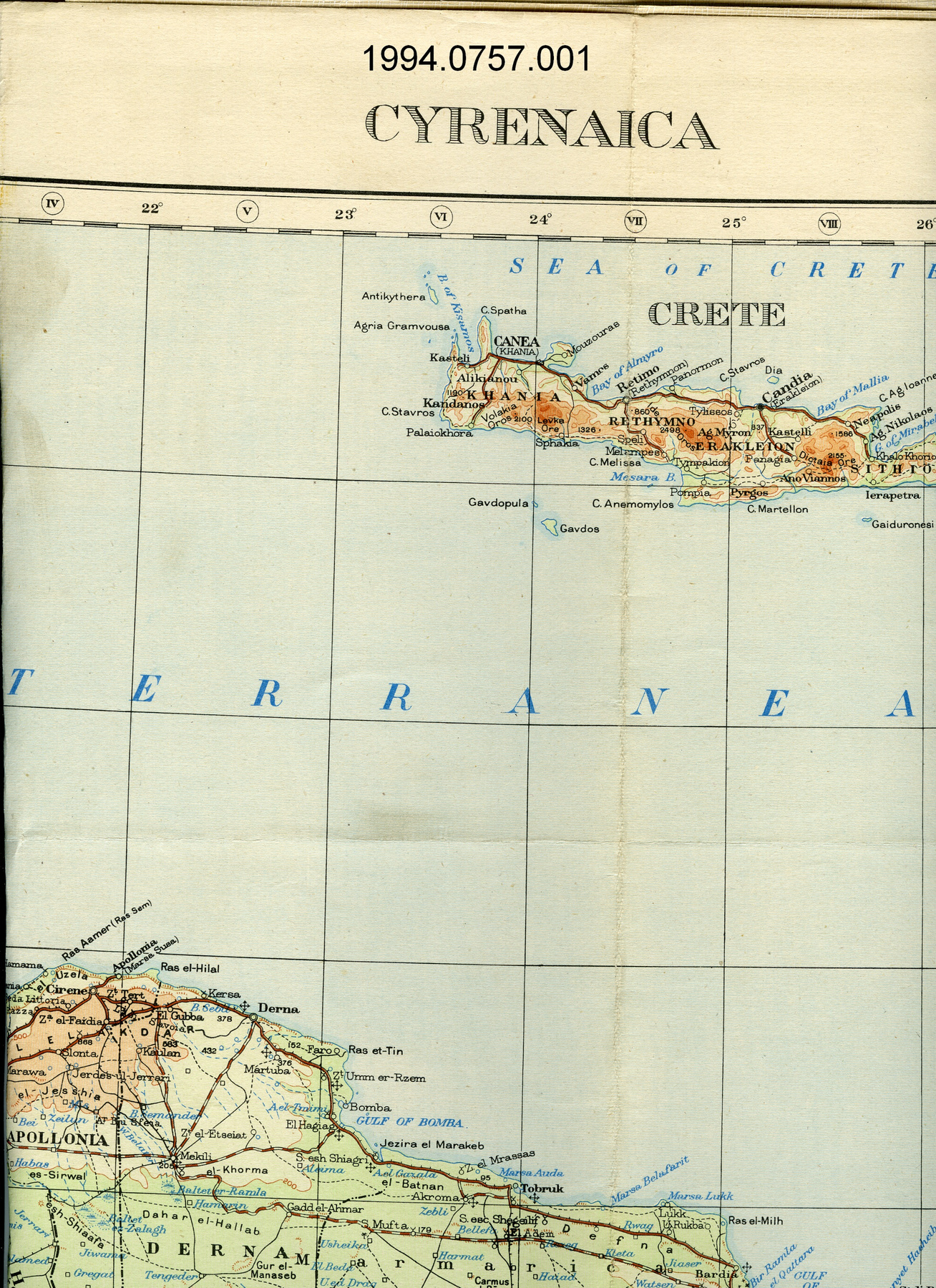
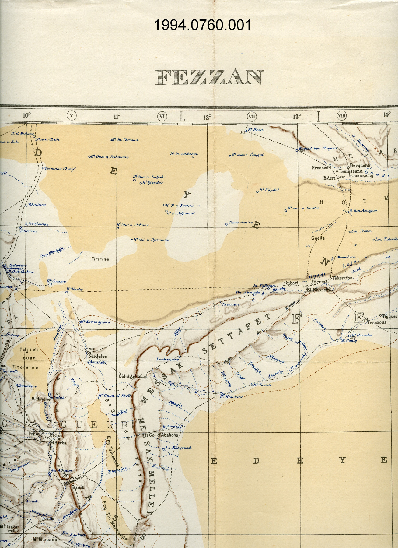
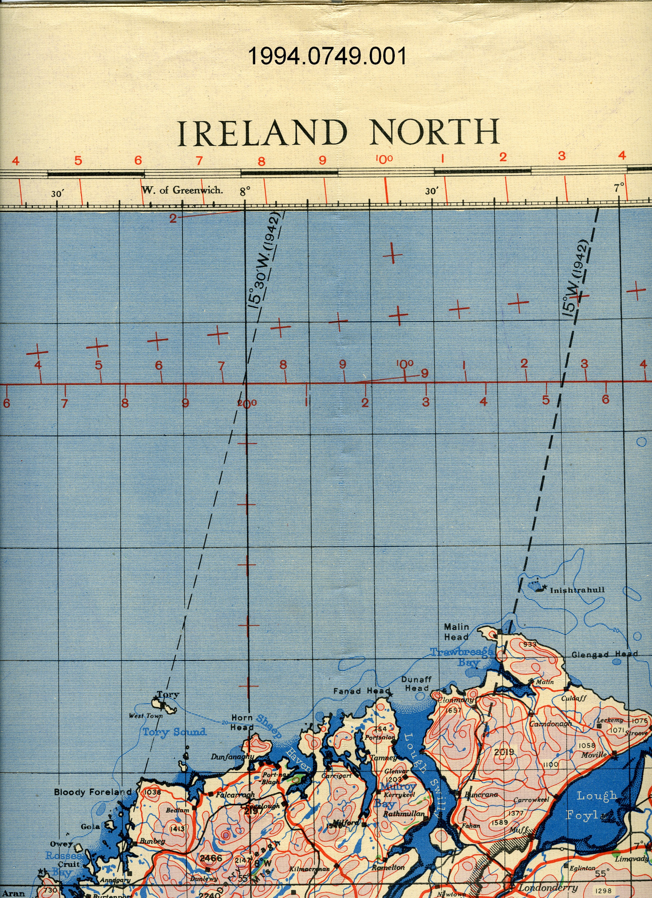
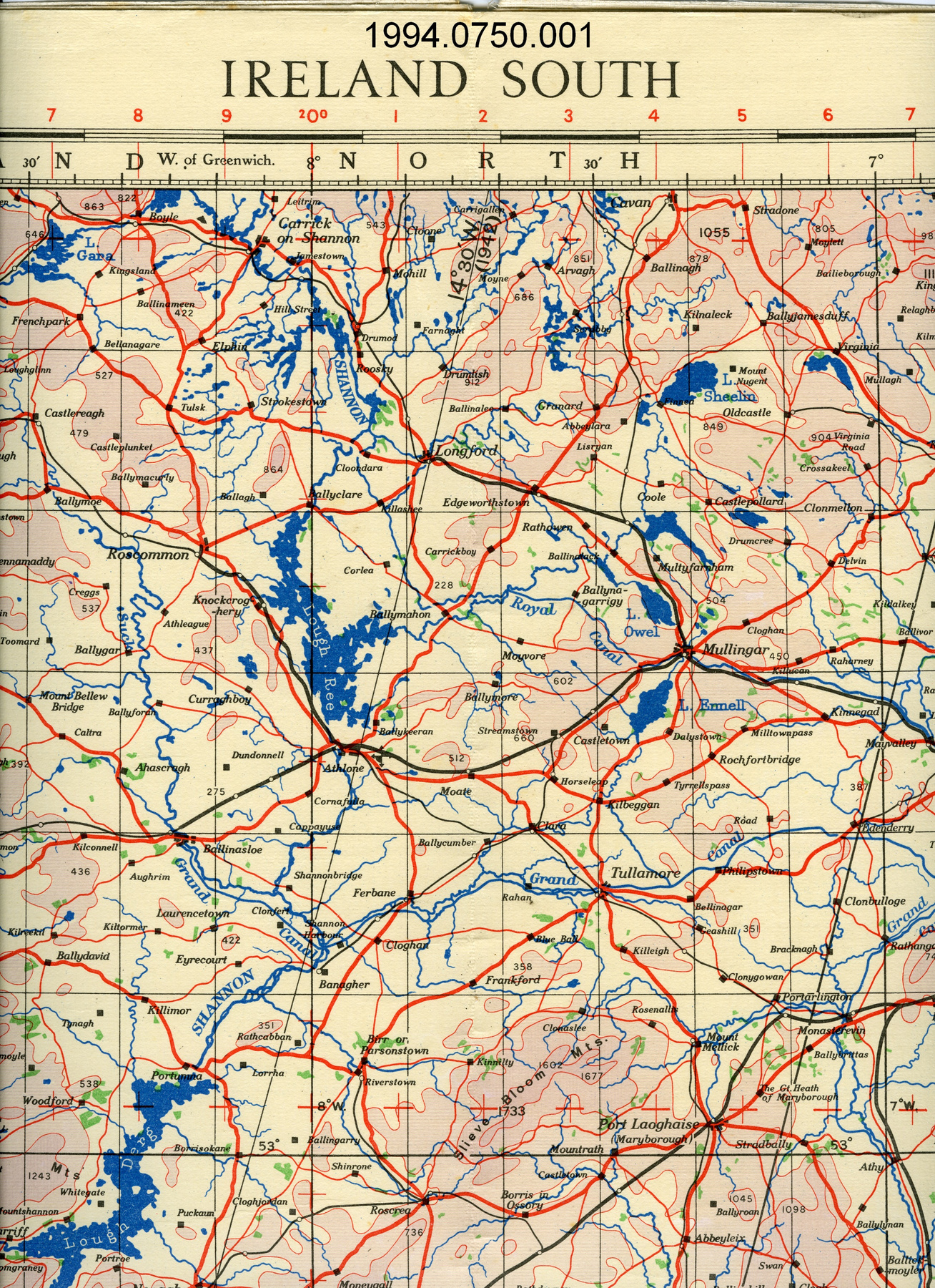
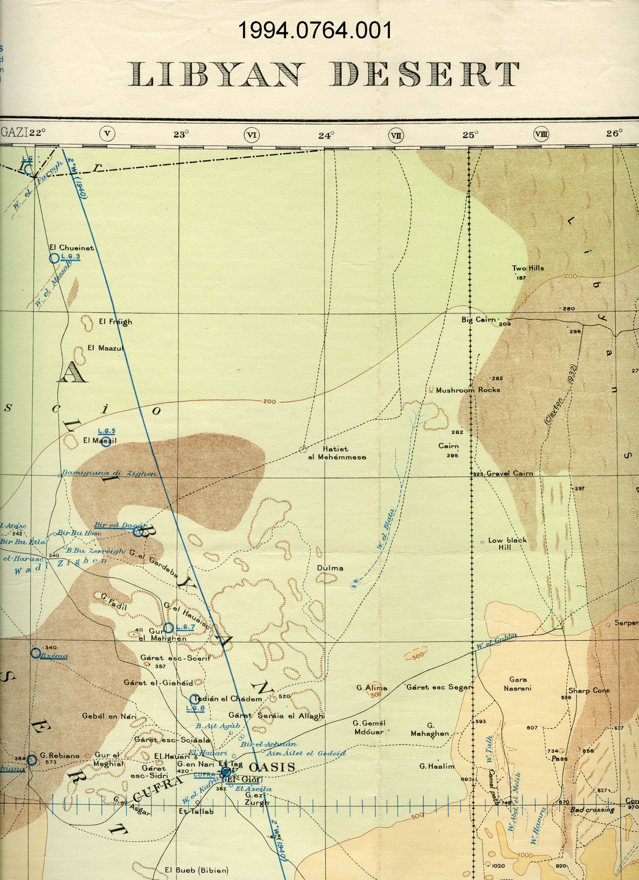
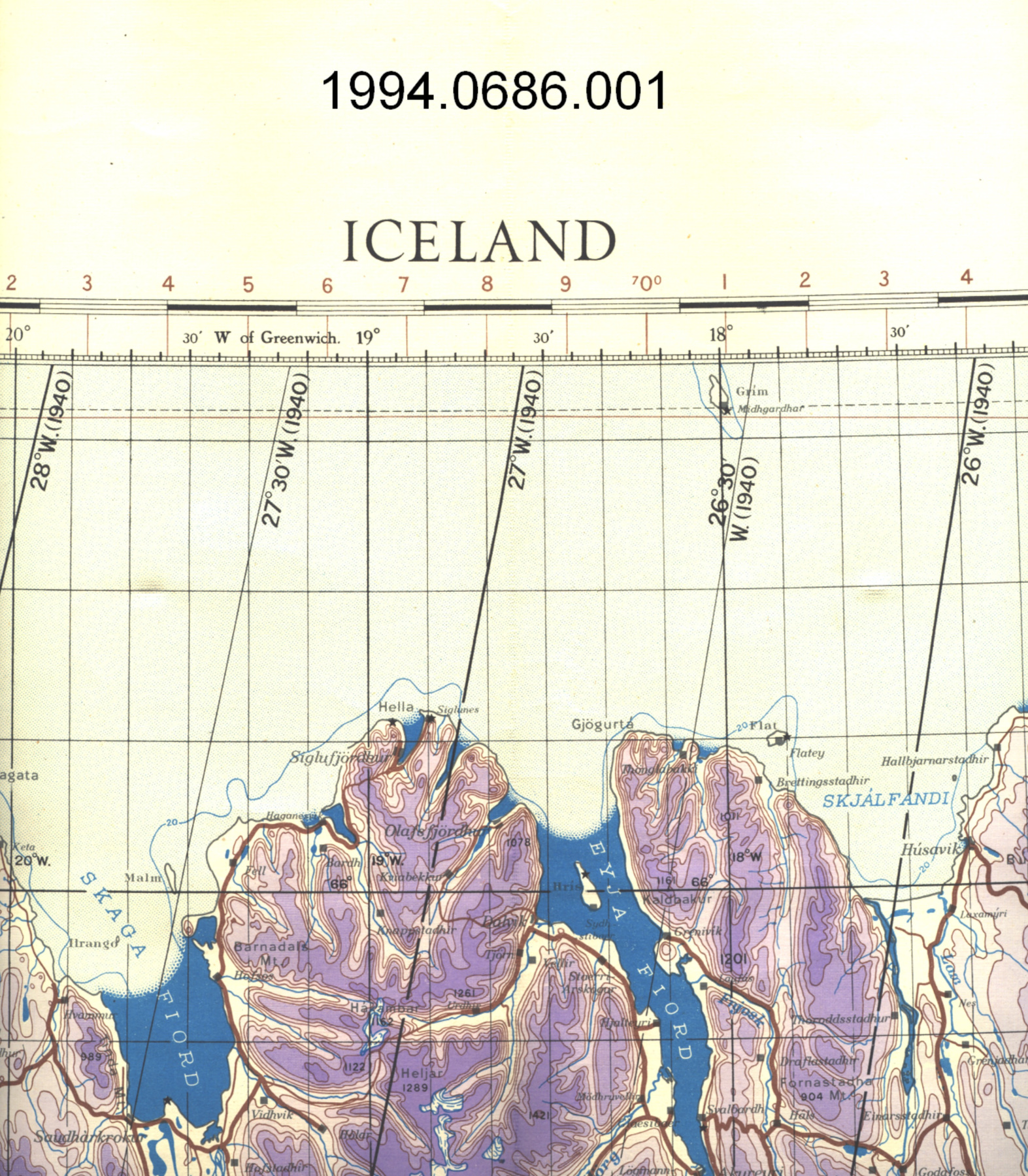
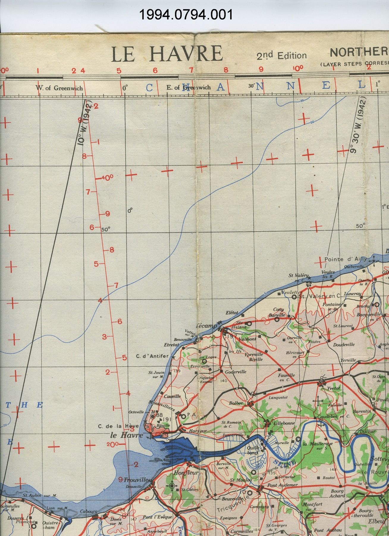
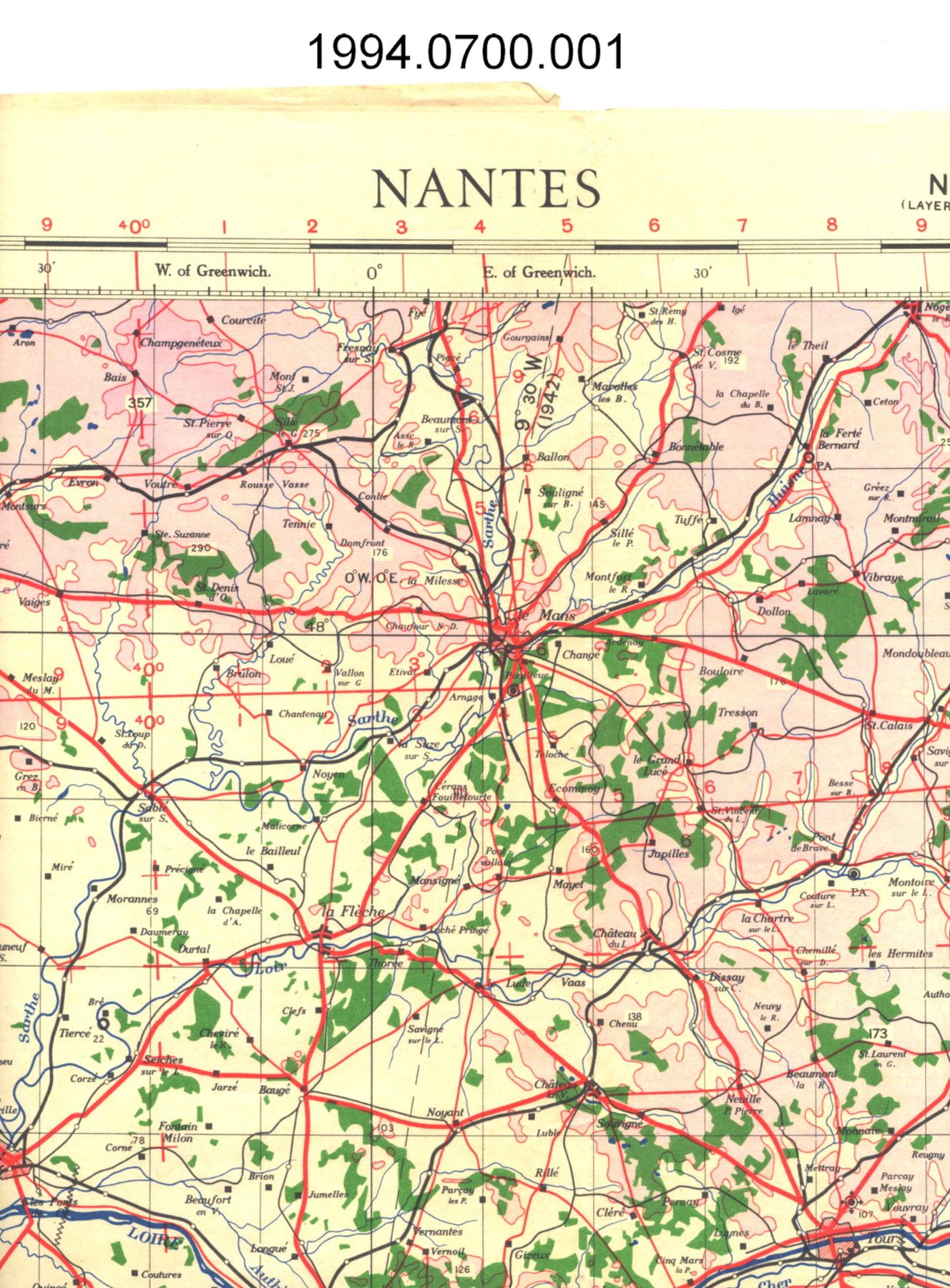
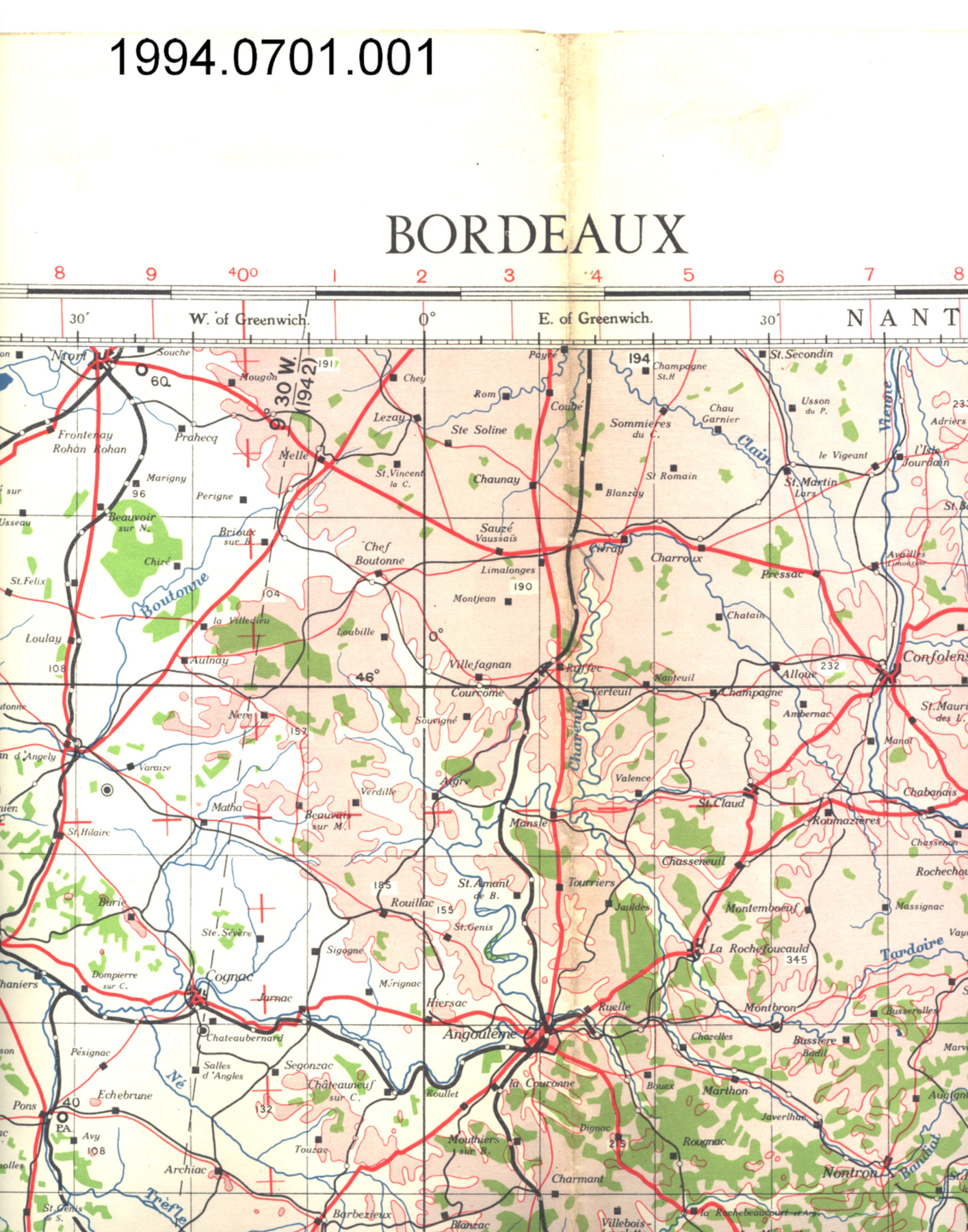
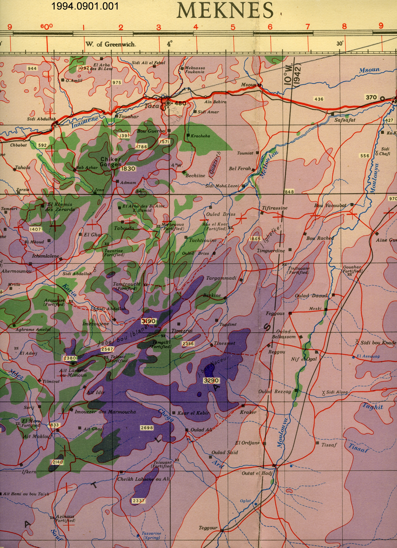
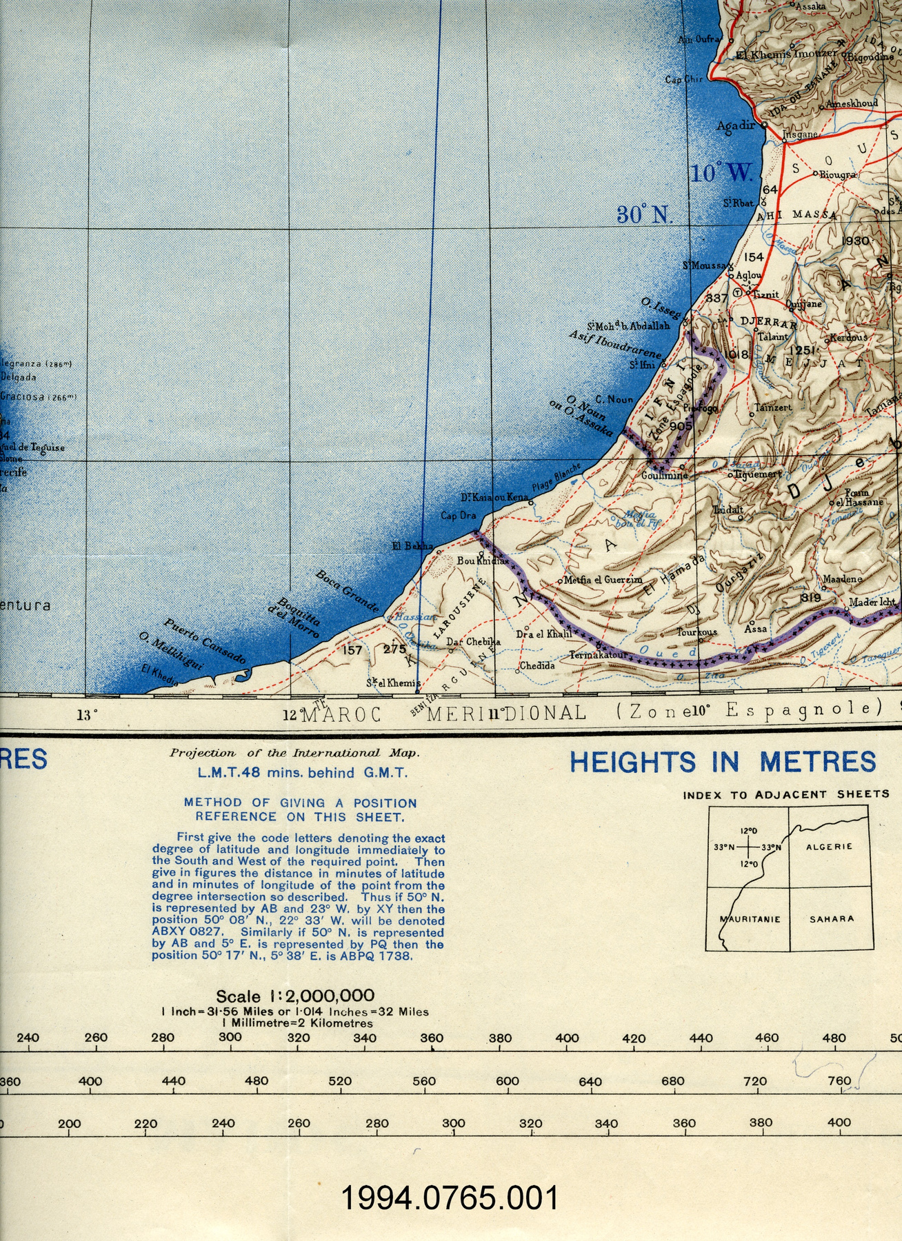
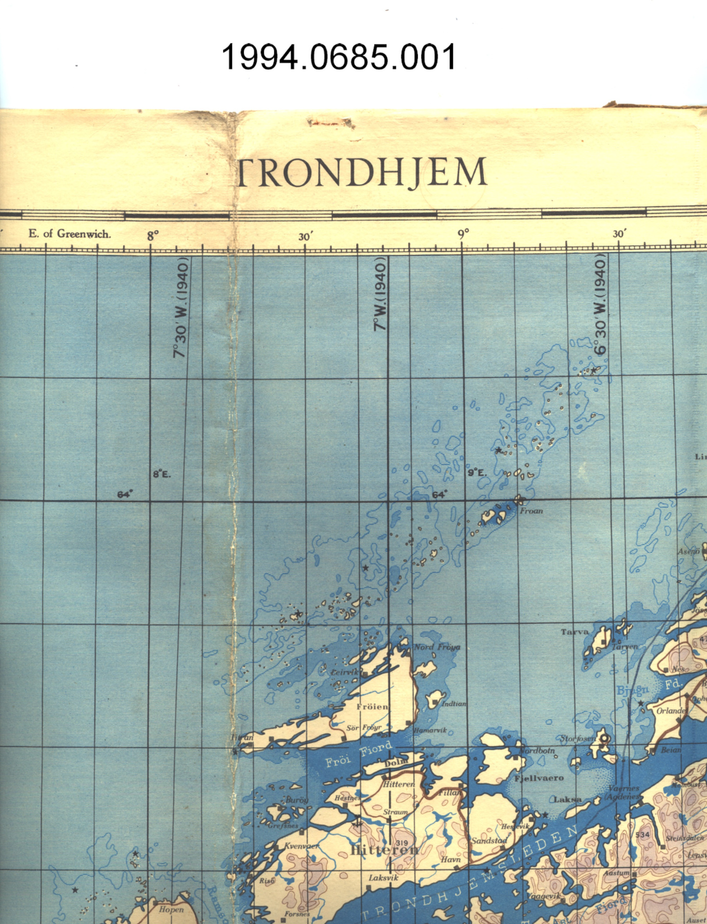
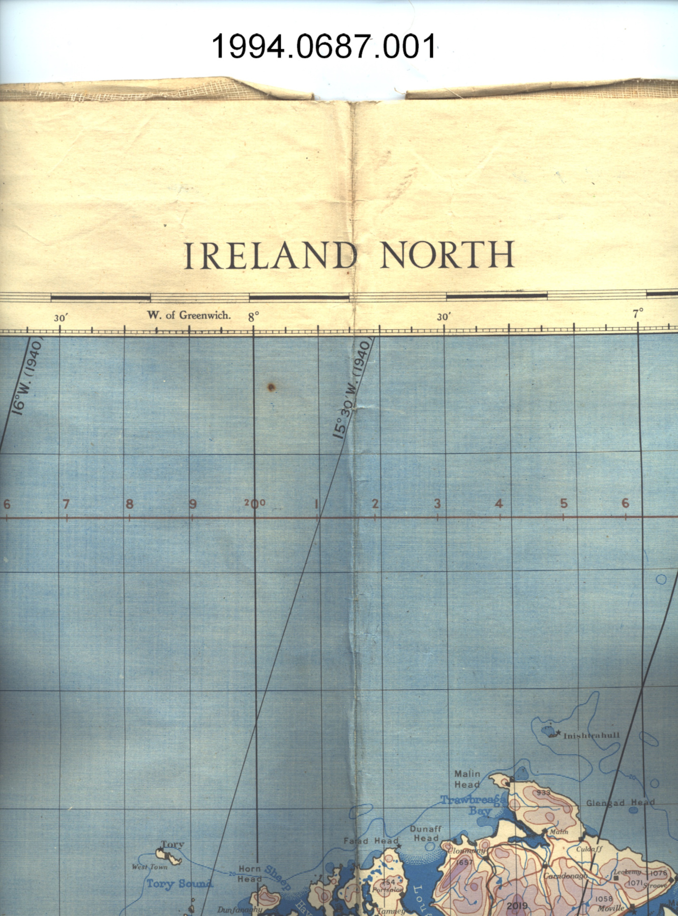
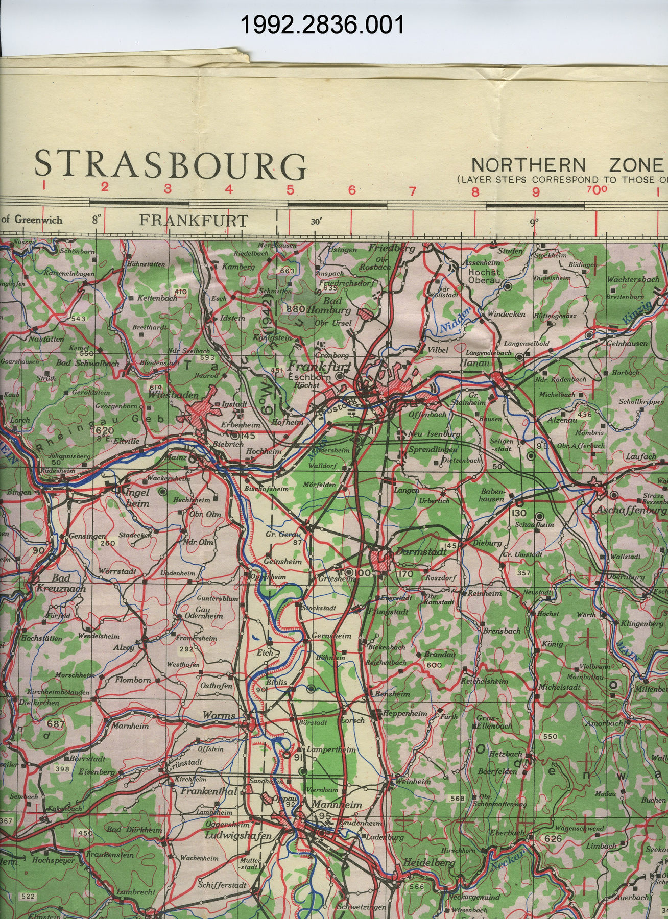
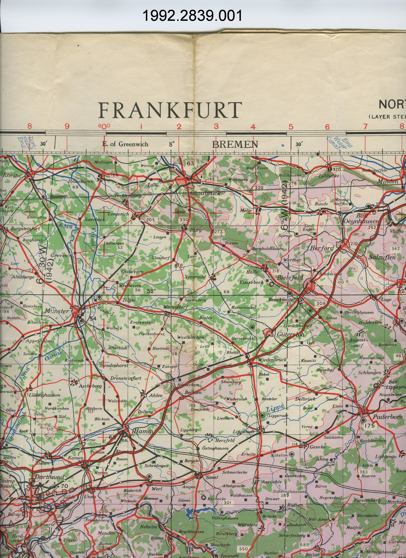
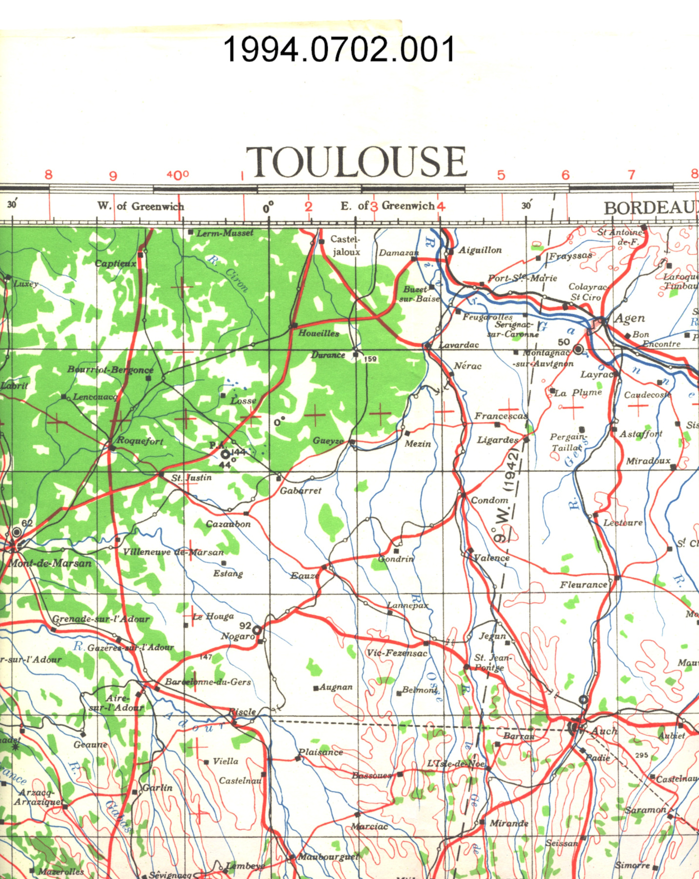
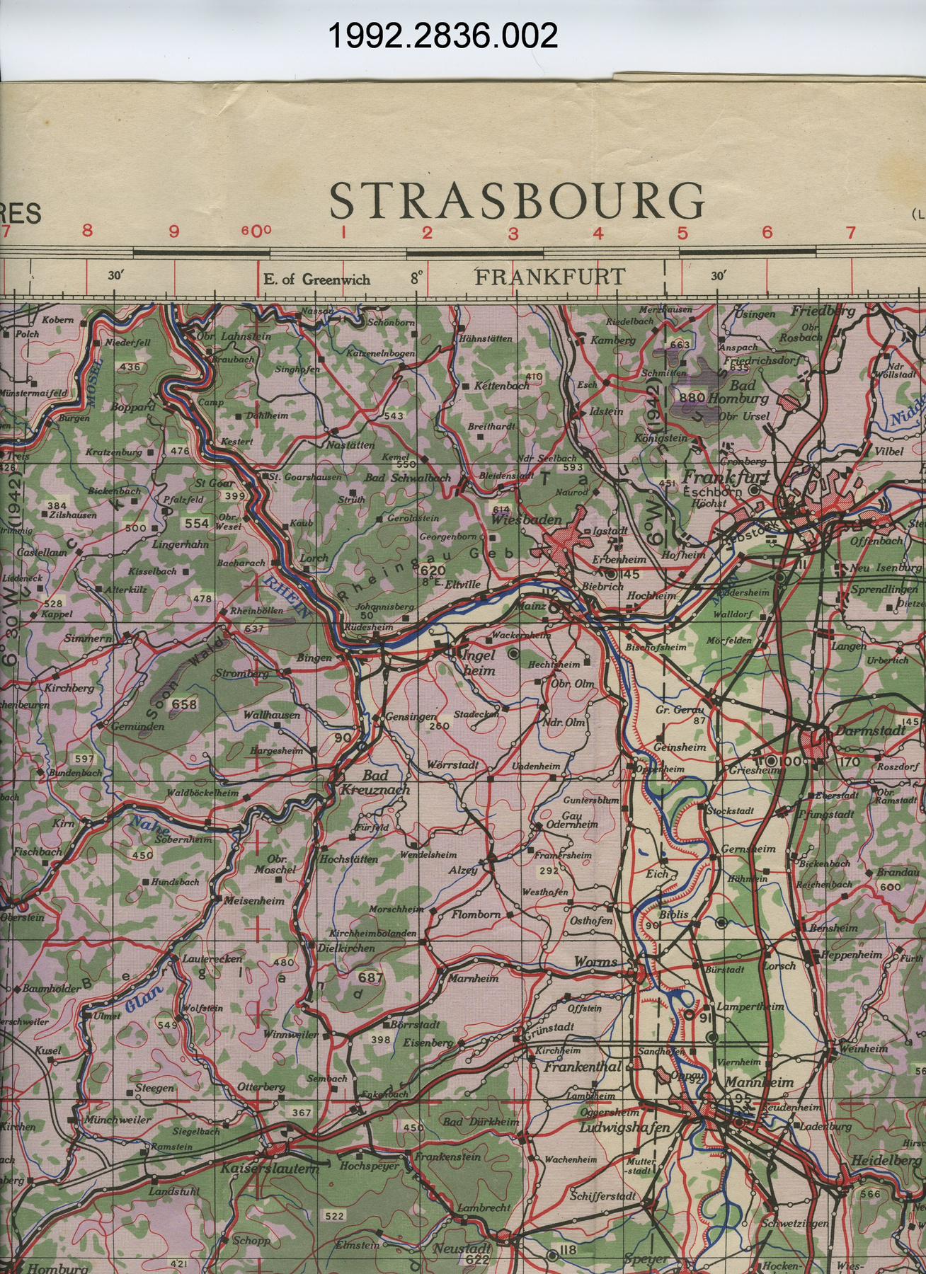
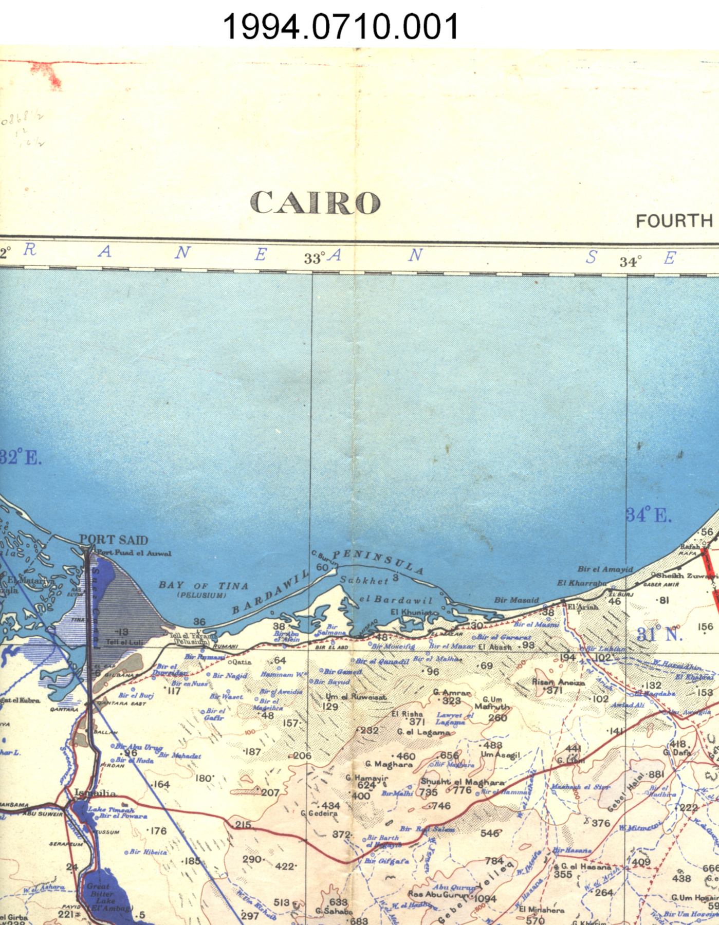
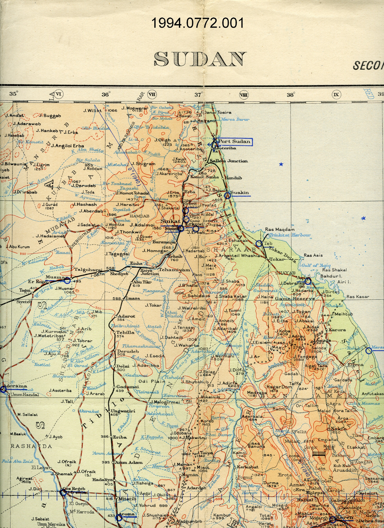
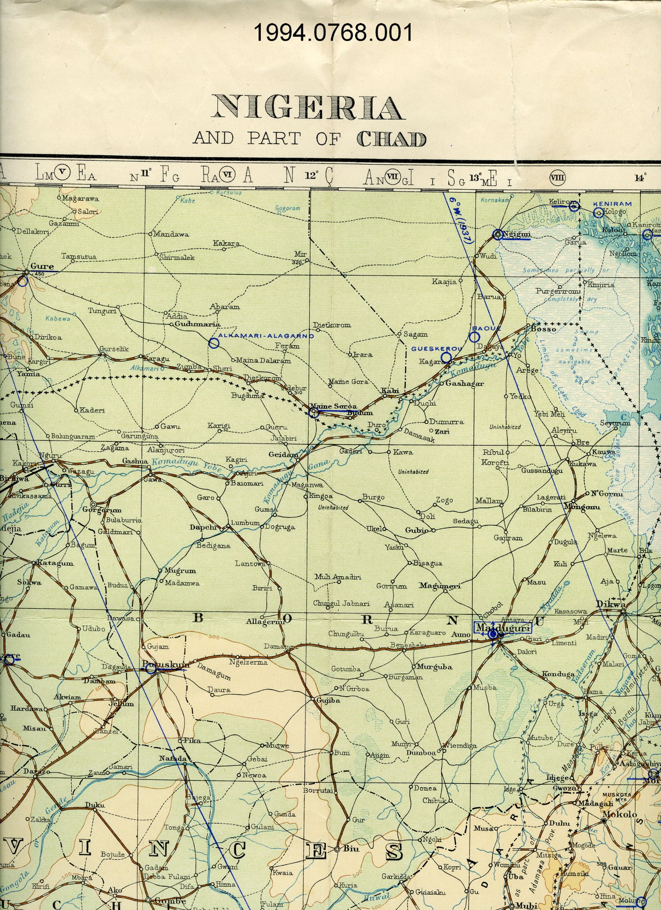
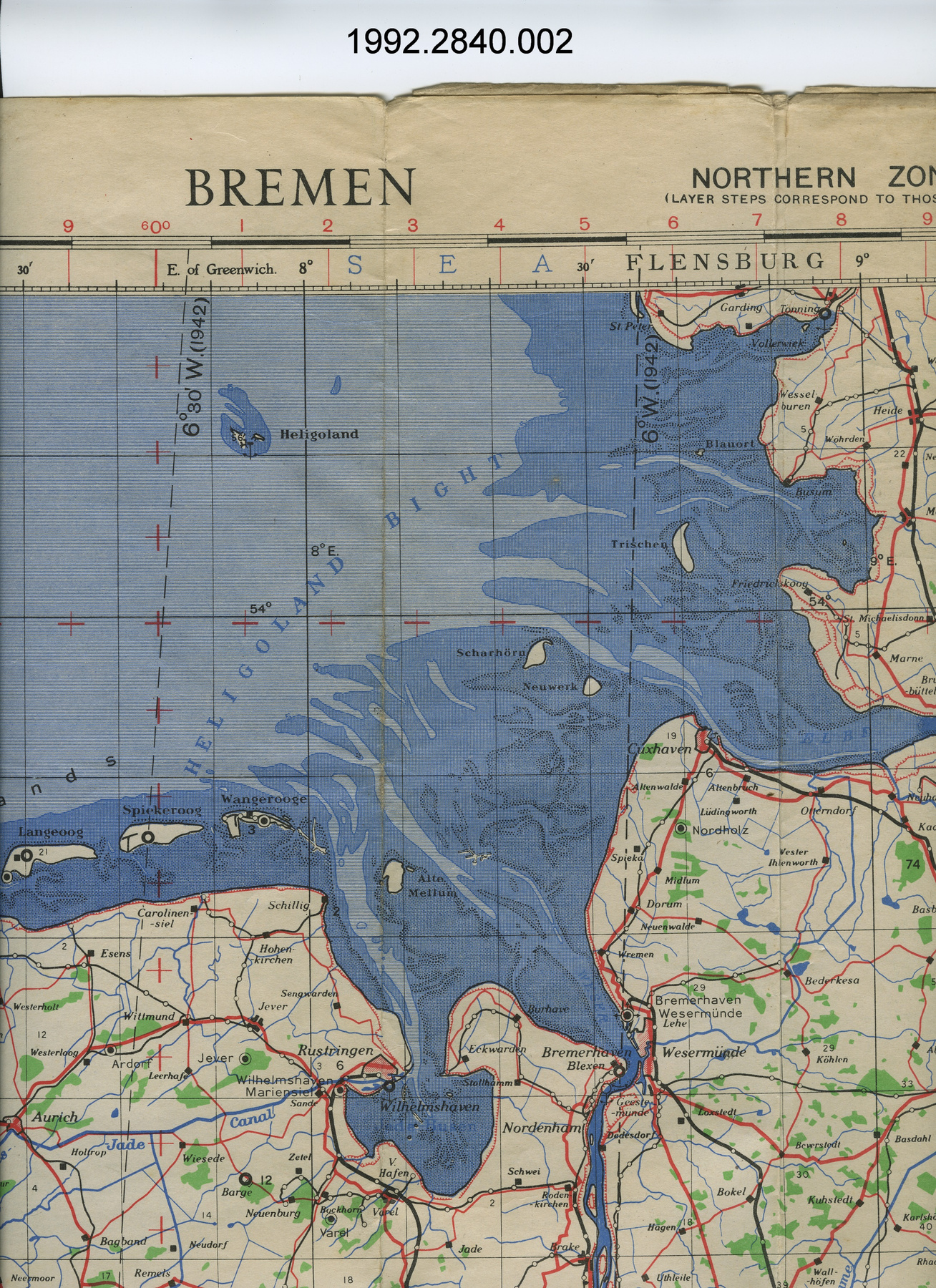
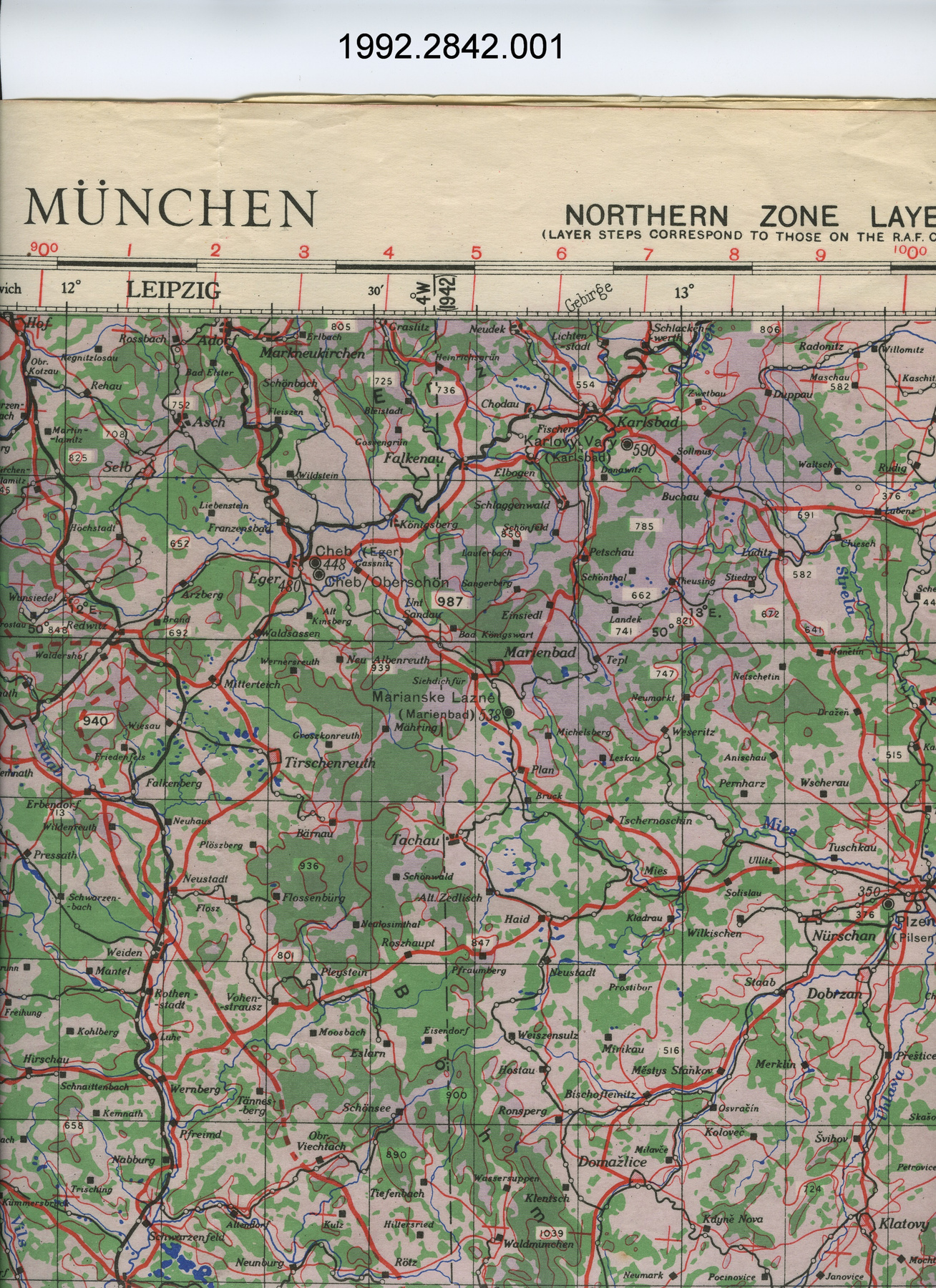
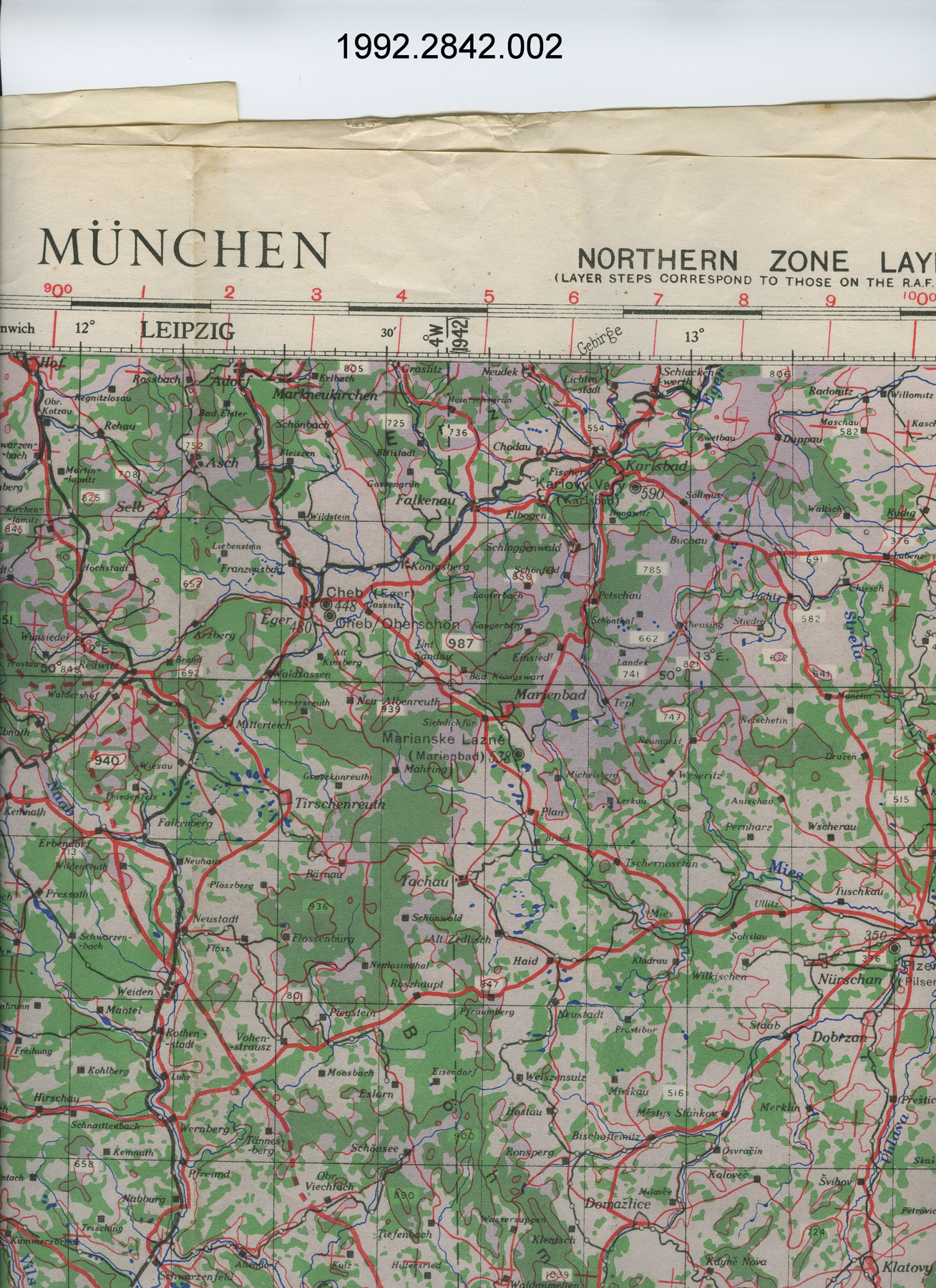
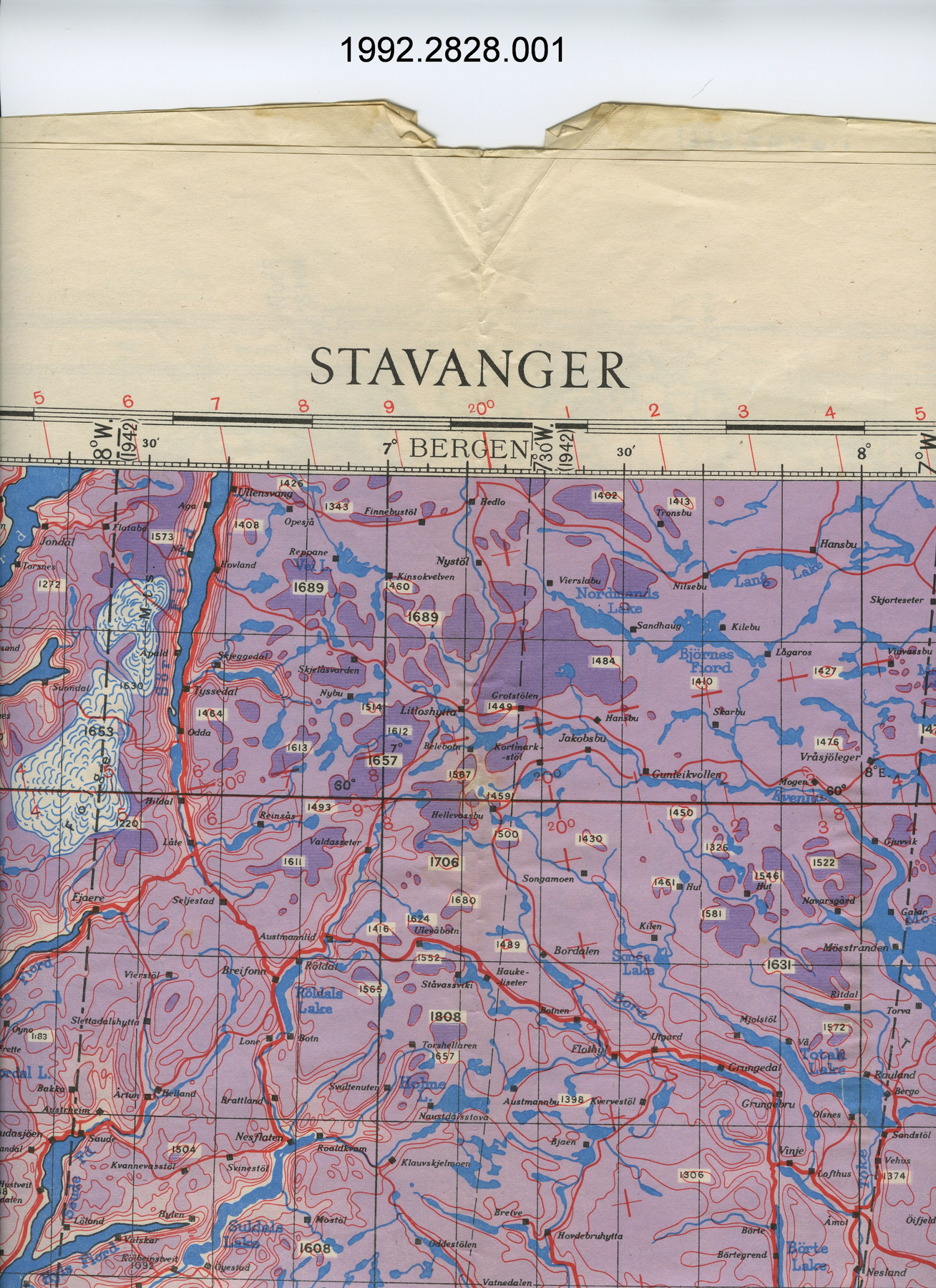
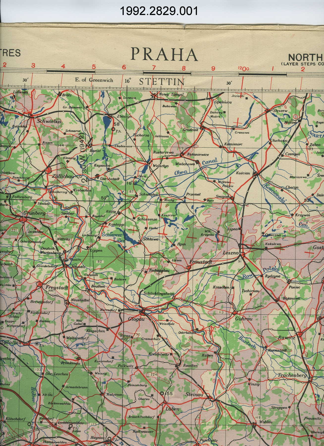
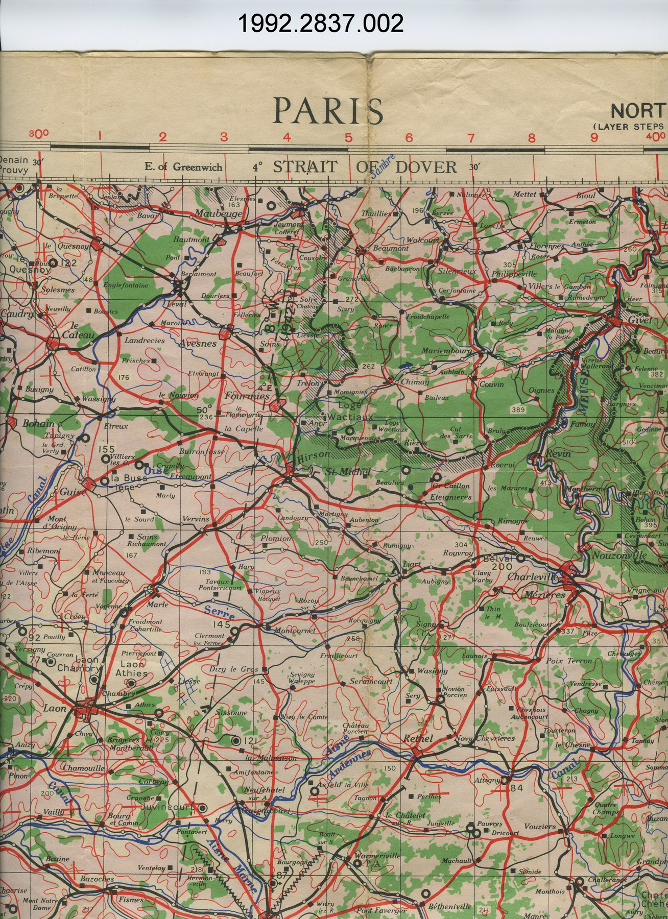
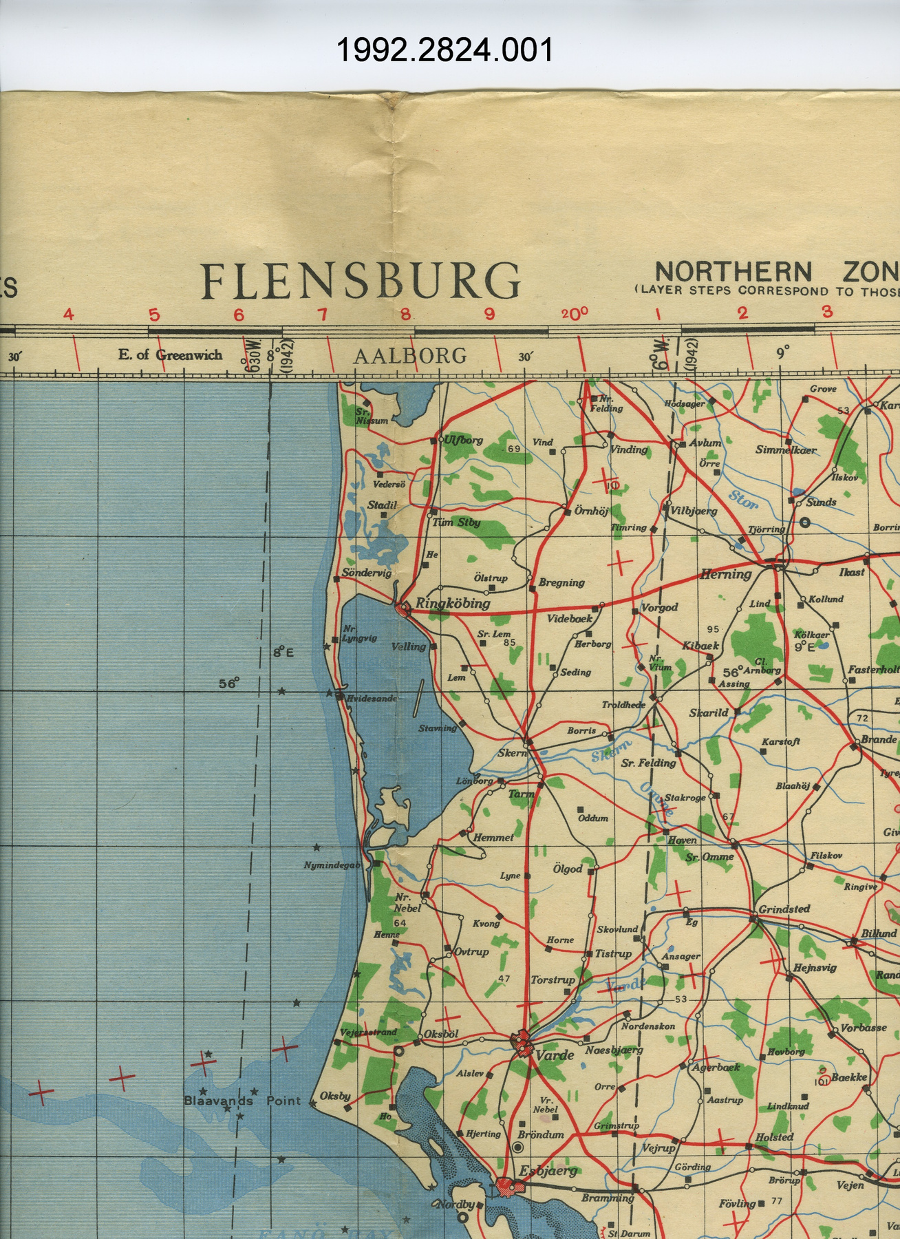
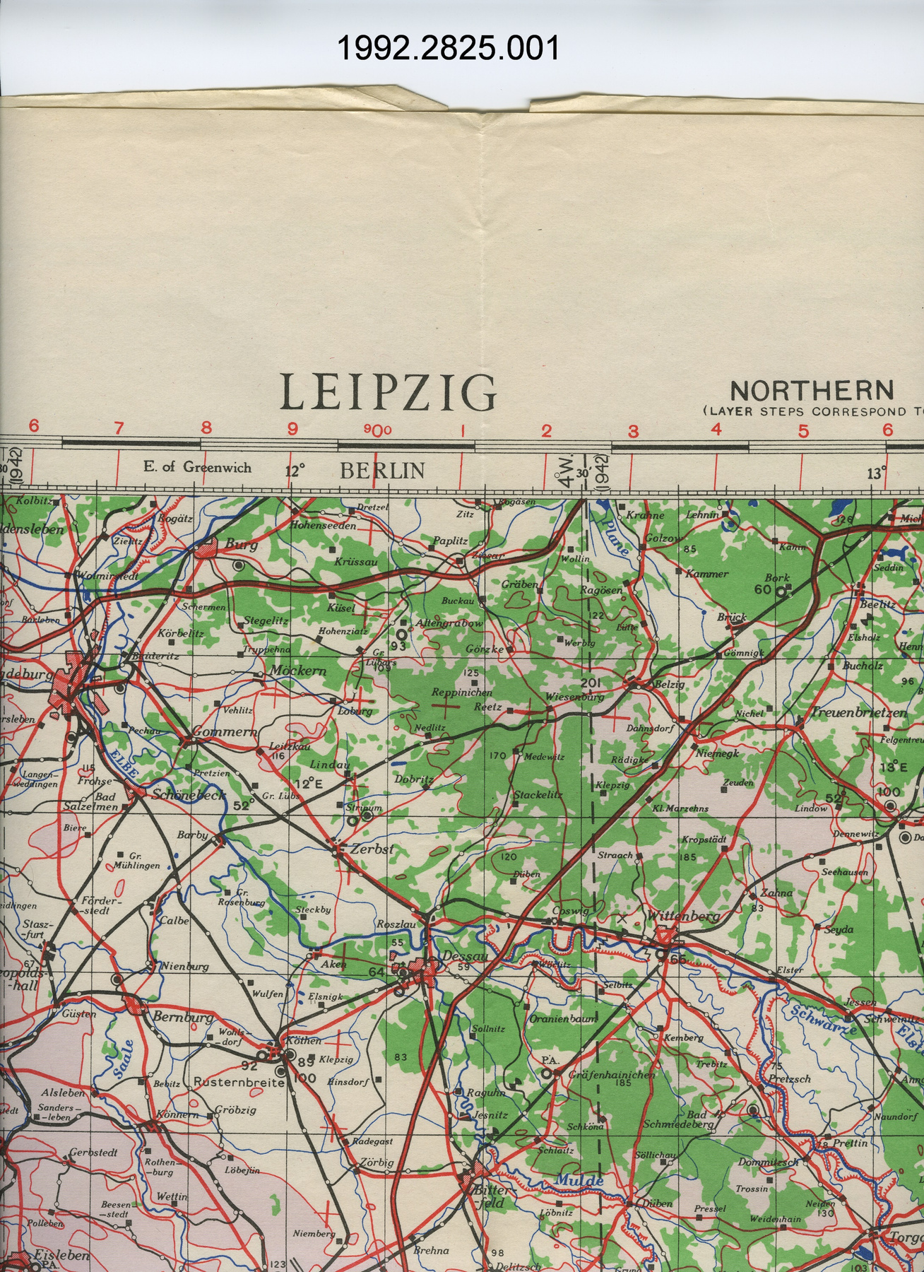
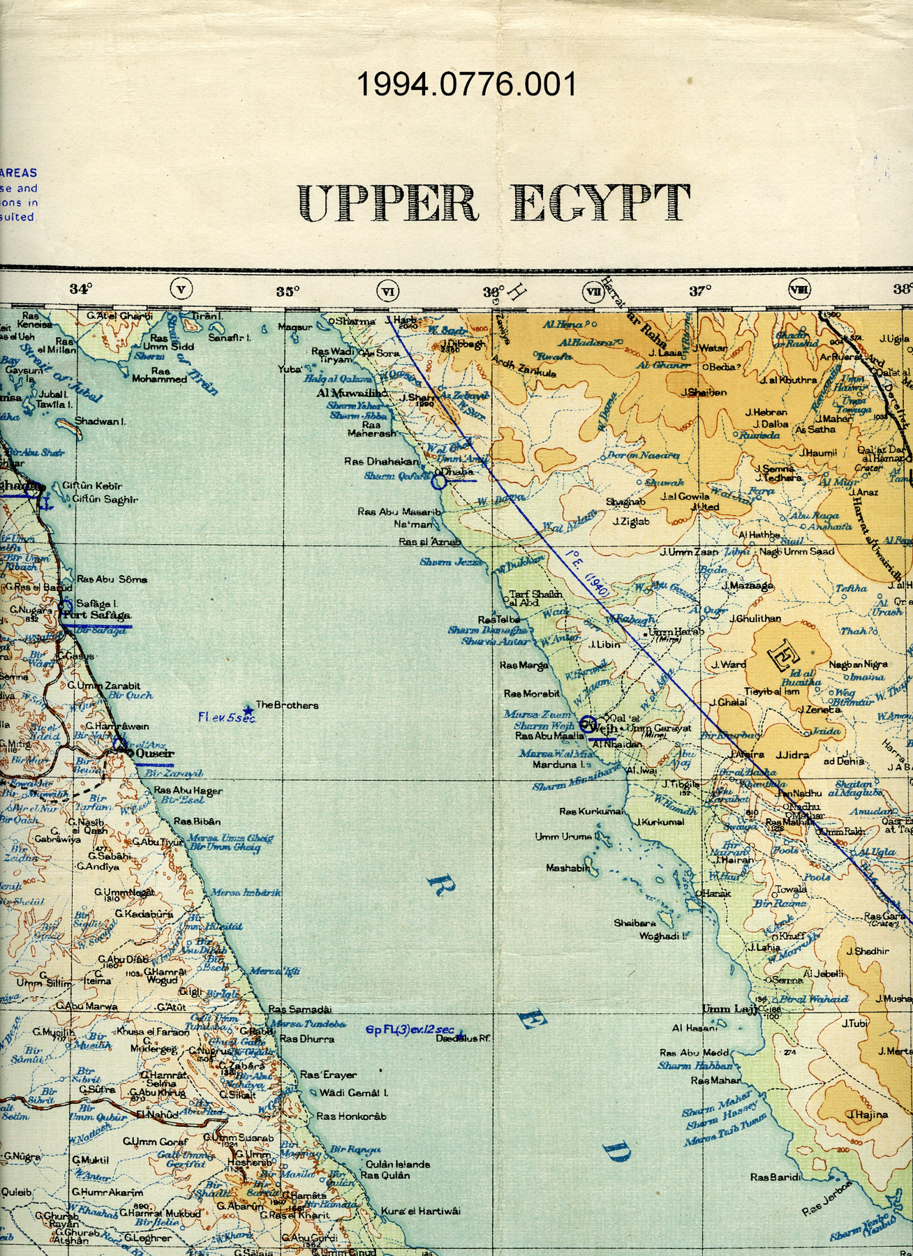
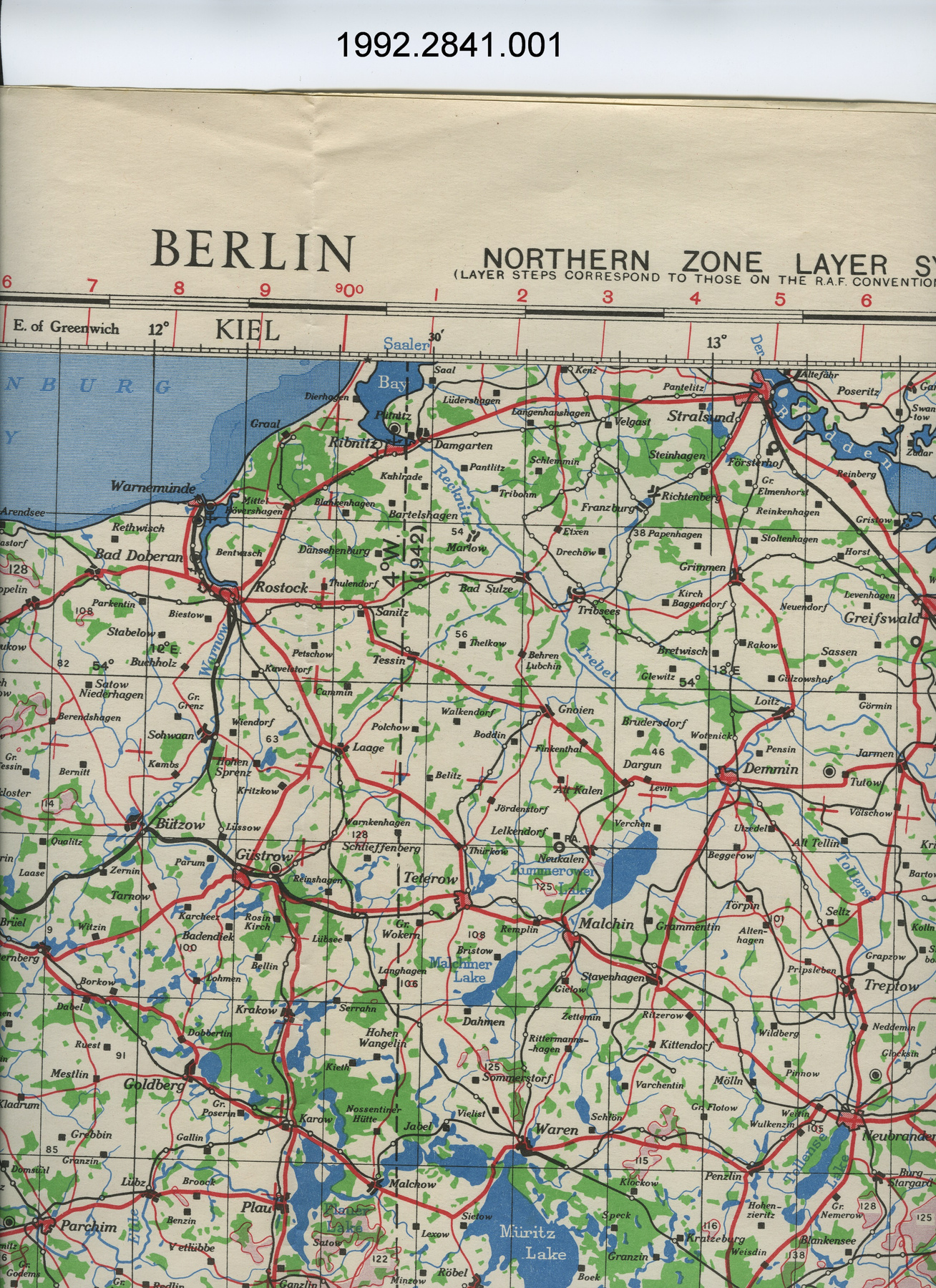
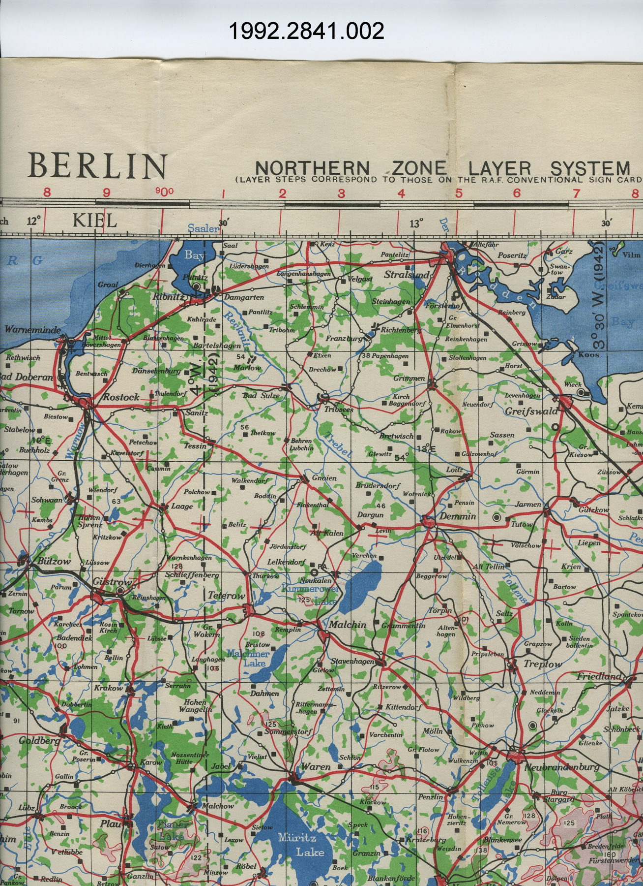
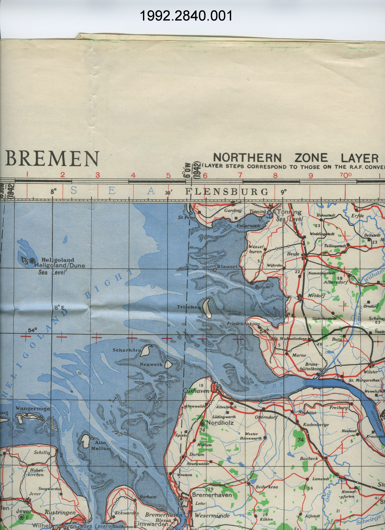
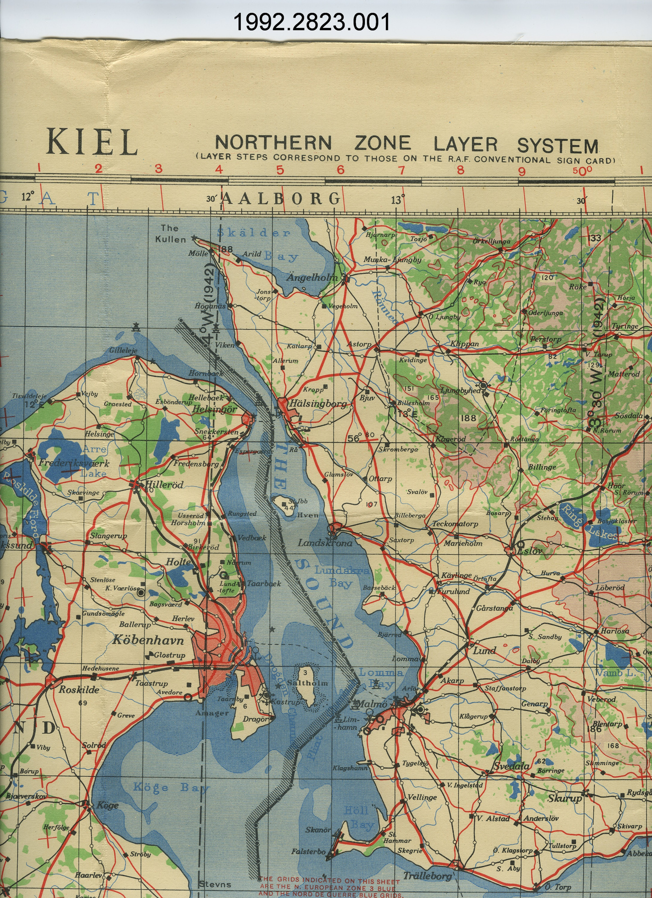
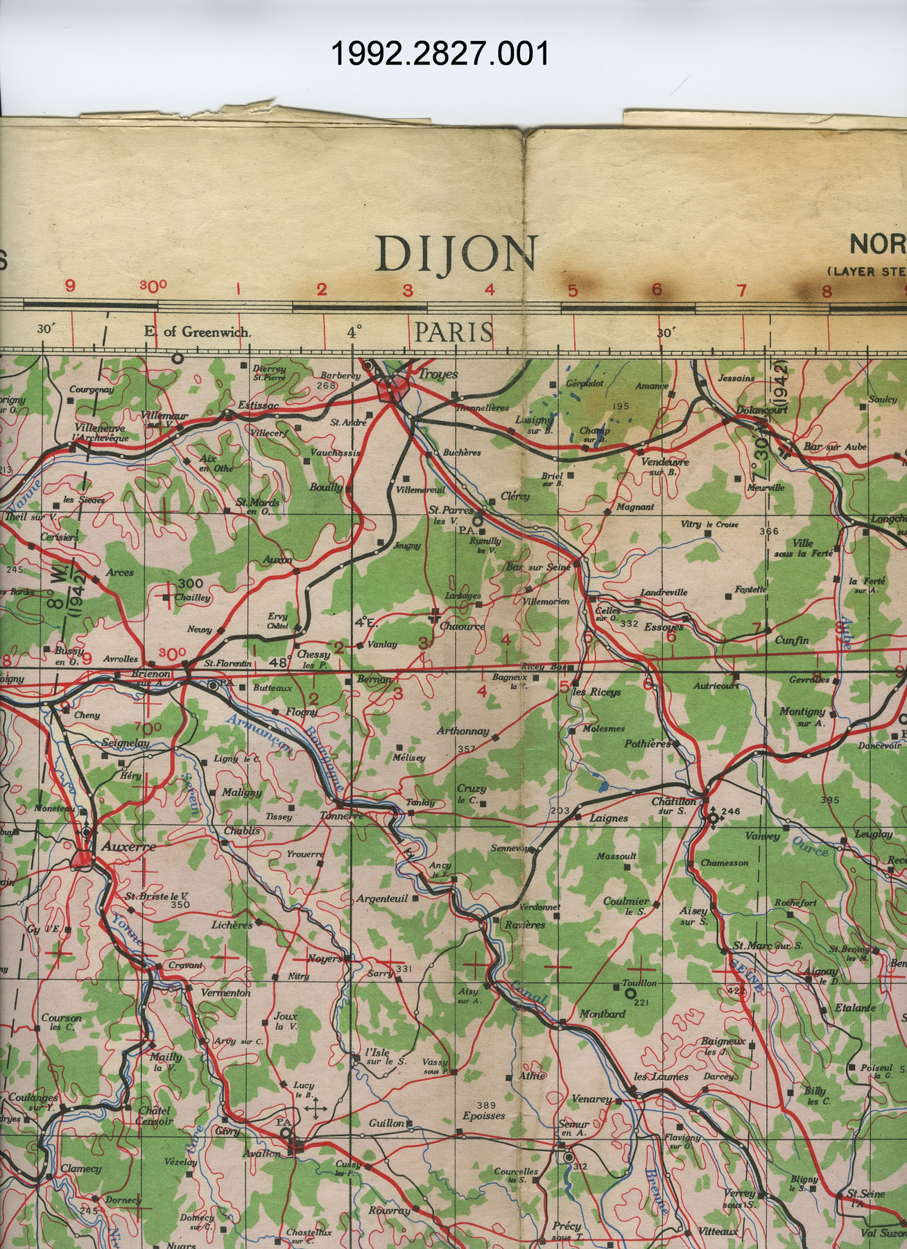
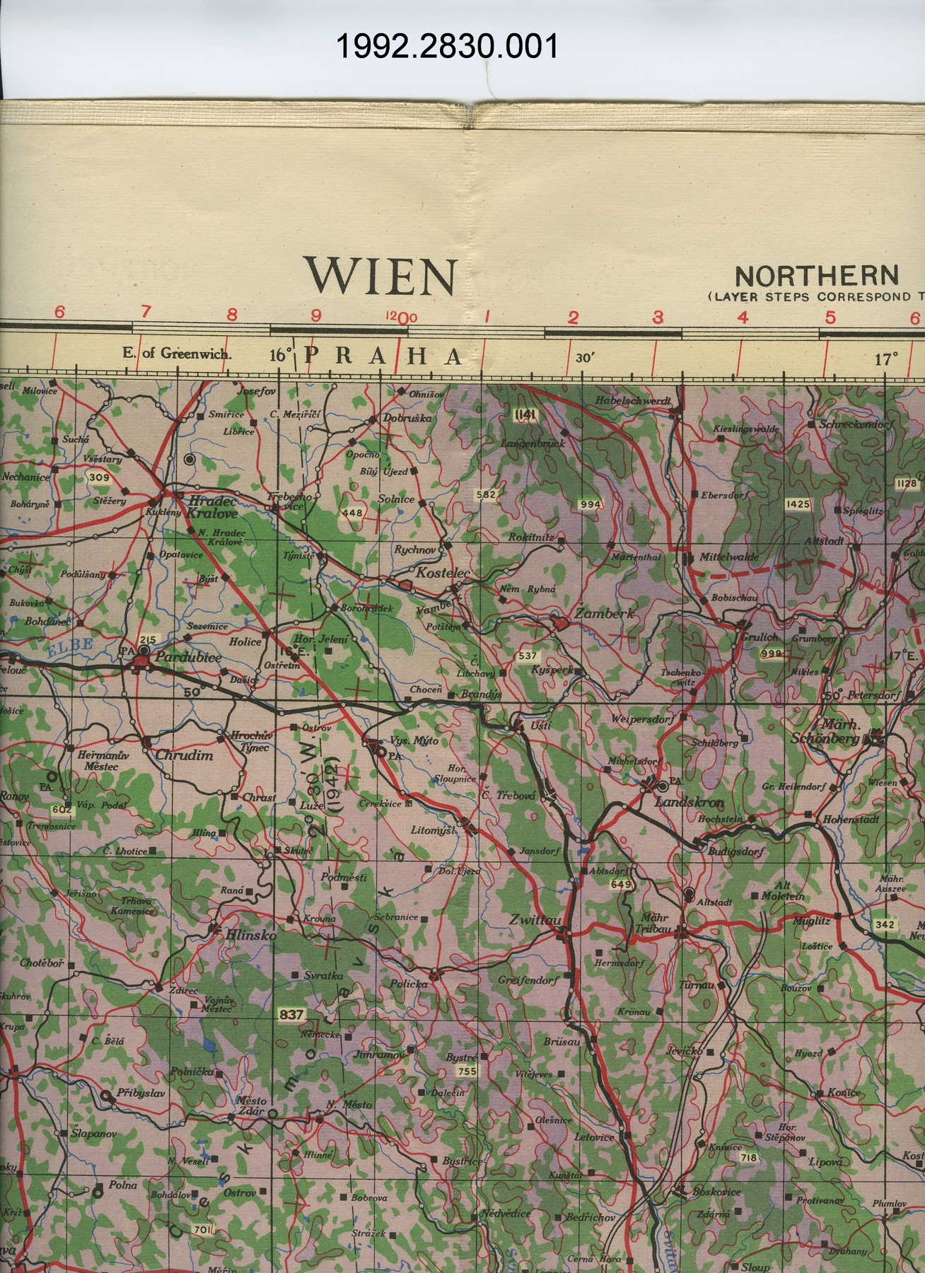
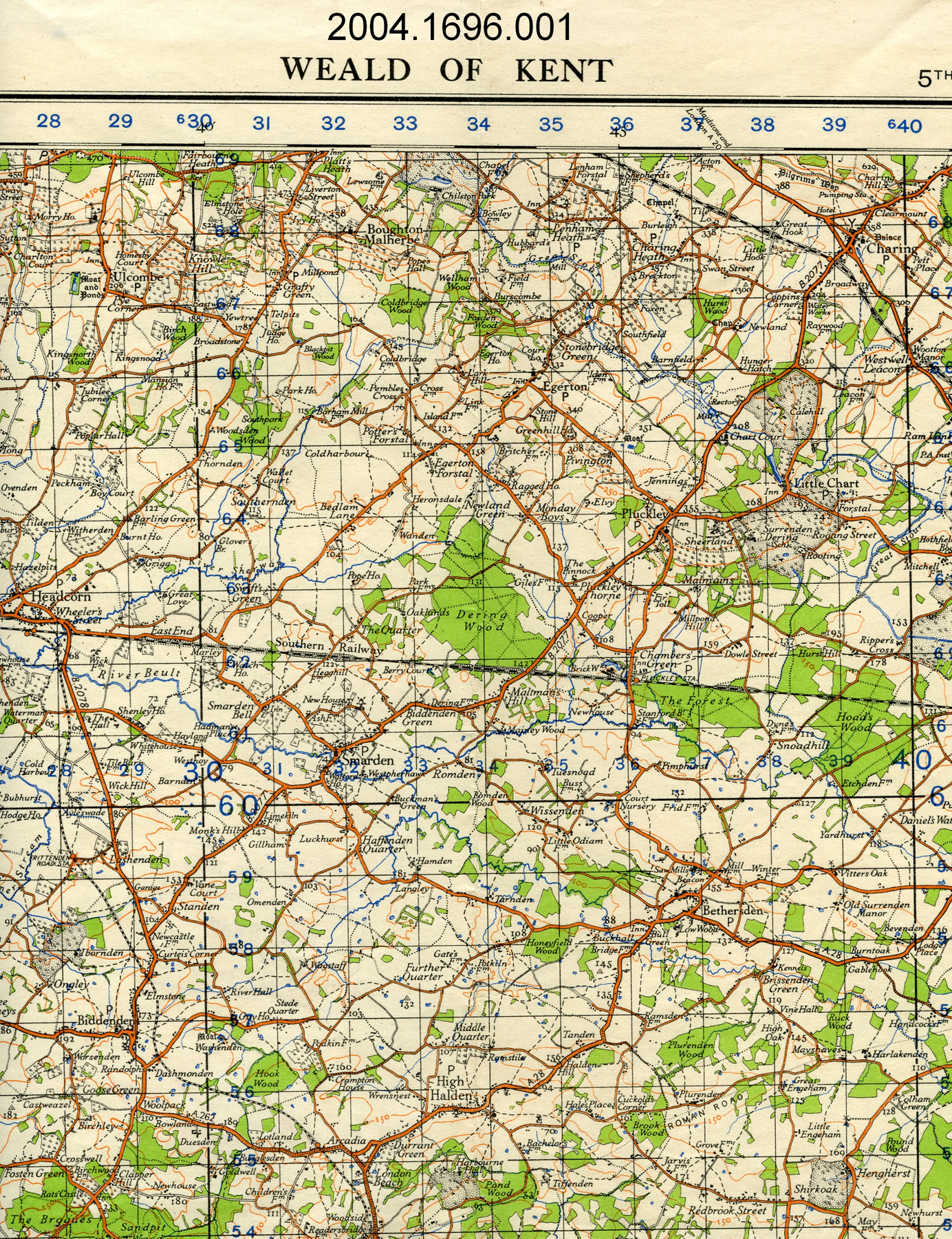
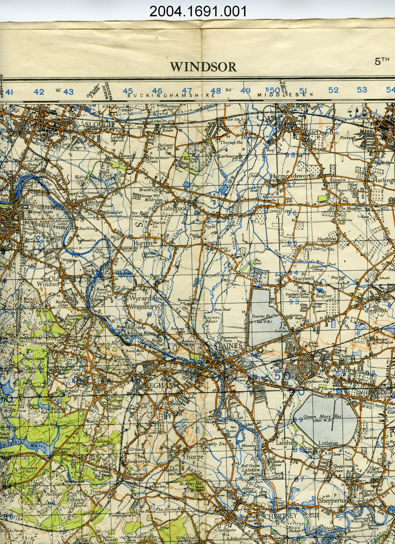
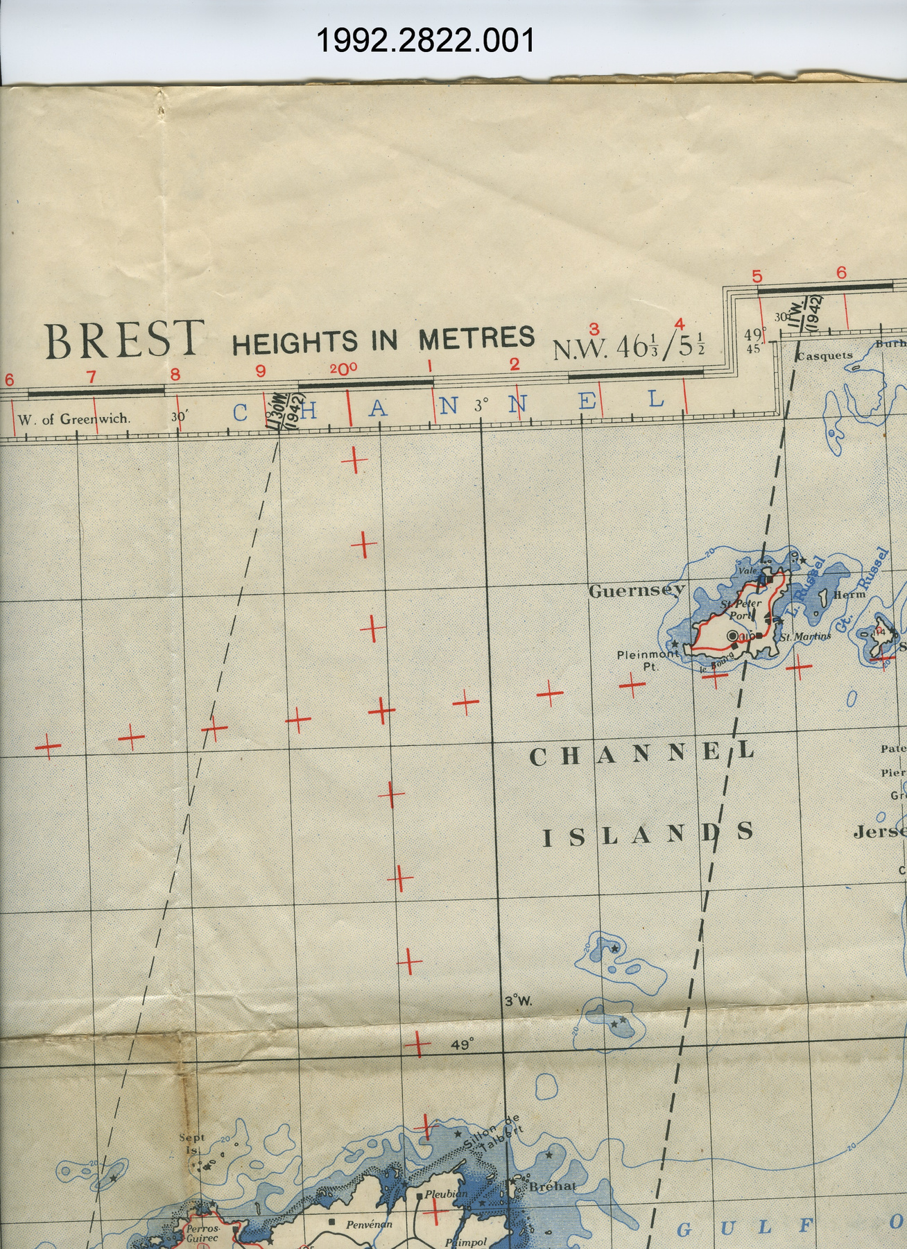
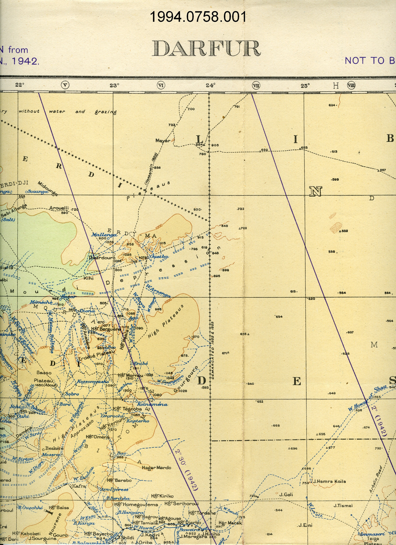
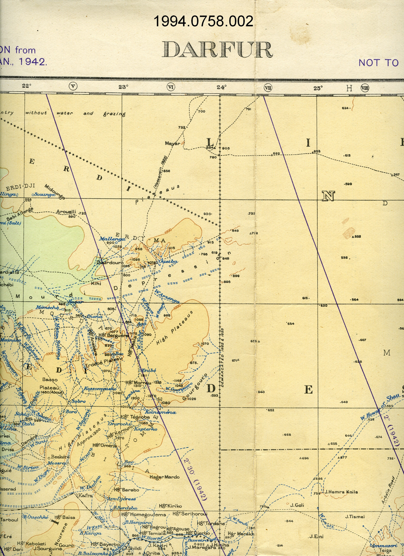
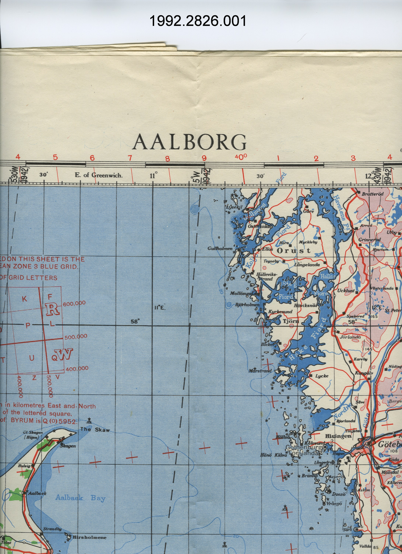
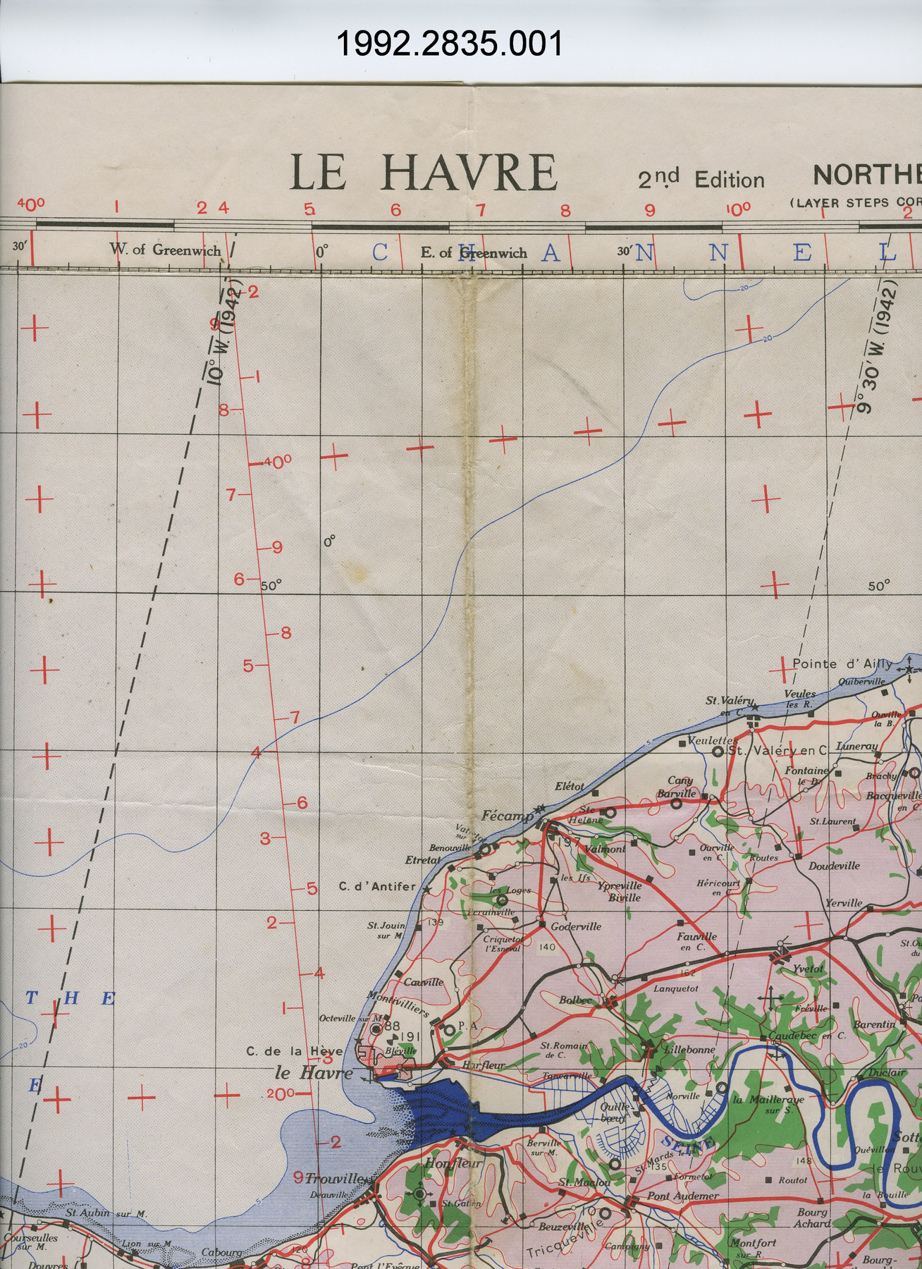
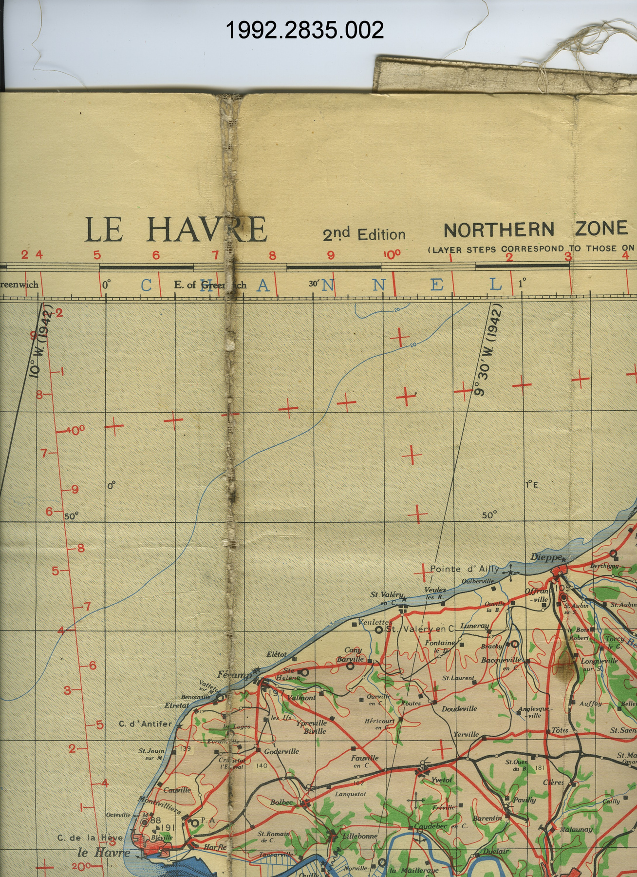
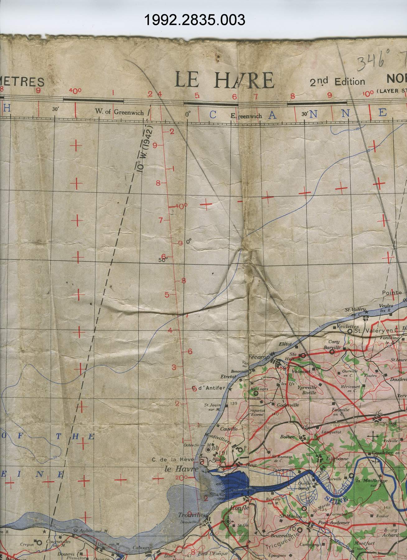
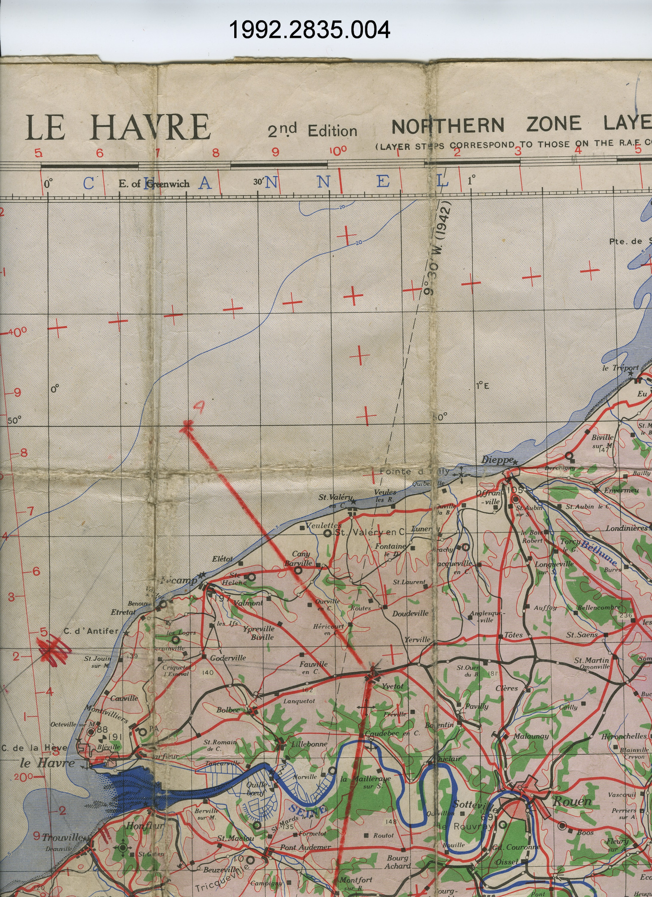
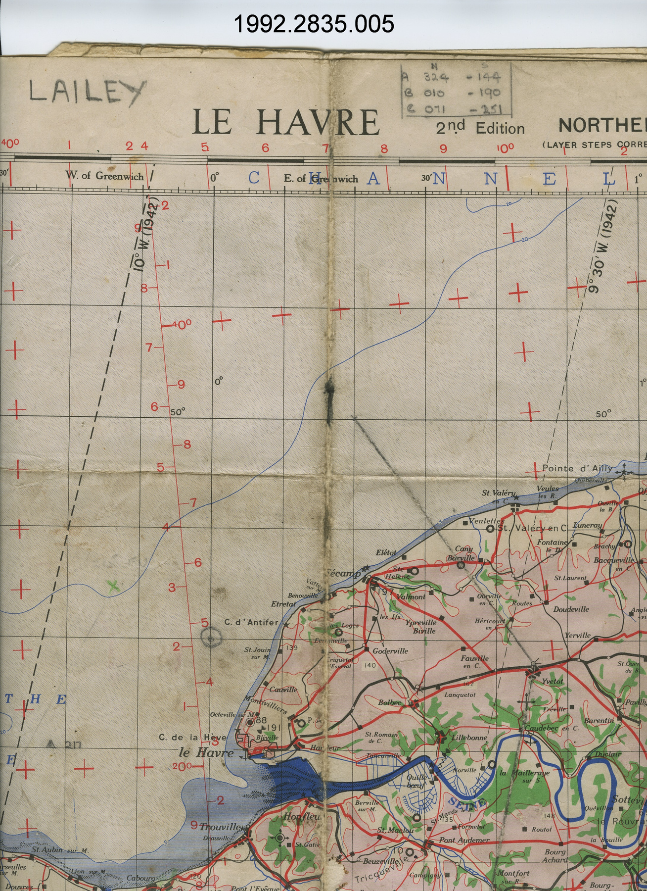
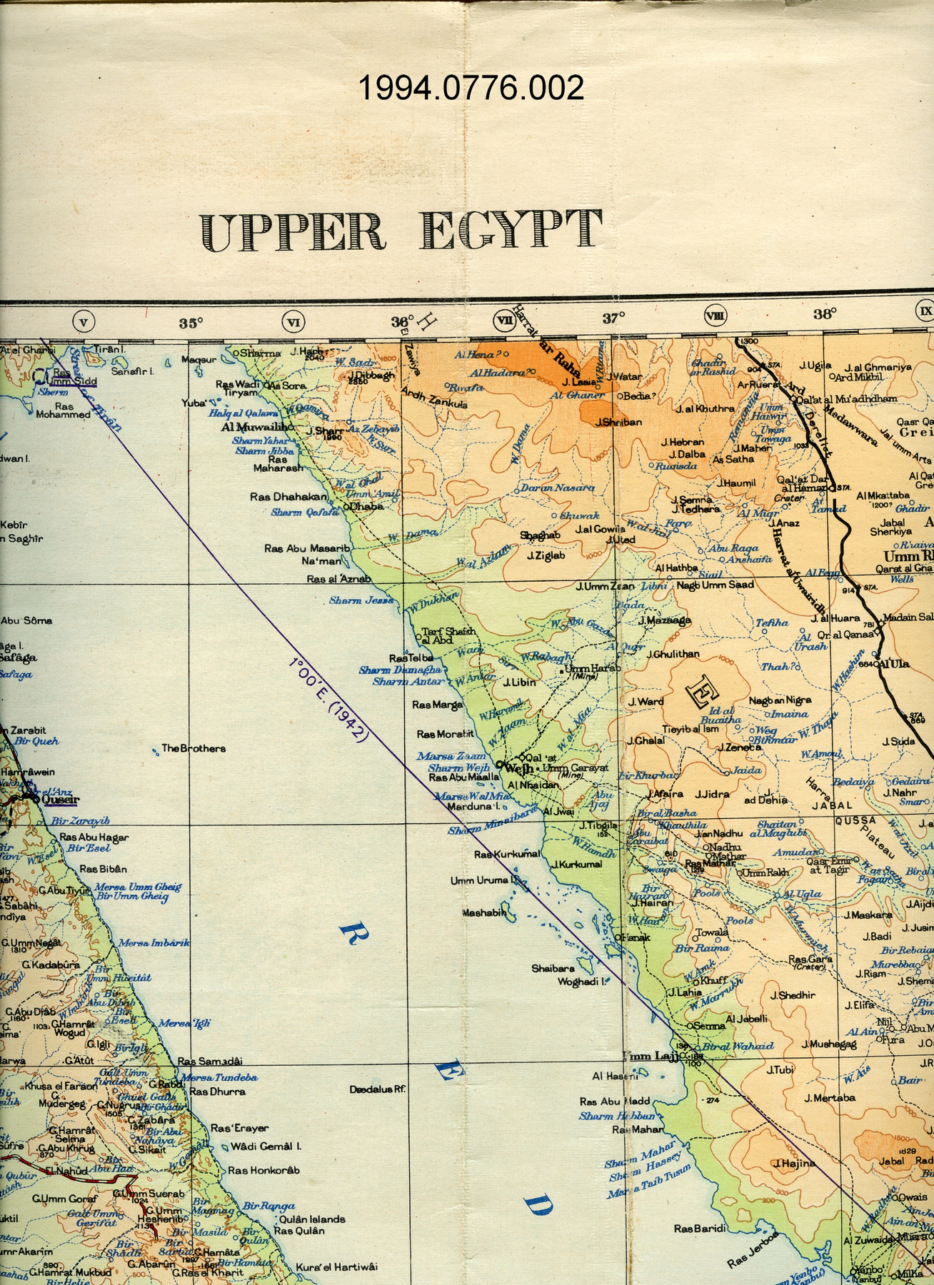
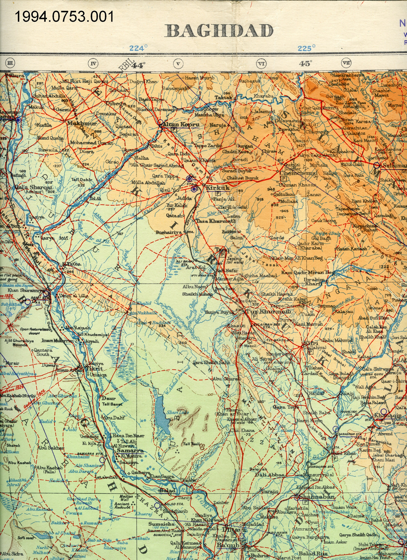
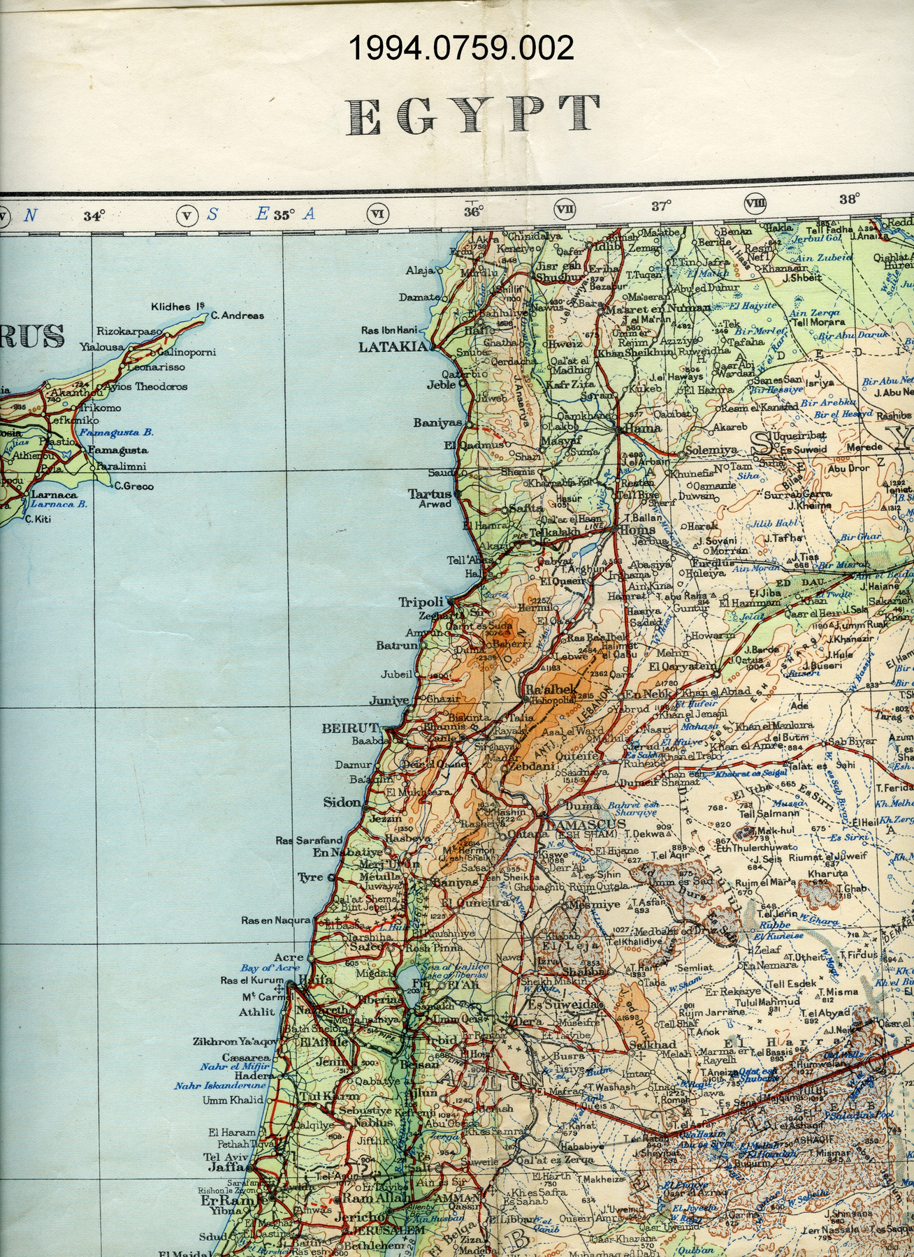
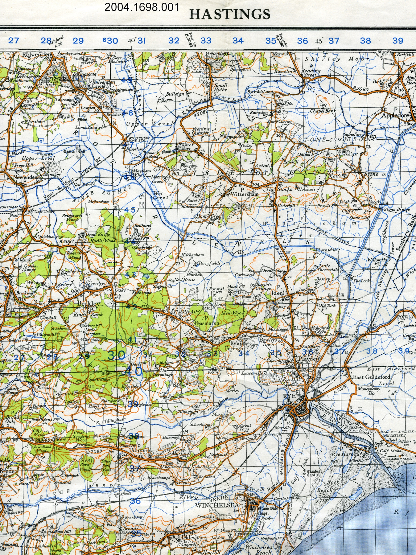
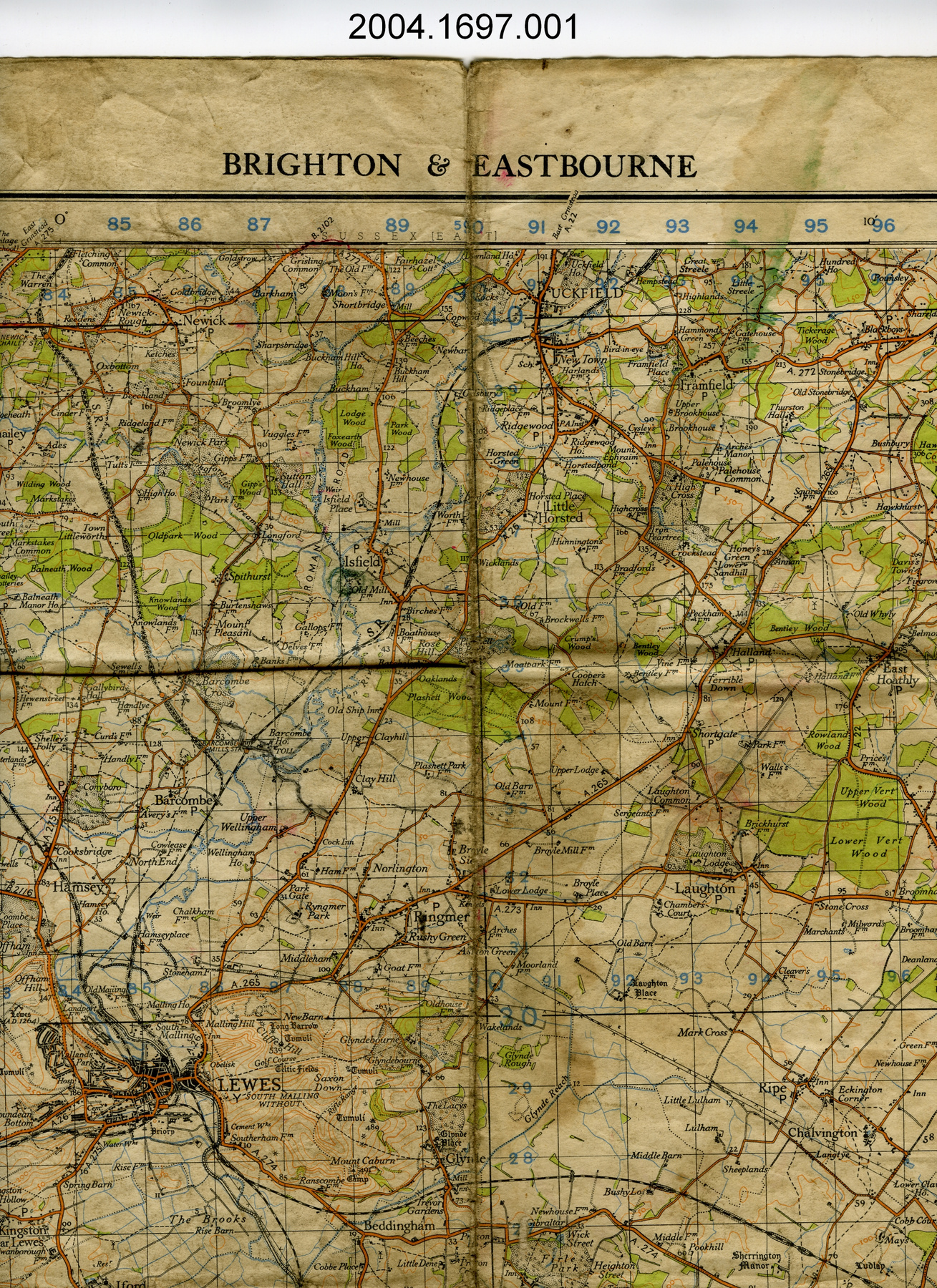
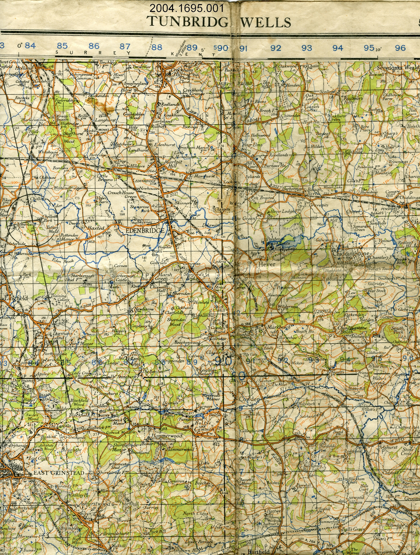
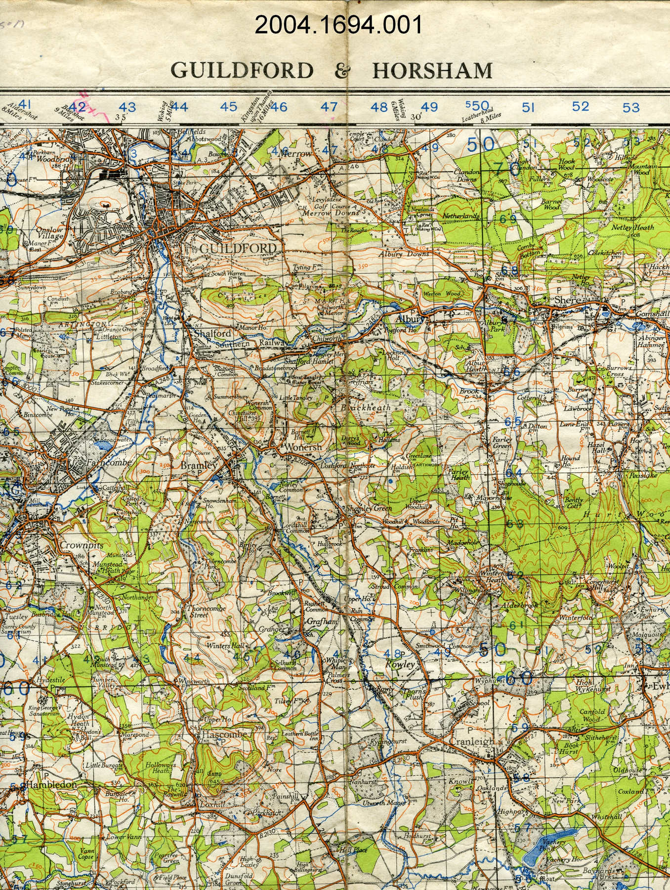
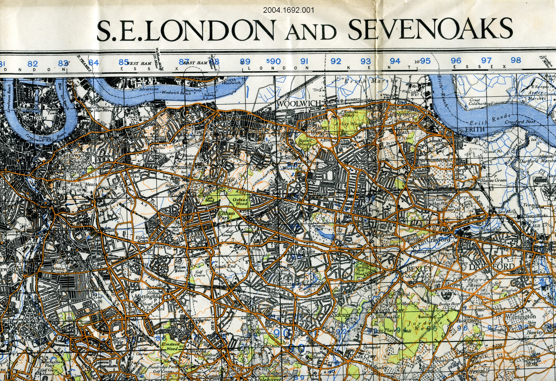
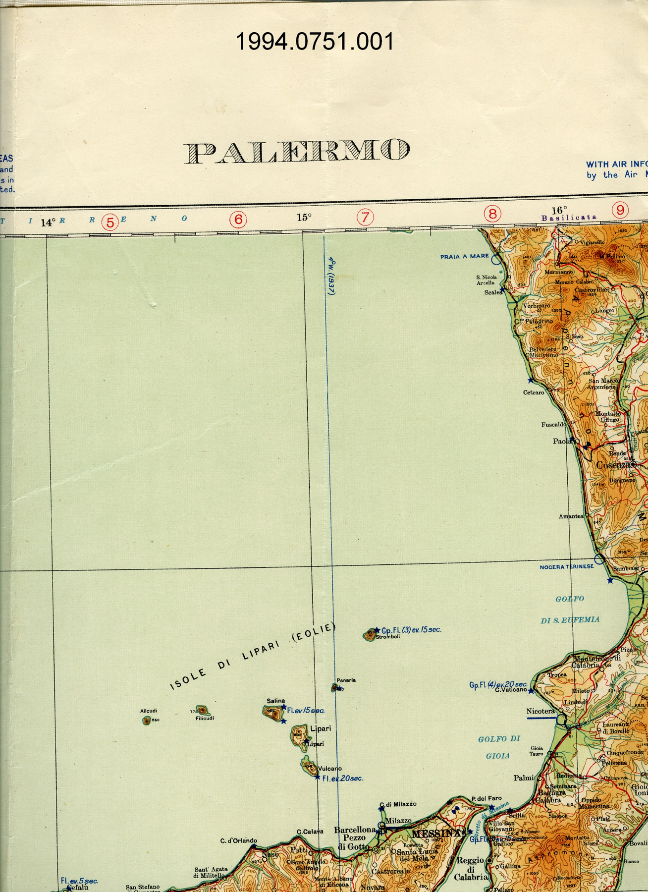
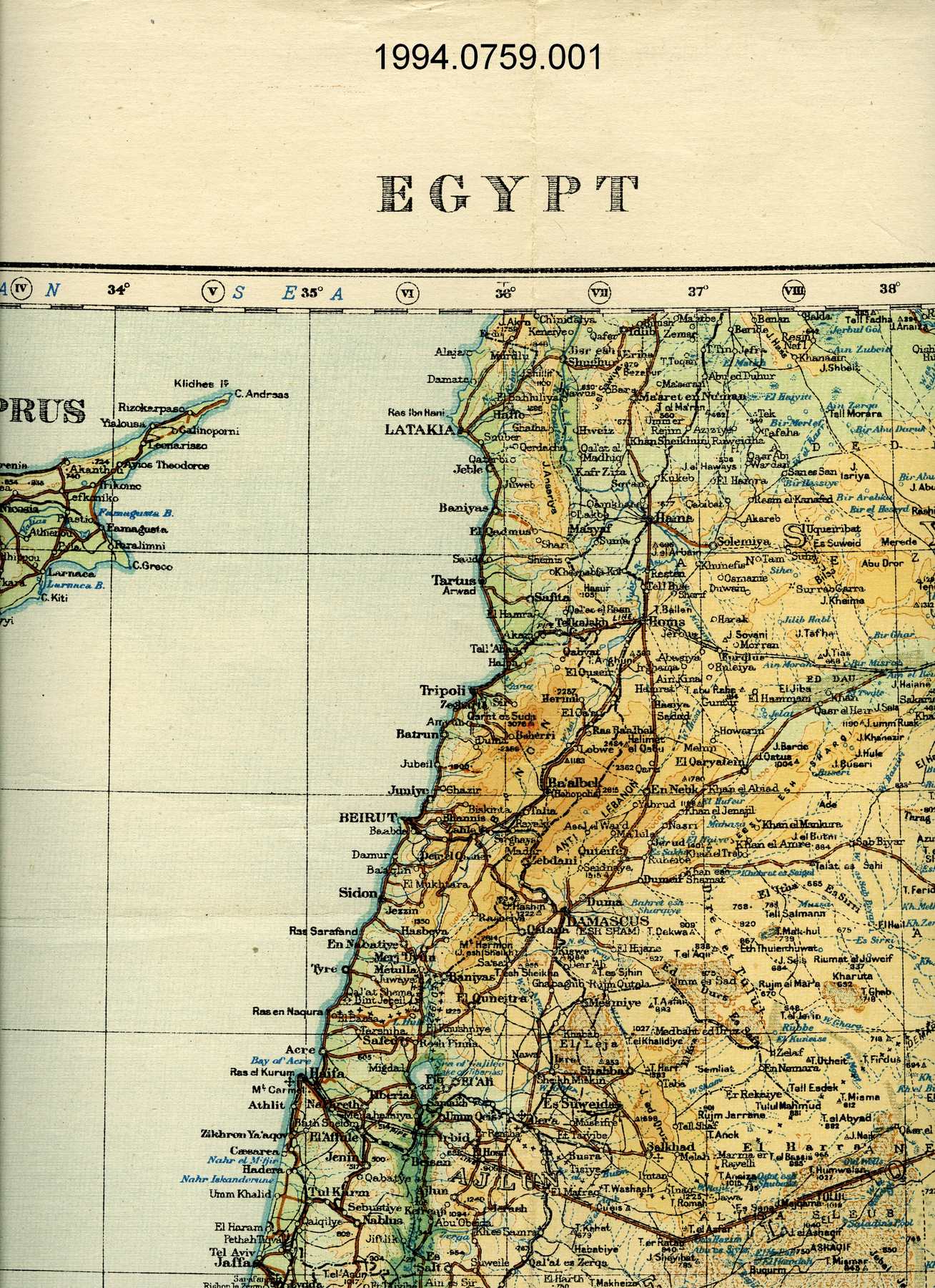
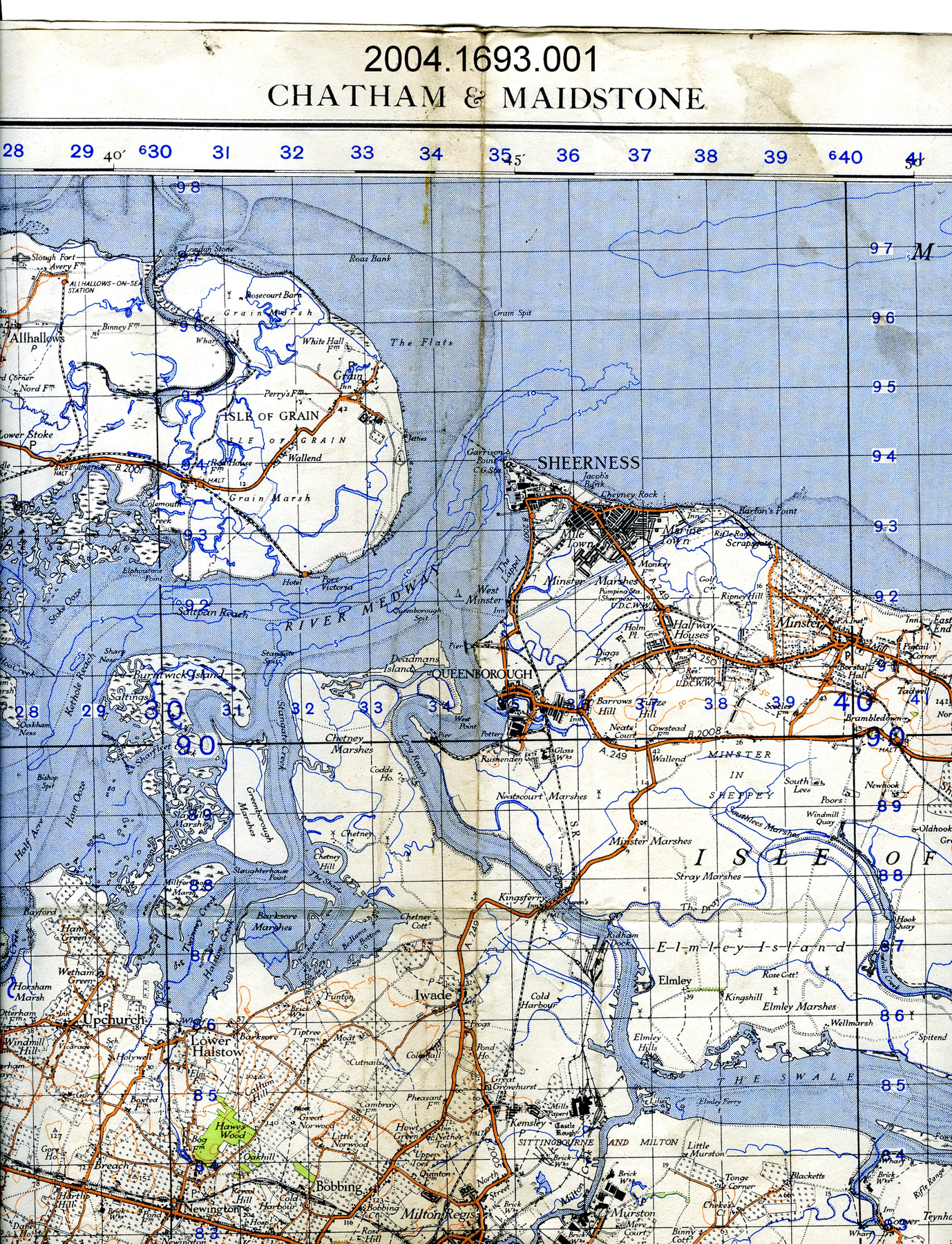
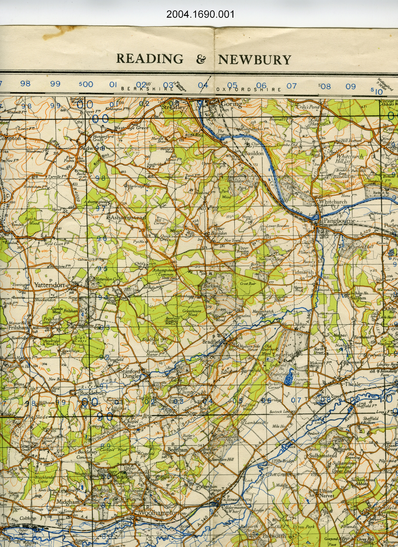
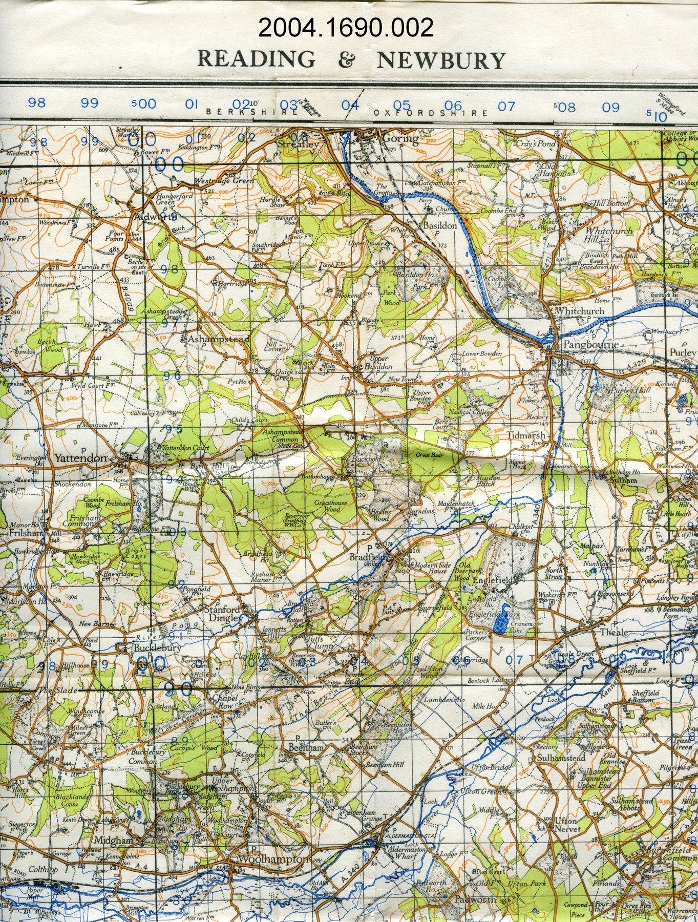
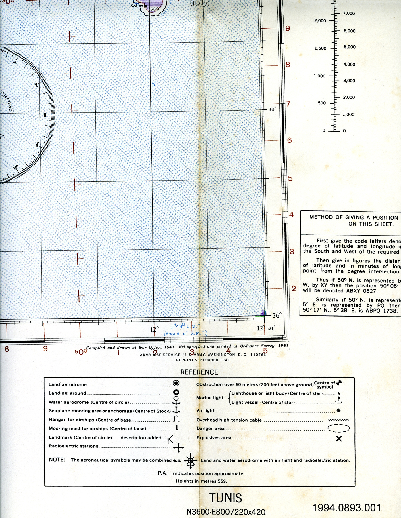
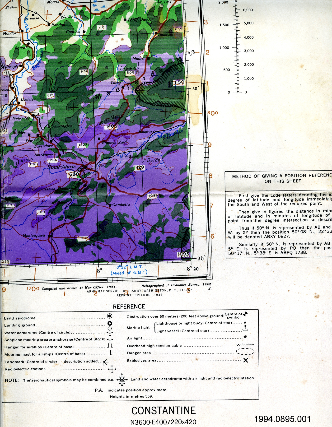
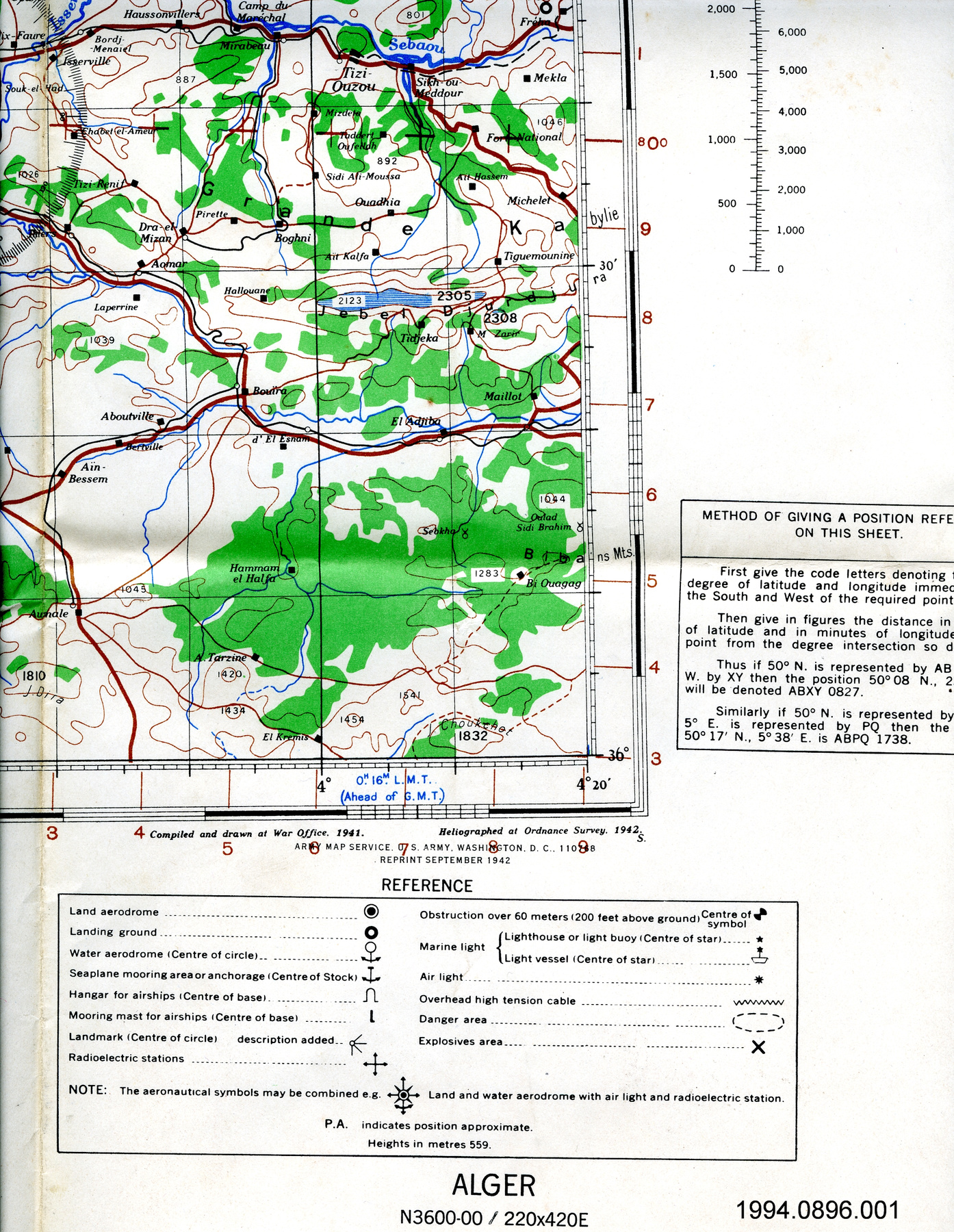
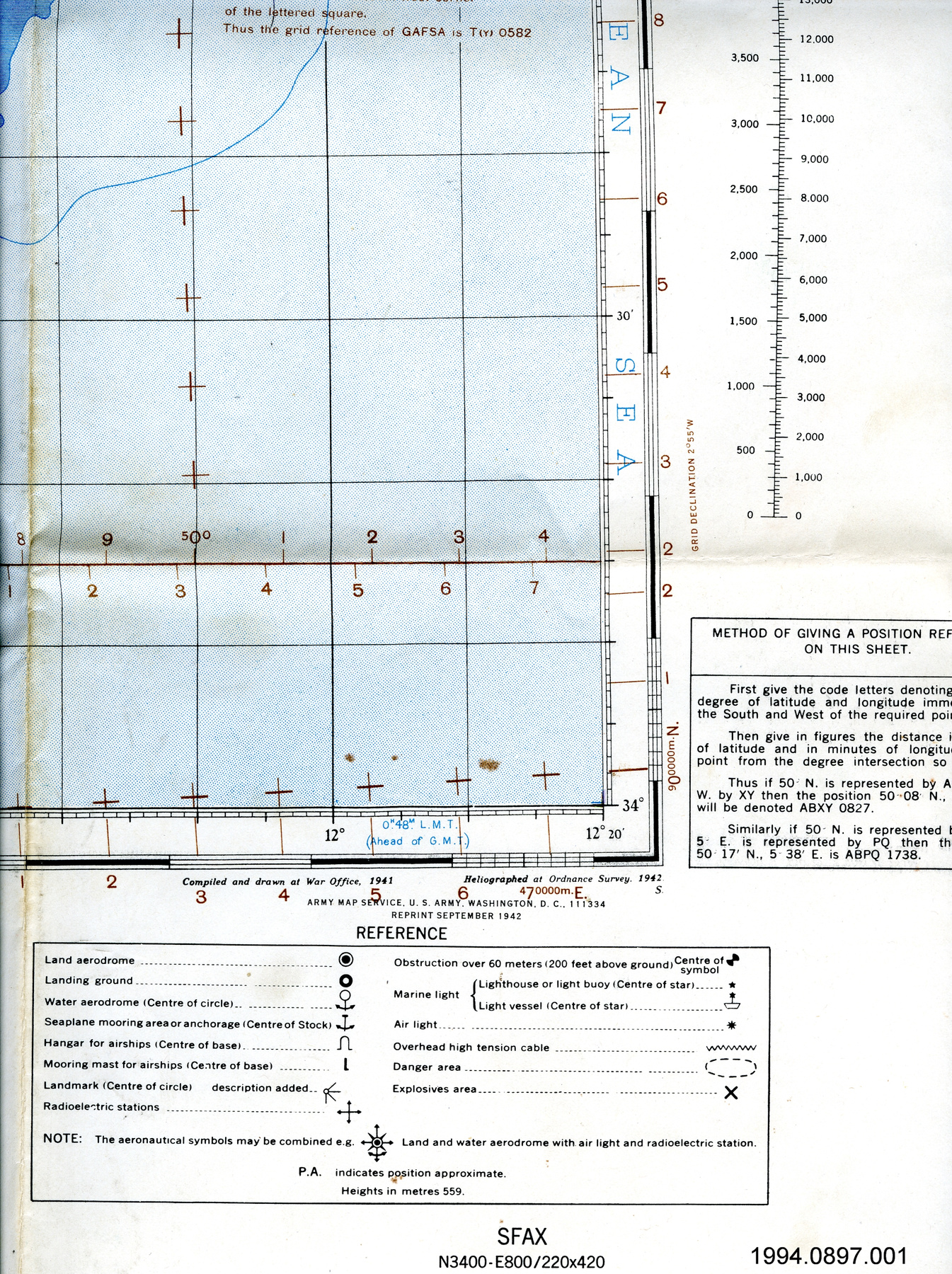
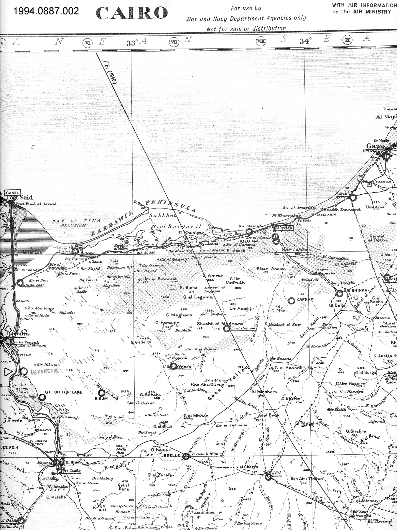
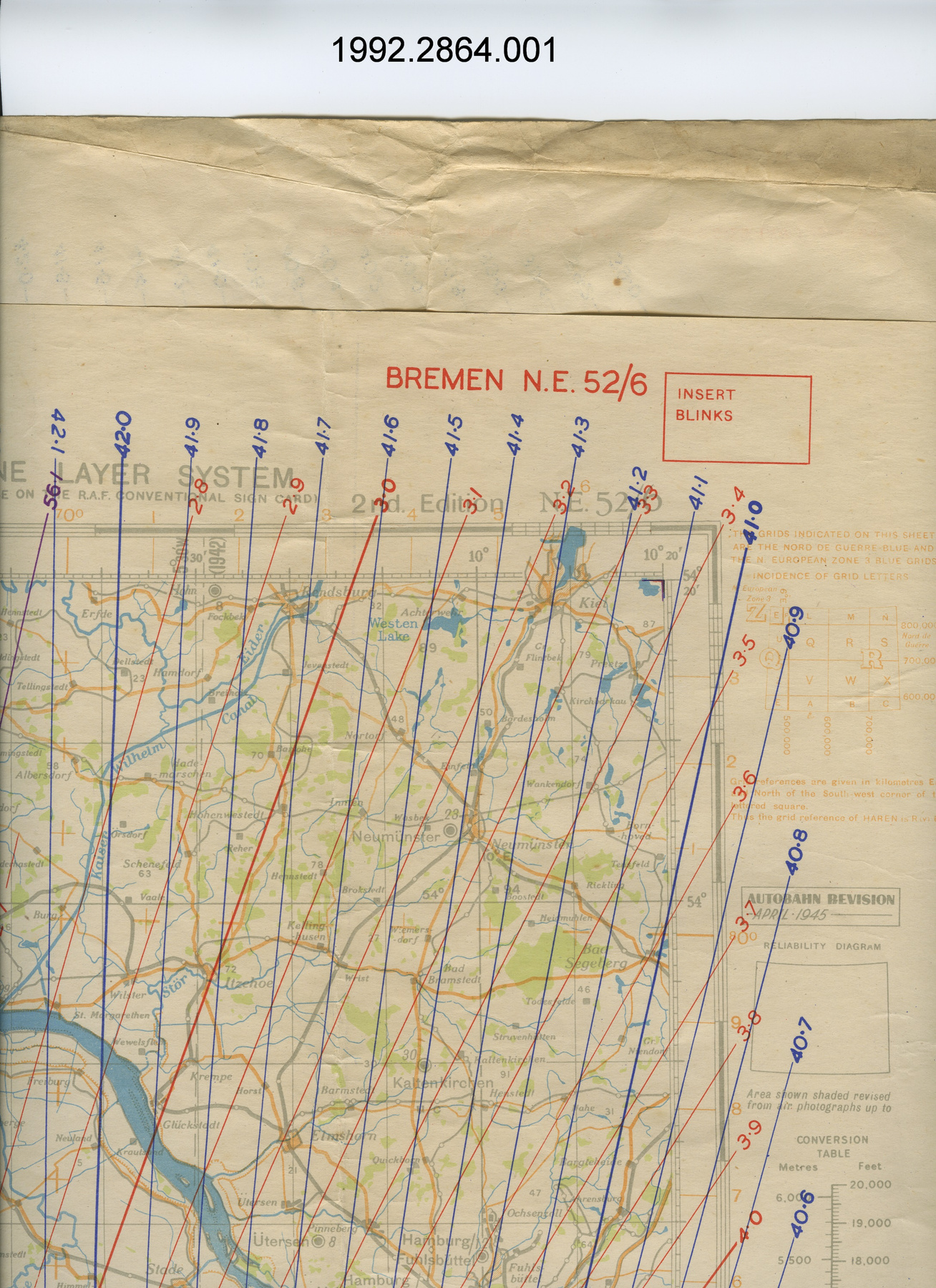
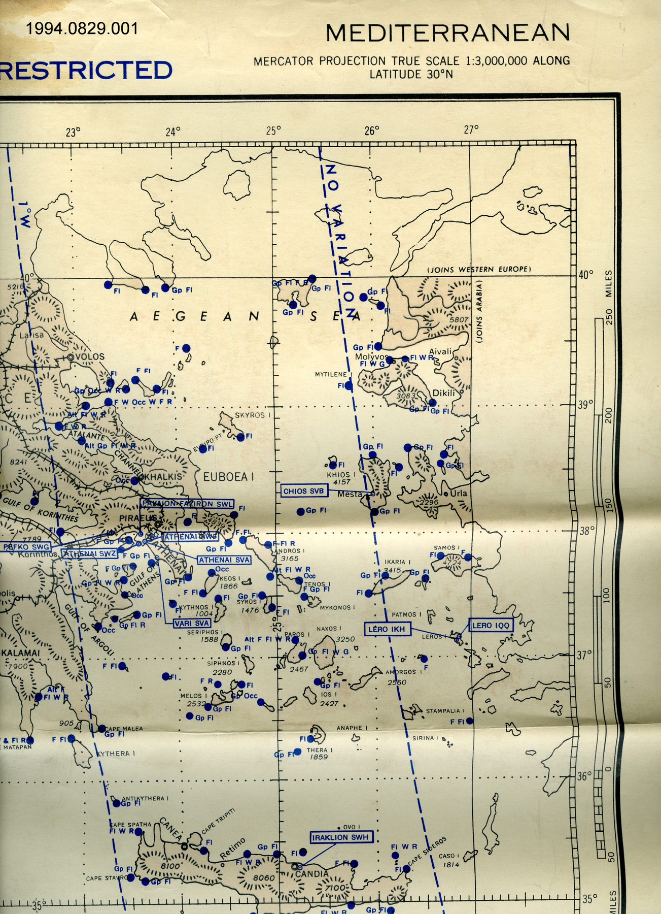
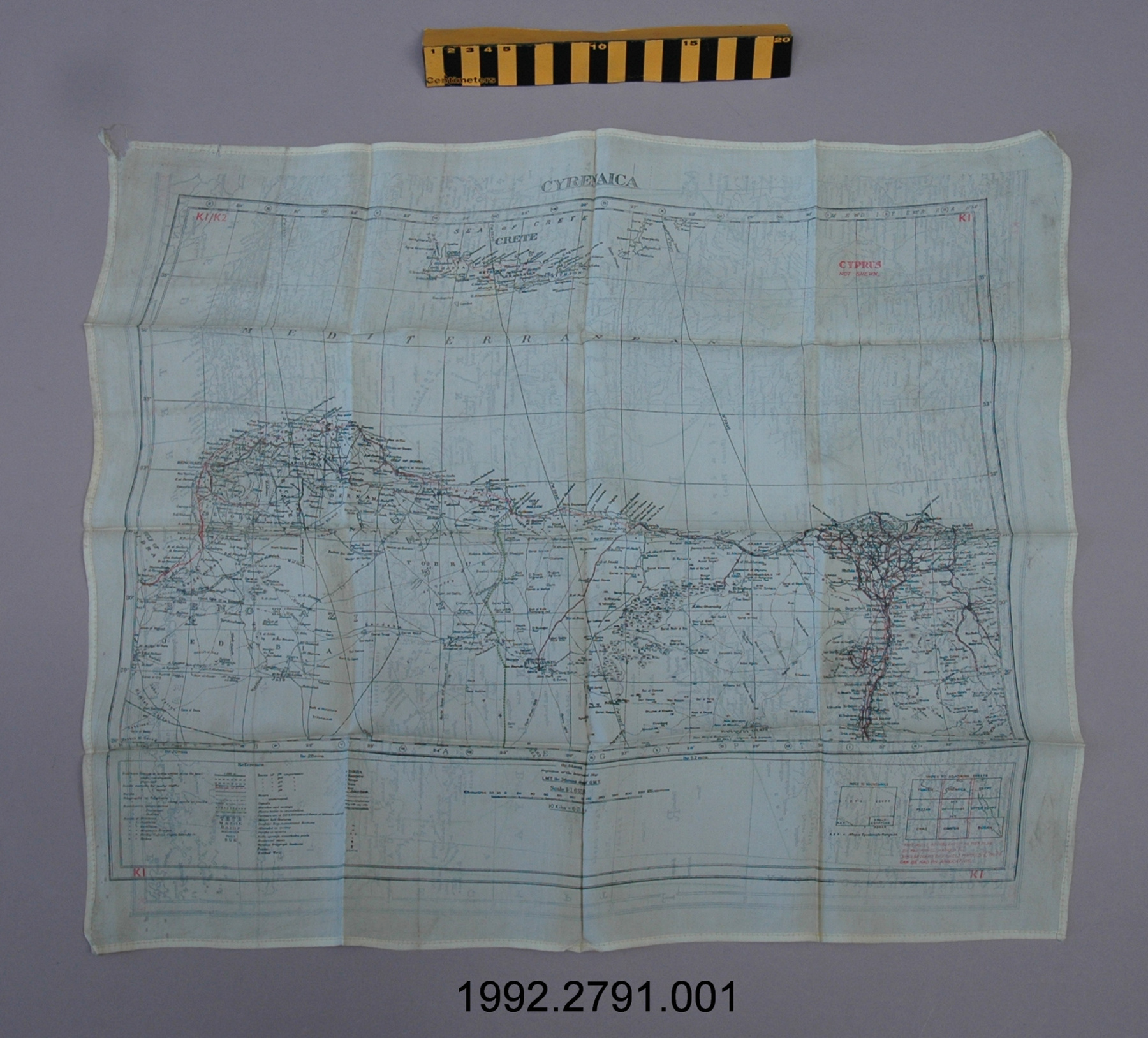
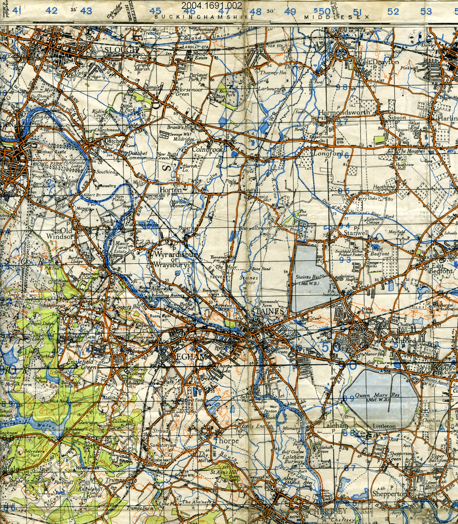
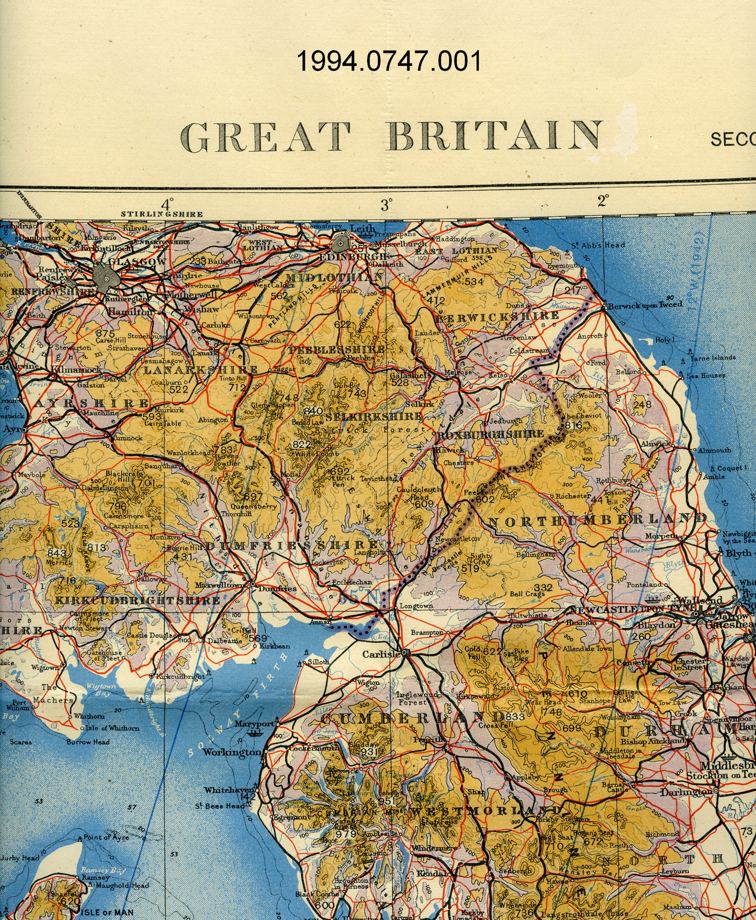
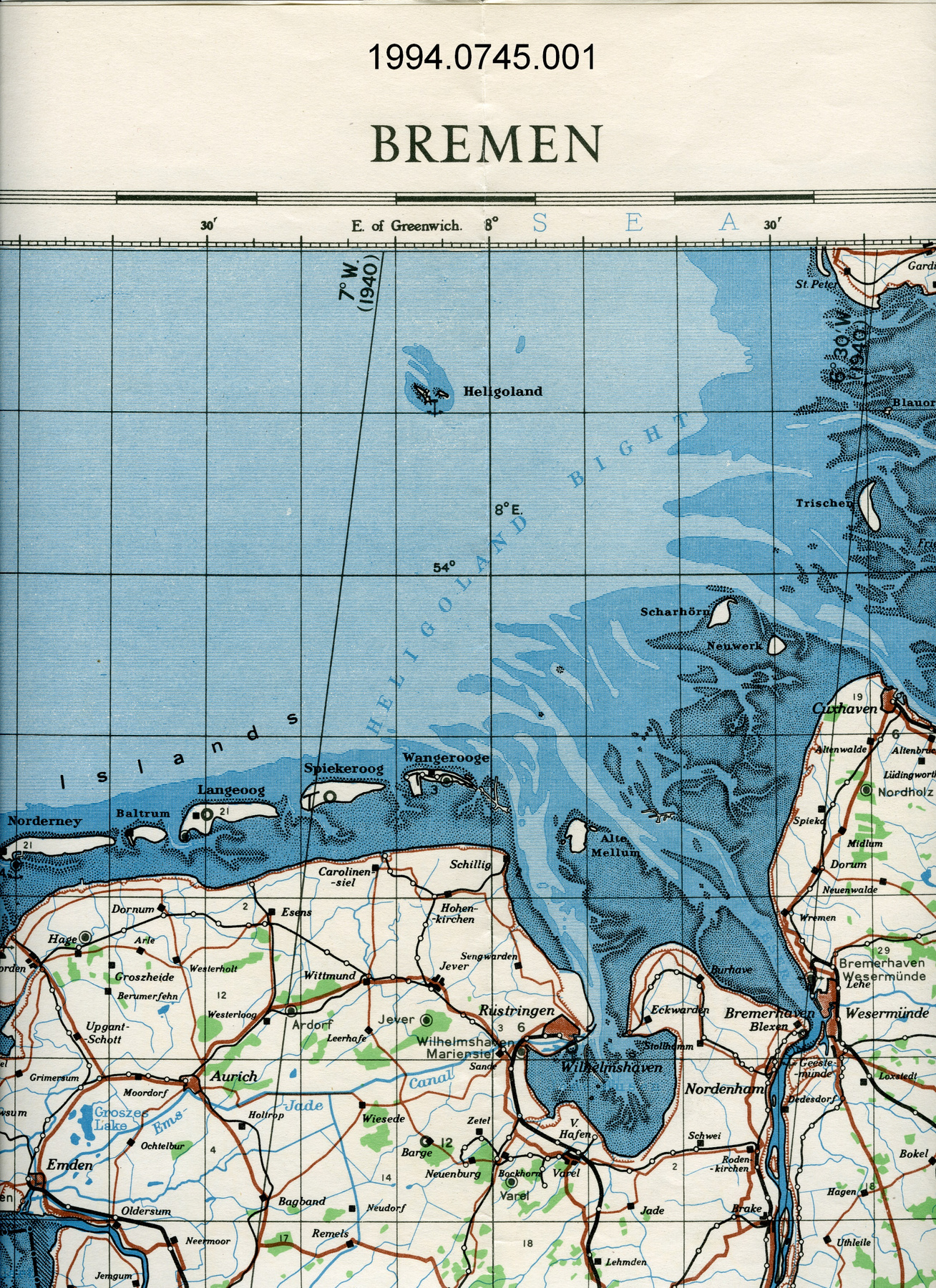
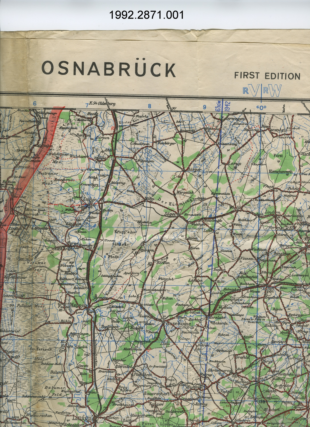
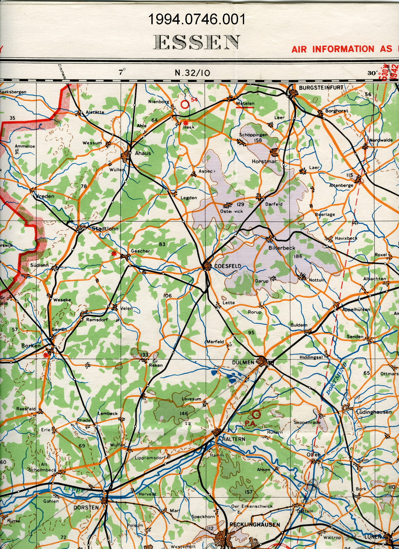
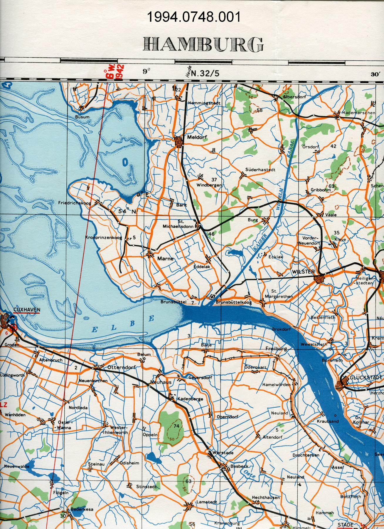
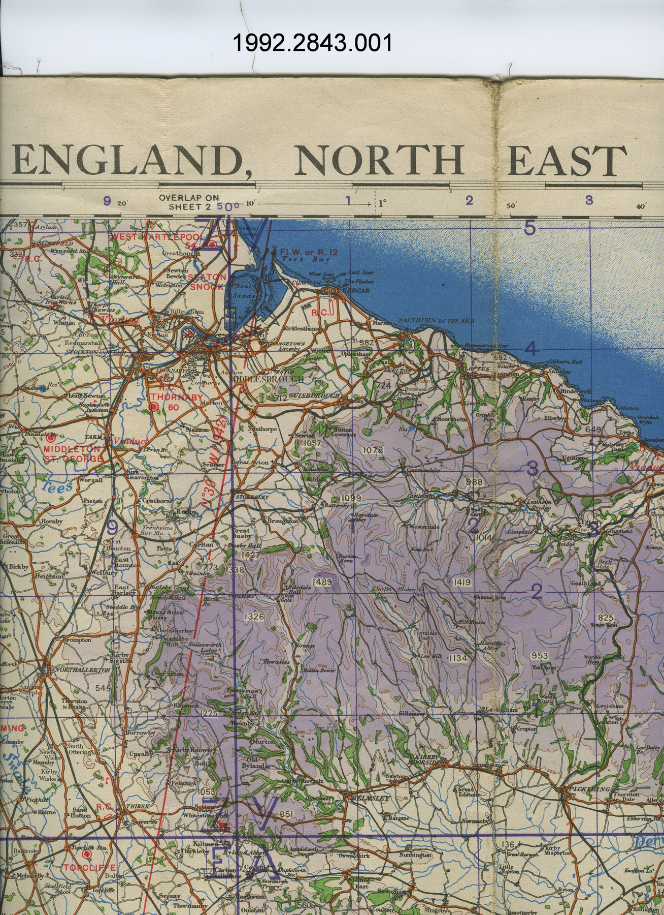
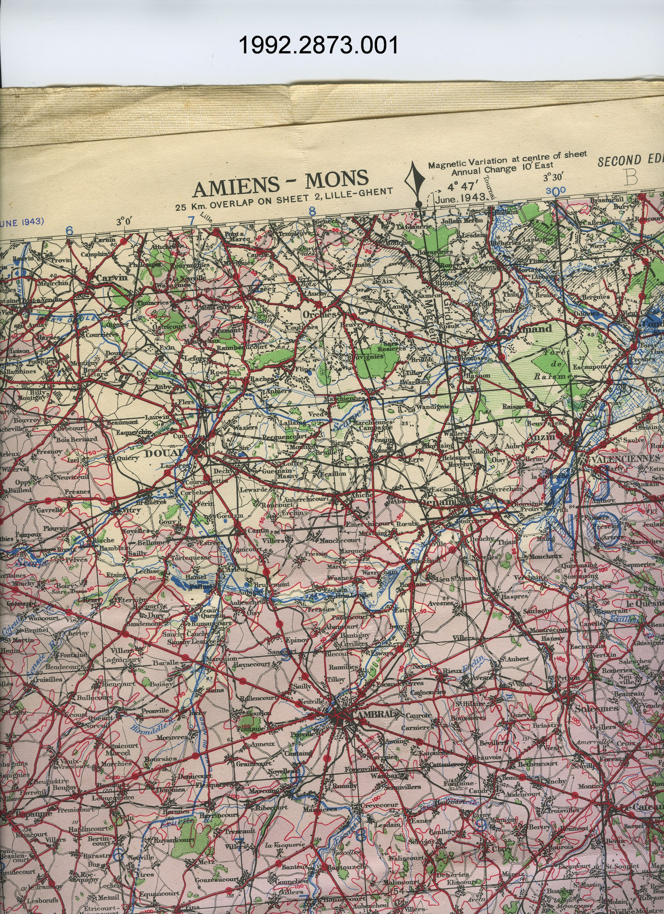
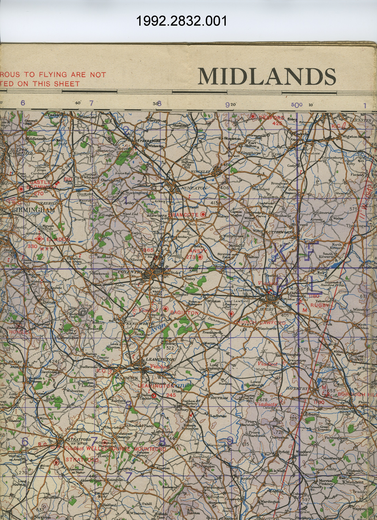
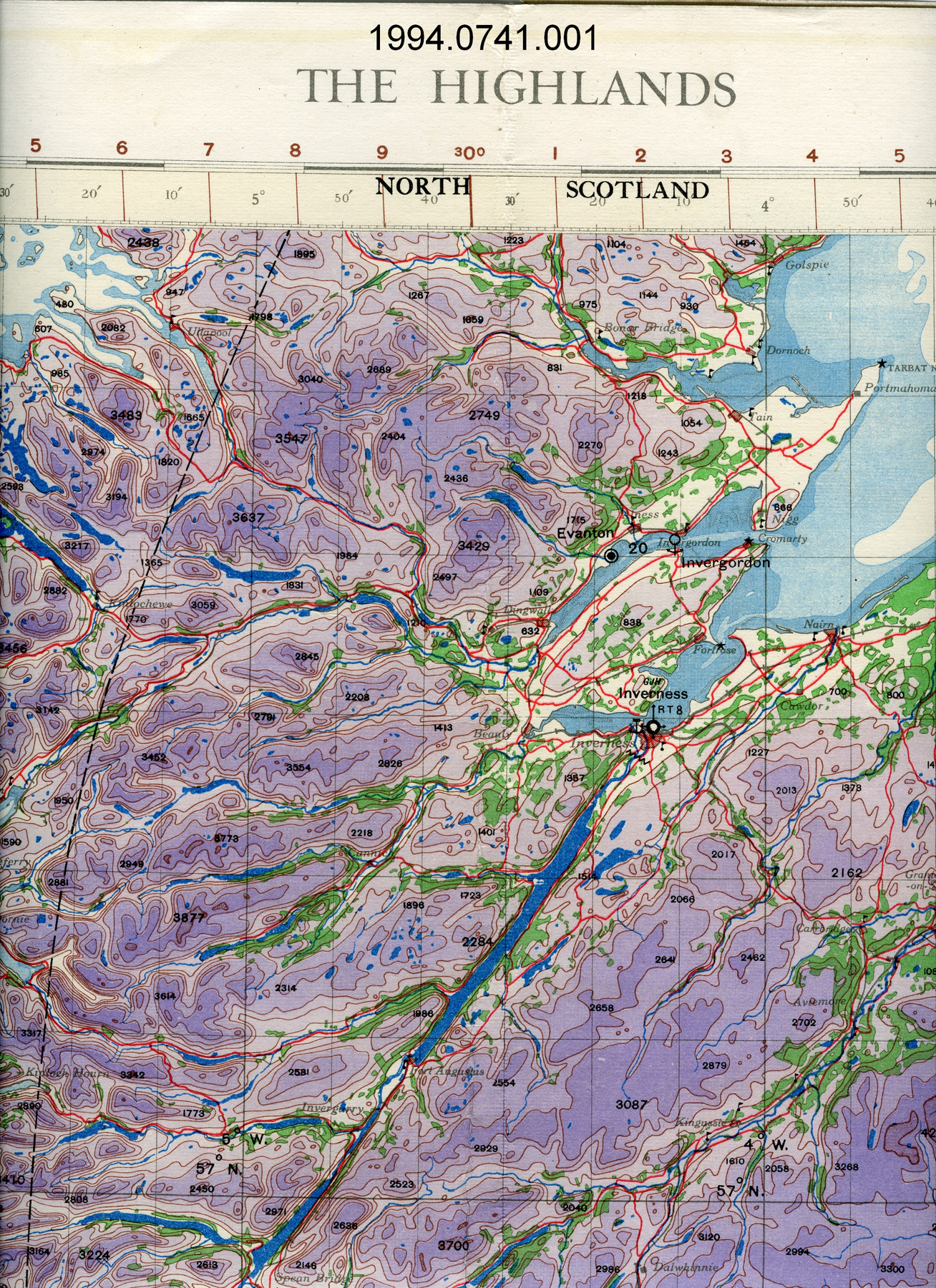
Map

Use this image

Can I reuse this image without permission? Yes

Object images on the Ingenium Collection’s portal have the following Creative Commons license:

Copyright Ingenium / CC BY-NC-ND (Attribution-NonCommercial 4.0 International (CC BY-NC 4.0)

ATTRIBUTE THIS IMAGE

Ingenium, 1994.0801.001
Permalink:

Ingenium is releasing this image under the Creative Commons licensing framework, and encourages downloading and reuse for non-commercial purposes. Please acknowledge Ingenium and cite the artifact number.

DOWNLOAD IMAGE

PURCHASE THIS IMAGE

This image is free for non-commercial use.

For commercial use, please consult our Reproduction Fees and contact us to purchase the image.

OBJECT TYPE
topographical/aeronautical
DATE
1940
ARTIFACT NUMBER
1994.0801.001
MANUFACTURER
Geographical Section, General Staff, War Office
MODEL
Cartagena
LOCATION
England

More Information


General Information

Serial #
N/A
Part Number
1
Total Parts
1
AKA
N/A
Patents
N/A
General Description
paper, linen backing

Dimensions

Note: These reflect the general size for storage and are not necessarily representative of the object's true dimensions.

Length
85.5 cm
Width
59.5 cm
Height
N/A
Thickness
N/A
Weight
N/A
Diameter
N/A
Volume
N/A

Lexicon

Group
Aviation
Category
Navigation instruments & equipment
Sub-Category
N/A

Manufacturer

AKA
Defence UK
Country
England
State/Province
Unknown
City
Unknown

Context

Country
Africa
State/Province
Unknown
Period
WWII (1939-1945); this map produced in 1940
Canada
Unknown
Function
two dimensional graphic representation of a section of the earth's surface/used for aerial navigation
Technical
Unknown
Area Notes
Unknown

Details

Markings
lettering on border above map reads: "1:500,000 AFRICA (AIR) HEIGHTS IN METRES CARTAGENA SOUTHERN ZONE LAYER SYSTEM 2nd Edition N.W.36/2"; lettering on border below map reads: "Geographical Section, General Staff, No. 4072./Additions and corrections January, 1942./3,500/4/42.Cr./Projection. Europe (Air) Conical Orthomorphic (Mediterranean Zone)/Annual change about 7' easterly. (mean)/Compiled, drawn, heliographed and printed at Ordnance Survey, 1940."
Missing
N/A
Finish
colour map; white border
Decoration
none

CITE THIS OBJECT

If you choose to share our information about this collection object, please cite:

Geographical Section, General Staff, War Office, Map, 1940, Artifact no. 1994.0801, Ingenium – Canada’s Museums of Science and Innovation, http://collection.ingeniumcanada.org/en/id/1994.0801.001/

FEEDBACK

Submit a question or comment about this artifact.

More Like This


...
Map

1994.0800.002

Object

...
Map

1994.0800.001

Object

...
Map

1994.0803.001

Object

...
Map

1994.0799.001

Object

...
Map

1994.0802.001

Object

...
Map

1994.0798.001

Object

...
Map

1994.0767.001

Object

...
Map

1994.0773.001

Object

...
Map

1994.0756.001

Object

...
Map

1994.0752.001

Object

...
Map

1994.0775.001

Object

...
Map

1994.0797.001

Object

...
Map

1994.0770.001

Object

...
Map

1994.0830.001

Object

...
Map

1994.0795.001

Object

...
Map

1994.0796.001

Object

...
Map

1994.0762.001

Object

...
Map

1994.0766.001

Object

...
Map

1994.0771.001

Object

...
Map

1994.0774.001

Object

...
Map

1994.0757.001

Object

...
Map

1994.0760.001

Object

...
Map

1994.0749.001

Object

...
Map

1994.0750.001

Object

...
Map

1994.0764.001

Object

...
Map

1994.0686.001

Object

...
Map

1994.0794.001

Object

...
Map

1994.0700.001

Object

...
Map

1994.0701.001

Object

...
Map

1994.0901.001

Object

...
Map

1994.0765.001

Object

...
Map

1994.0685.001

Object

...
Map

1994.0687.001

Object

...
Map

1992.2836.001

Object

...
Map

1992.2839.001

Object

...
Map

1994.0702.001

Object

...
Map

1992.2836.002

Object

...
Map

1994.0710.001

Object

...
Map

1994.0772.001

Object

...
Map

1994.0768.001

Object

...
Map

1992.2837.001

Object

...
Map

1992.2839.002

Object

...
Map

1992.2831.001

Object

...
Map

1992.2840.002

Object

...
Map

1992.2842.001

Object

...
Map

1992.2842.002

Object

...
Map

1992.2828.001

Object

...
Map

1992.2829.001

Object

...
Map

1992.2837.002

Object

...
Map

1992.2824.001

Object

...
Map

1992.2825.001

Object

...
Map

1994.0776.001

Object

...
Map

1992.2841.001

Object

...
Map

1992.2841.002

Object

...
Map

1992.2840.001

Object

...
Map

1992.2823.001

Object

...
Map

1992.2827.001

Object

...
Map

1992.2830.001

Object

...
Map

2004.1696.001

Object

...
Map

2004.1691.001

Object

...
Map

1992.2822.001

Object

...
Map

1994.0758.001

Object

...
Map

1994.0758.002

Object

...
Map

1992.2826.001

Object

...
Map

1992.2835.001

Object

...
Map

1992.2835.002

Object

...
Map

1992.2835.003

Object

...
Map

1992.2835.004

Object

...
Map

1992.2835.005

Object

...
Map

1994.0776.002

Object

...
Map

1994.0753.001

Object

...
Map

1994.0759.002

Object

...
Map

2004.1698.001

Object

...
Map

2004.1697.001

Object

...
Map

2004.1695.001

Object

...
Map

2004.1694.001

Object

...
Map

2004.1692.001

Object

...
Map

1994.0751.001

Object

...
Map

1994.0759.001

Object

...
Map

2004.1693.001

Object

...
Map

2004.1690.001

Object

...
Map

2004.1690.002

Object

...
Map

1994.0893.001

Object

...
Map

1994.0895.001

Object

...
Map

1994.0896.001

Object

...
Map

1994.0897.001

Object

...
Map

1994.0887.002

Object

...
Map

1992.2864.001

Object

...
Map

1994.0829.001

Object

...
Map

1992.2791.001

Object

...
Map

2004.1691.002

Object

...
Map

1994.0747.001

Object

...
Map

1994.0745.001

Object

...
Map

1992.2871.001

Object

...
Map

1994.0746.001

Object

...
Map

1994.0748.001

Object

...
Map

1992.2843.001

Object

...
Map

1992.2873.001

Object

...
Map

1992.2832.001

Object

...
Map

1994.0741.001

Object