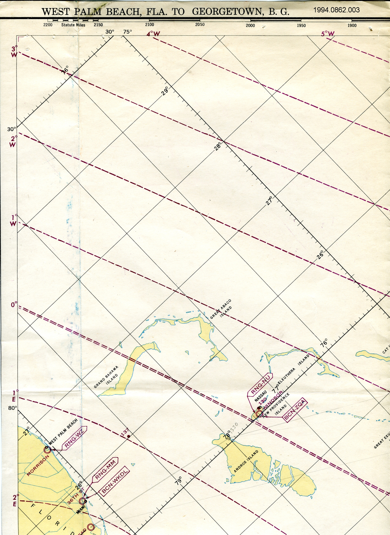
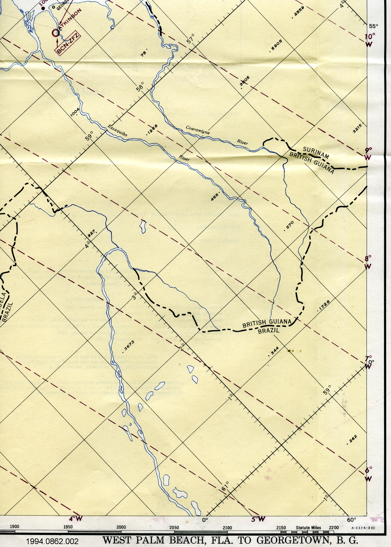
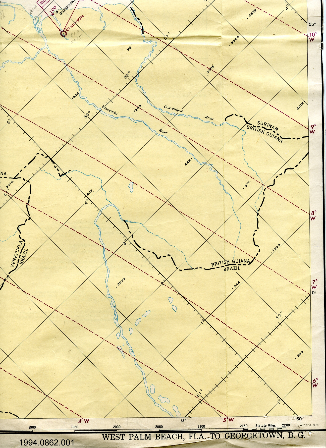
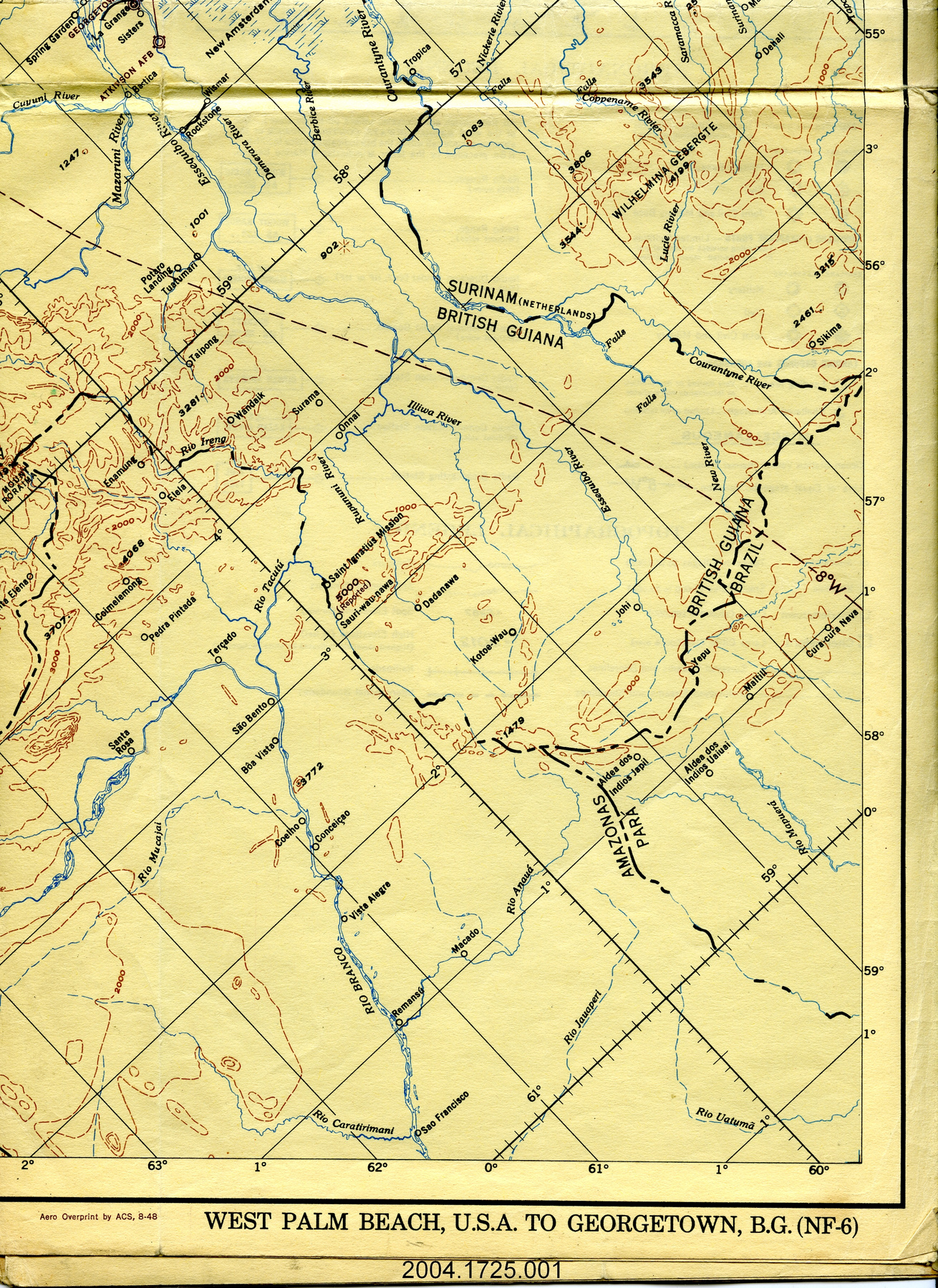
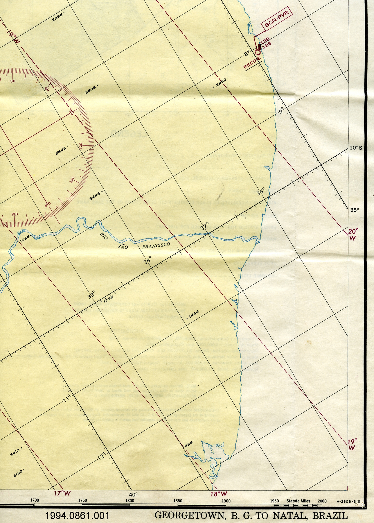
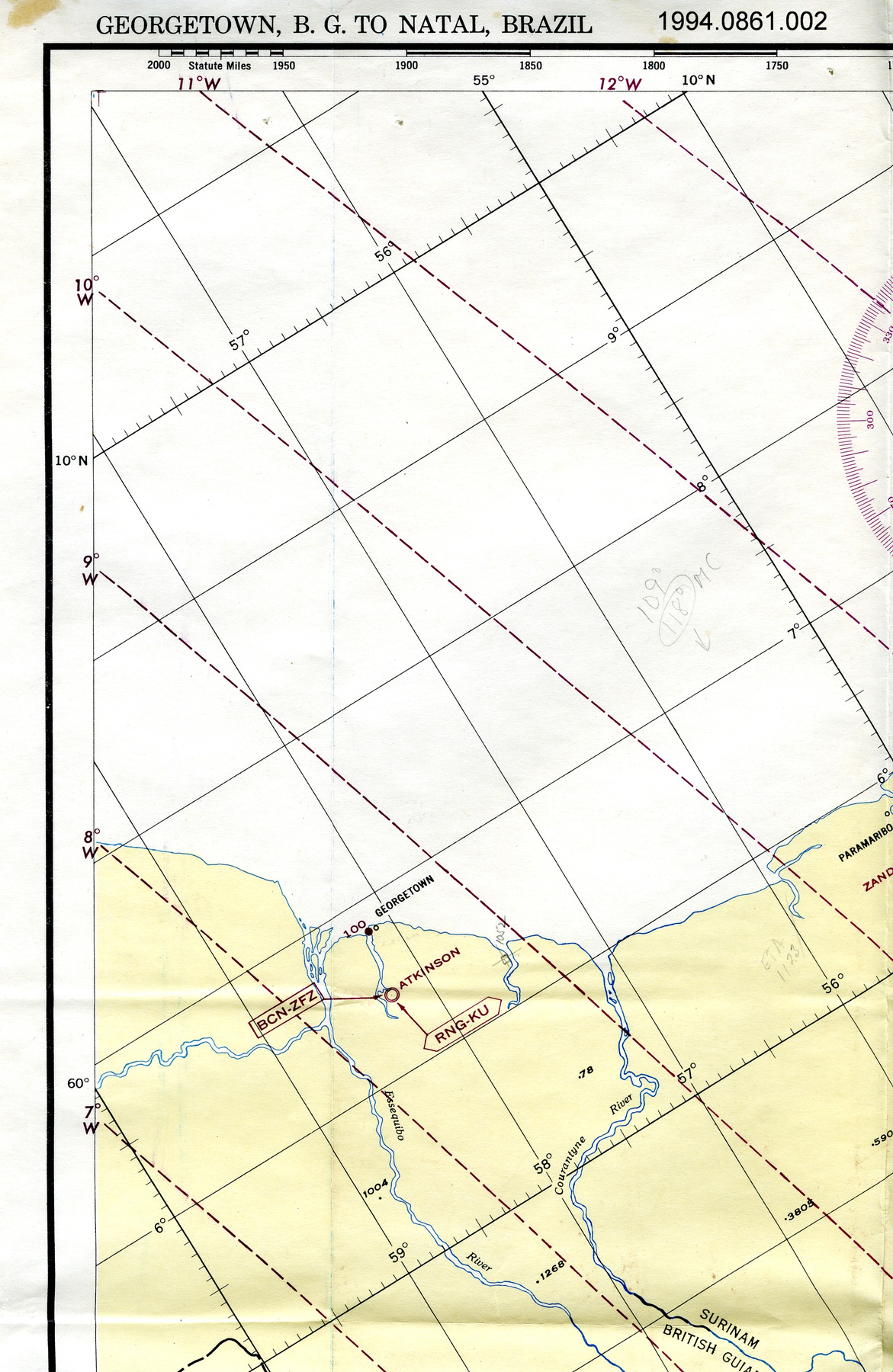
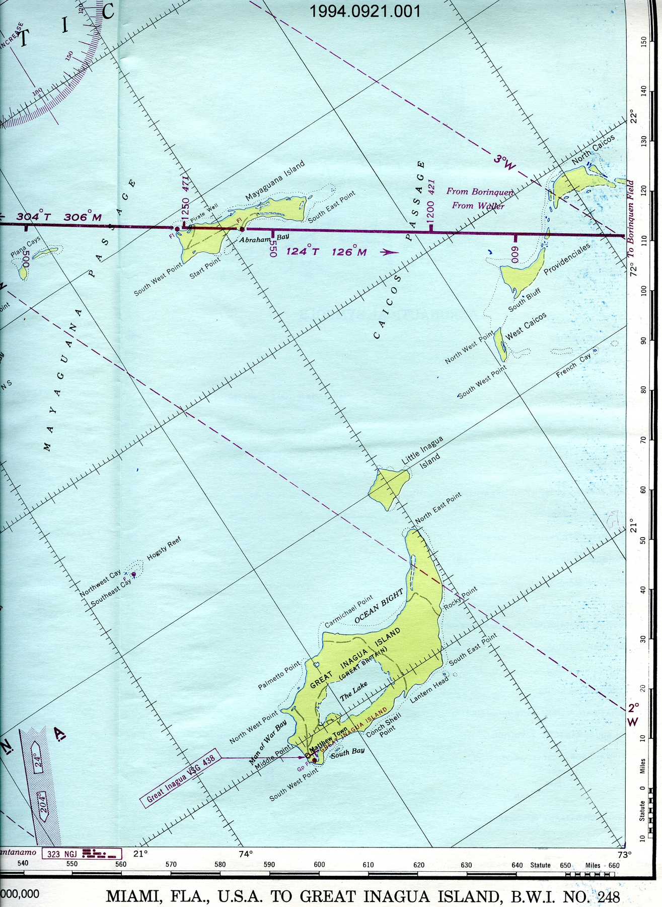
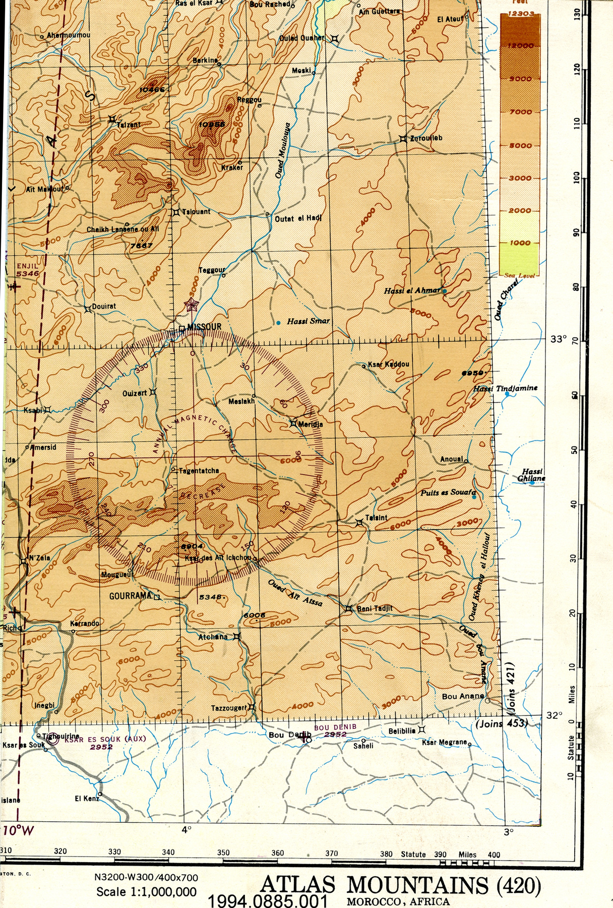
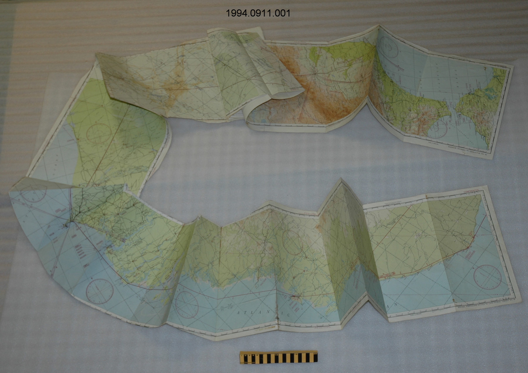
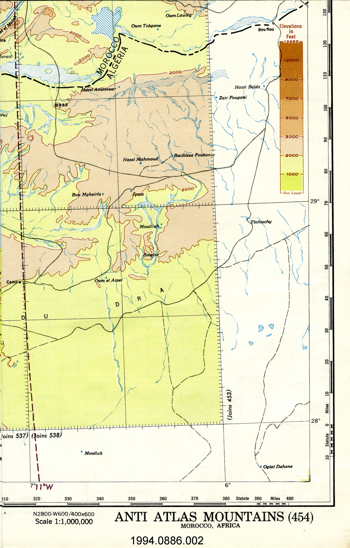
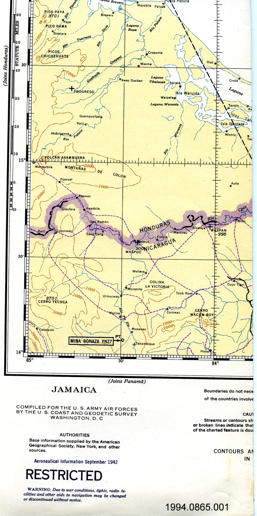
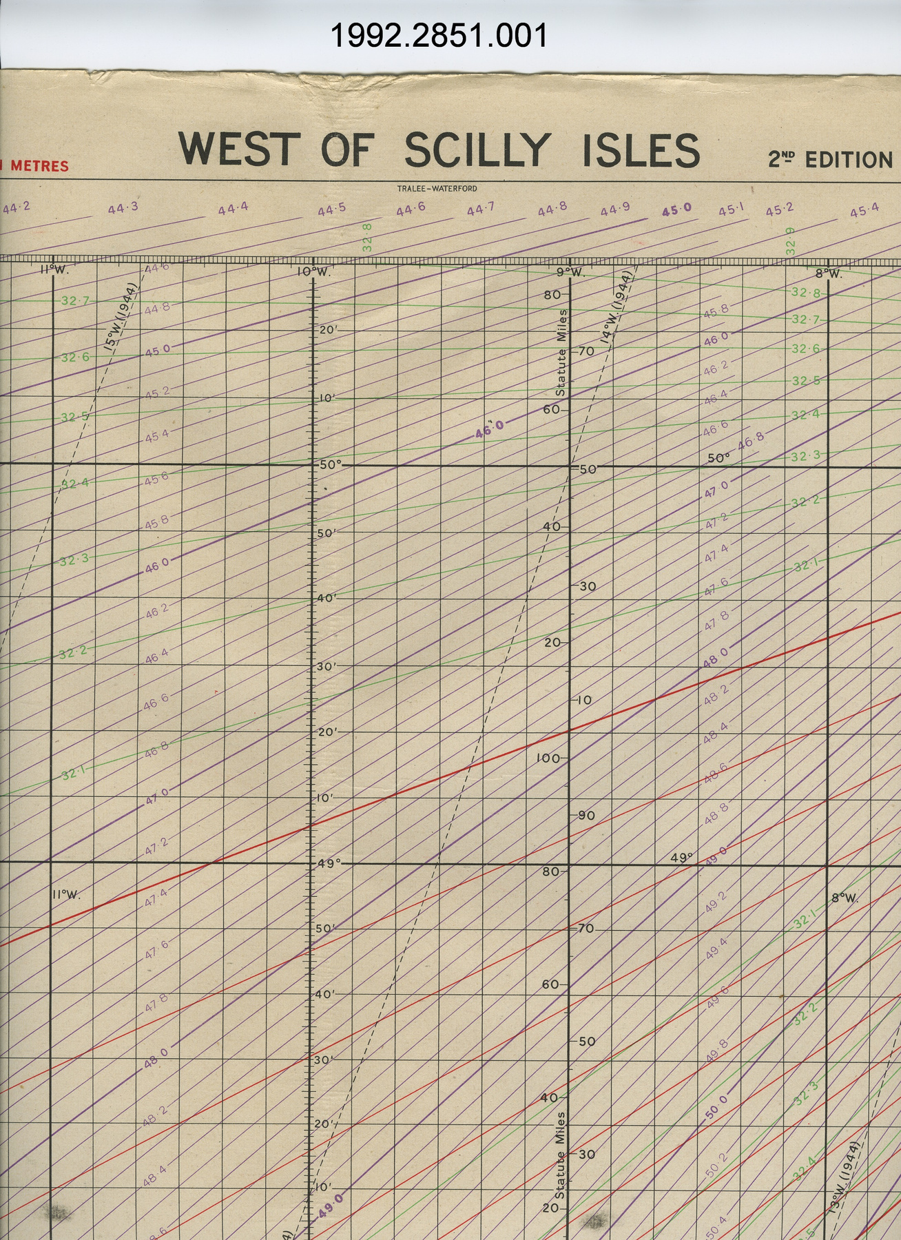
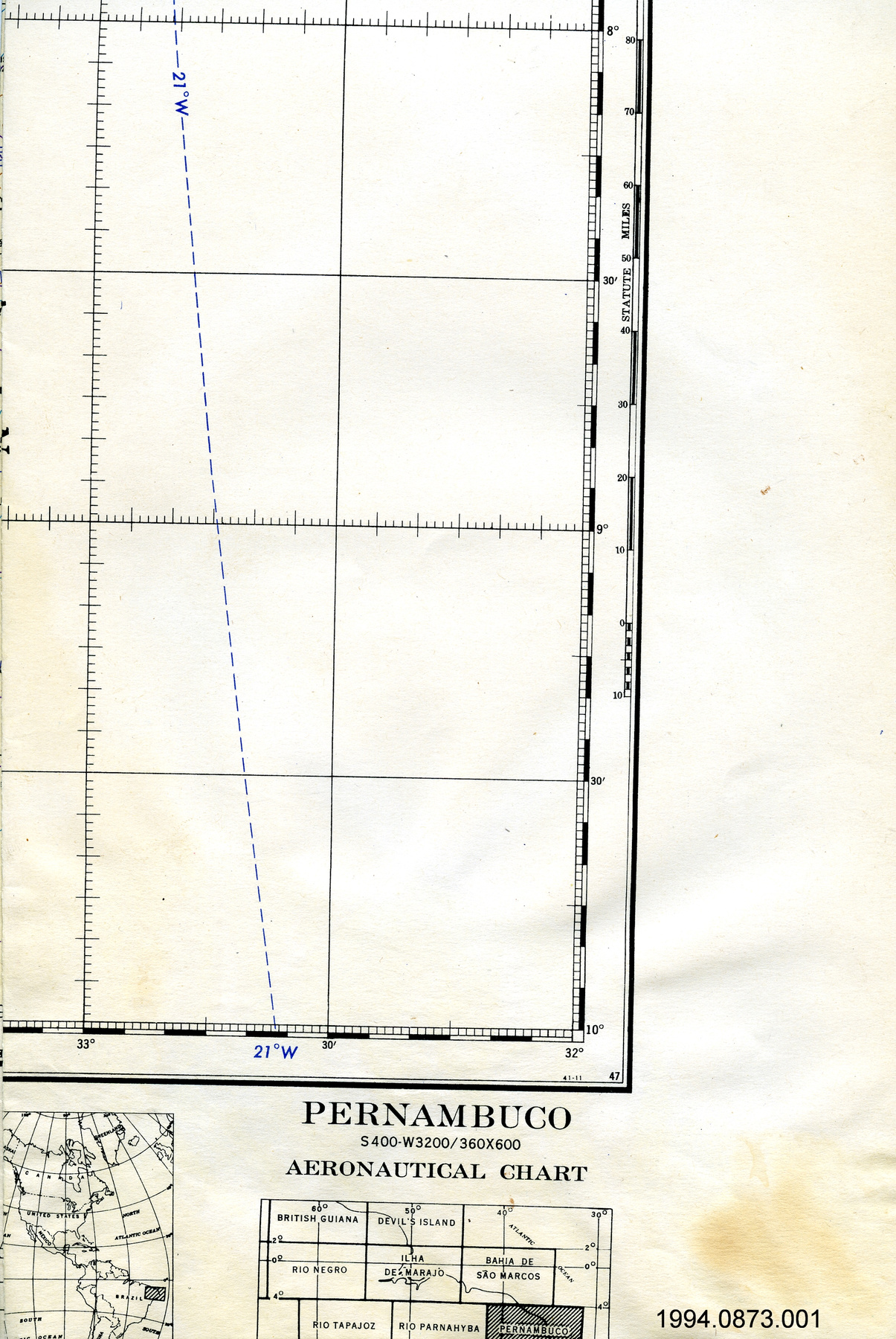
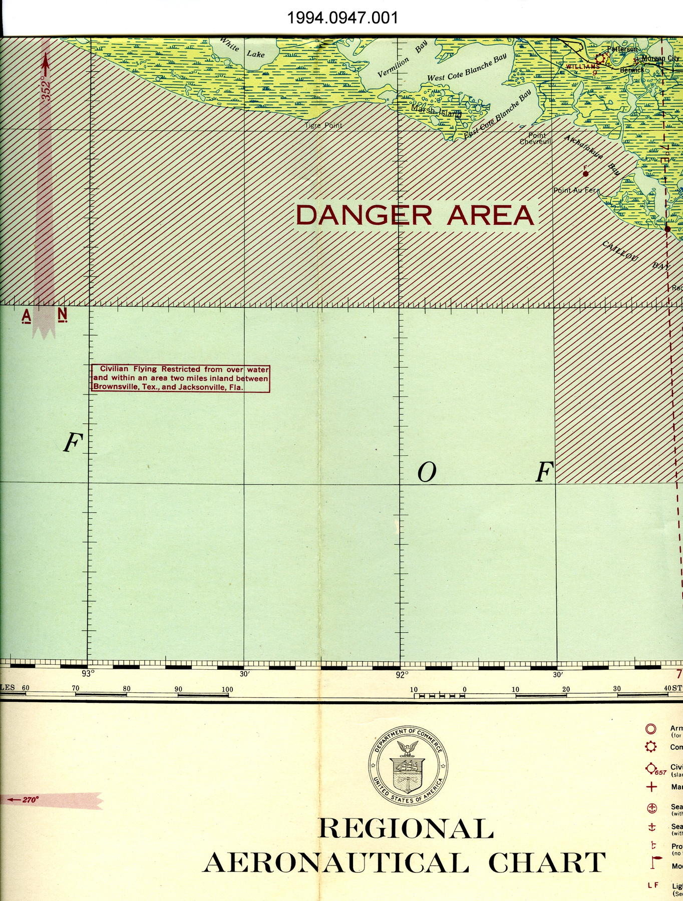
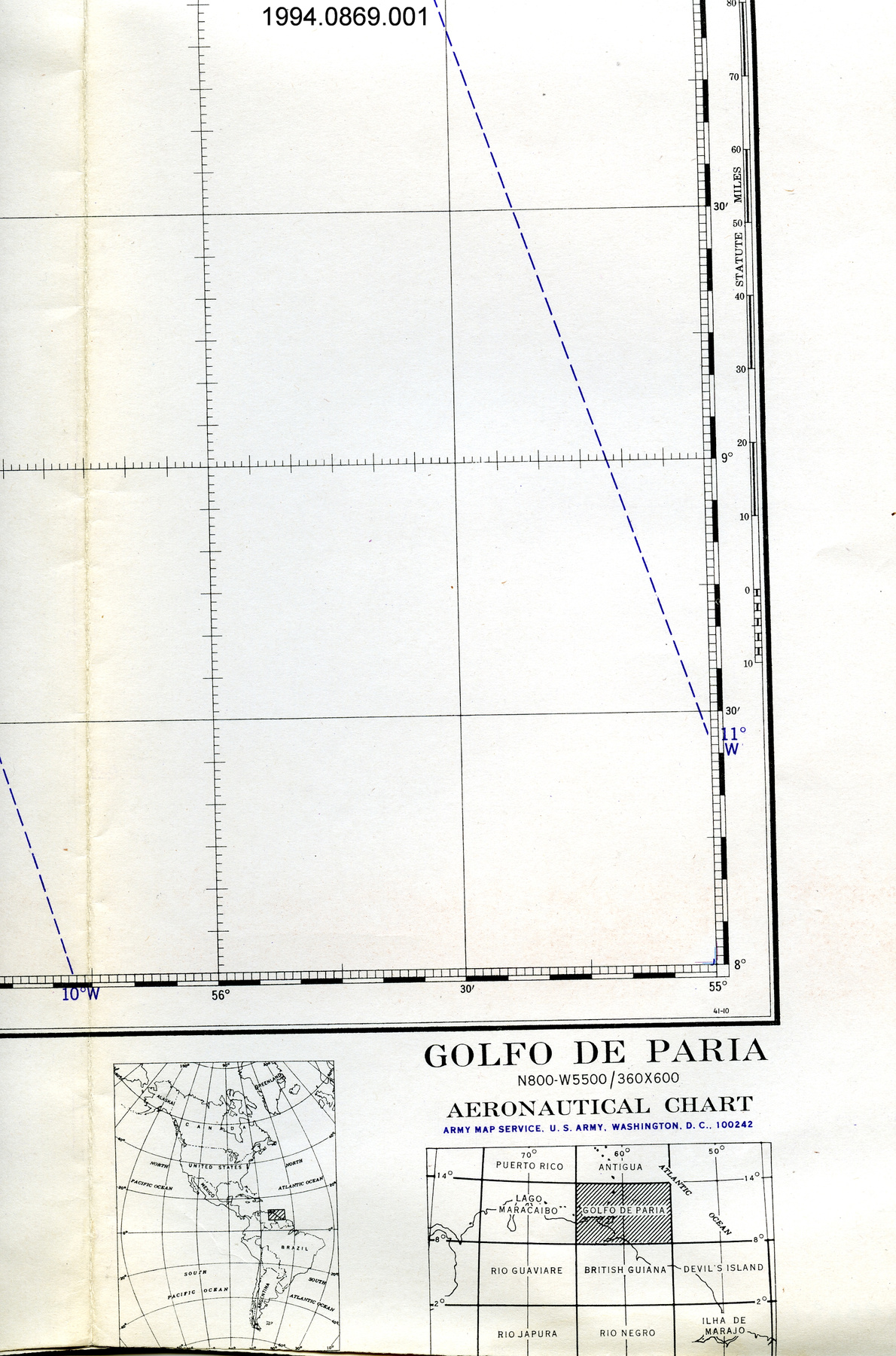
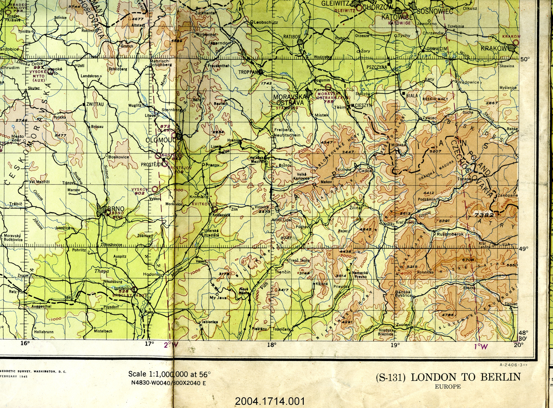
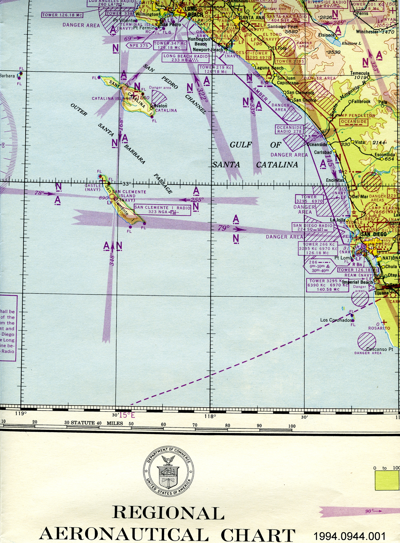
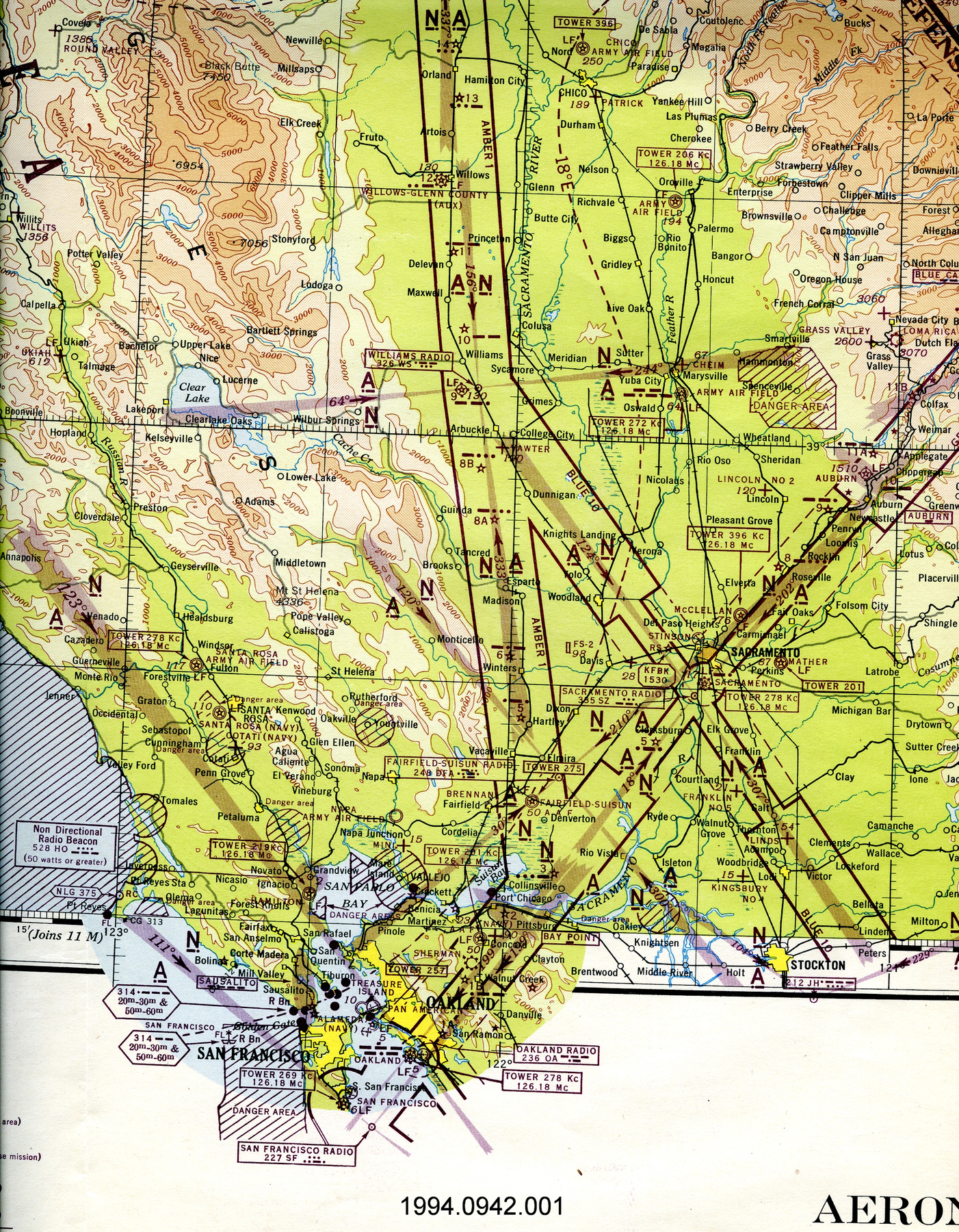
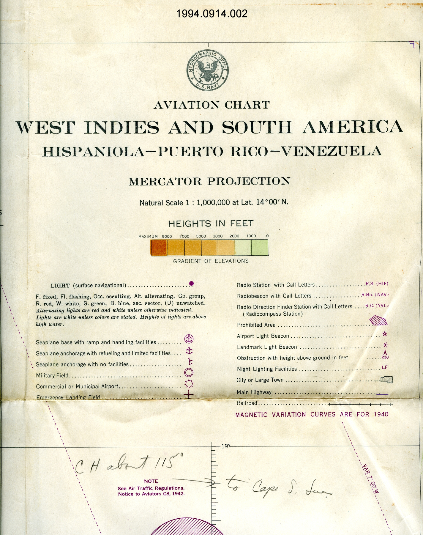
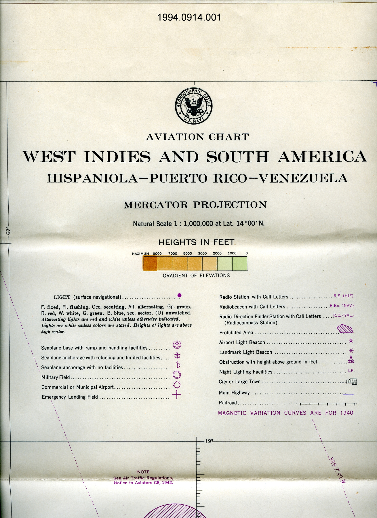
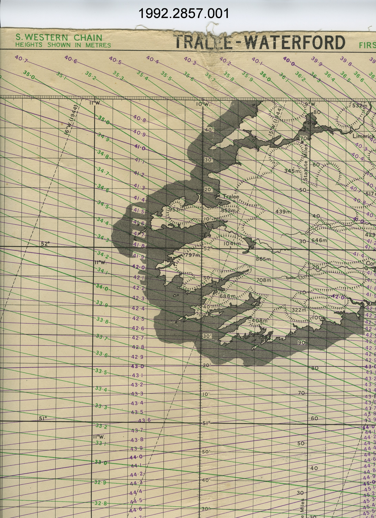
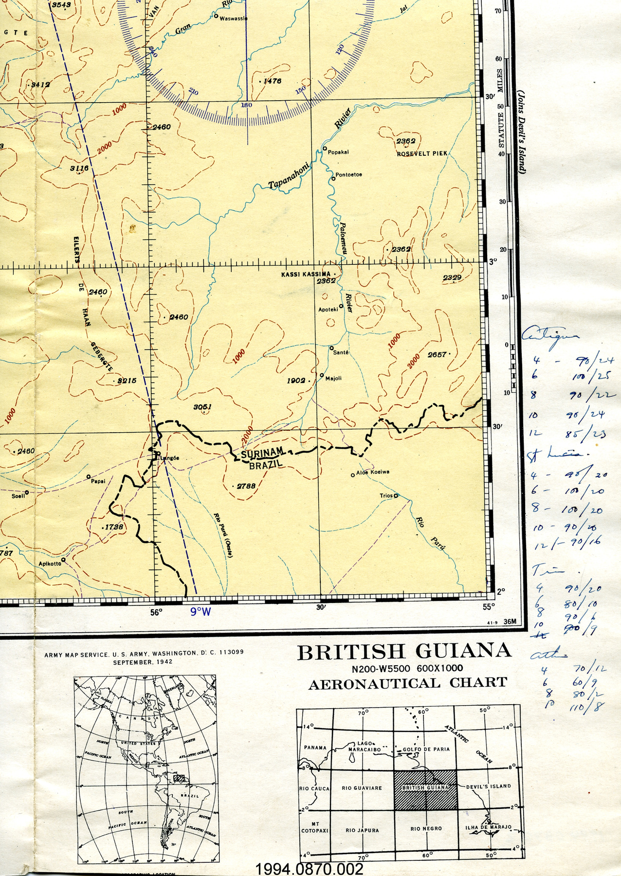
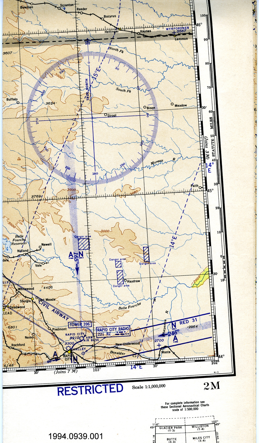
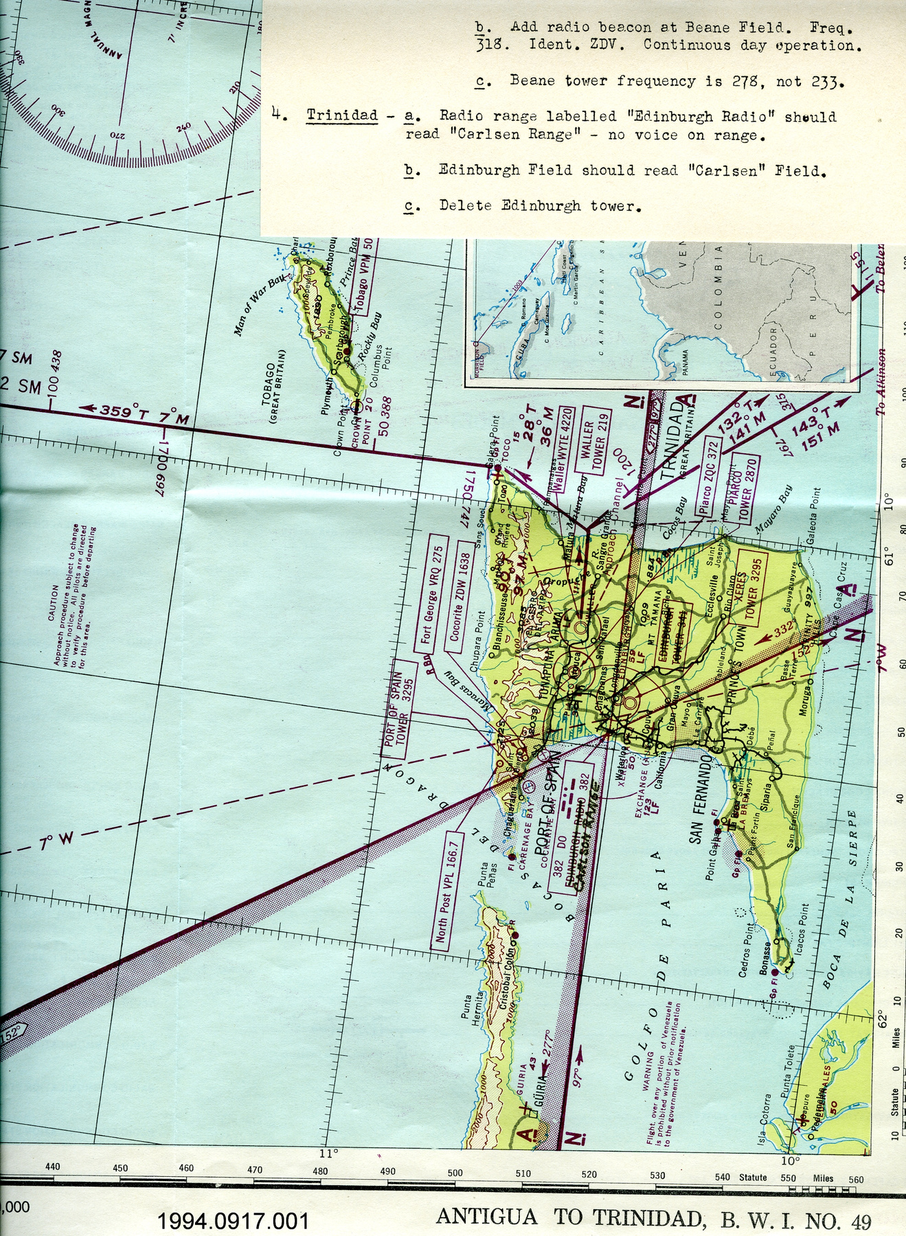
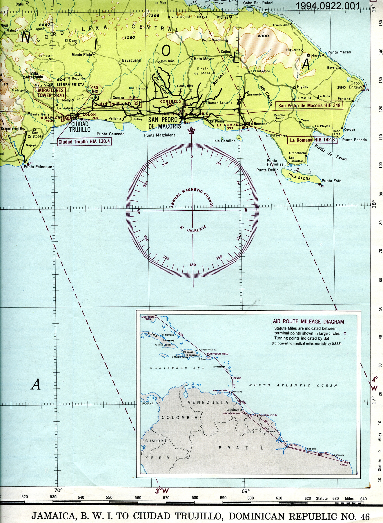
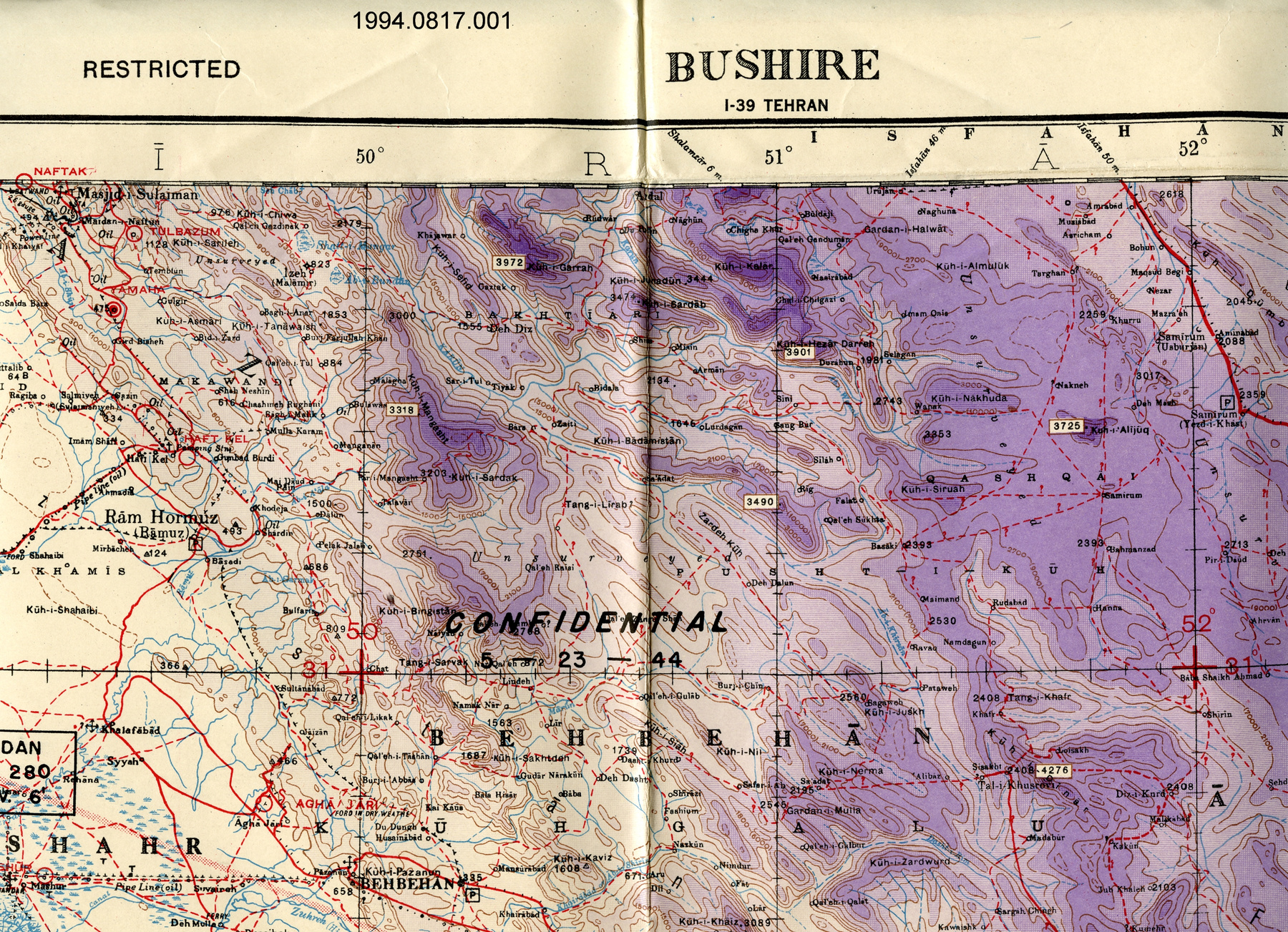
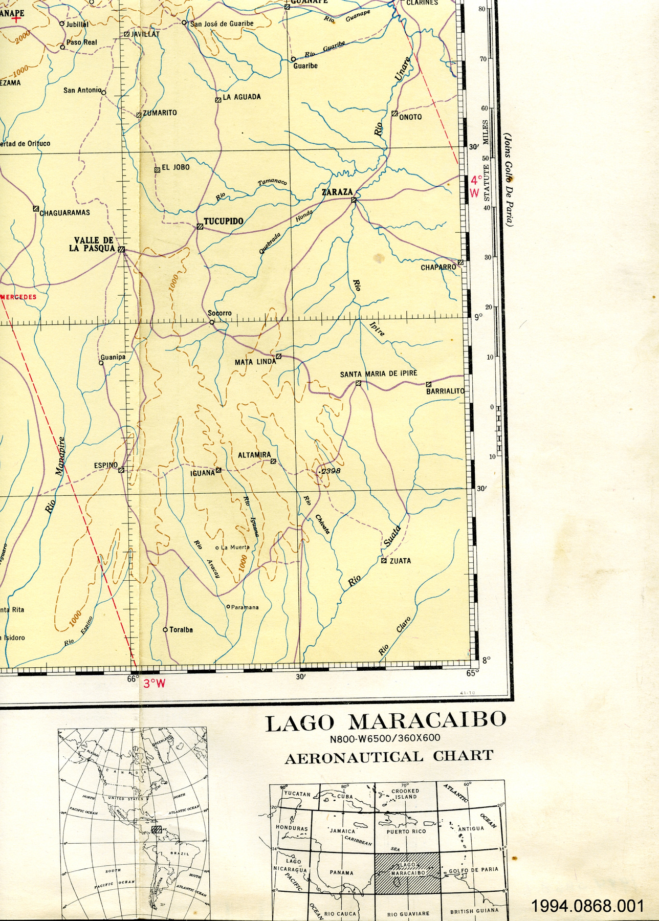
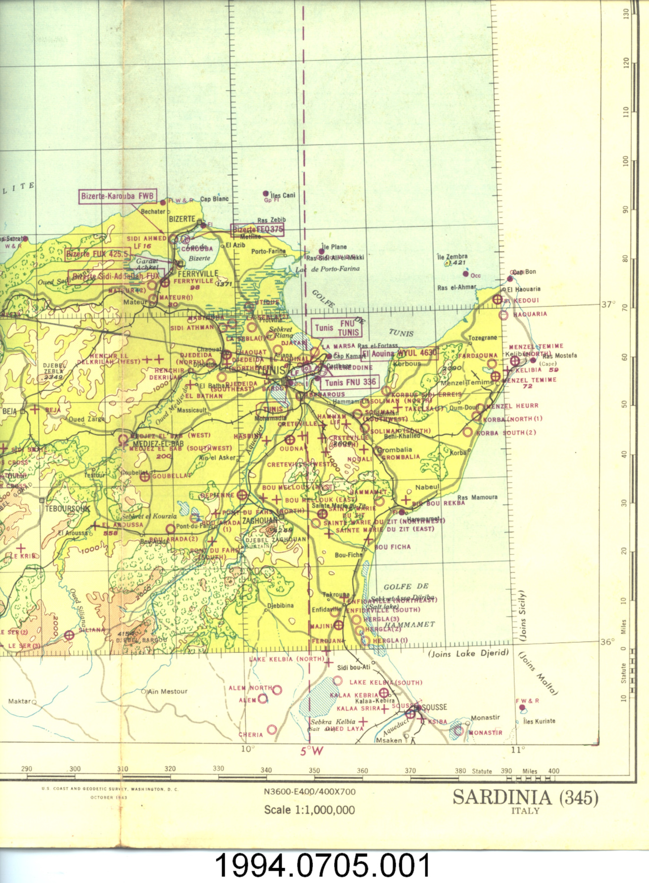
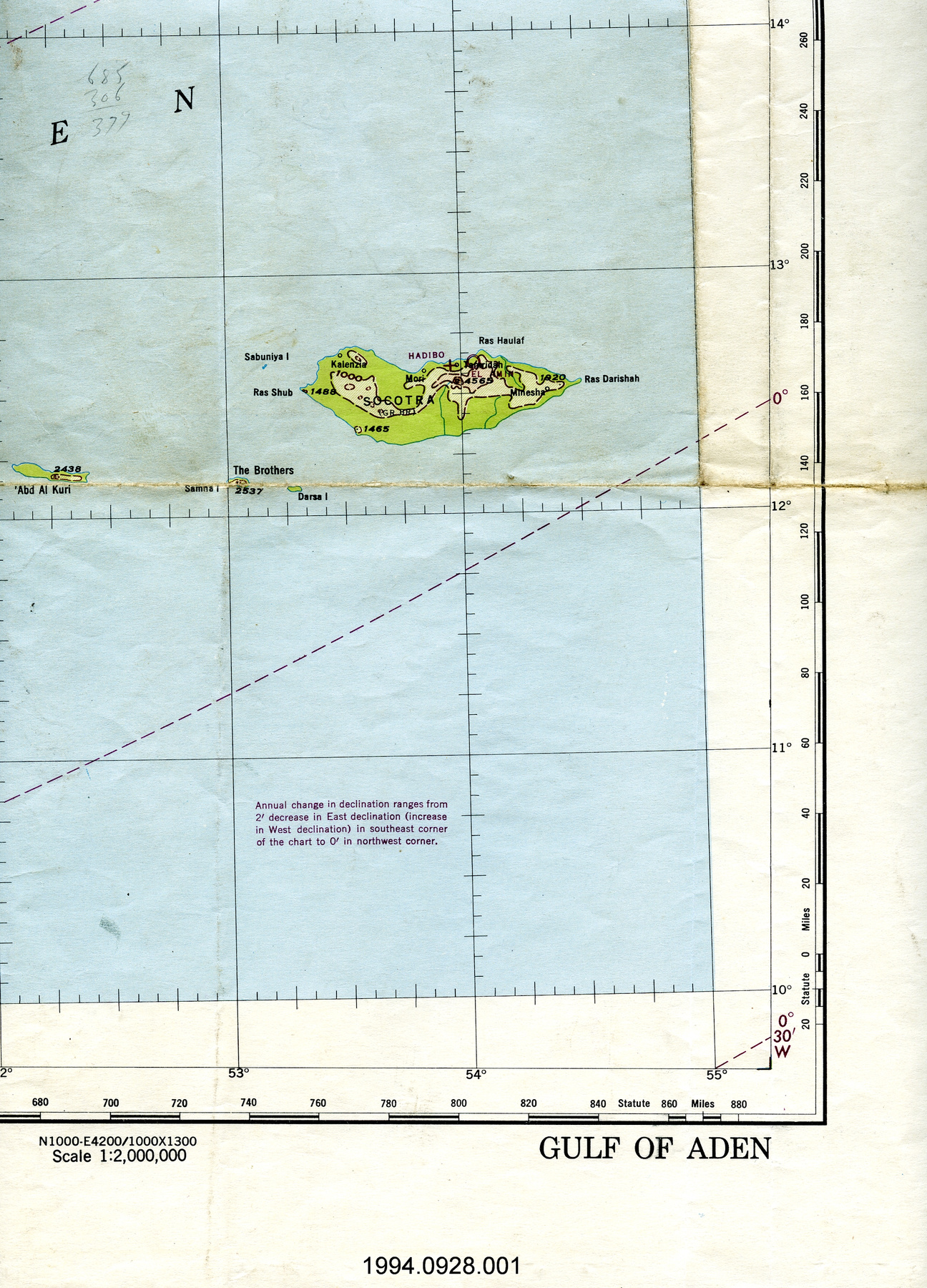
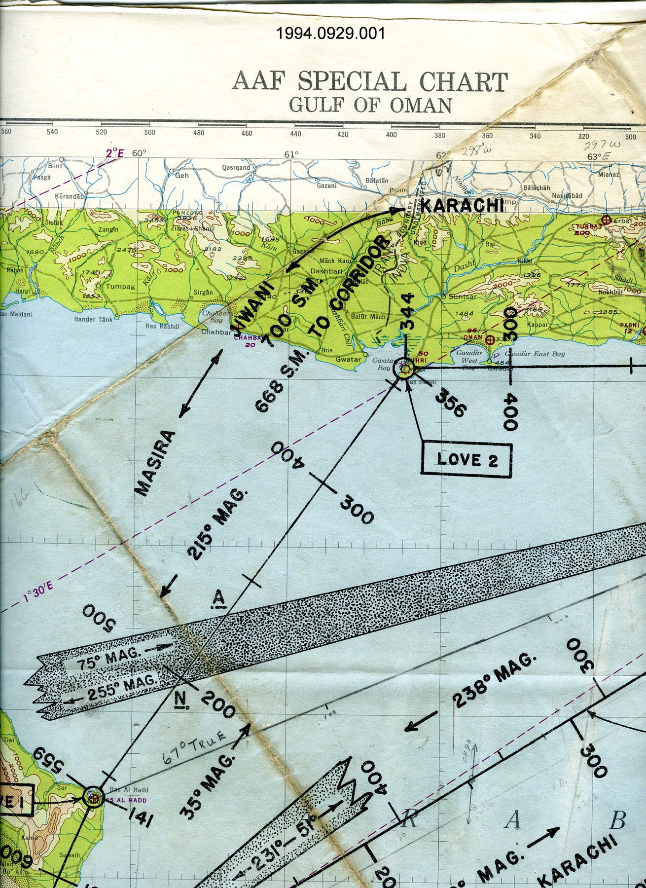
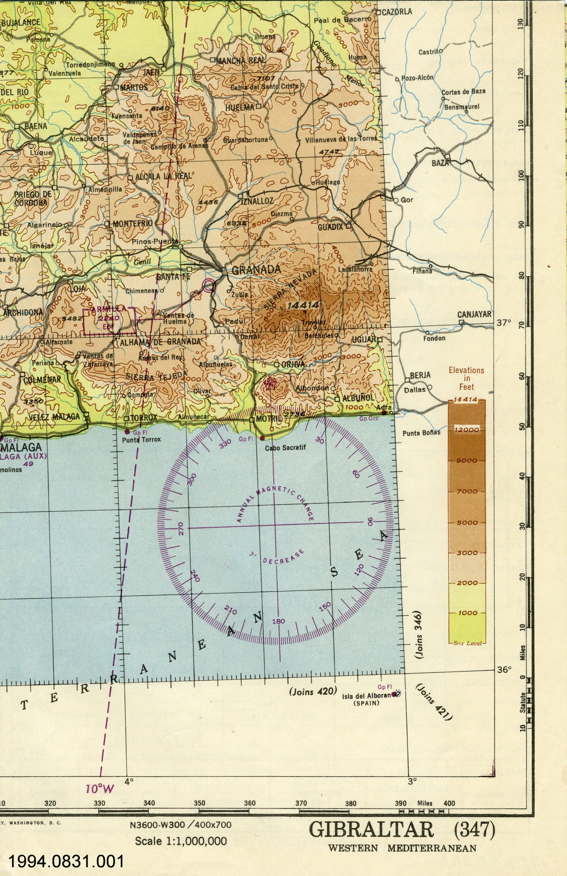
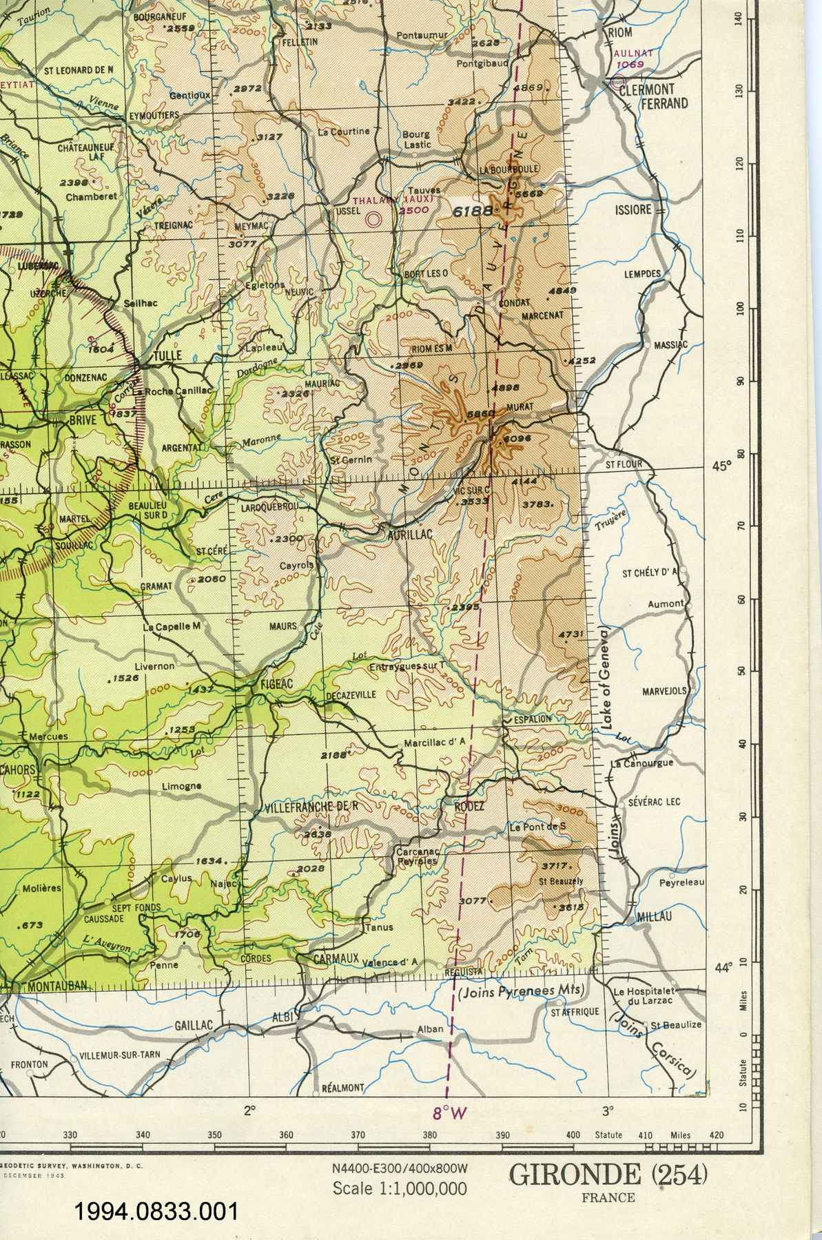
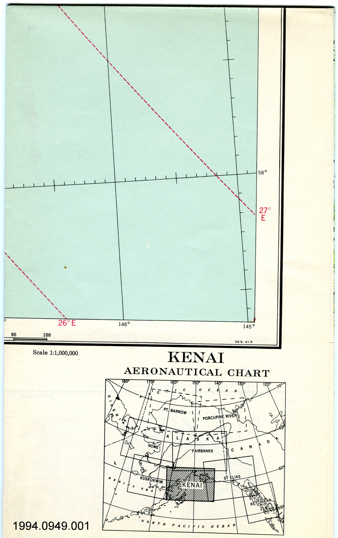
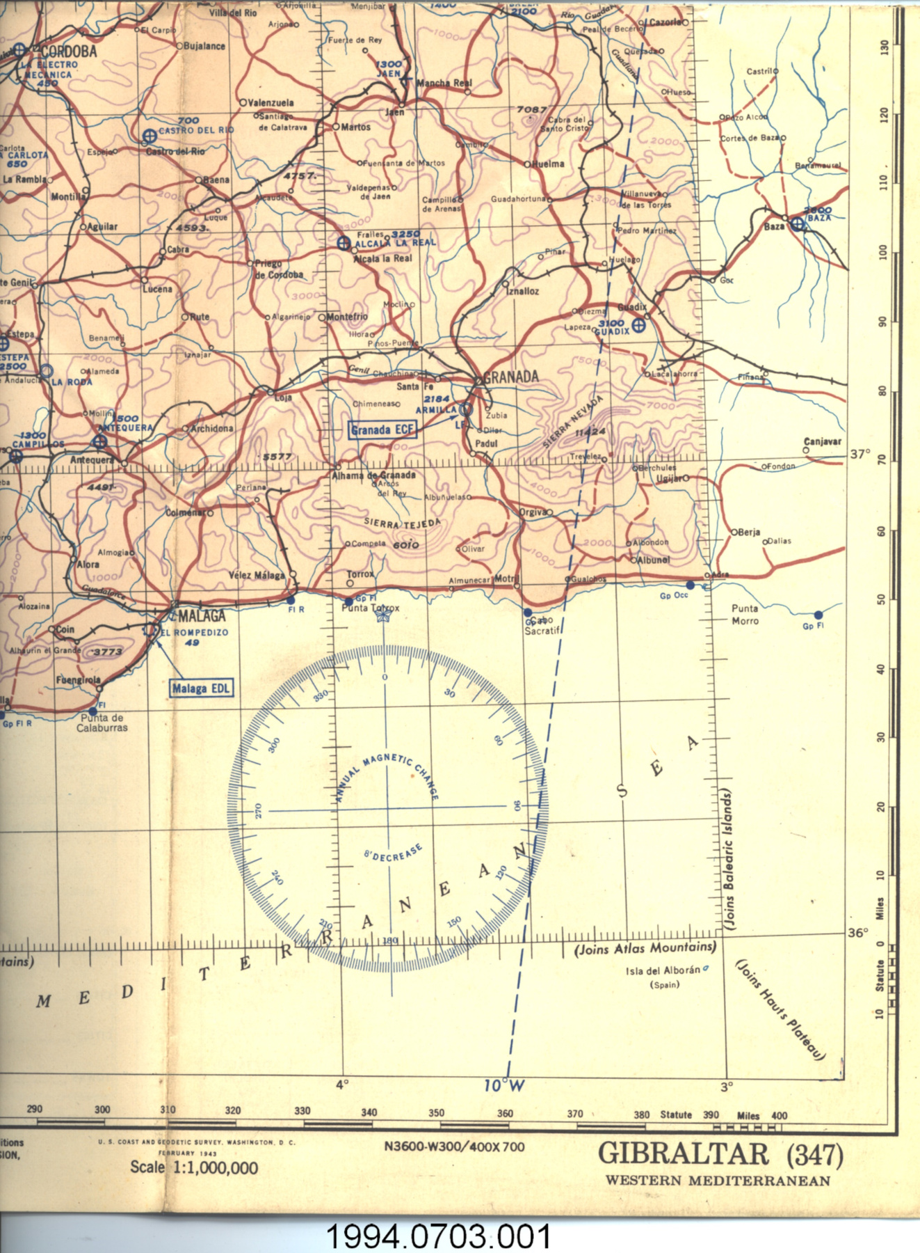
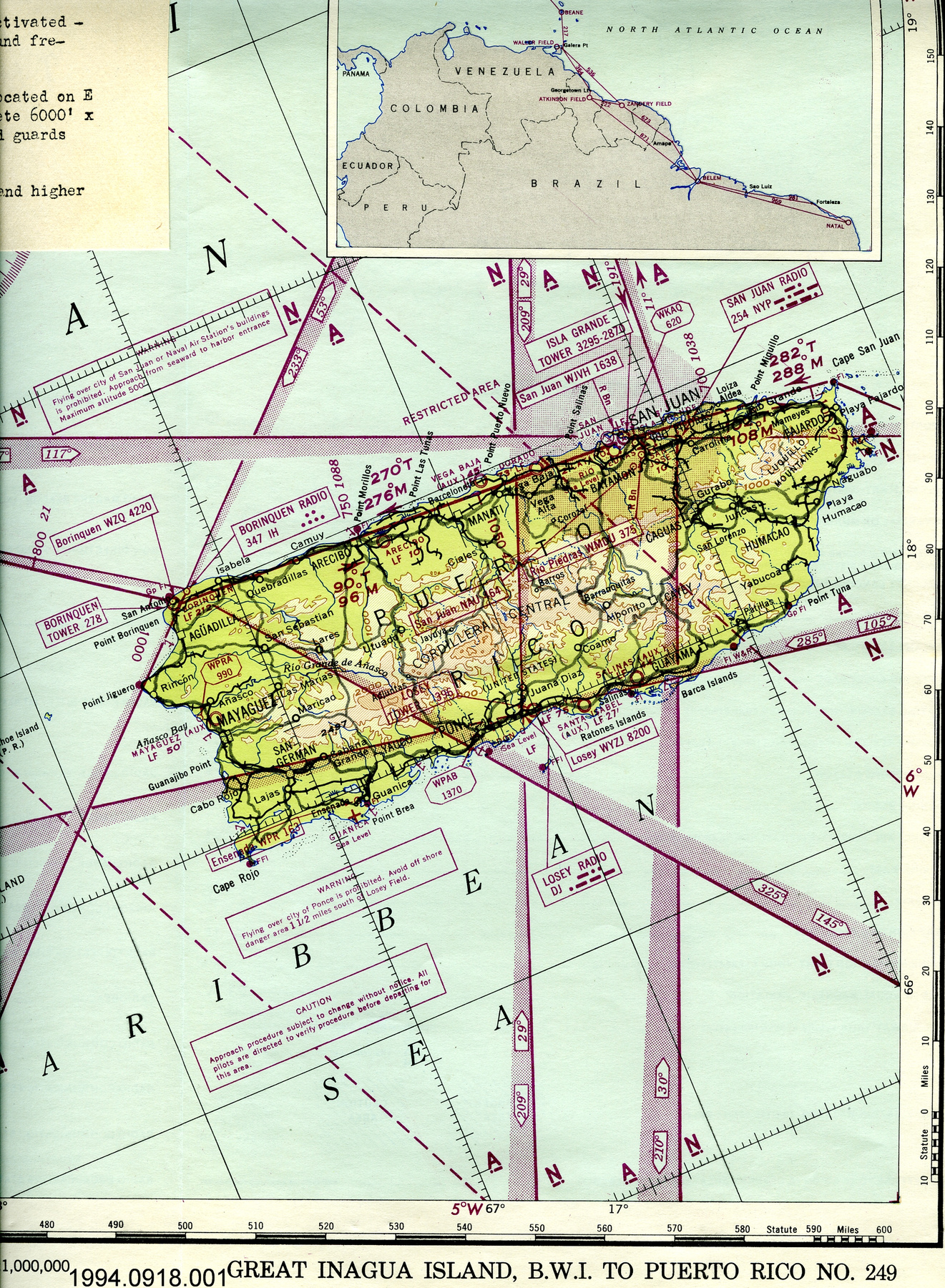
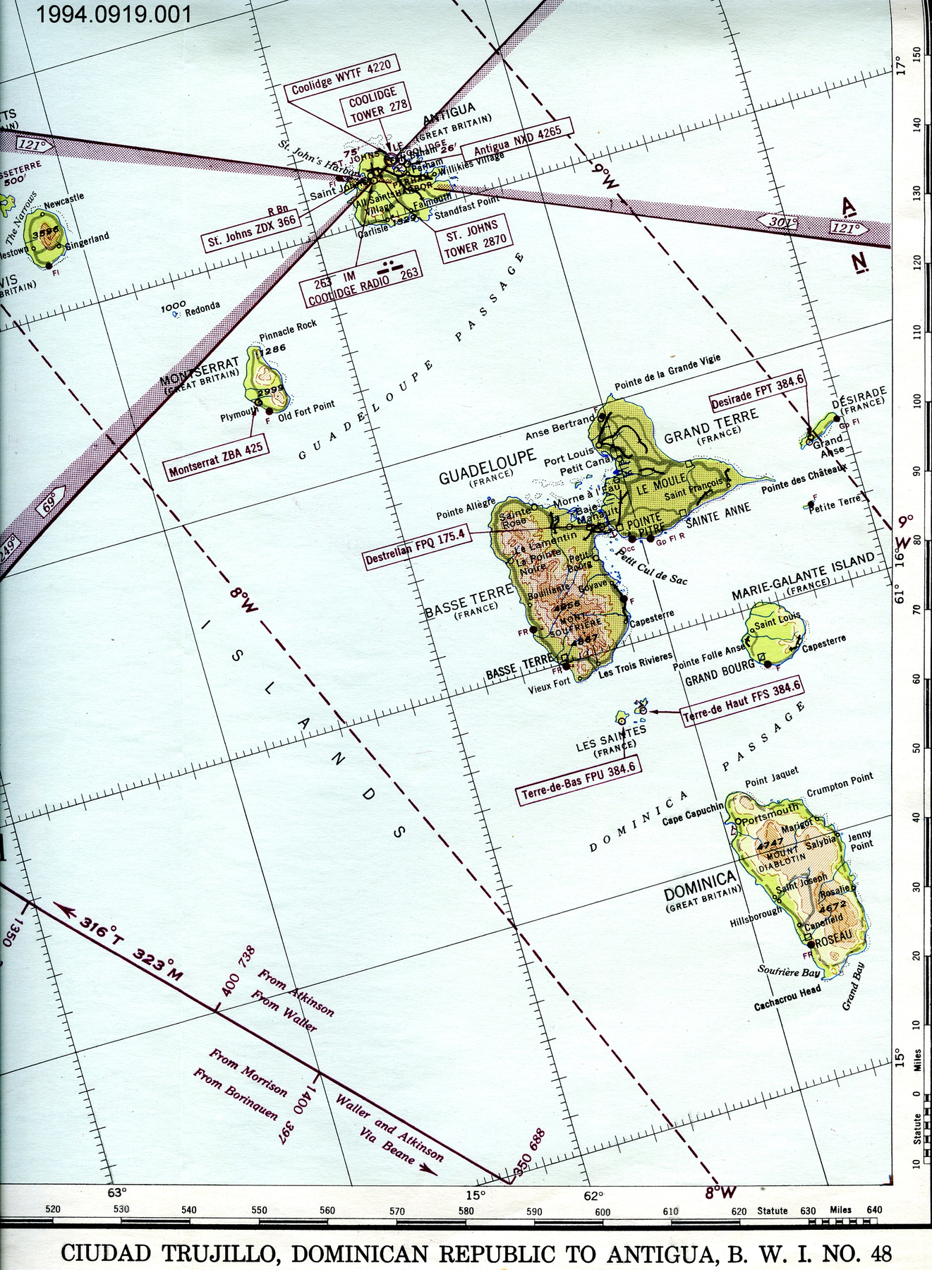
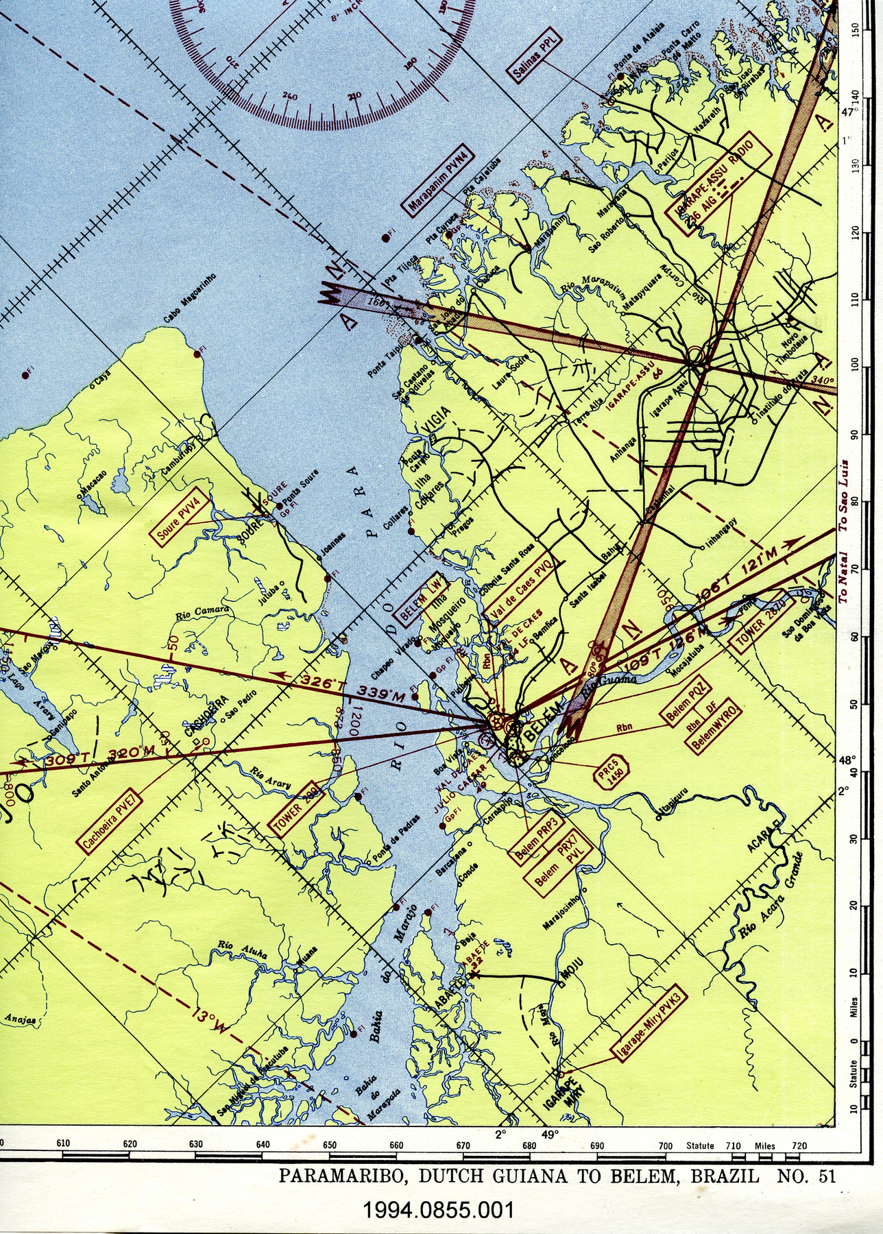
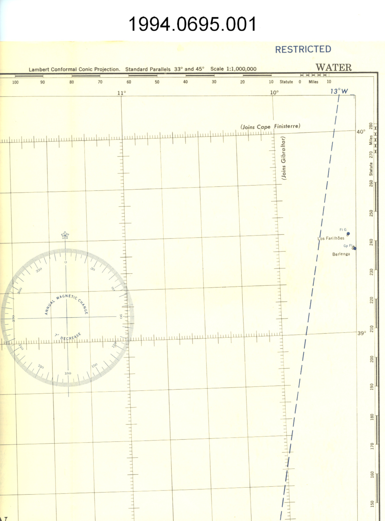
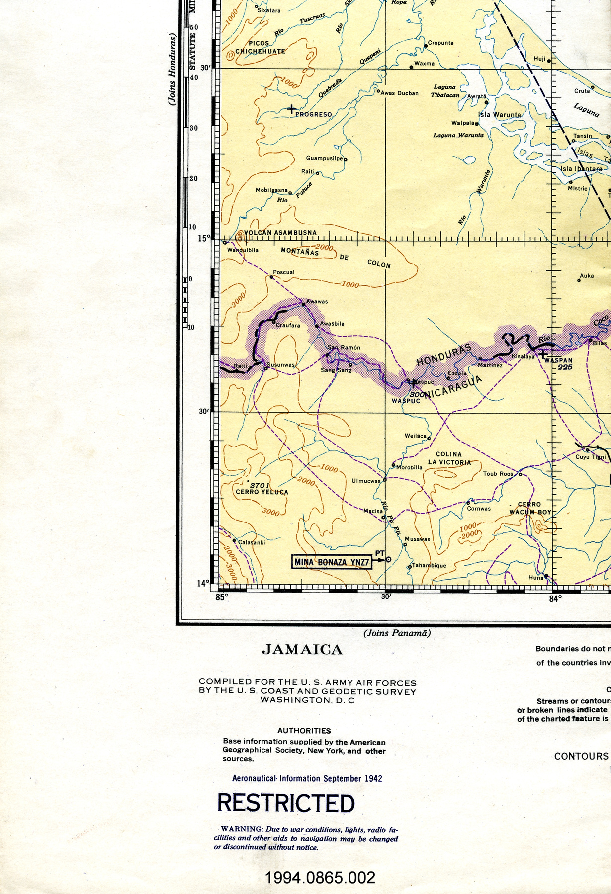
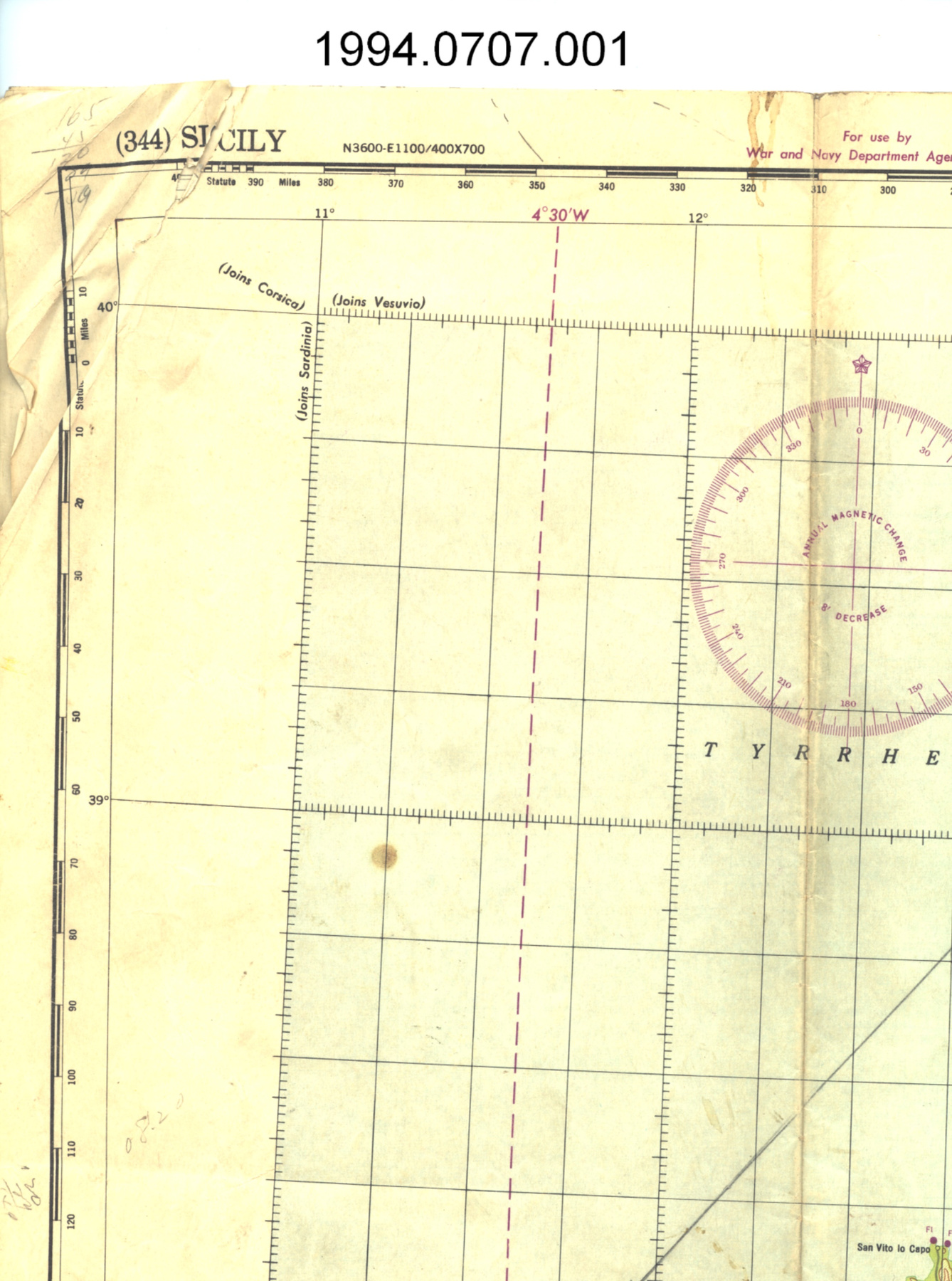
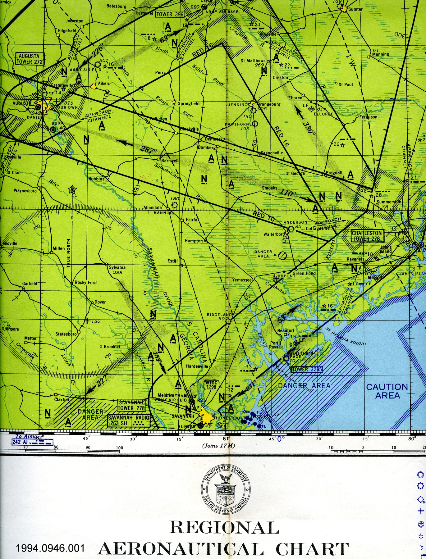
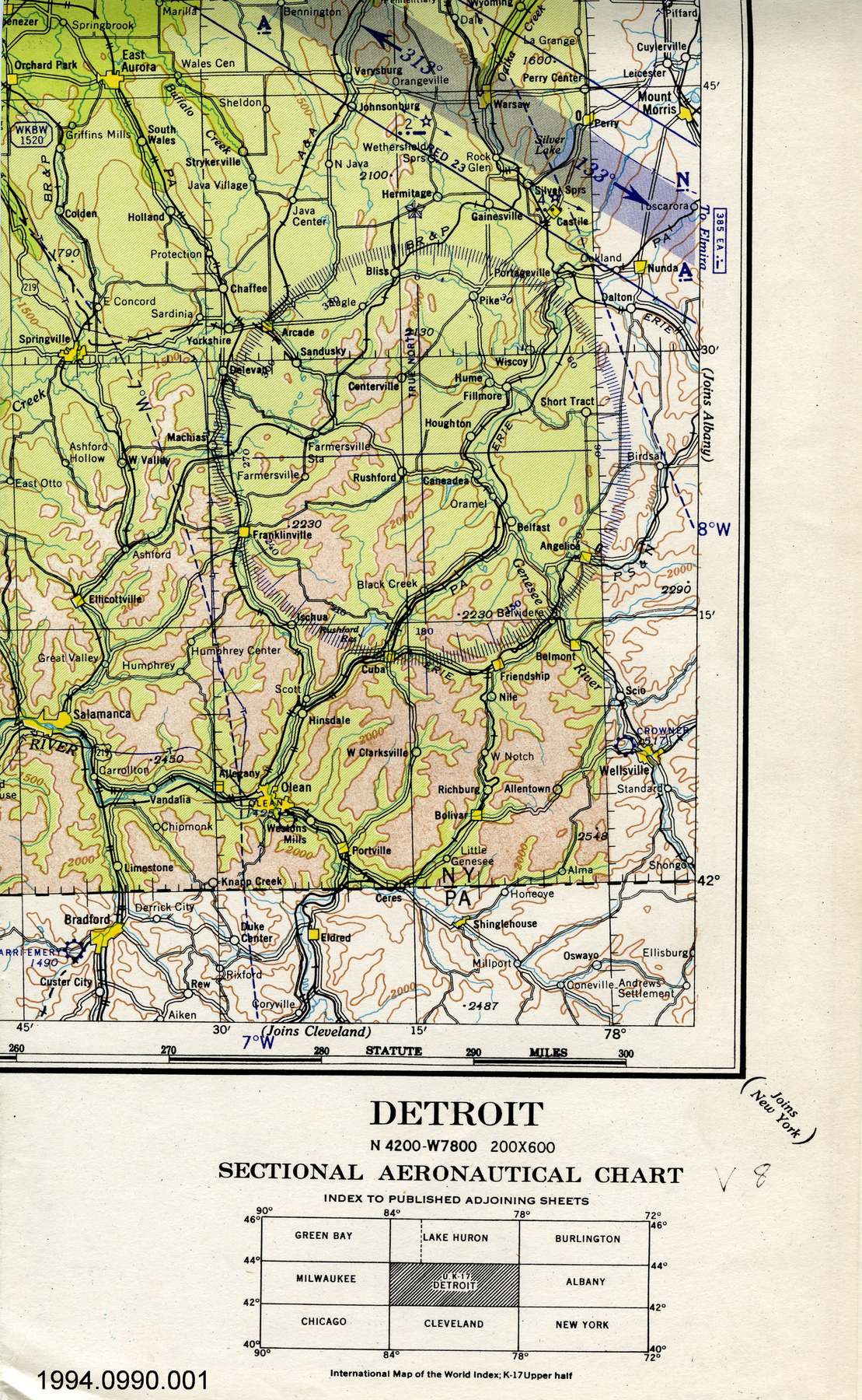
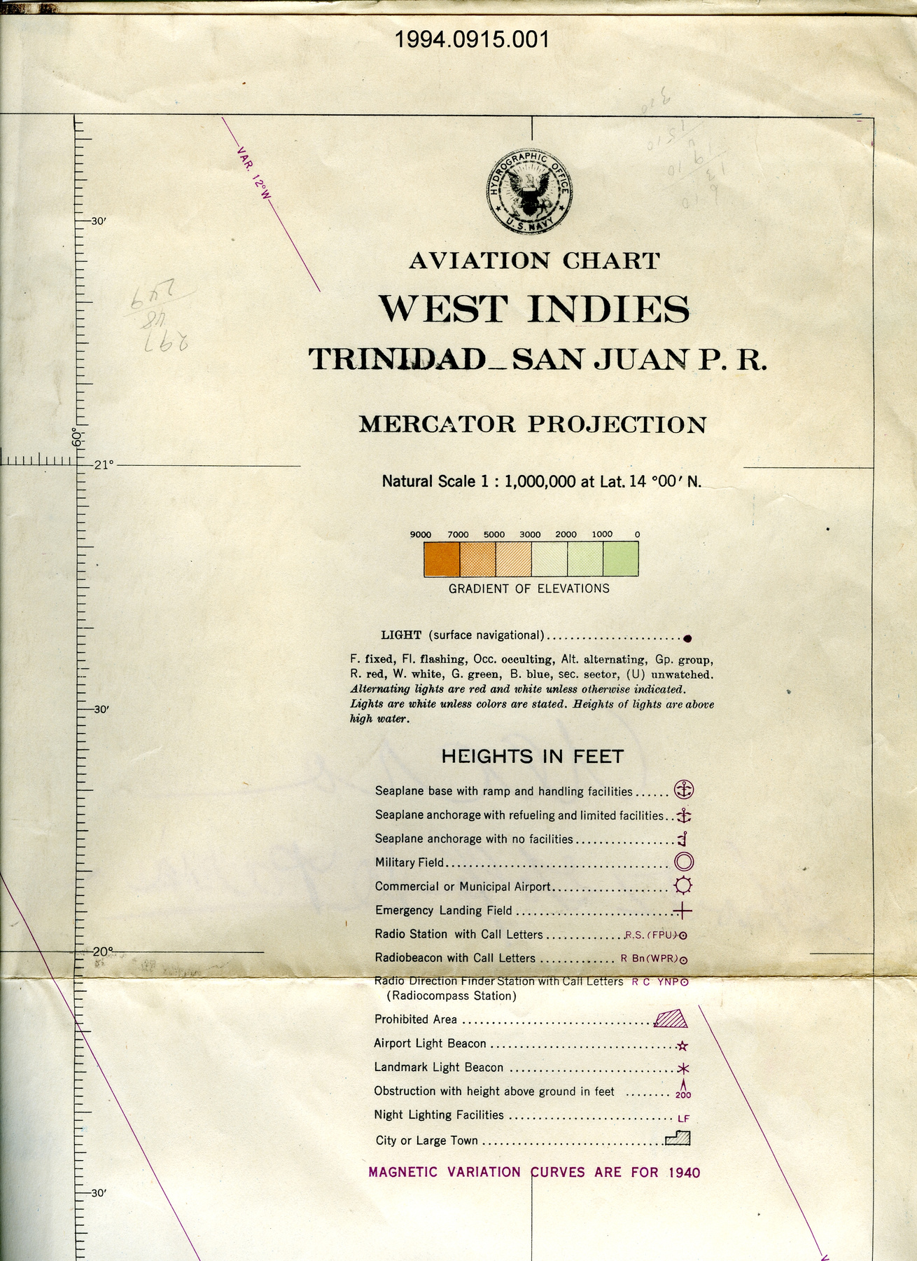
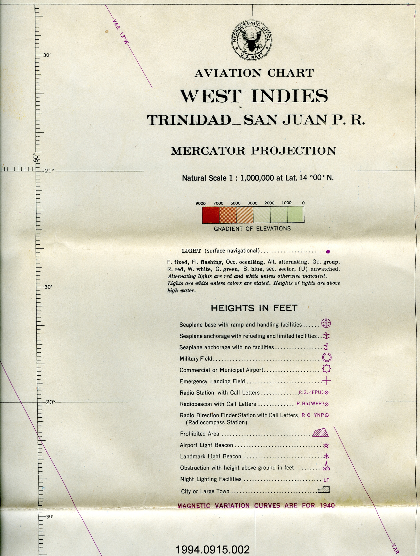
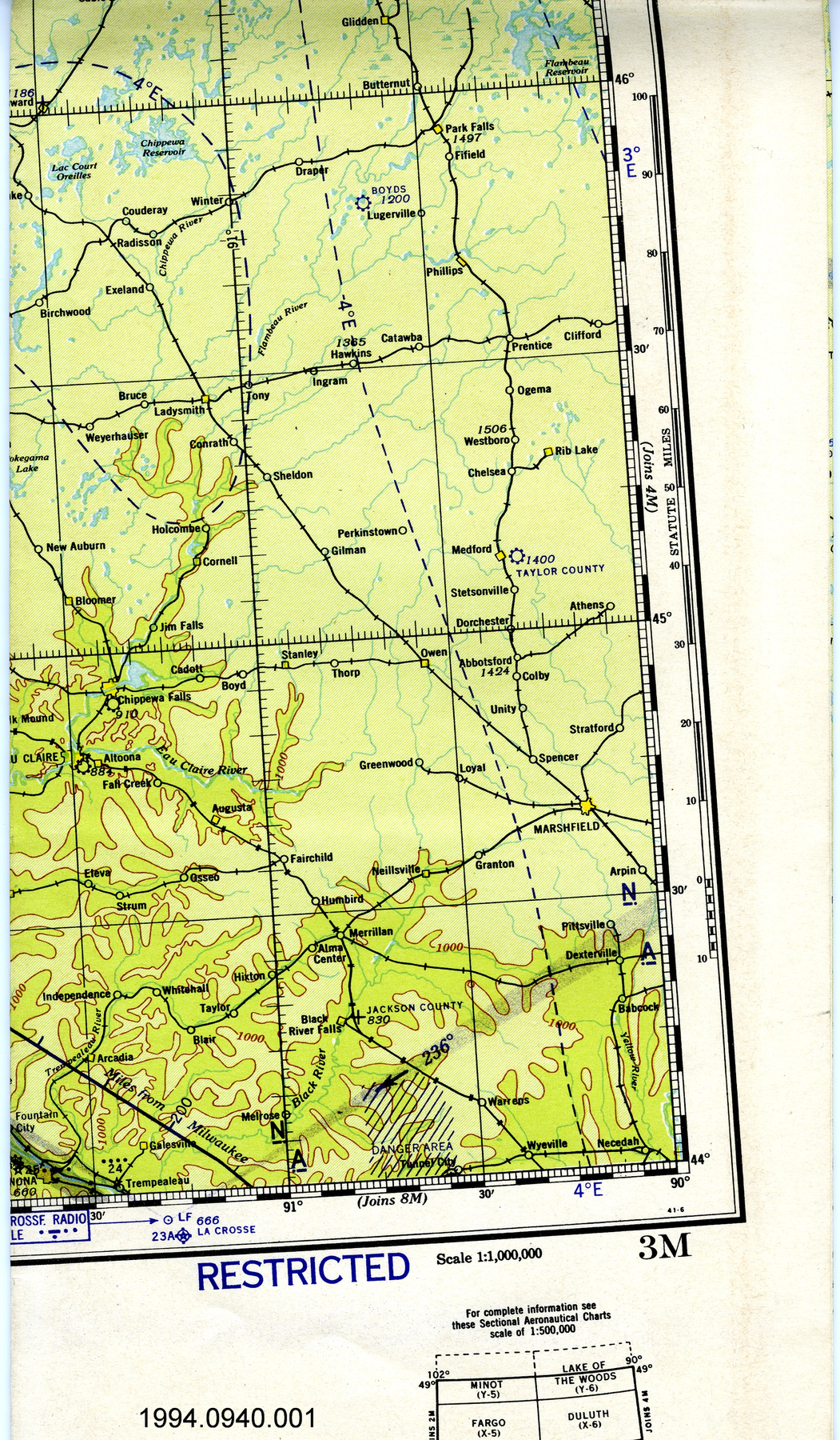
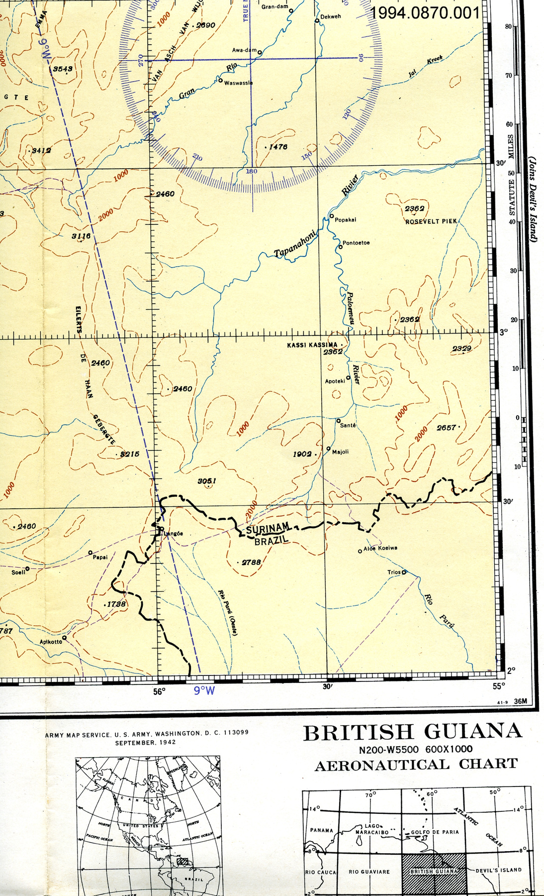
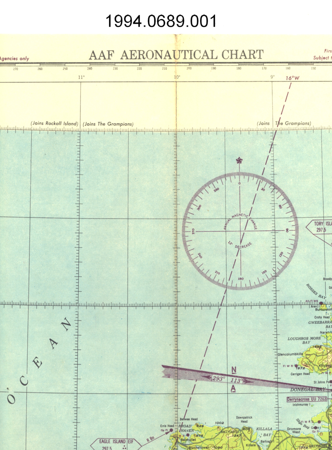
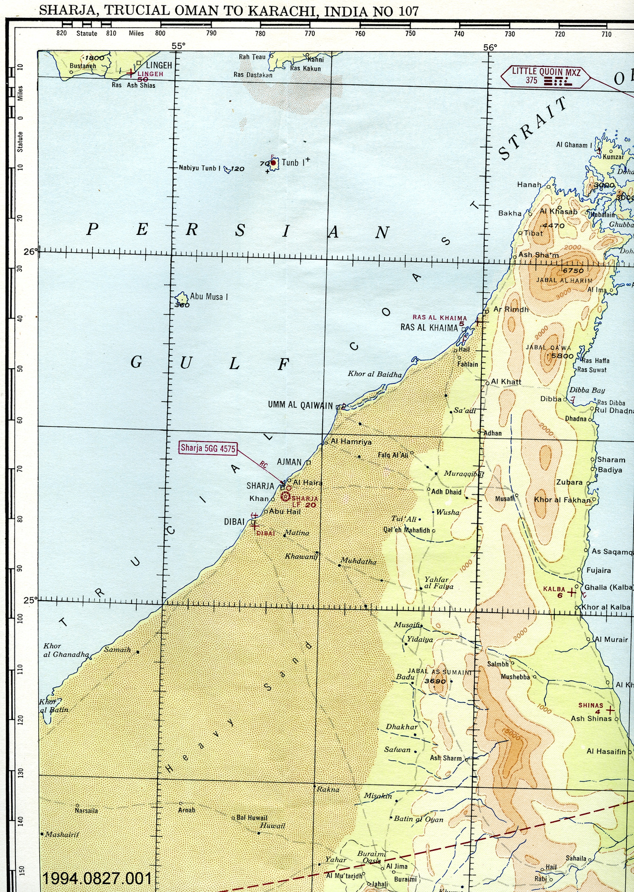
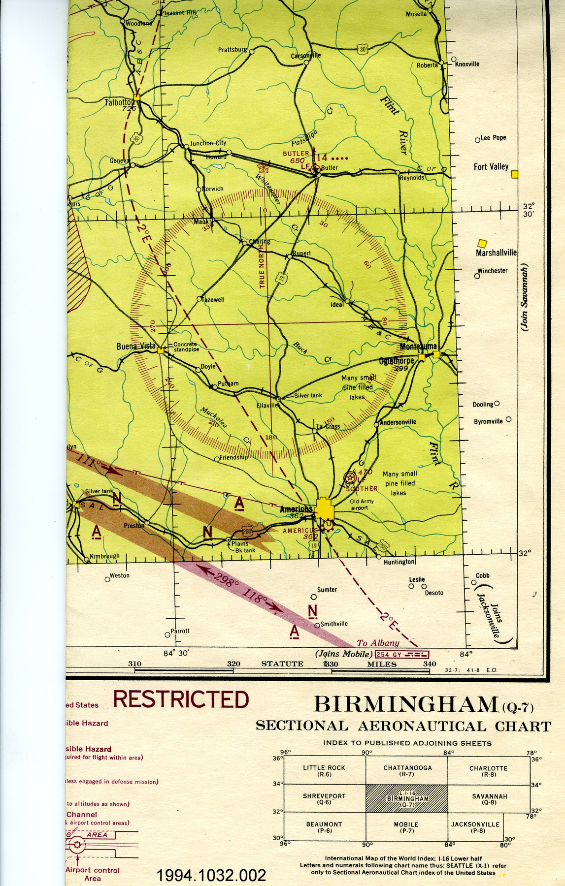
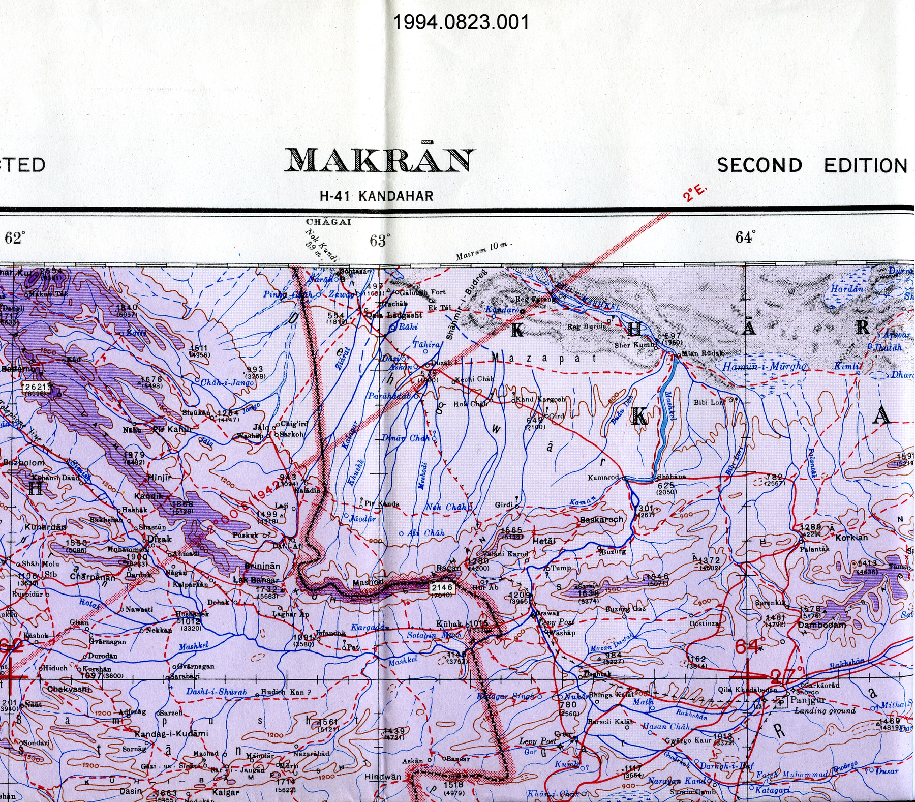
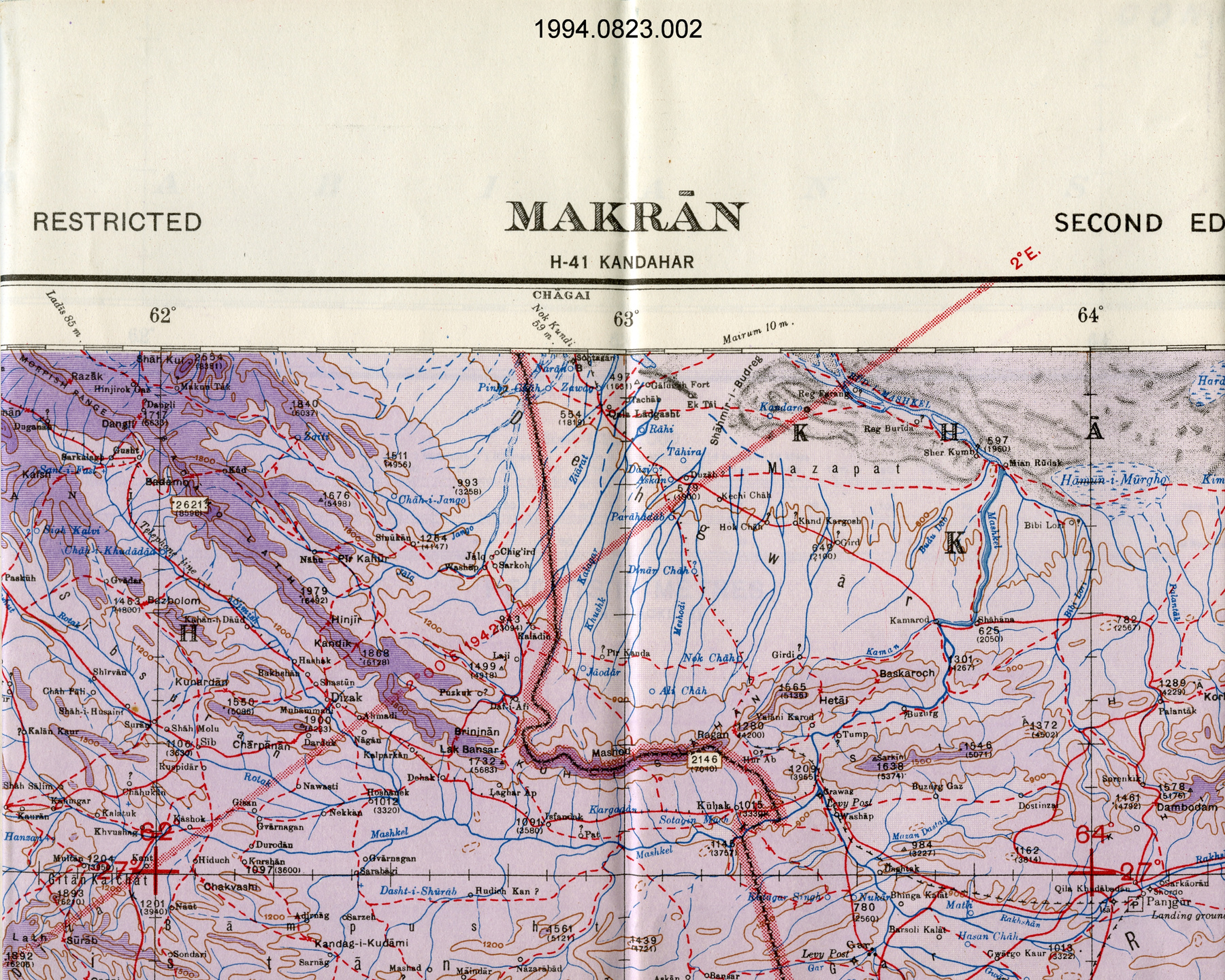
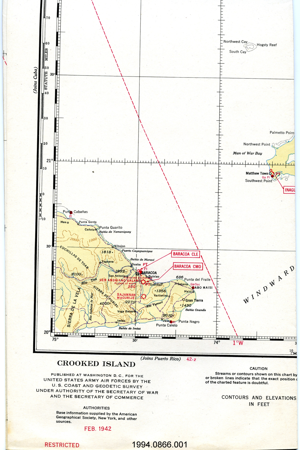
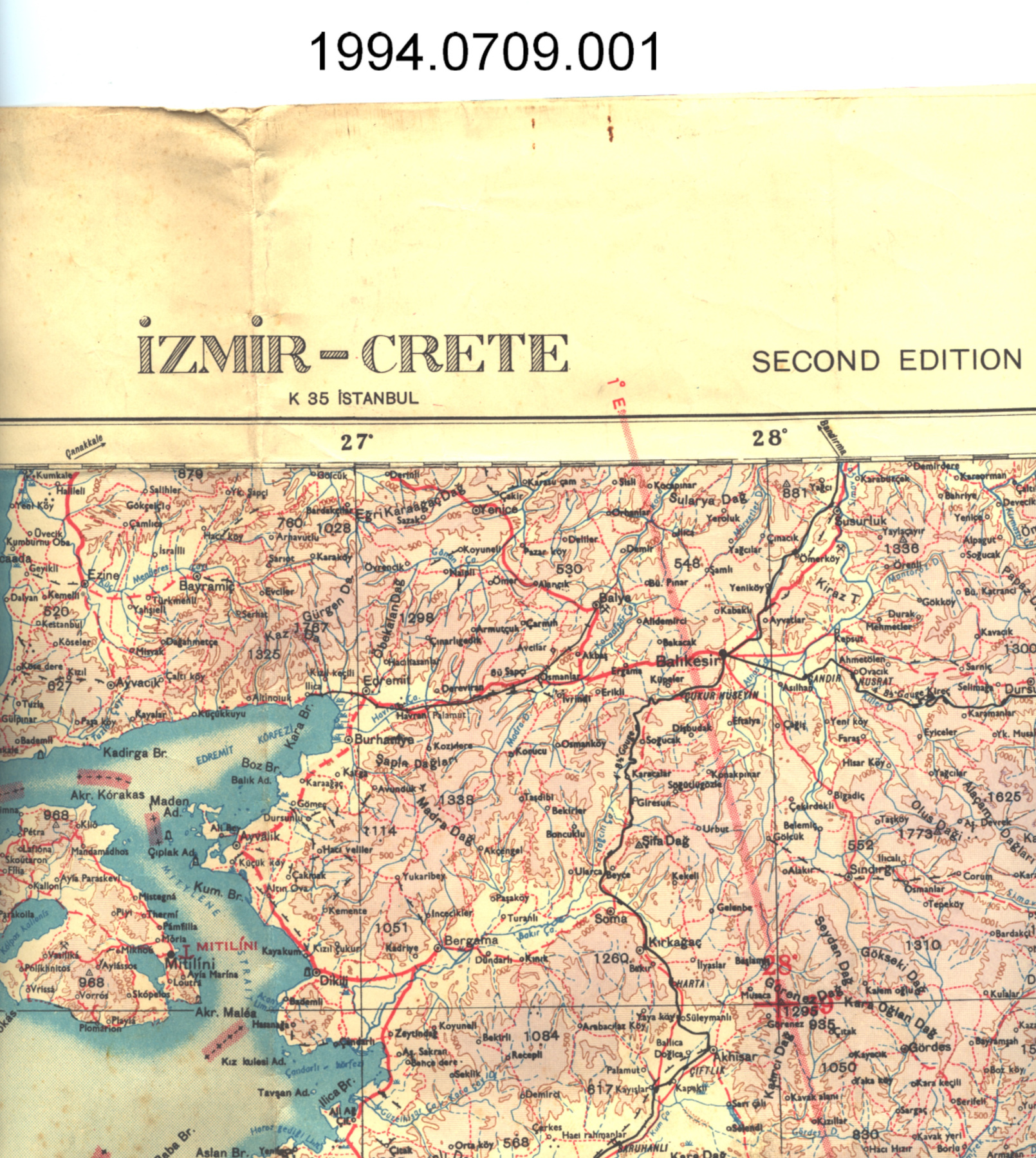
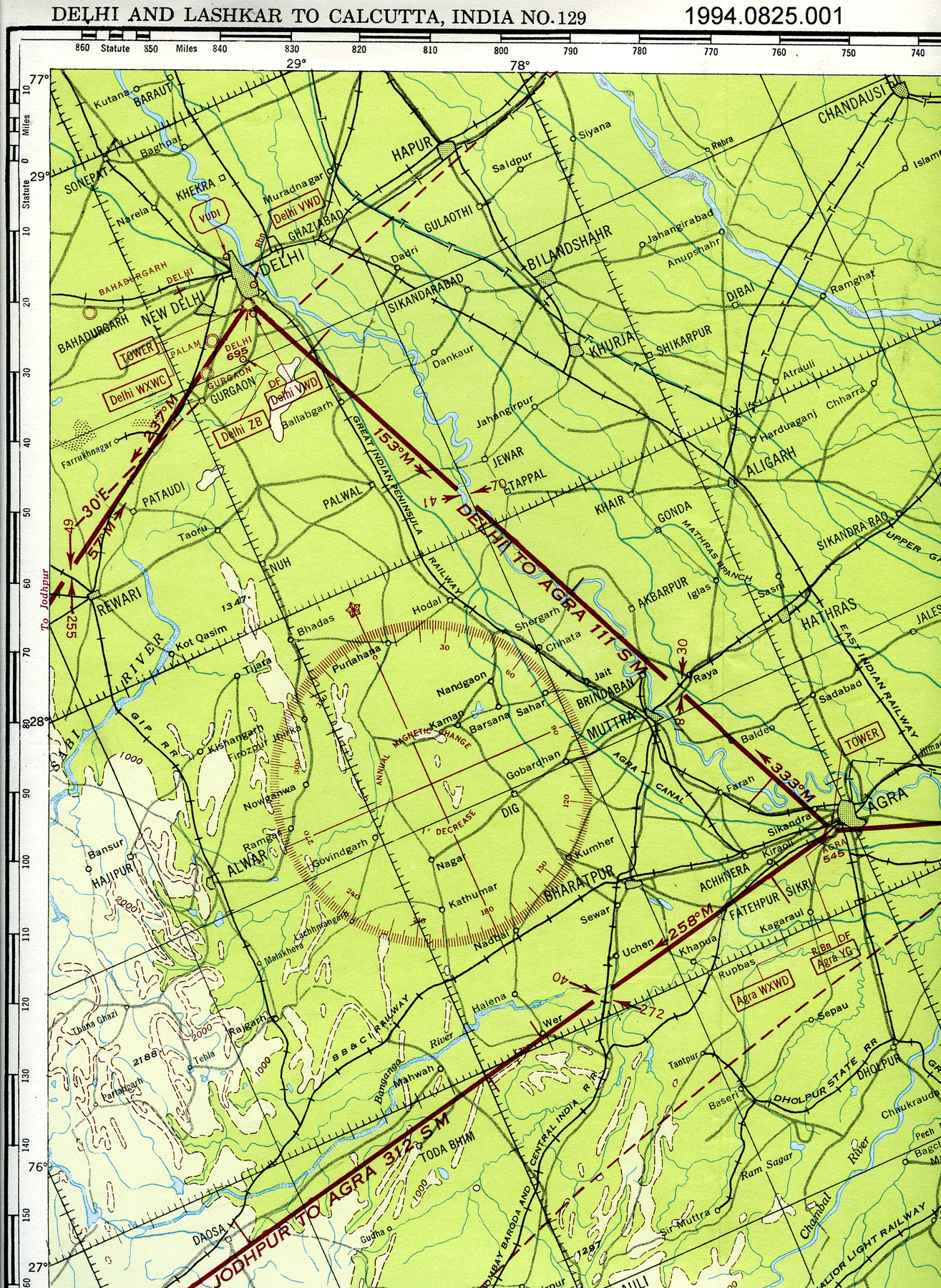
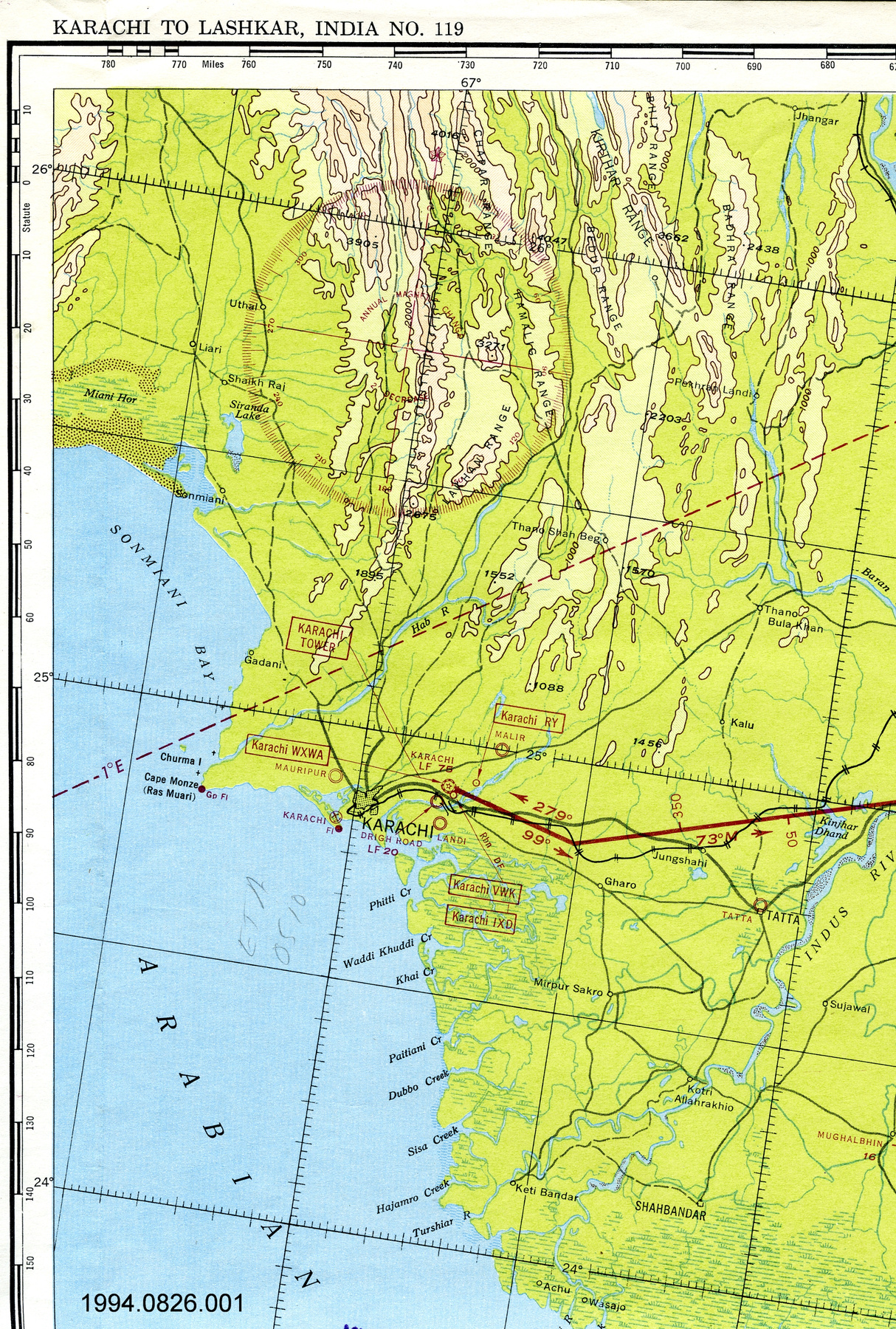
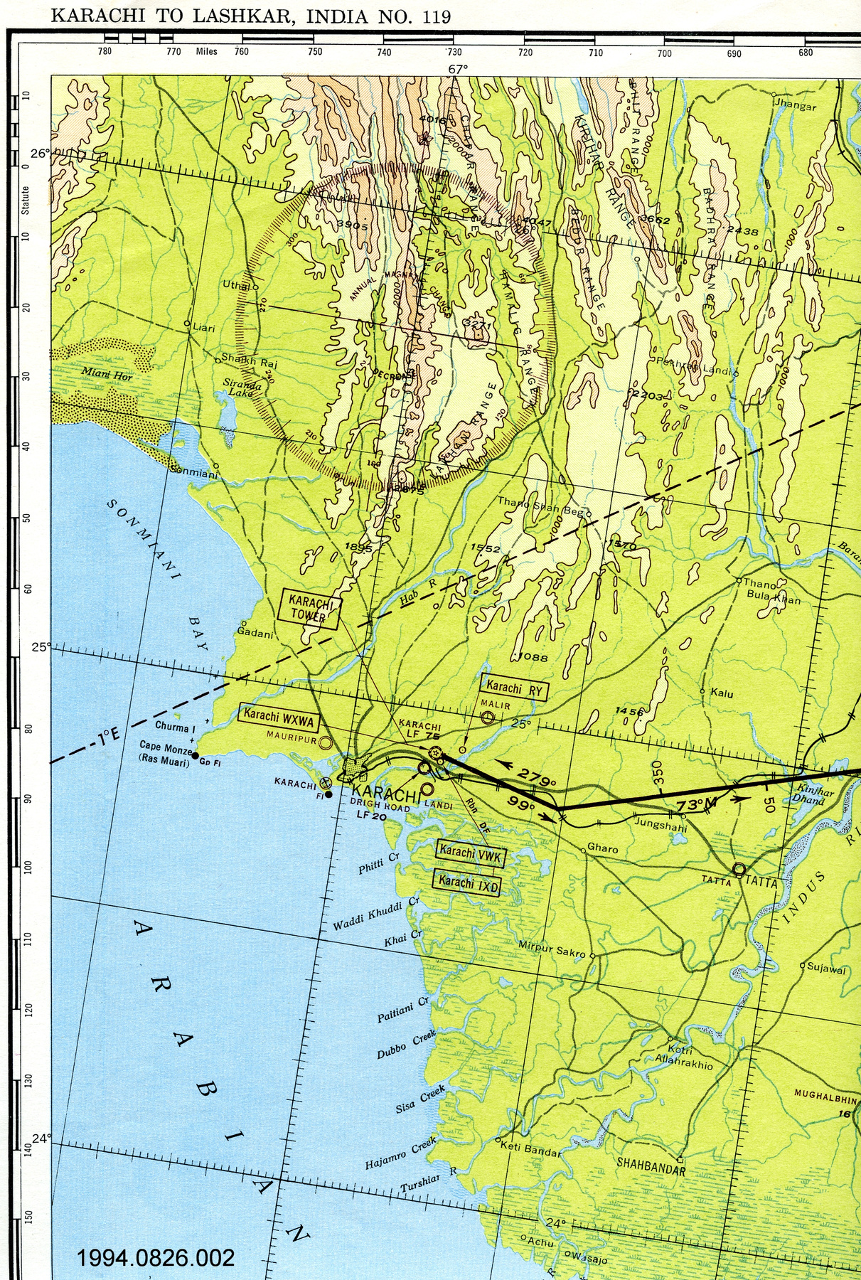
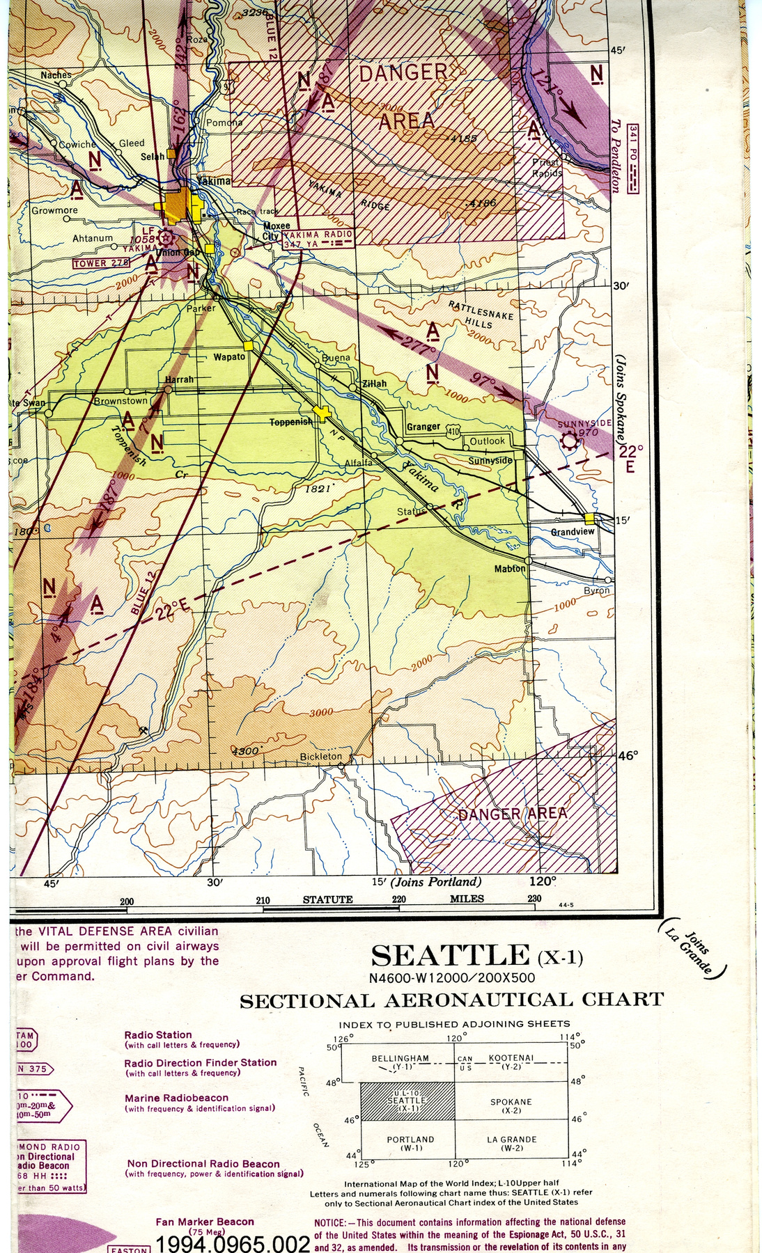
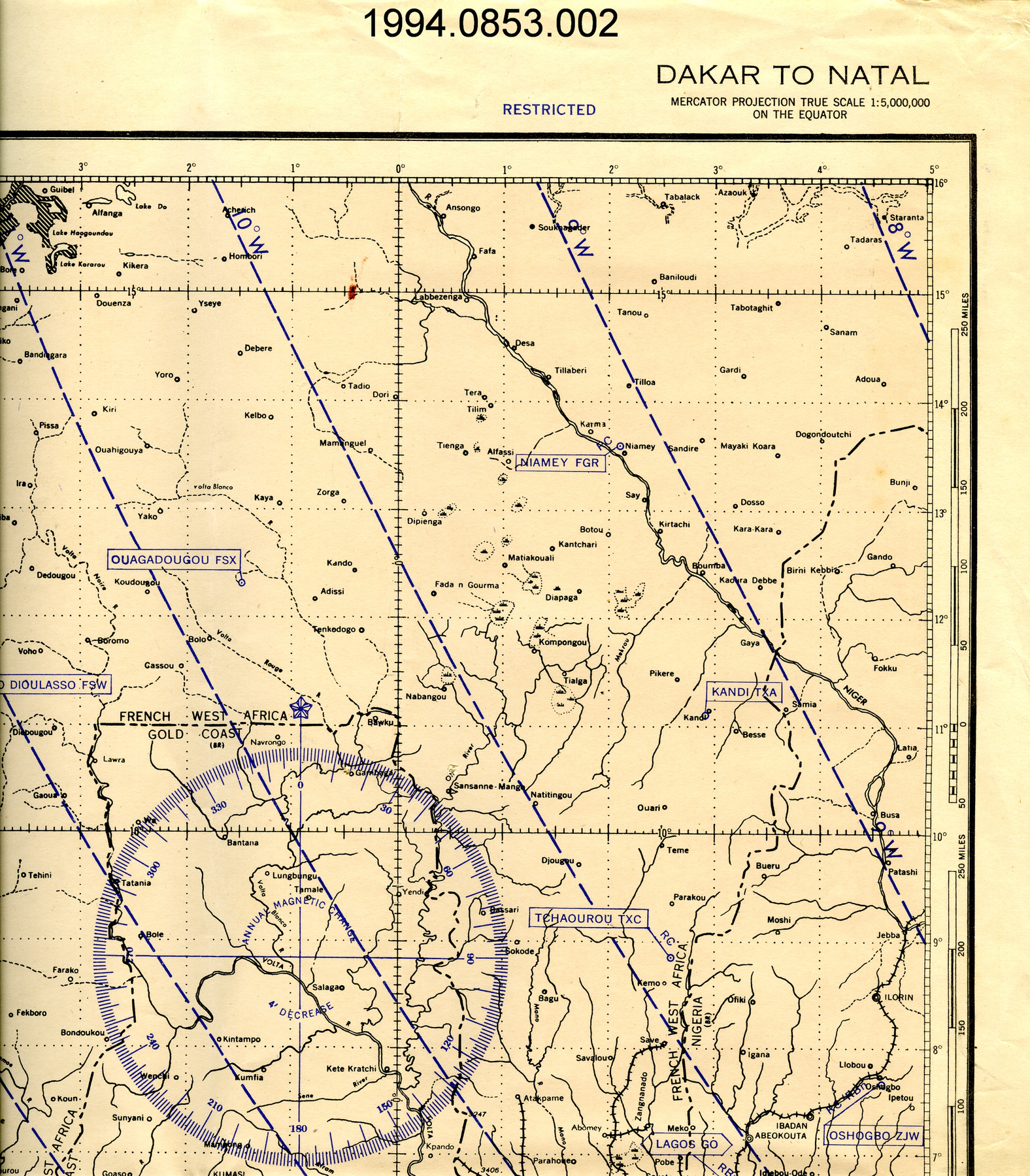
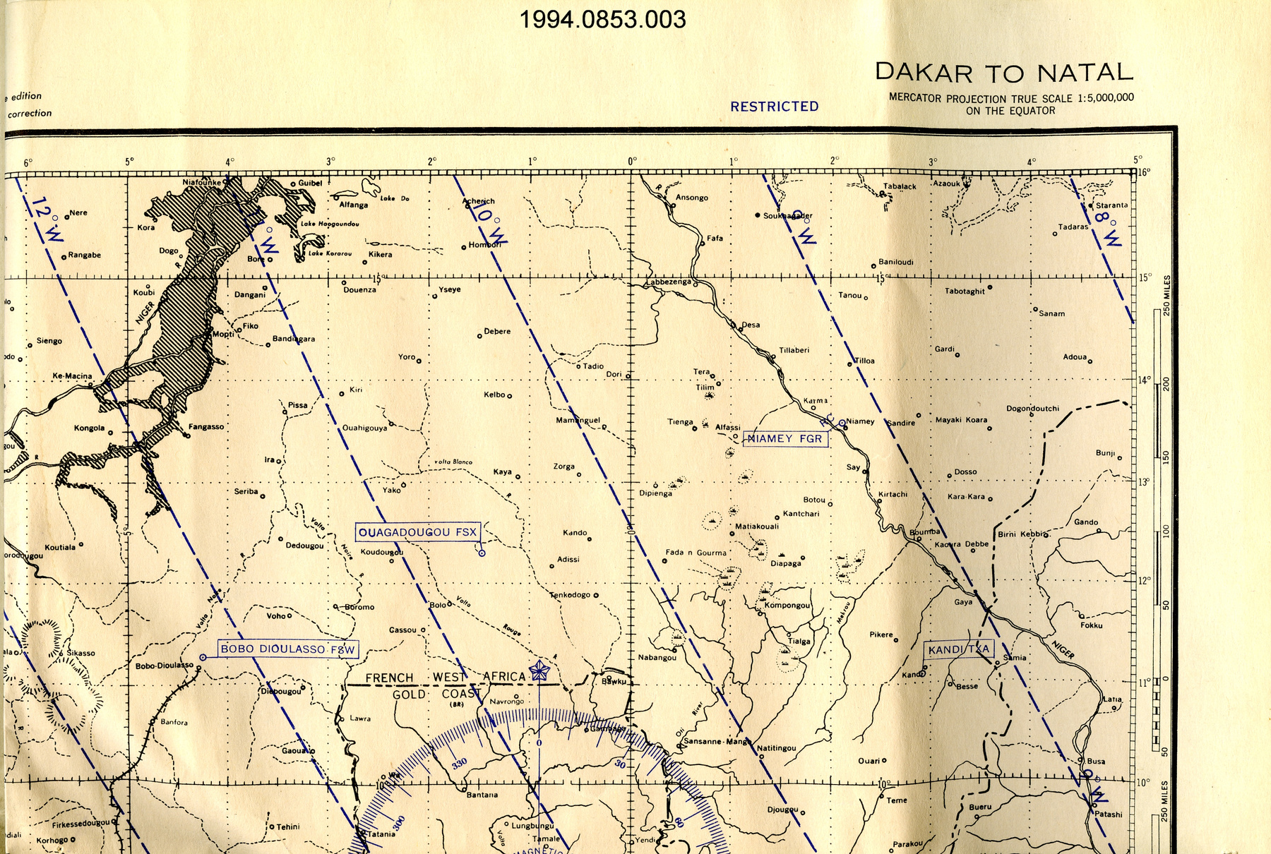
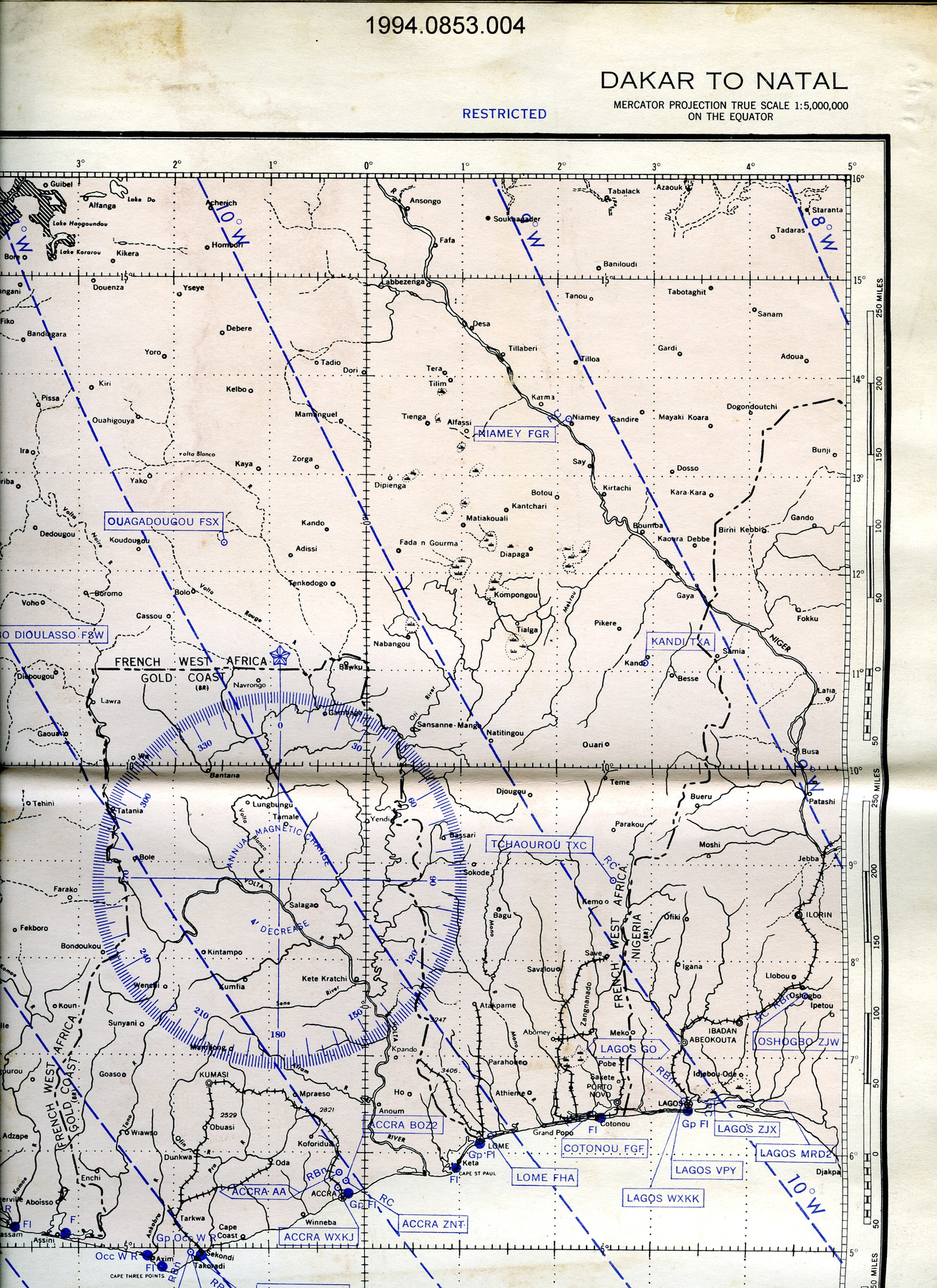
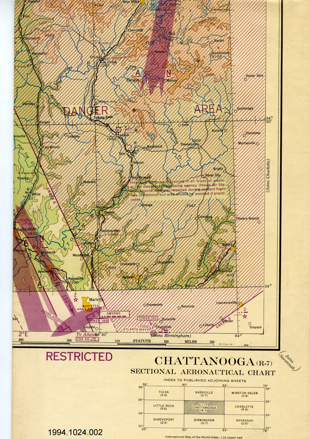
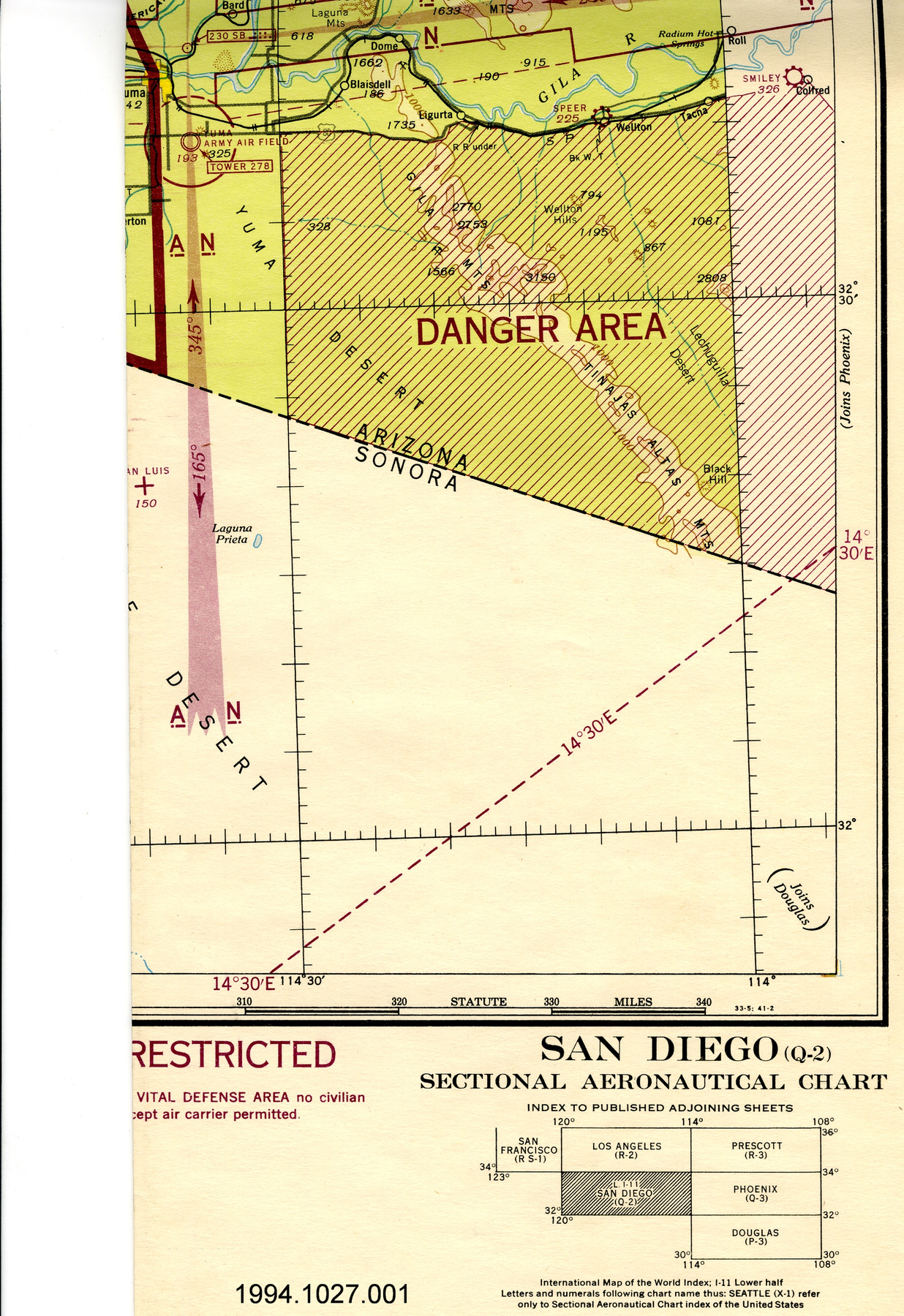
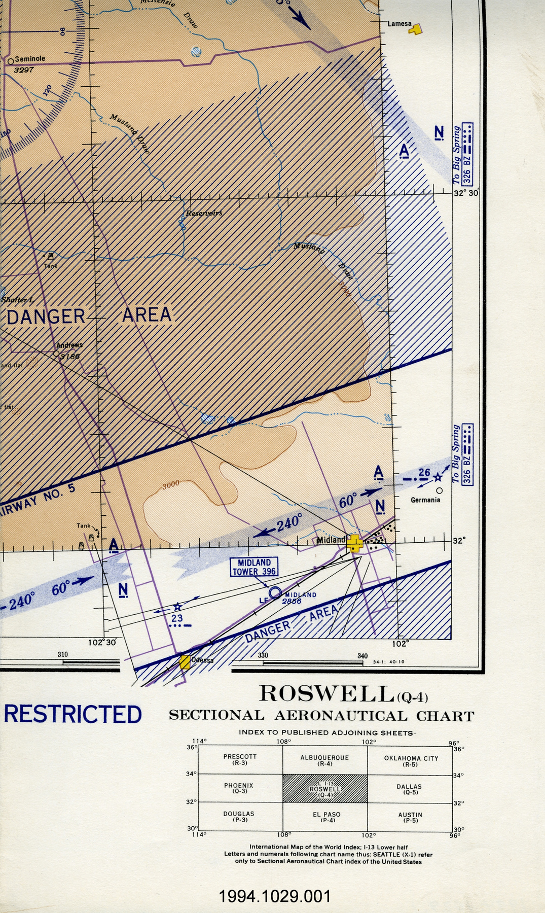
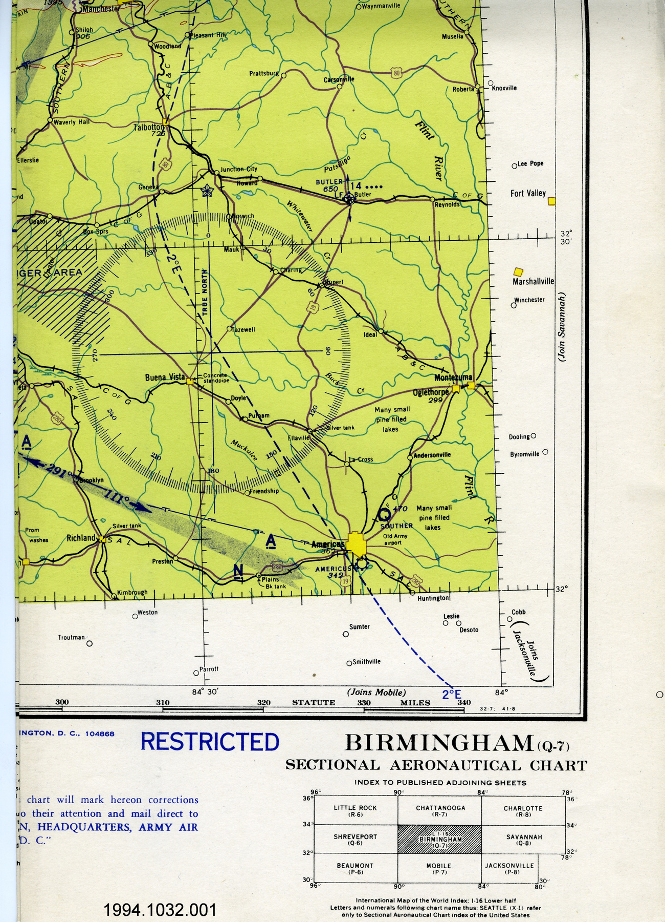
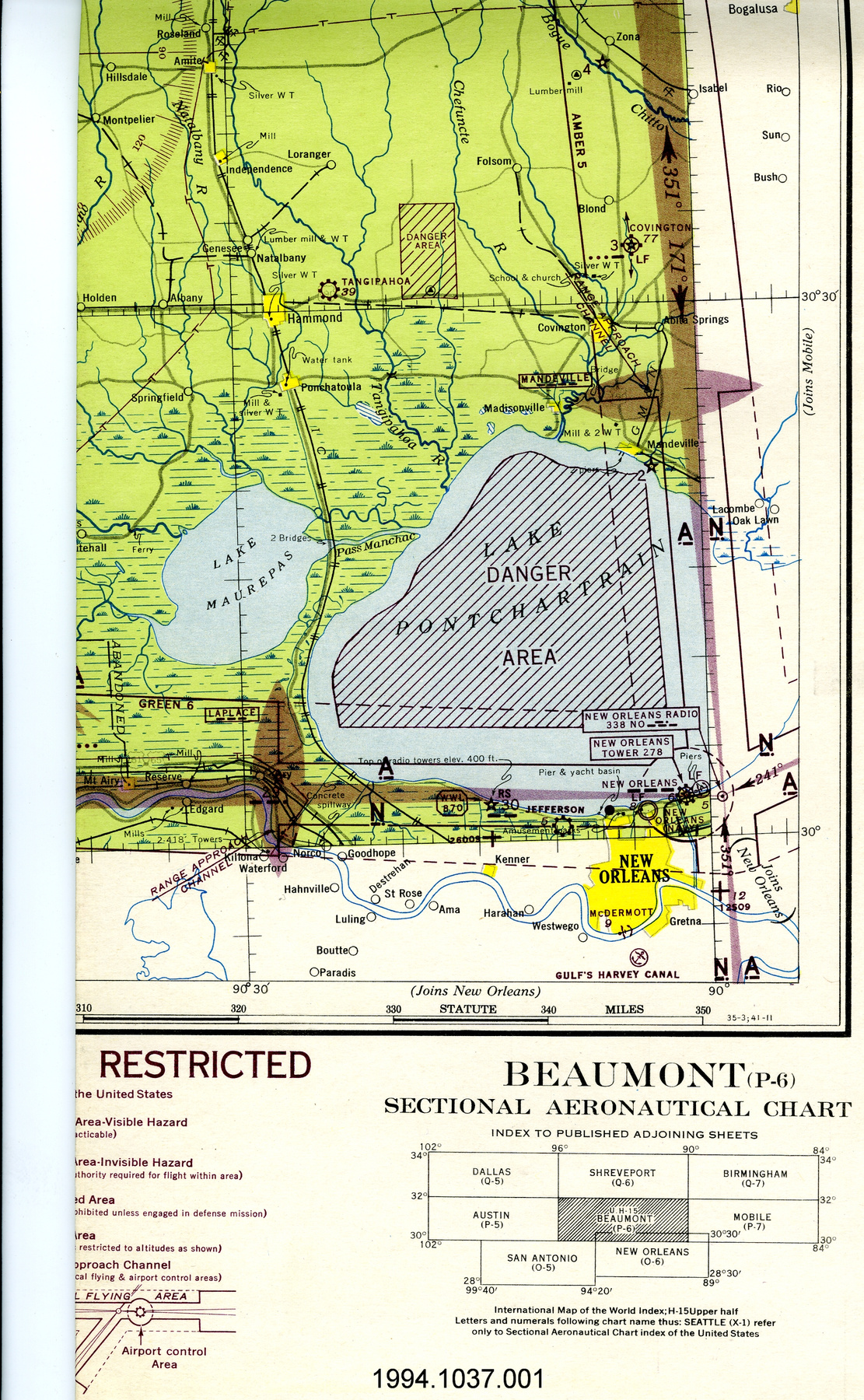
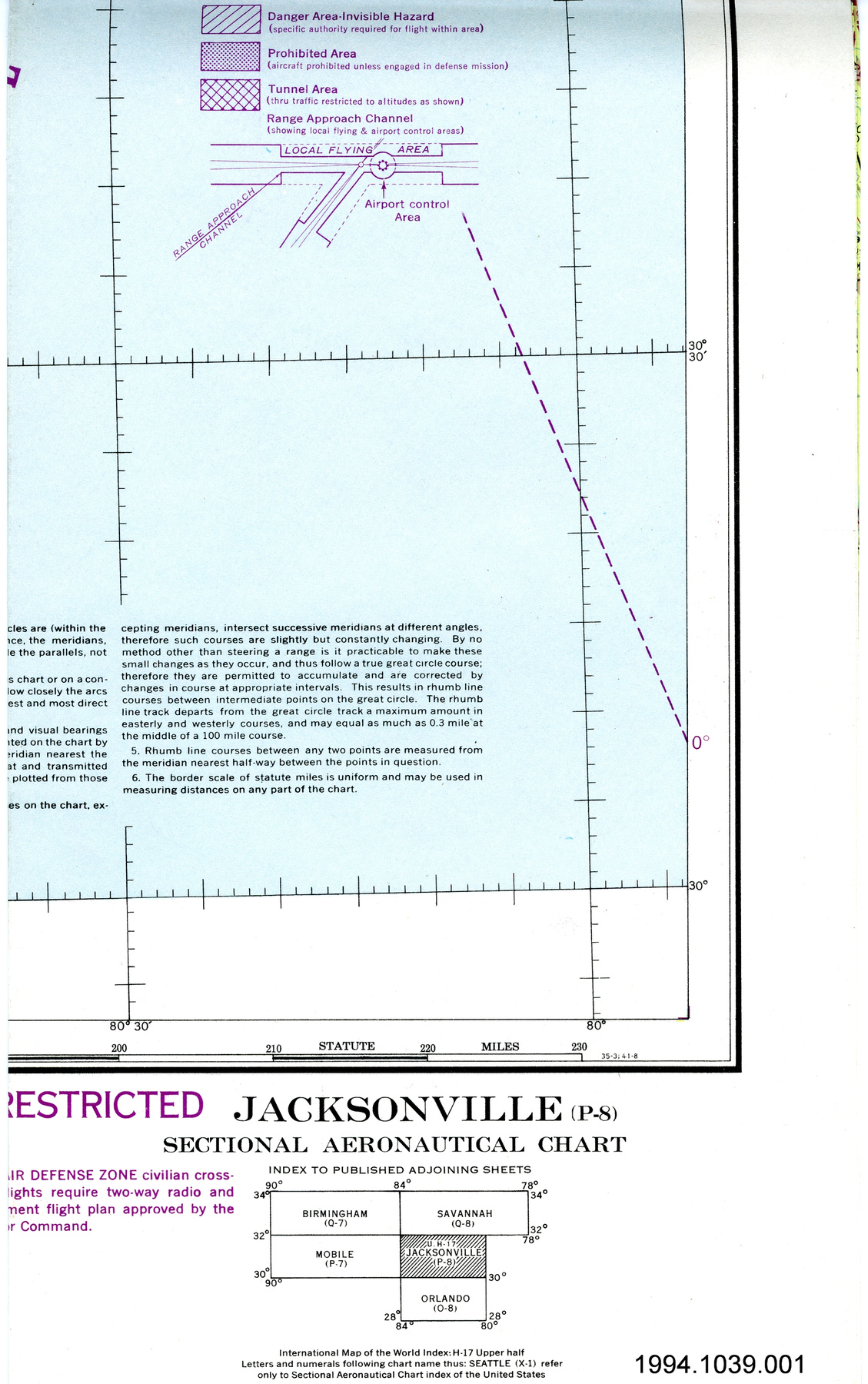
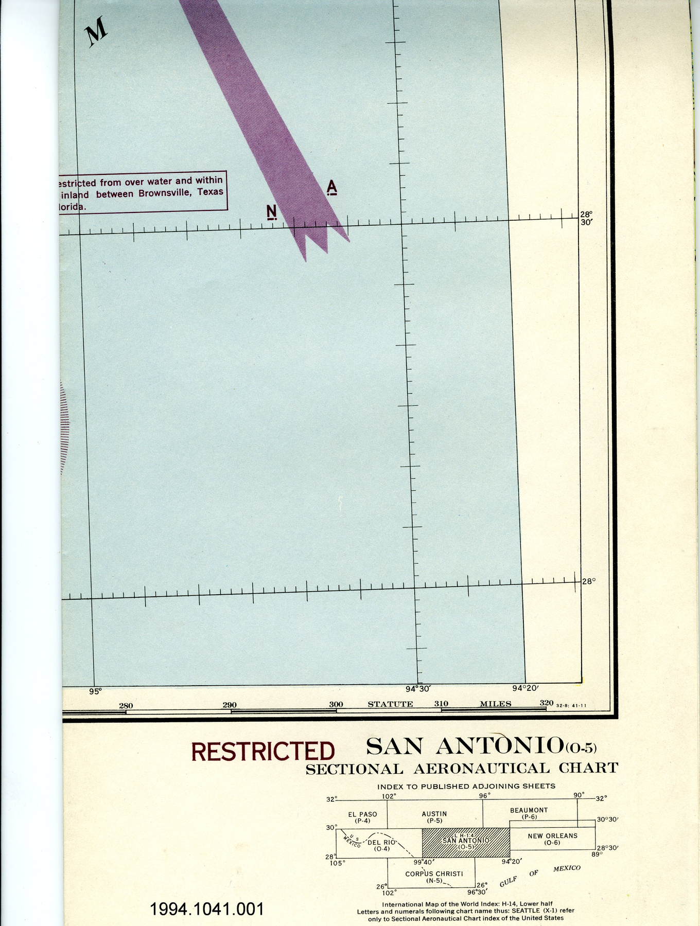
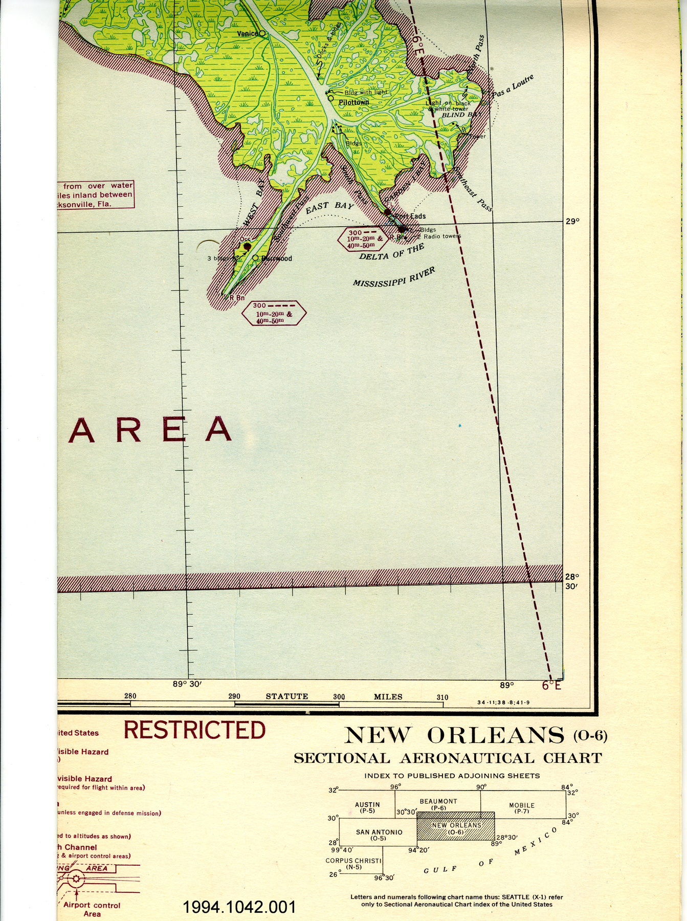
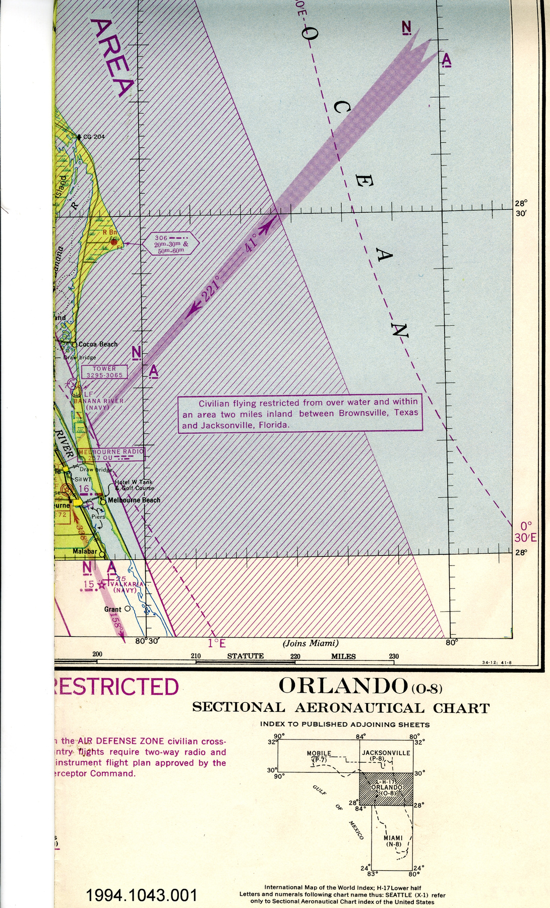
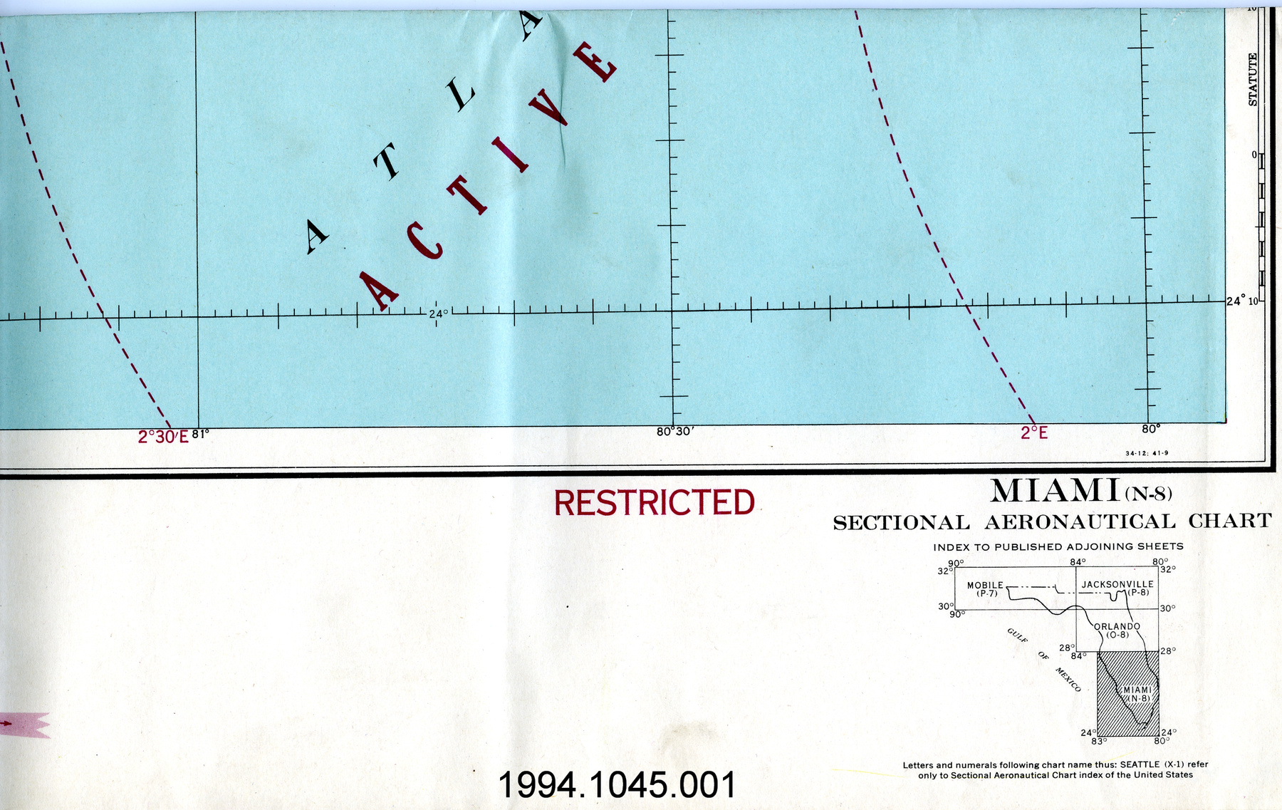
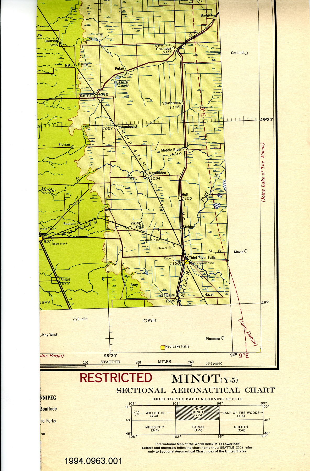
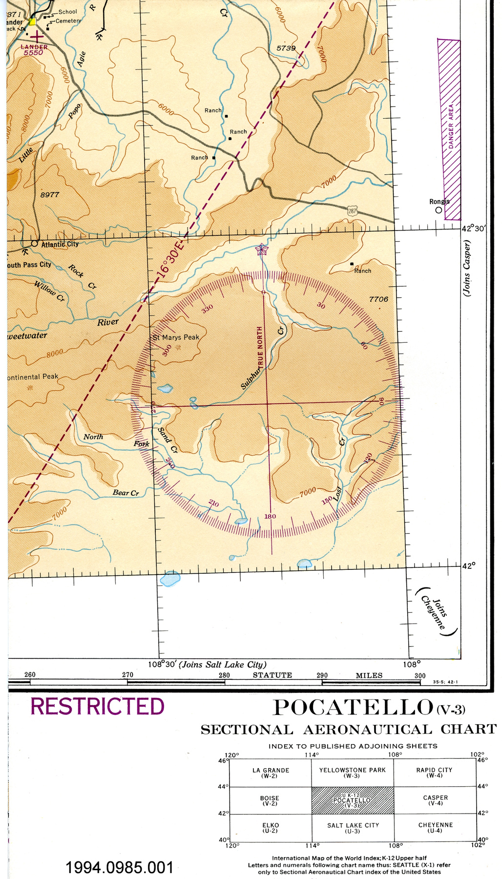
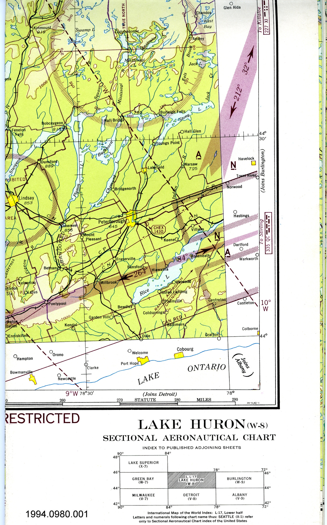
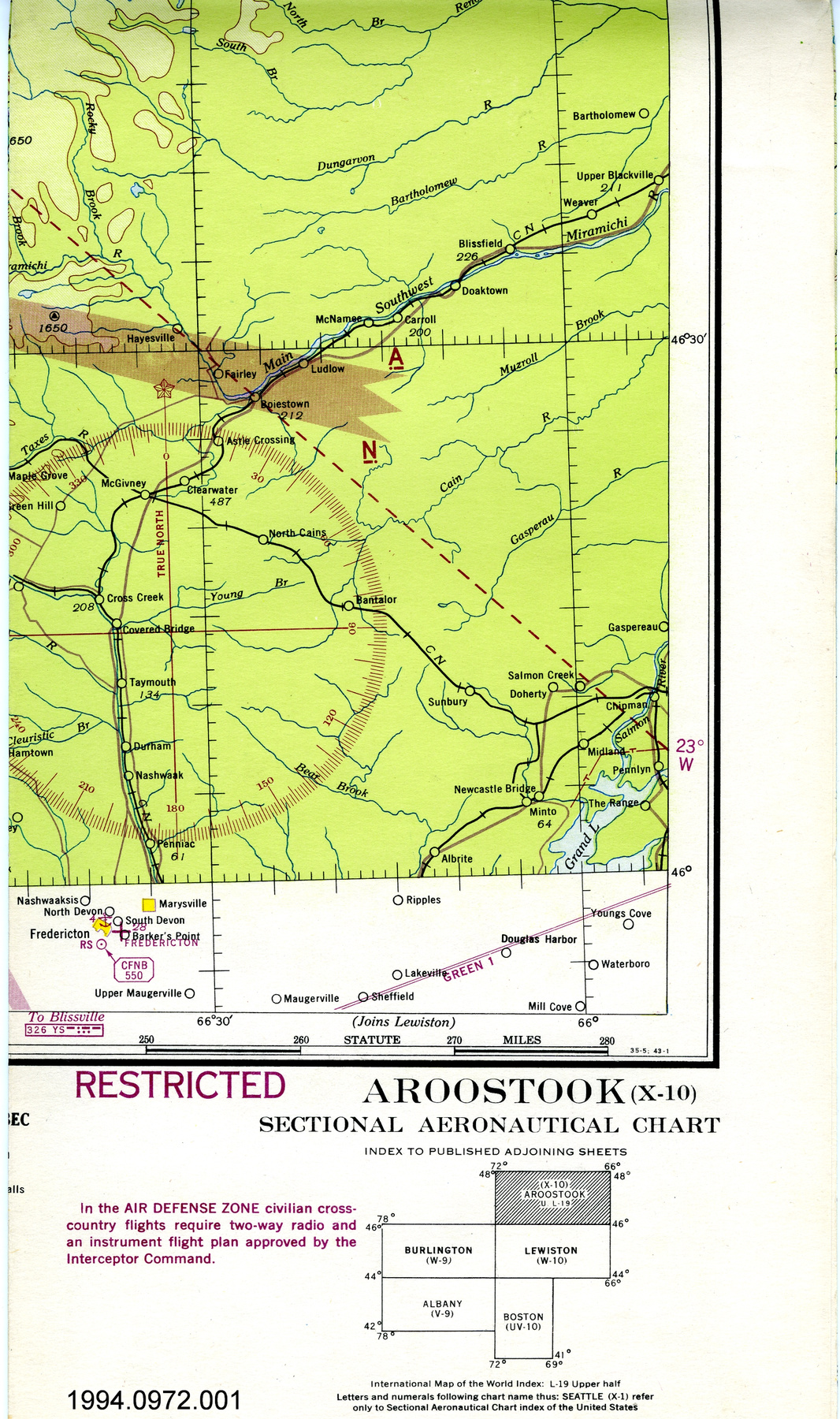
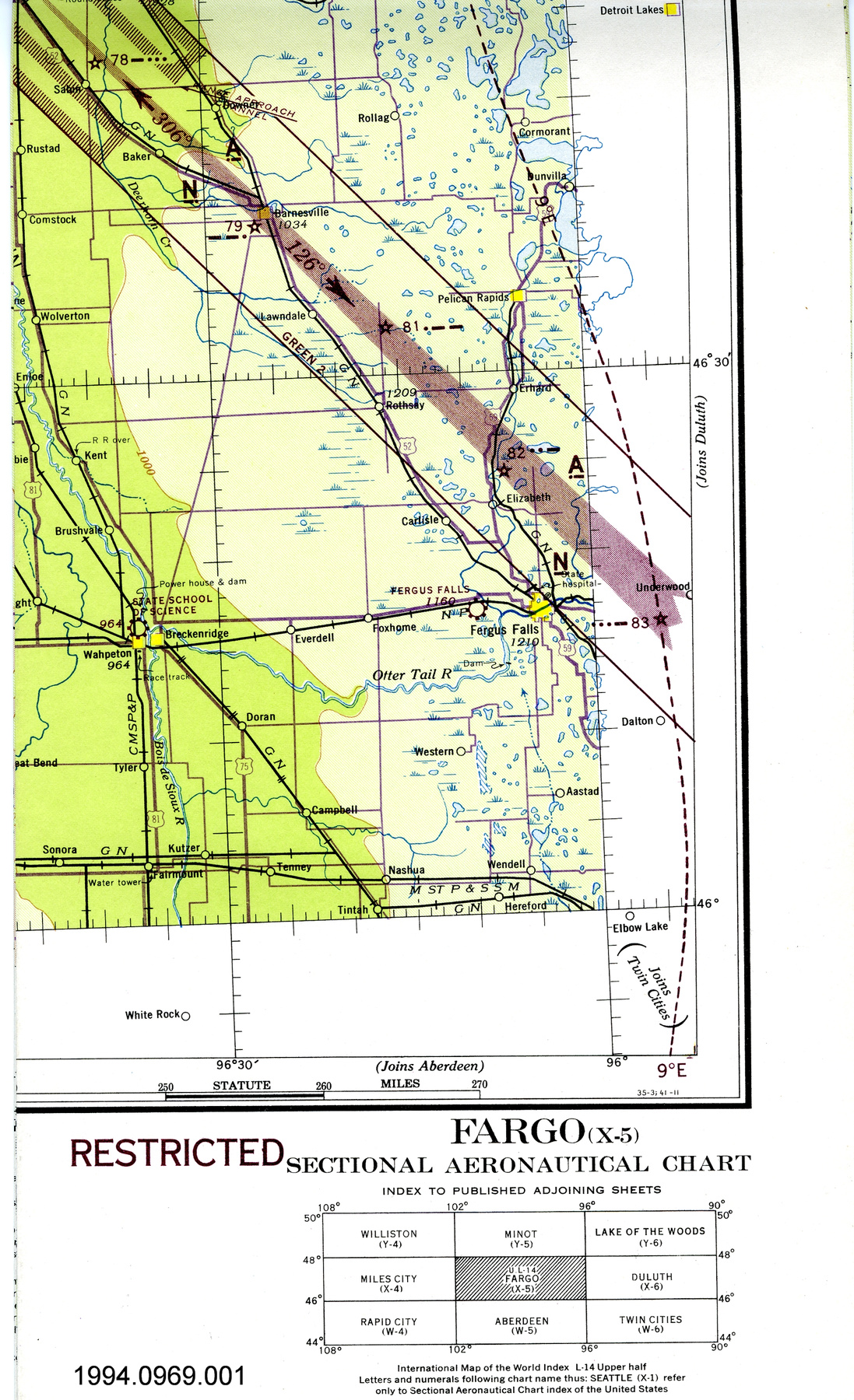
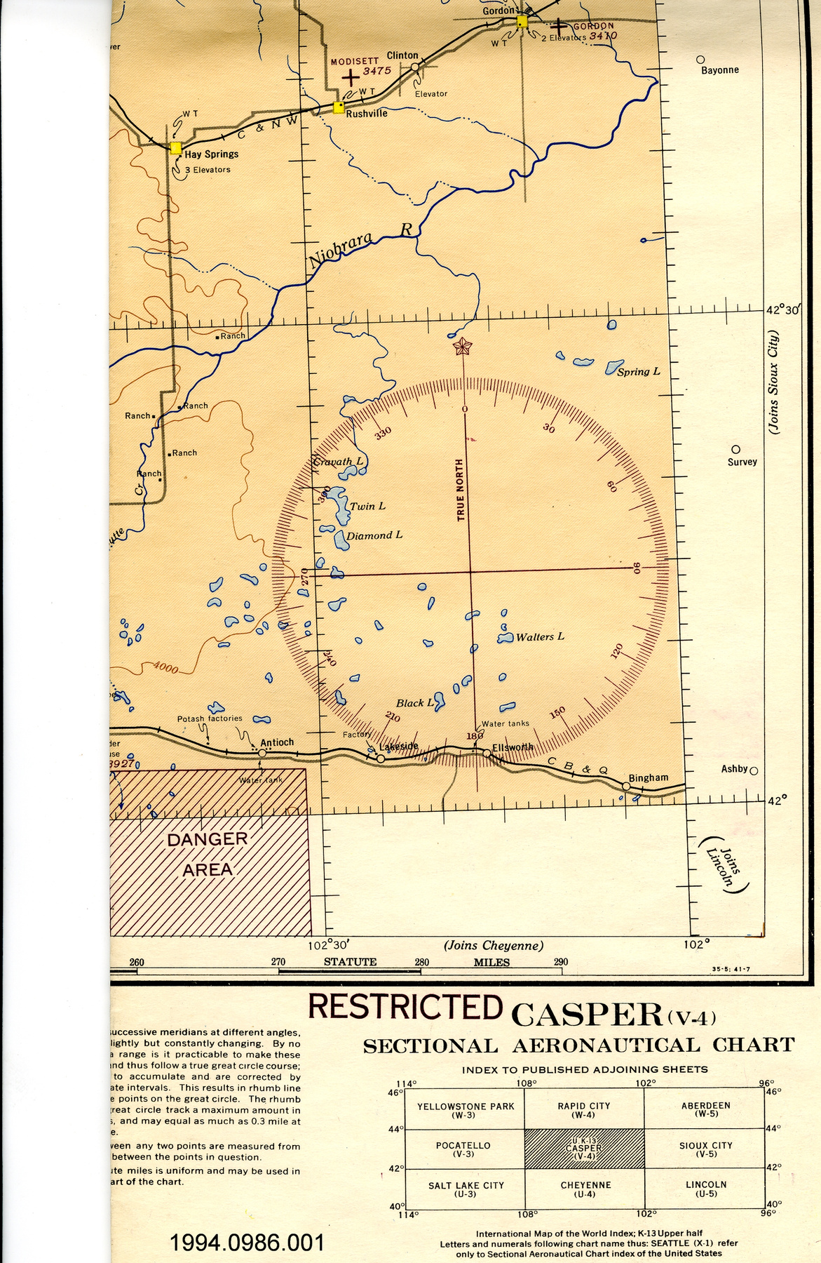
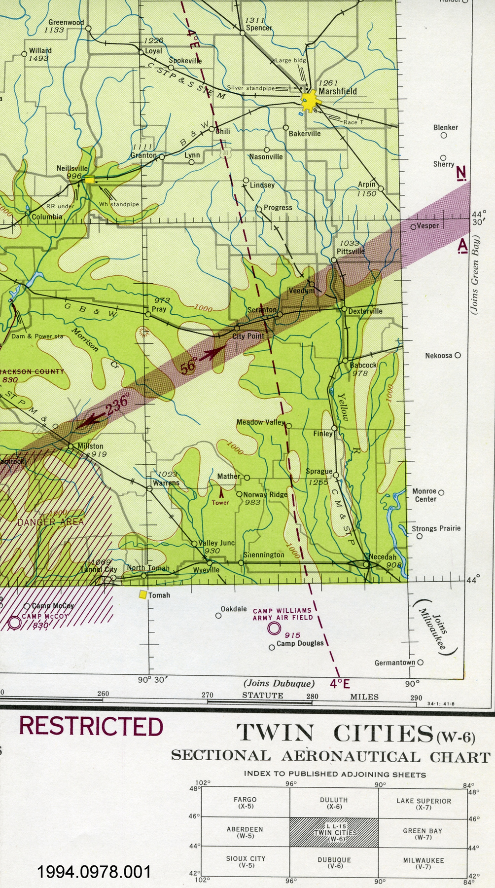
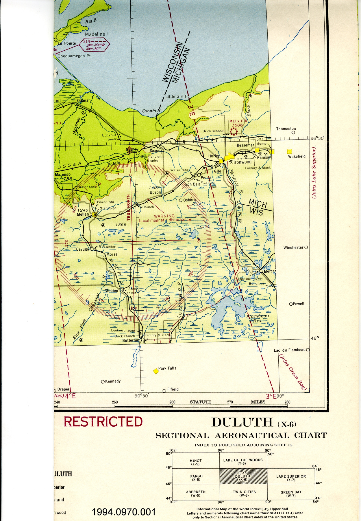
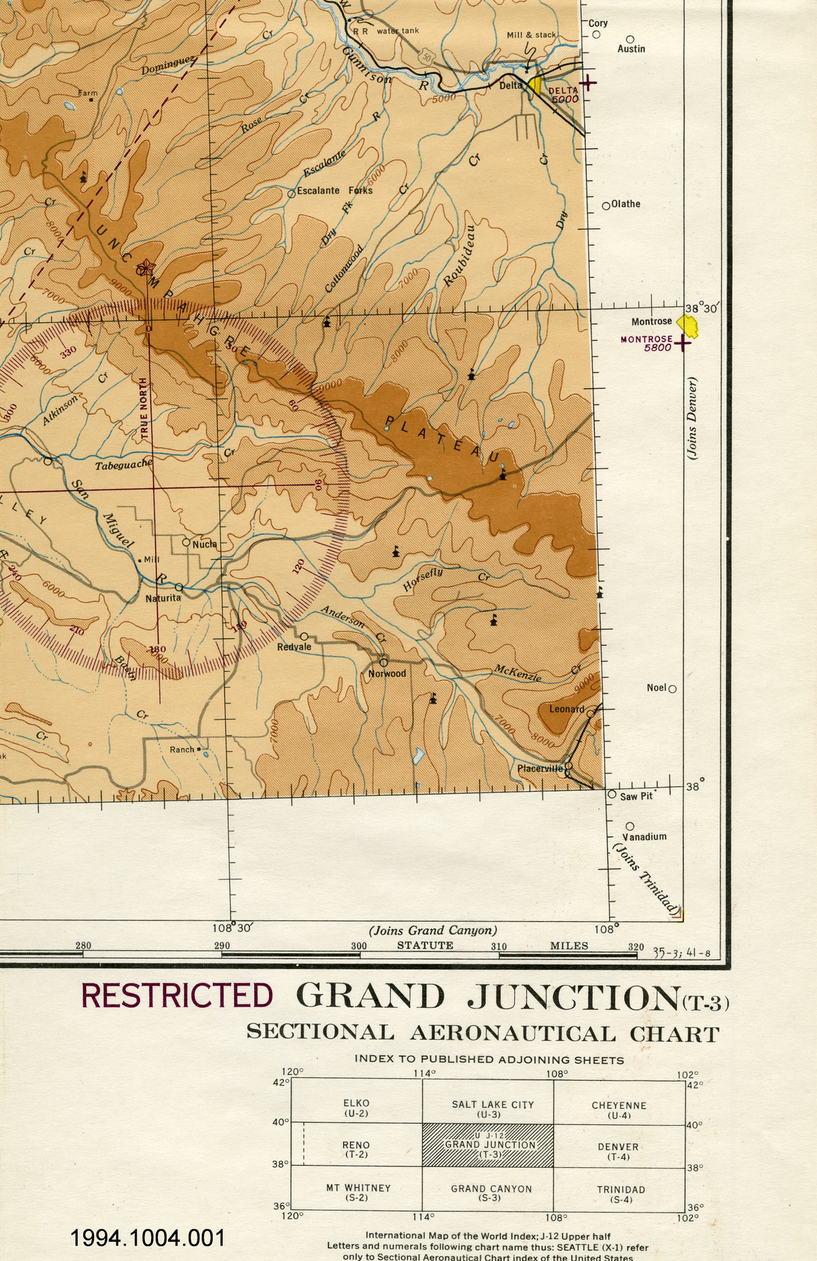
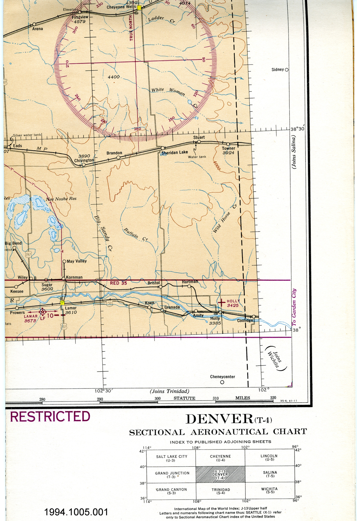
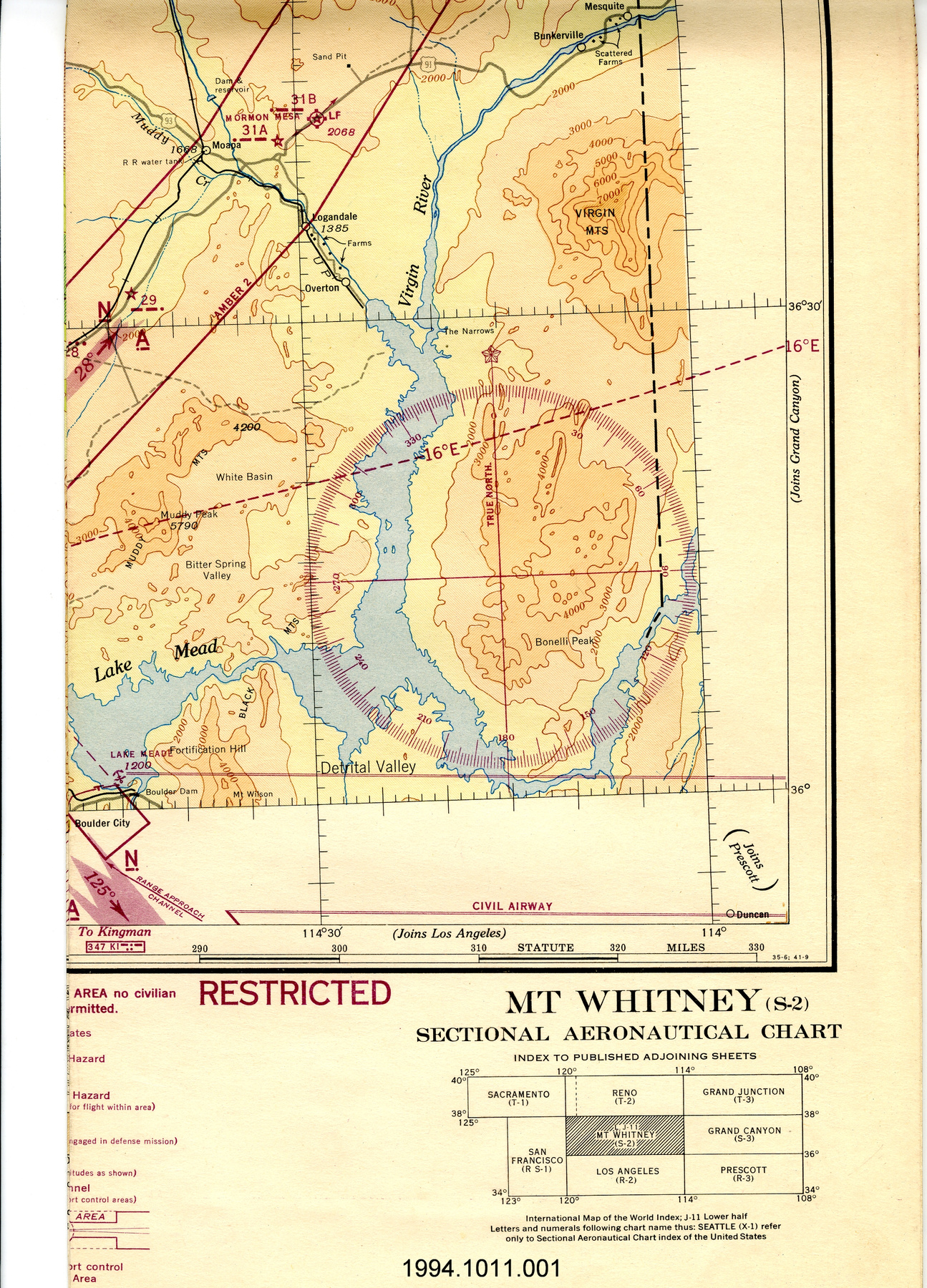
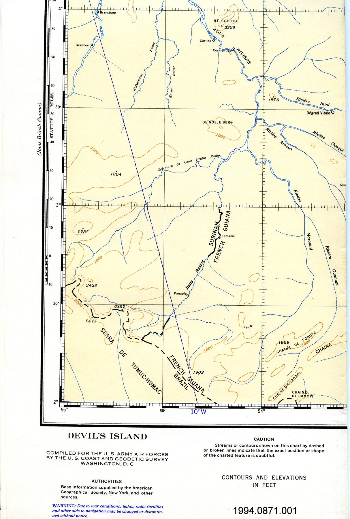
Map

Use this image

Can I reuse this image without permission? Yes

Object images on the Ingenium Collection’s portal have the following Creative Commons license:

Copyright Ingenium / CC BY-NC-ND (Attribution-NonCommercial 4.0 International (CC BY-NC 4.0)

ATTRIBUTE THIS IMAGE

Ingenium, 1994.0862.003
Permalink:

Ingenium is releasing this image under the Creative Commons licensing framework, and encourages downloading and reuse for non-commercial purposes. Please acknowledge Ingenium and cite the artifact number.

DOWNLOAD IMAGE

PURCHASE THIS IMAGE

This image is free for non-commercial use.

For commercial use, please consult our Reproduction Fees and contact us to purchase the image.

OBJECT TYPE
topographical/aeronautical/folding
DATE
1943–1944
ARTIFACT NUMBER
1994.0862.003
MANUFACTURER
U.S. Coast & Geodetic Survey
MODEL
West Palm Beach, Fla. To Georgetown, B.G.
LOCATION
Washington, District of Columbia, United States of America

More Information


General Information

Serial #
N/A
Part Number
3
Total Parts
3
AKA
N/A
Patents
N/A
General Description
paper

Dimensions

Note: These reflect the general size for storage and are not necessarily representative of the object's true dimensions.

Length
133.2 cm
Width
44.5 cm
Height
N/A
Thickness
N/A
Weight
N/A
Diameter
N/A
Volume
N/A

Lexicon

Group
Aviation
Category
Navigation instruments & equipment
Sub-Category
N/A

Manufacturer

AKA
Survey US
Country
United States of America
State/Province
District of Columbia
City
Washington

Context

Country
South America
State/Province
Unknown
Period
WWII (1939-1945); this map a first edition of an original possibly produced 1943 or 1944
Canada
Unknown
Function
WWII (1939-1945); this map produced in Aug. 1943
Technical
Unknown
Area Notes
Unknown

Details

Markings
lettering across top border reads: "WEST PALM BEACH, FLA. TO GEORGETOWN, B.G./Legend and Notes on reverse side/Not for sale or distribution/For use by War and Navy Department Agancies only/First edition subject to correction/Mercator Projection/CONFIDENTIAL"
Missing
N/A
Finish
colour map on white sheet; red overprint
Decoration
none

CITE THIS OBJECT

If you choose to share our information about this collection object, please cite:

U.S. Coast & Geodetic Survey, Map, between 1943–1944, Artifact no. 1994.0862, Ingenium – Canada’s Museums of Science and Innovation, http://collection.ingeniumcanada.org/en/id/1994.0862.003/

FEEDBACK

Submit a question or comment about this artifact.

More Like This


...
Map

1994.0862.002

Object

...
Map

1994.0862.001

Object

...
Map

2004.1725.001

Object

...
Map

1994.0861.001

Object

...
Map

1994.0861.002

Object

...
Map

1994.0921.001

Object

...
Map

1994.0885.001

Object

...
Map

1994.0911.001

Object

...
Map

1994.0857.001

Object

...
Map

1994.0858.001

Object

...
Map

1994.0886.001

Object

...
Map

1994.0886.002

Object

...
Map

1994.0865.001

Object

...
Map

1992.2851.001

Object

...
Map

1994.0873.001

Object

...
Map

1992.2875.001

Object

...
Map

1994.0851.001

Object

...
Map

1994.0948.001

Object

...
Map

1994.0920.001

Object

...
Map

1994.0947.001

Object

...
Map

1994.0869.001

Object

...
Map

2004.1714.001

Object

...
Map

1994.0944.001

Object

...
Map

1994.0942.001

Object

...
Map

1994.0914.002

Object

...
Map

1994.0914.001

Object

...
Map

1992.2857.001

Object

...
Map

1994.0870.002

Object

...
Map

1994.0874.001

Object

...
Map

1994.0943.001

Object

...
Map

1994.0945.001

Object

...
Map

1994.0939.001

Object

...
Map

1994.0917.001

Object

...
Map

1994.0922.001

Object

...
Map

1994.0817.001

Object

...
Map

1994.0868.001

Object

...
Map

1994.0705.001

Object

...
Map

1994.0928.001

Object

...
Map

1994.0929.001

Object

...
Map

1994.0831.001

Object

...
Map

1994.0833.001

Object

...
Map

1994.0949.001

Object

...
Map

1994.0703.001

Object

...
Map

1994.0918.001

Object

...
Map

1994.0919.001

Object

...
Map

1994.0855.001

Object

...
Map

1994.0927.001

Object

...
Map

1994.0695.001

Object

...
Map

1994.0865.002

Object

...
Map

1994.0707.001

Object

...
Map

1994.0946.001

Object

...
Map

1992.2844.002

Object

...
Map

1992.2844.001

Object

...
Map

1994.0704.001

Object

...
Map

1994.0954.001

Object

...
Map

1994.0990.001

Object

...
Map

1994.0915.001

Object

...
Map

1994.0915.002

Object

...
Map

1994.0940.001

Object

...
Map

1994.0870.001

Object

...
Map

1994.0689.001

Object

...
Map

1994.0827.001

Object

...
Map

1994.1032.002

Object

...
Map

1994.0823.001

Object

...
Map

1994.0823.002

Object

...
Map

1994.0866.001

Object

...
Map

1994.0709.001

Object

...
Map

1994.0825.001

Object

...
Map

1994.0826.001

Object

...
Map

1994.0826.002

Object

...
Map

1994.0965.002

Object

...
Map

1994.0853.002

Object

...
Map

1994.0853.003

Object

...
Map

1994.0853.004

Object

...
Map

1994.1024.002

Object

...
Map

1994.1027.001

Object

...
Map

1994.1029.001

Object

...
Map

1994.1032.001

Object

...
Map

1994.1037.001

Object

...
Map

1994.1039.001

Object

...
Map

1994.1041.001

Object

...
Map

1994.1042.001

Object

...
Map

1994.1043.001

Object

...
Map

1994.1045.001

Object

...
Map

1994.0963.001

Object

...
Map

1994.0985.001

Object

...
Map

1994.0980.001

Object

...
Map

1994.0972.001

Object

...
Map

1994.0969.001

Object

...
Map

1994.0986.001

Object

...
Map

1994.0978.001

Object

...
Map

1994.0970.001

Object

...
Map

1994.1004.001

Object

...
Map

1994.1005.001

Object

...
Map

1994.1011.001

Object

...
Map

1994.0979.001

Object

...
Map

1994.1035.001

Object

...
Map

1994.1038.001

Object

...
Map

1992.2853.001

Object

...
Map

1994.0871.001

Object