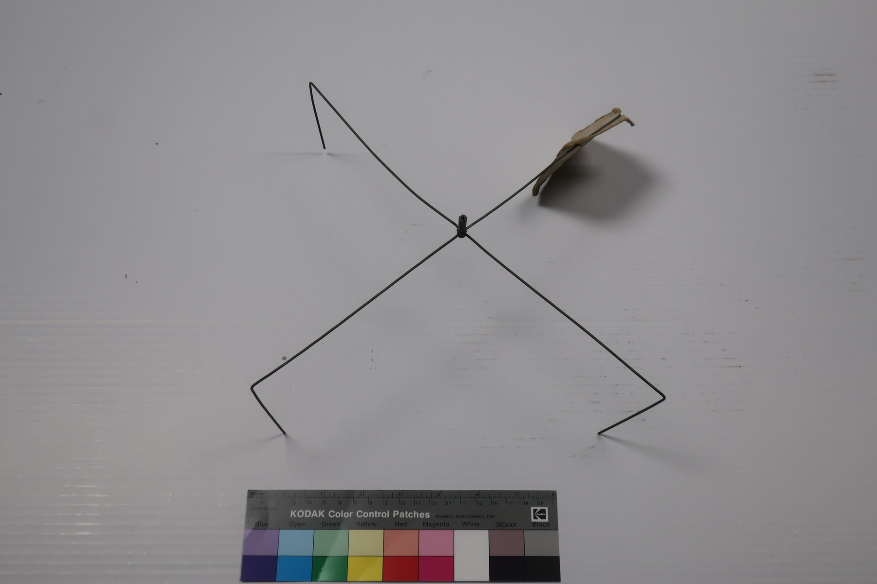
Calculator, distance
Use this image
Can I reuse this image without permission? Yes
Object images on the Ingenium Collection’s portal have the following Creative Commons license:
Copyright Ingenium / CC BY-NC-ND (Attribution-NonCommercial 4.0 International (CC BY-NC 4.0)
ATTRIBUTE THIS IMAGE
Ingenium,
2004.1963.001
Permalink:
Ingenium is releasing this image under the Creative Commons licensing framework, and encourages downloading and reuse for non-commercial purposes. Please acknowledge Ingenium and cite the artifact number.
DOWNLOAD IMAGEPURCHASE THIS IMAGE
This image is free for non-commercial use.
For commercial use, please consult our Reproduction Fees and contact us to purchase the image.
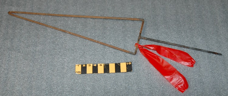
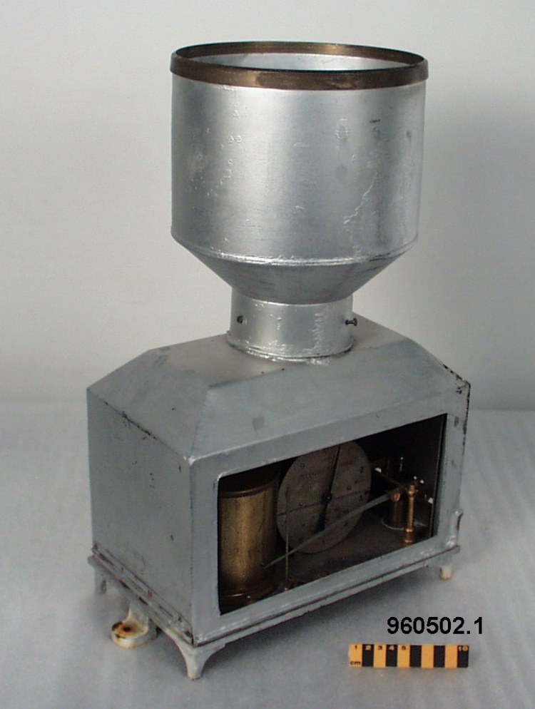
- OBJECT TYPE
- HF radio frequency prediction
- DATE
- 1956
- ARTIFACT NUMBER
- 2004.1963.001
- MANUFACTURER
- Canadian Hydrographic Service
- MODEL
- Great Circle Distance Calculator S-143
- LOCATION
- Canada
More Information
General Information
- Serial #
- N/A
- Part Number
- 1
- Total Parts
- 1
- AKA
- N/A
- Patents
- N/A
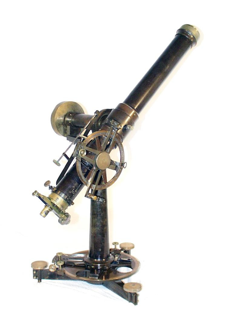
- General Description
- synthetic base and disk/ metal spindle
Dimensions
Note: These reflect the general size for storage and are not necessarily representative of the object's true dimensions.
- Length
- 34.7 cm
- Width
- 34.3 cm
- Height
- N/A
- Thickness
- N/A
- Weight
- N/A
- Diameter
- N/A
- Volume
- N/A
Lexicon
- Group
- Mathematics
- Category
- Calculating devices
- Sub-Category
- N/A
Manufacturer
- AKA
- Hydrographic
- Country
- Canada
- State/Province
- Unknown
- City
- Unknown
Context
- Country
- Canada
- State/Province
- Unknown
- Period
- mid 1950's +
- Canada
-
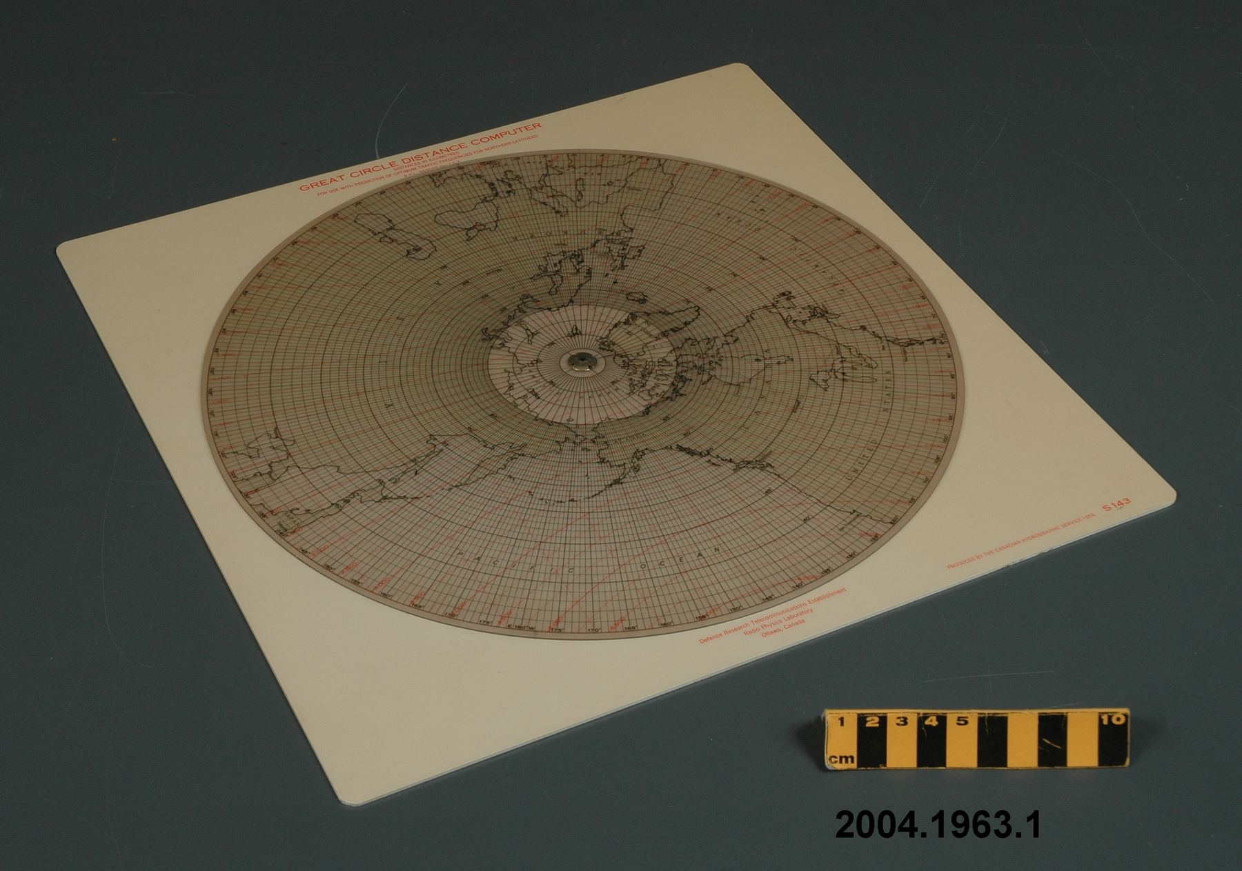
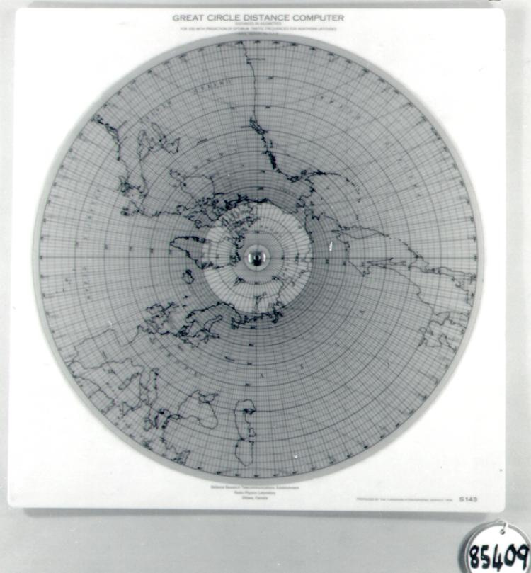
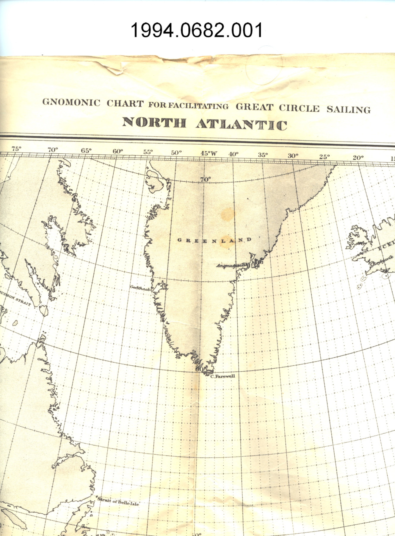
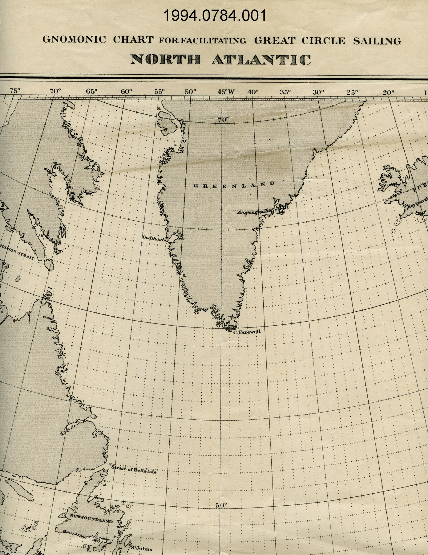
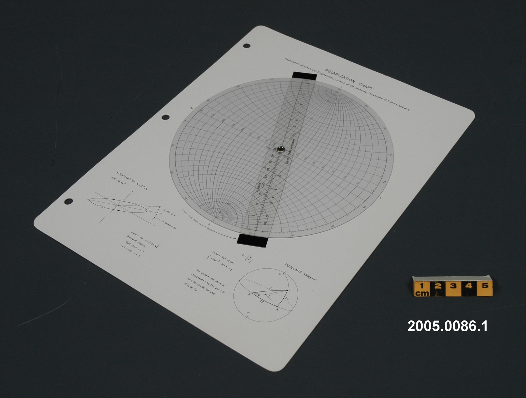
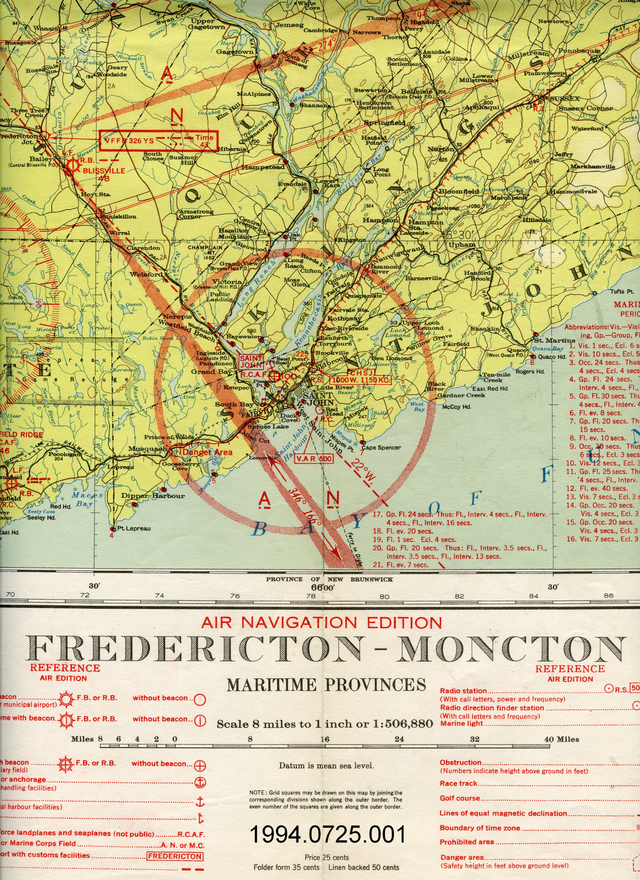
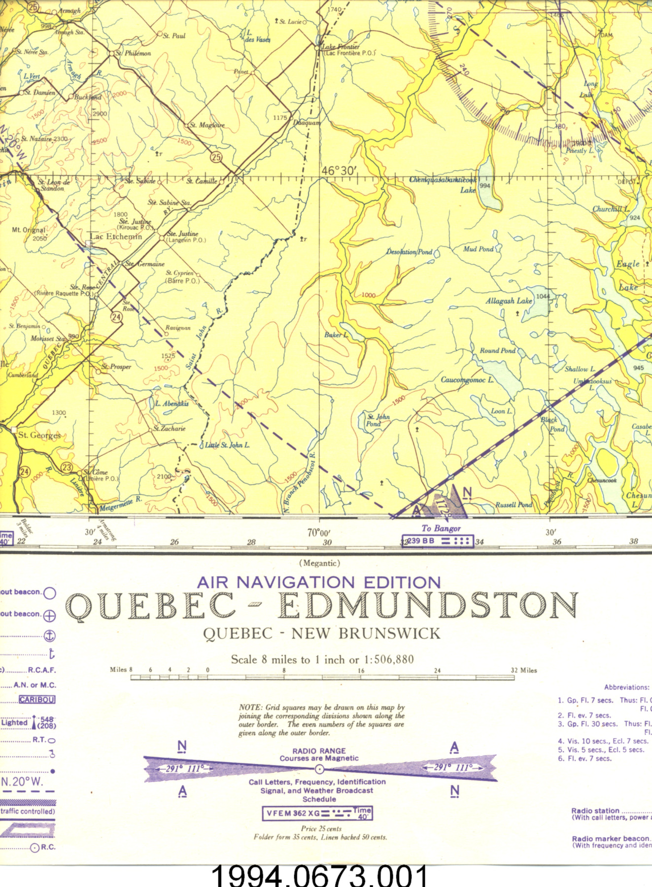
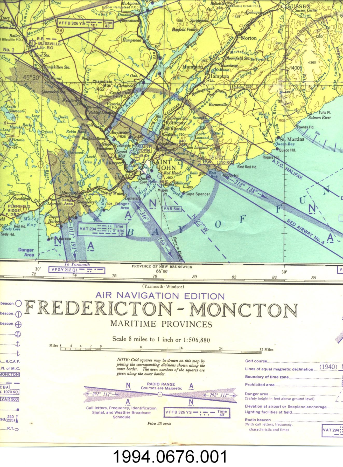
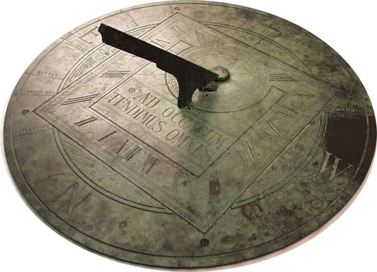
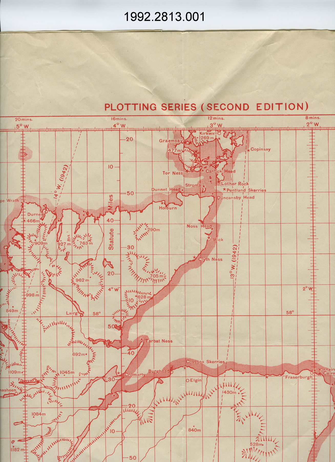
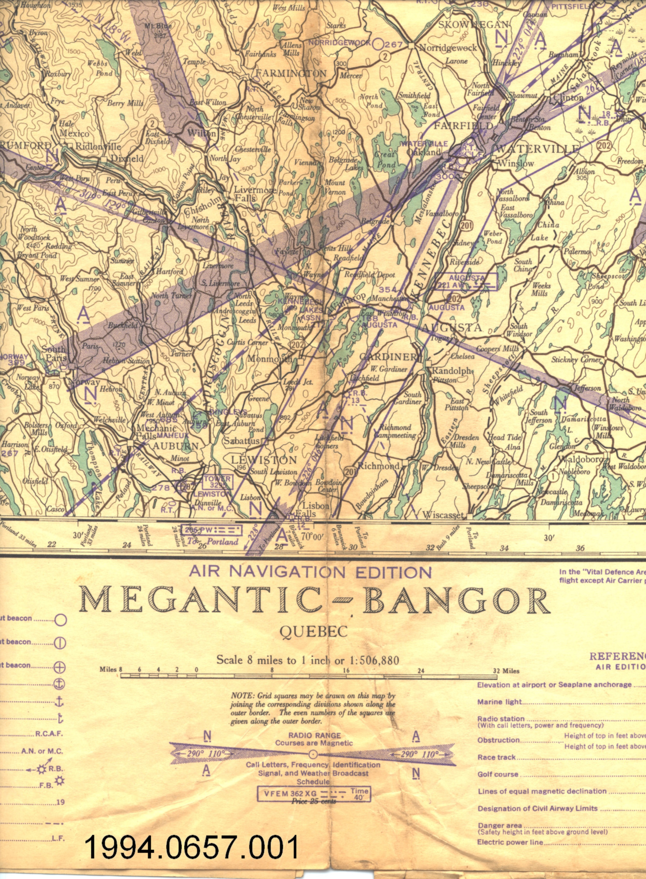
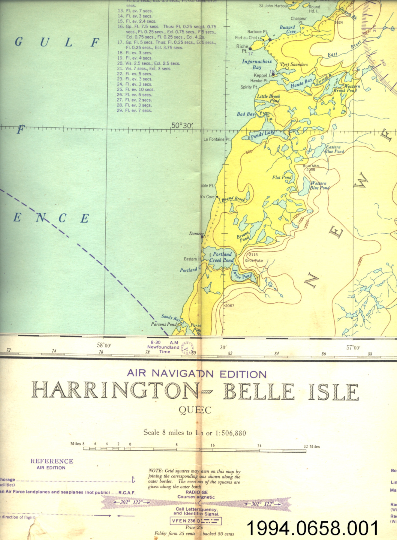
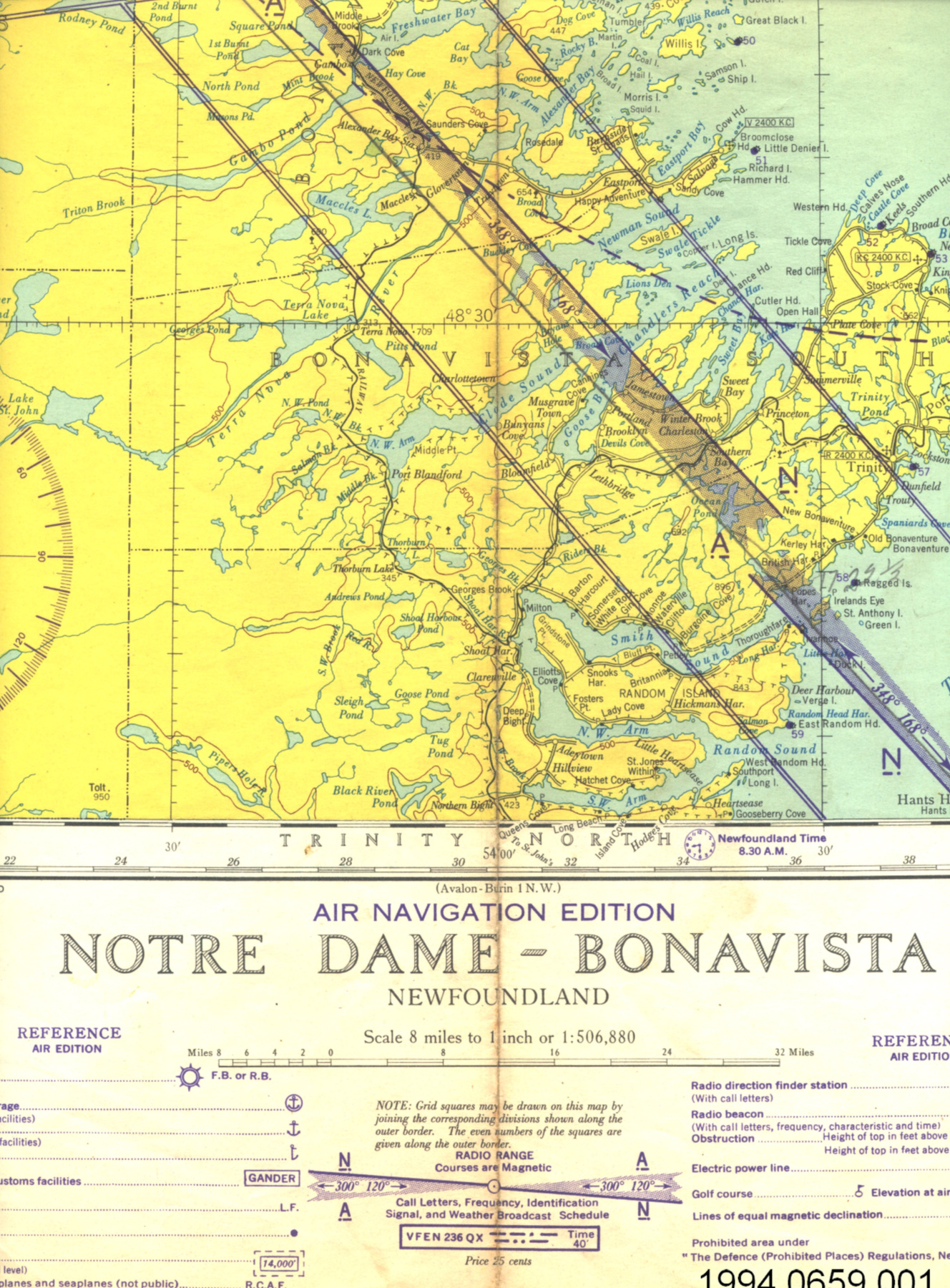
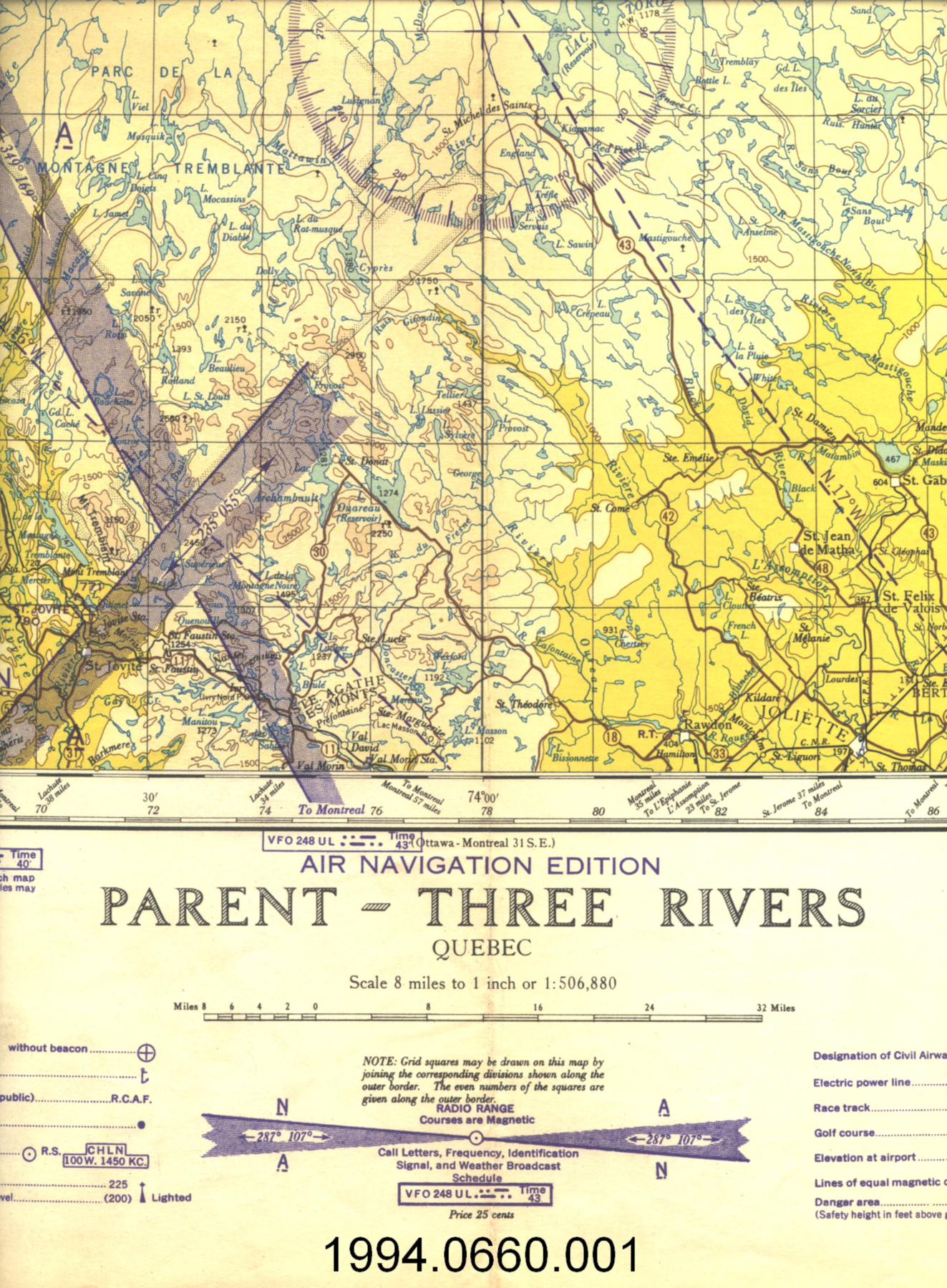
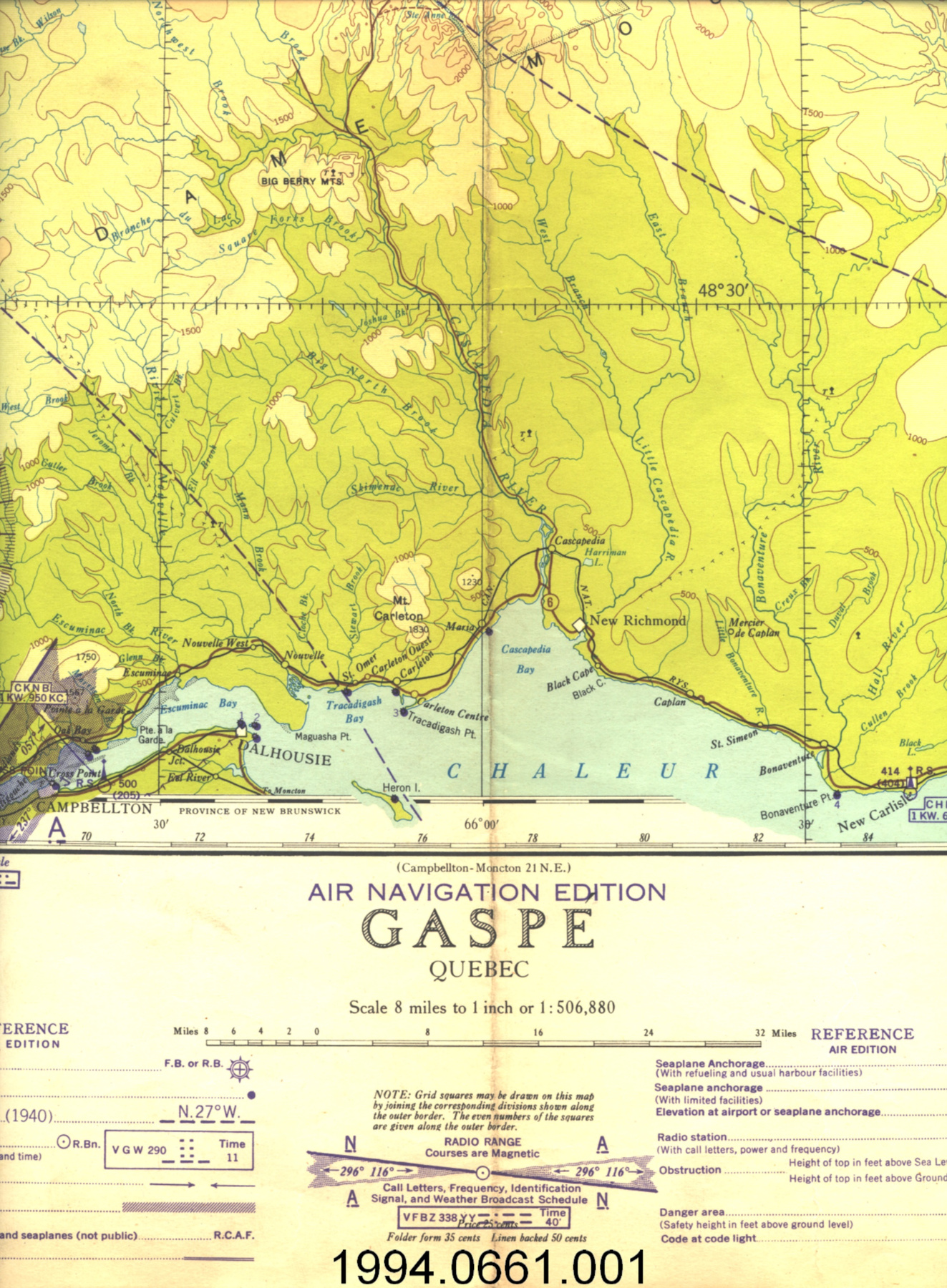
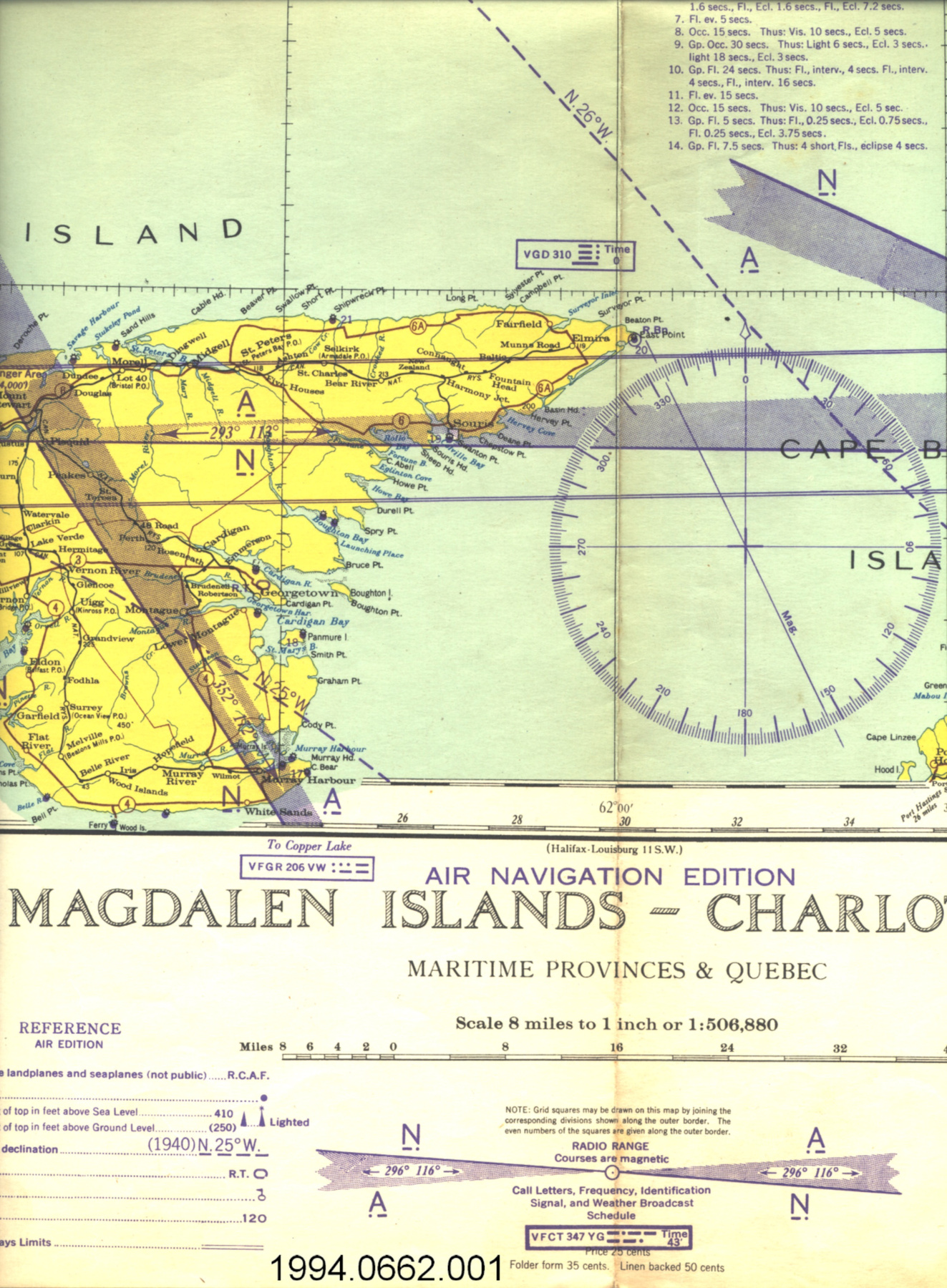
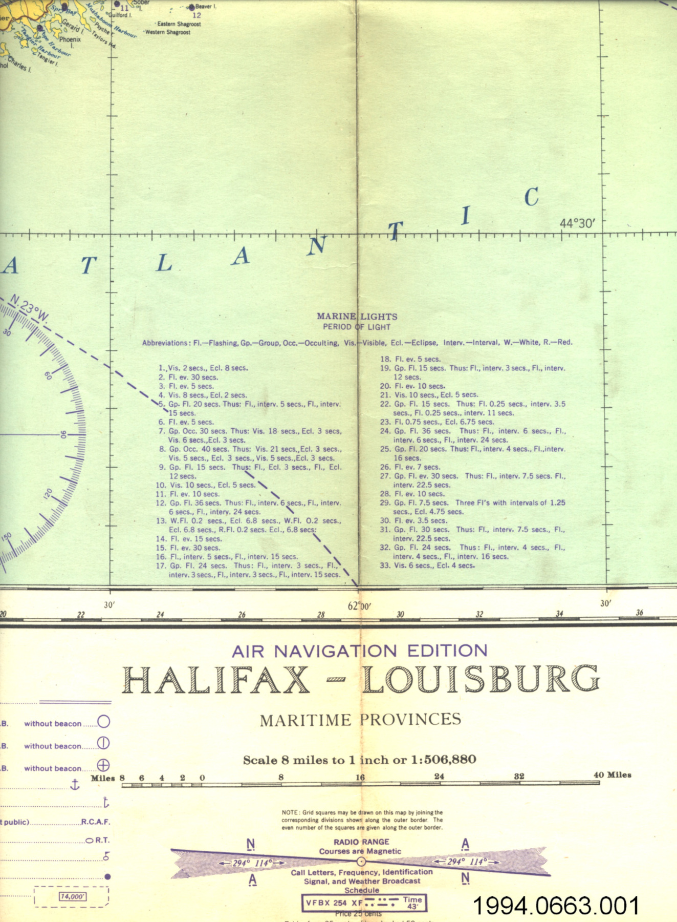
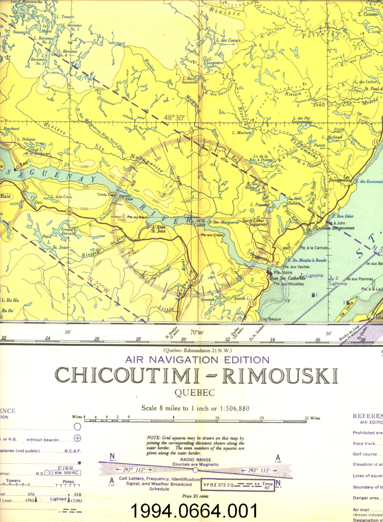
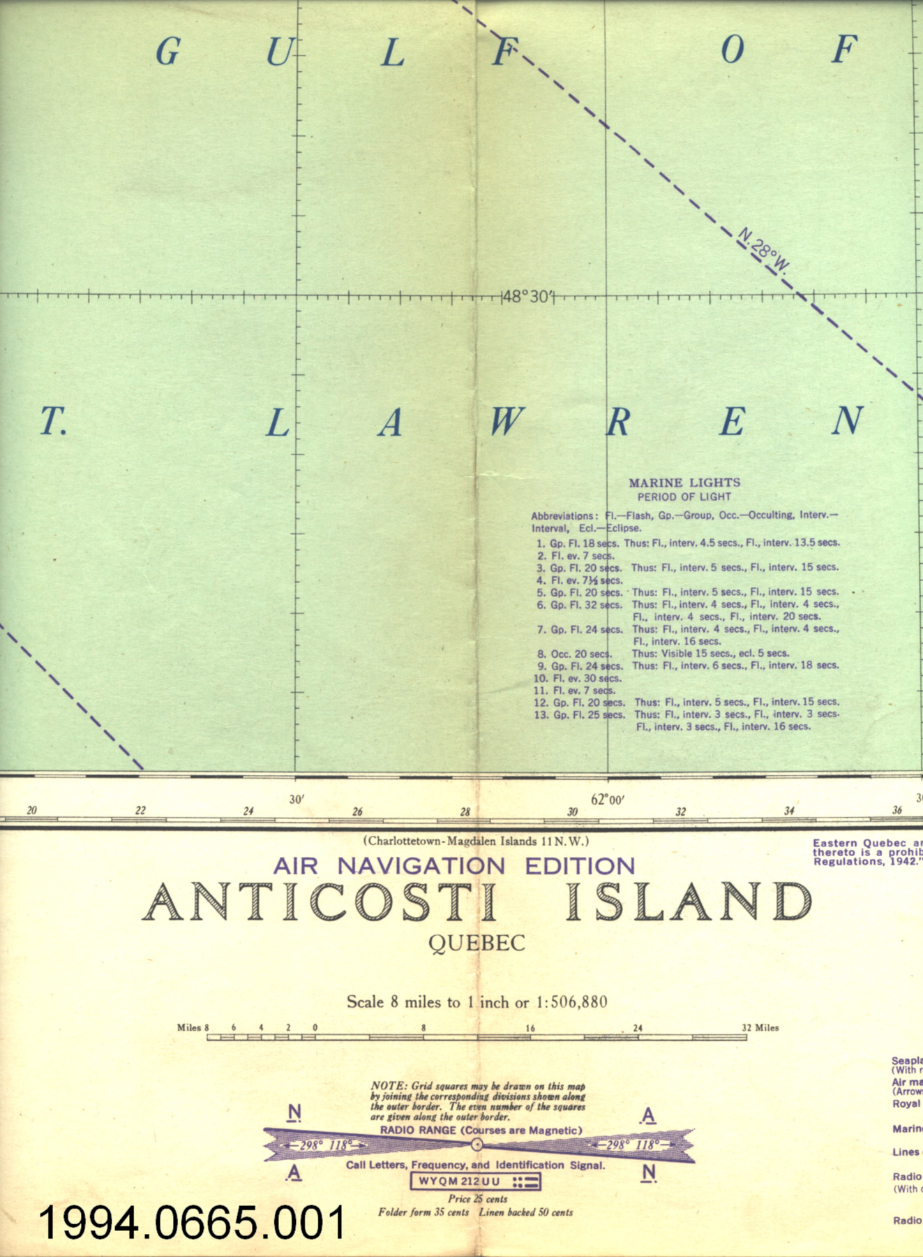
This calculator was produced by the Canadian Hydrographic Service in 1956 for the Defence Research Telecommunications Establishment, Radio Physics Laboratory, Ottawa, Canada. It was probably used in conjunction with Boulder Colorado reports on the behaviour of aurora. It was acquired by the donor while he was with DRTE at Shirley's Bay. This system for predicting the number of frequencies was developed within the Defense Research Board for use by DND personnel to improve radio communications within Canada & to NATO bases abroad. It was later made available for civilian use. DRTE was the Defence Research Telecommunications Establishment of the Defence Research Board of the Department of National Defence. Since 1883, the Canadian Hydrographic Service (CHS) has studied Canada's oceans, lakes and rivers to ensure their safe, sustainable and navigable use. The service was established in 1883 to survey and chart the navigable waters of Georgian Bay and Lake Huron and eventually all of Canada's inland waterways and coastal regions. In 1928 the name Canadian Hydrographic Service was officially adopted. The demand for Arctic surveys reached a peak during 1954-57 when the Distant Early Warning (DEW line) system was built across Canada with many stations in the Canadian Arctic. - Function
-
A device used in the prediction of optimum traffic frequencies for northern latitudes. It showed where the great circle distance intersected with the auroral zone. The calculator was used to determine the length of a radio circuit which was then used with the tables to calculate the maximum useable frequency for that circuit as a function of time of day, month, and for a given sunspot number. - Technical
-
Any tool which gives answers quickly, accurately and without extensive calculating is helpful. This system covered high latitudes which was the Canadian requirement compared with the American system which did not provide coverage of the north. The system was based on statistical averaging of data taken by ionospheres around the world. The system was later computerized & used for many years. A great circle is a circle containing a segment that represents the shortest distance two given points on the earth's surface. The great circle distance is the length of the shorter arc of the great circle joining the two points [Ref. 1]. - Area Notes
-
Unknown
Details
- Markings
- red lettering on base reads 'GREAT CIRCLE DISTANCE CALCULATOR/ DISTANCES IN KILOMETRES/ FOR USE WITH PREDICTION OF OPTIMUM TRAFFIC FREQUENCIES FOR NORTHERN LATITUDES/ R.P.I REPORT No. 1-1-3'; 'Defence Research Telecommunications Establishment/ Radio Physics Laboratory/ Ottawa, Canada'; and 'PRODUCED BY THE CANADIAN HYDROGRAPHIC SERVICE 1956 S-143'/ black lettering, numbers and markings on disk map
- Missing
- appears complete
- Finish
- white base with colourless transparent disk and metallic spindle
- Decoration
- N/A
CITE THIS OBJECT
If you choose to share our information about this collection object, please cite:
Canadian Hydrographic Service, Calculator, distance, 1956, Artifact no. 2004.1963, Ingenium – Canada’s Museums of Science and Innovation, http://collection.ingeniumcanada.org/en/id/2004.1963.001/
FEEDBACK
Submit a question or comment about this artifact.
More Like This

2004.1963.001