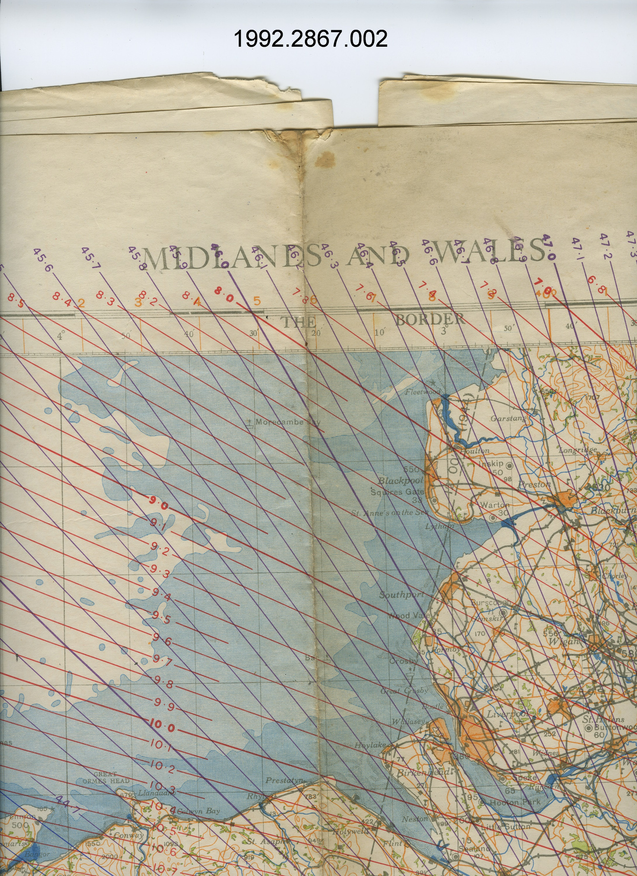
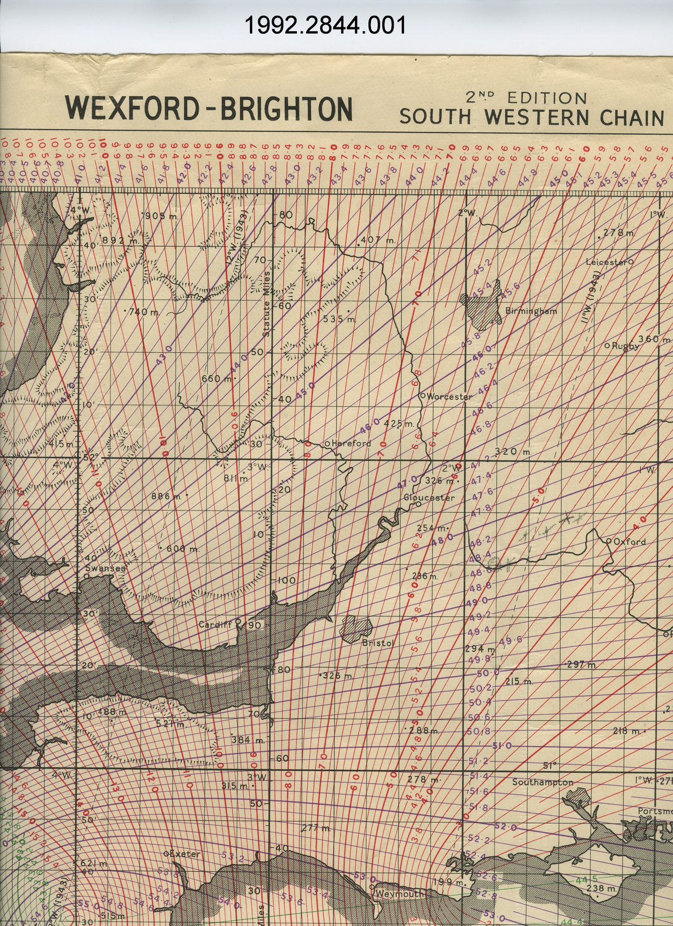
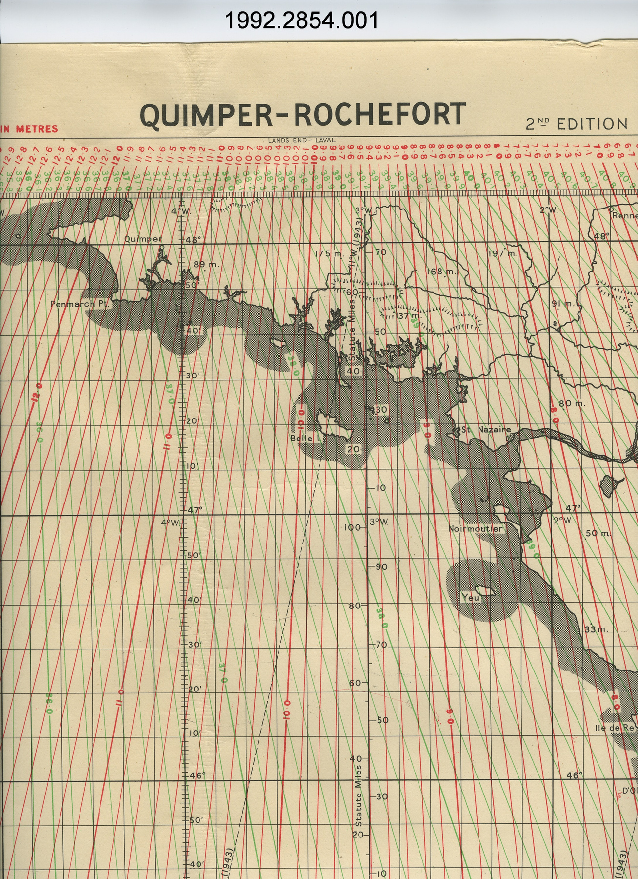
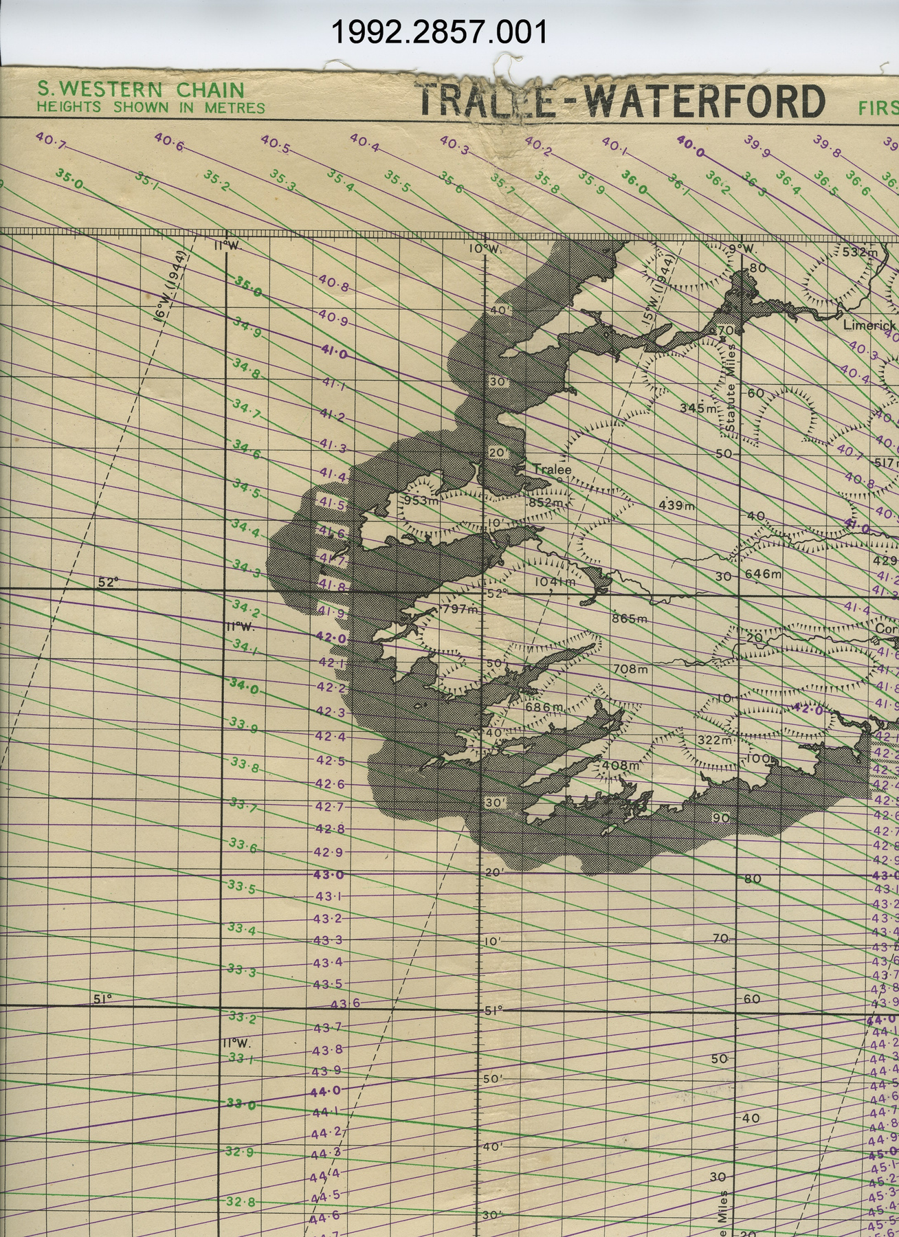
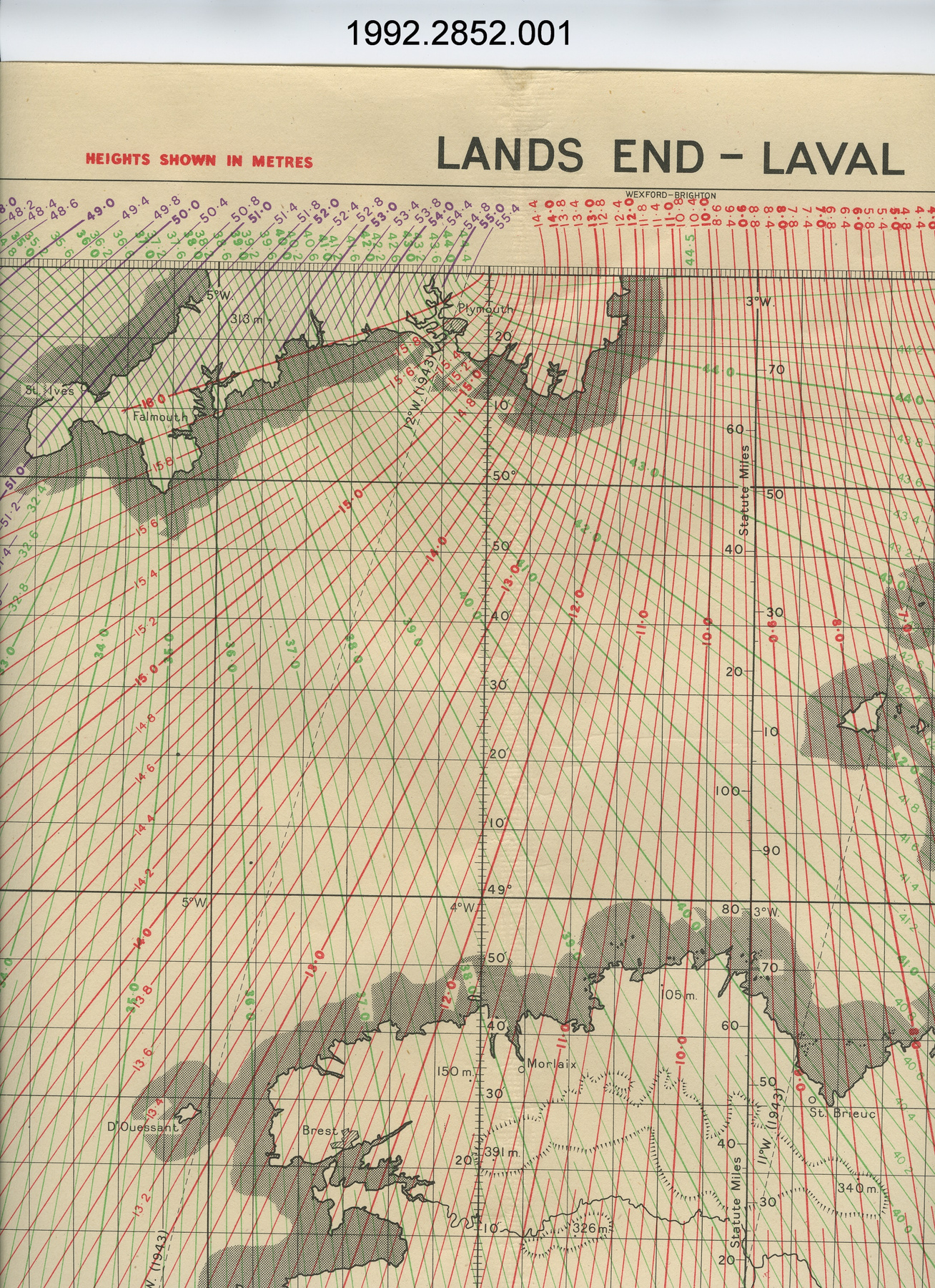
Chart
Use this image
Can I reuse this image without permission? Yes
Object images on the Ingenium Collection’s portal have the following Creative Commons license:
Copyright Ingenium / CC BY-NC-ND (Attribution-NonCommercial 4.0 International (CC BY-NC 4.0)
ATTRIBUTE THIS IMAGE
Ingenium,
2018.0113.001
Permalink:
Ingenium is releasing this image under the Creative Commons licensing framework, and encourages downloading and reuse for non-commercial purposes. Please acknowledge Ingenium and cite the artifact number.
DOWNLOAD IMAGEPURCHASE THIS IMAGE
This image is free for non-commercial use.
For commercial use, please consult our Reproduction Fees and contact us to purchase the image.
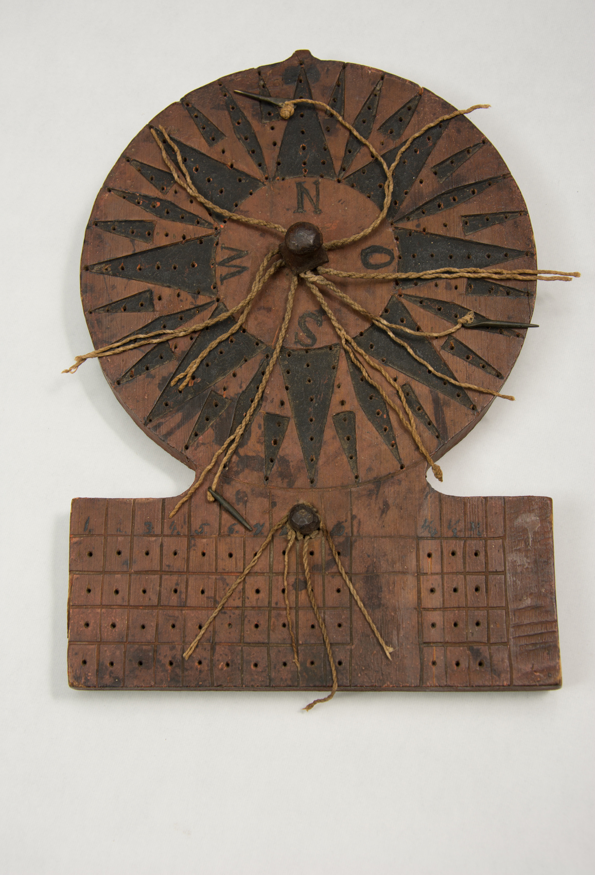
- OBJECT TYPE
- marine/navigational/Rebbelith
- DATE
- 1950
- ARTIFACT NUMBER
- 2018.0113.001
- MANUFACTURER
- Unknown
- MODEL
- Unknown
- LOCATION
- Unknown
More Information
General Information
- Serial #
- N/A
- Part Number
- 1
- Total Parts
- 1
- AKA
- Stick chart
- Patents
- N/A
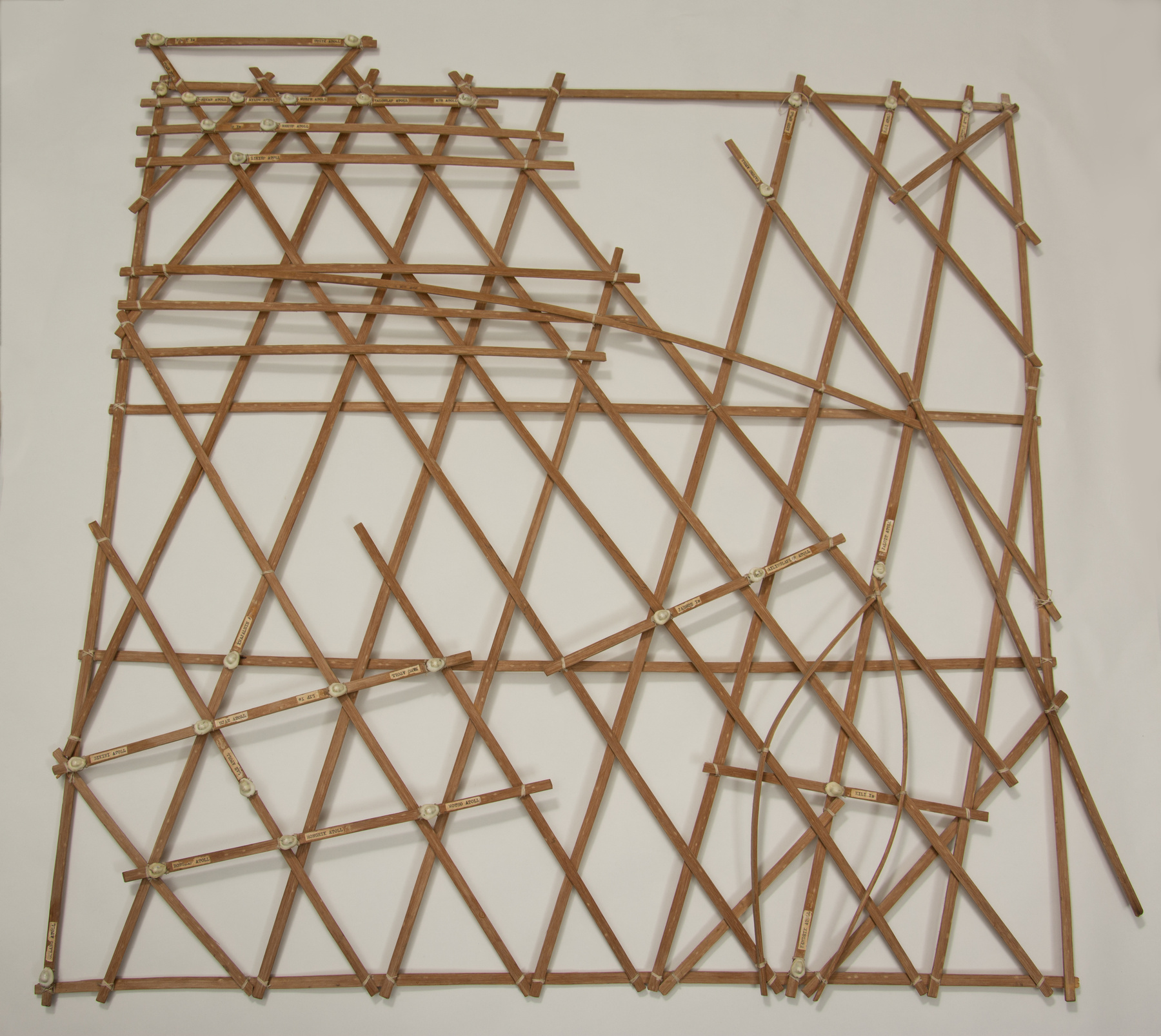
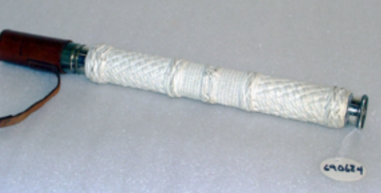
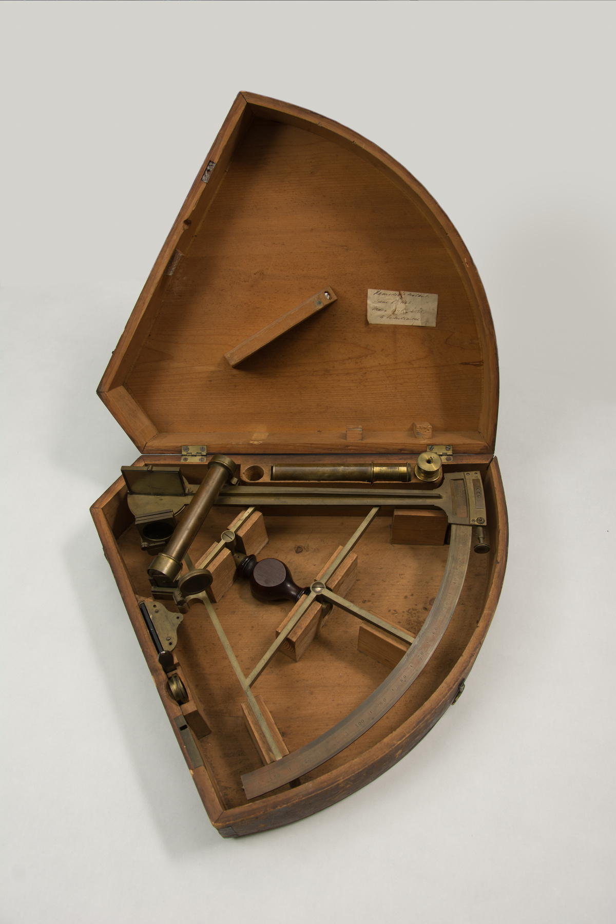
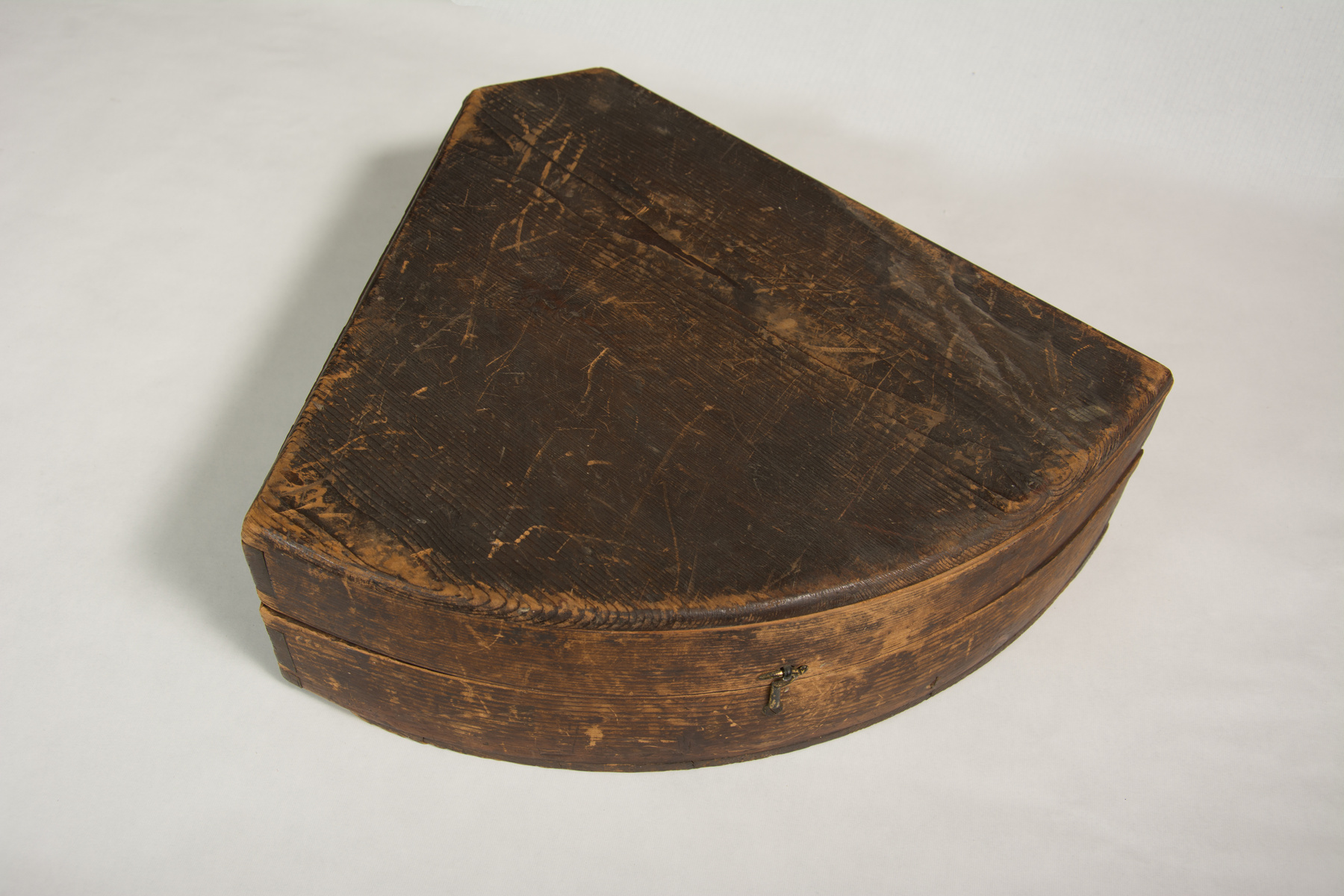
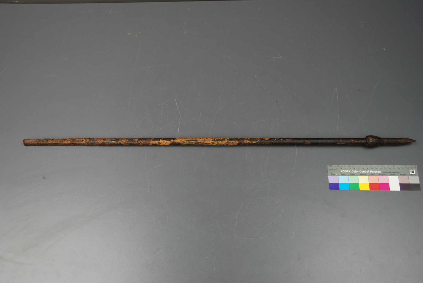
- General Description
- Wood chart with fibre twine, shell island markers and paper labels
Dimensions
Note: These reflect the general size for storage and are not necessarily representative of the object's true dimensions.
- Length
- 89.0 cm
- Width
- 88.0 cm
- Height
- 3.5 cm
- Thickness
- N/A
- Weight
- N/A
- Diameter
- N/A
- Volume
- N/A
Lexicon
- Group
- Marine Transportation
- Category
- Navigation instruments & equipment
- Sub-Category
- N/A
Manufacturer
- AKA
- Unknown
- Country
- Unknown
- State/Province
- Unknown
- City
- Unknown
Context
- Country
- Unknown
- State/Province
- Unknown
- Period
- Unknown
- Canada
-
Marshall Islands Stick Charts do not have a direct connection to Canada. They do represent, however, many fundamental aspects of ocean knowledge, and geographically, a significant dimension of the scientific culture and heritage in the Pacific region. Through generations of attention and scholarship on the unique heritage of Oceania navigation traditions, these charts have become an international source of pride for ocean ways of knowing and indigenous science in general. There are numerous historic instruments and collections in museums that represent Western navigation and ocean knowledge. This is not the case with indigenous ocean knowledge, where there are very few artifacts to represent these scientific knowledge traditions related to the ocean. The stick charts are an exception, and therefore rare and valuable. Due to the extensive scholarship on Oceania navigation culture, and specifically the use of these charts dating back to c. 1900, these studies provide a fruitful and powerful model for studying other indigenous knowledge systems and practices. For example, the skills and techniques described by David Lewis in "We, The Navigators" resemble the navigational and wayfinding skills employed by Inuit in Canada’s north. Although applied often in a frozen context, the Inuit have developed a sophisticated and holistic navigation system based on observations and vocabulary for wind, snowdrift patterns, stars, clouds, vegetation, sea currents and landmarks. (MacDonald, pp. 160-191). Based on a preliminary search, there are no known stick charts in Canadian collections. There could be a reason for this absence. Most of the museum that have stick charts have a deep history of colonial exploration of the Oceania region – Britain, Germany and the United States. (see Winkler 1901). In fact, one of the shells in this model “Bikini” serves as powerful reminder of another context for this story - the appropriation of the Marshall Islands by the United States as a nuclear testing ground in the post-WWII era. In fact, many of the stick charts in collections such as the Smithsonian (see below) were obtained at this time owing to special attention paid to this region during this testing, by military visitors, scholars (e.g. ethnologists), explorers such as Lewis interested in the history of navigation, and the tourist public. The labels on the proposed stick chart speaks to this larger colonial influence in the history of stick charts, a subject for future research on this chart, and others. (From Acquisition Proposal, see Ref. 1) - Function
-
Stick Charts were mnemonic and instructional devices used to teach navigation based on careful observation of complex swell patterns and ocean movements, in conjunction with other navigational indictors such as observation of stars, sun, seasonal changes, and bird migration. (From Acquisition Proposal, see Ref. 1) - Technical
-
Marshall Island Stick Charts are made of palm sticks assembled to represent the prevailing ocean movements around an islands, small group of islands or the large Marshall Chain. Intersections often represent islands, and larger intersections and islands represented with sewn Cowrie shells. There are three types of Marshallese charts, mattang, meddo, and rebbilib. The mattang is “instructional and mnemonic,” the meddo “shows swells patterns in relation to a few islands,” and the rebbilib covers a larger part of the archipelago with a more geographic focus on the islands among swell patterns. The latter charts, with their geographic representation, appear to be influenced by Western traditions. (Lewis, 1994, pp 245-250). (From Acquisition Proposal, see Ref. 1) - Area Notes
-
Unknown
Details
- Markings
- On the various labels on the chart, in the top proper right quadrant: "M[?]J[?]T Is"/ "UTRIK ATOLL"/ "OKAK ATOLL"/ "BIKAR ATOLL"/ "AILUK ATOLL"/ "WOTJE ATOLL"/ "MALOELAP ATOLL"/ "AUR ATOLL"/ "[?]O Is"/ "ERKUP ATOLL"/ "LIKIEP ATOLL"/ In the top proper left quatrant: "ARNO ATOLL"/ "MILI ATOLL"/ "[M[ADRIKE[I]K ATOLL"/ "MAJURO ATOLL"/ In the lower proper left quadrant: "JABWOT Is"/ "AILINGLAPLAP ATOLL"/ "JALUIT ATOLL"/ "KILI Is"/ "NAMDRIK ATOLL"/ In the lower proper right quadrant: "KWAJALEIN A"/ "BIKINI ATOLL"/ "UJAE ATOLL"/ "LIP Is"/ "NAMO ATOLL"/ LAE ATOLL"/ "UJLANG ATOLL"/ RONG[L]AP ATOLL"/ "RONGRIK ATOLL"/ "WOTHO ATOLL"
- Missing
- Appears complete
- Finish
- Light brown wood sticks lashed together in an irregular lattice formation with off-white coloured twine. Placed at different spots on the lattice are off-white shells attached to the wood next to beige coloured paper labels with black printing.
- Decoration
- N/A
CITE THIS OBJECT
If you choose to share our information about this collection object, please cite:
Unknown Manufacturer, Chart, circa 1950, Artifact no. 2018.0113, Ingenium – Canada’s Museums of Science and Innovation, http://collection.ingeniumcanada.org/en/id/2018.0113.001/
FEEDBACK
Submit a question or comment about this artifact.
More Like This


2018.0113.001