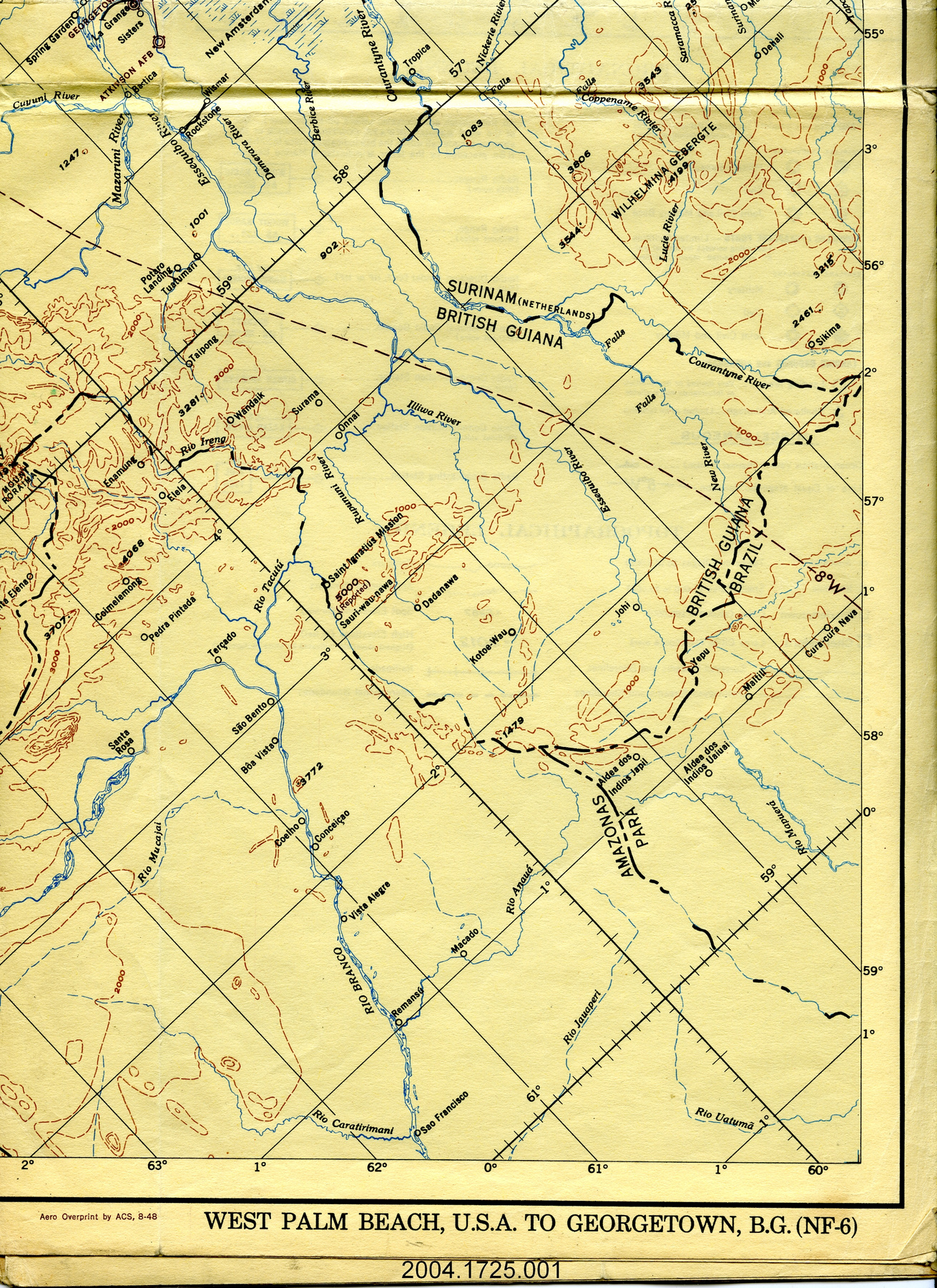
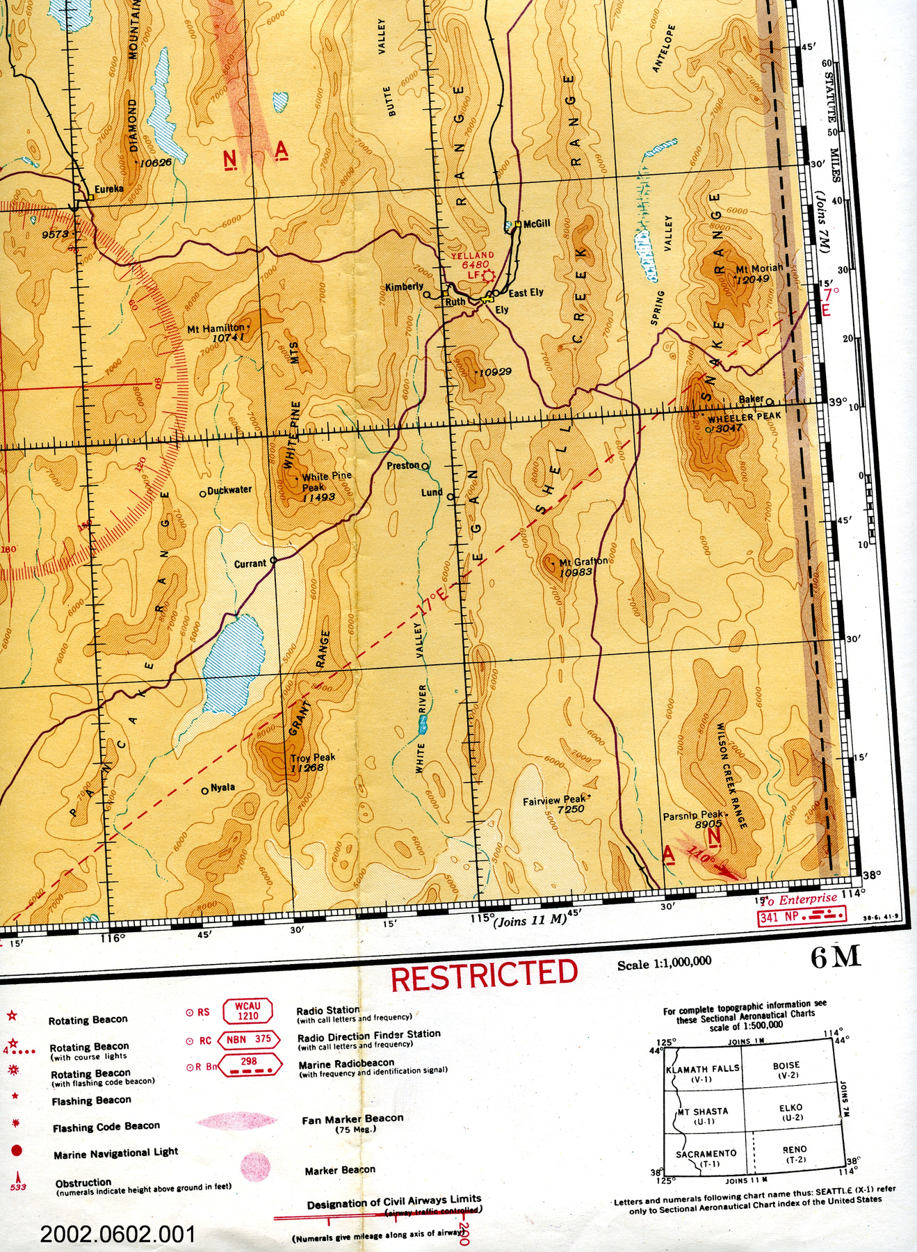
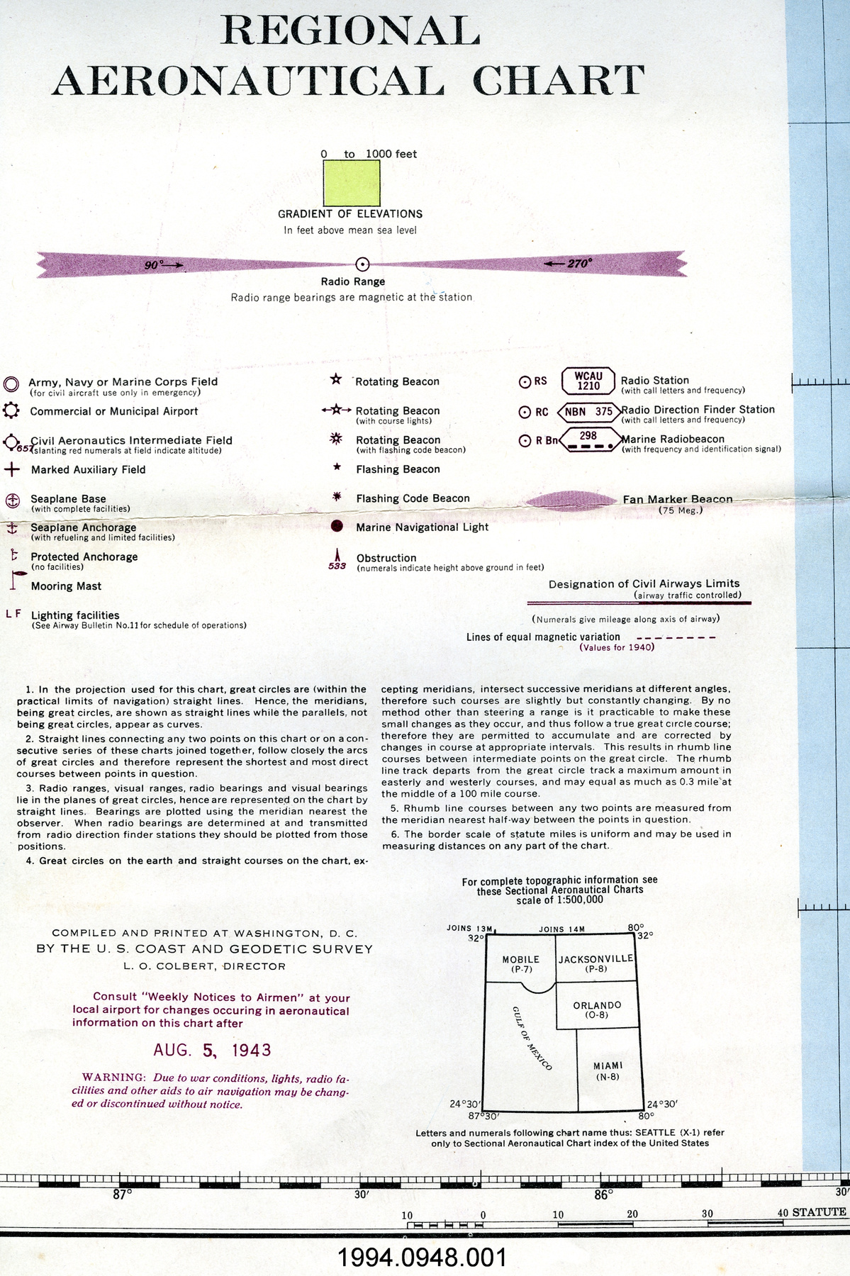
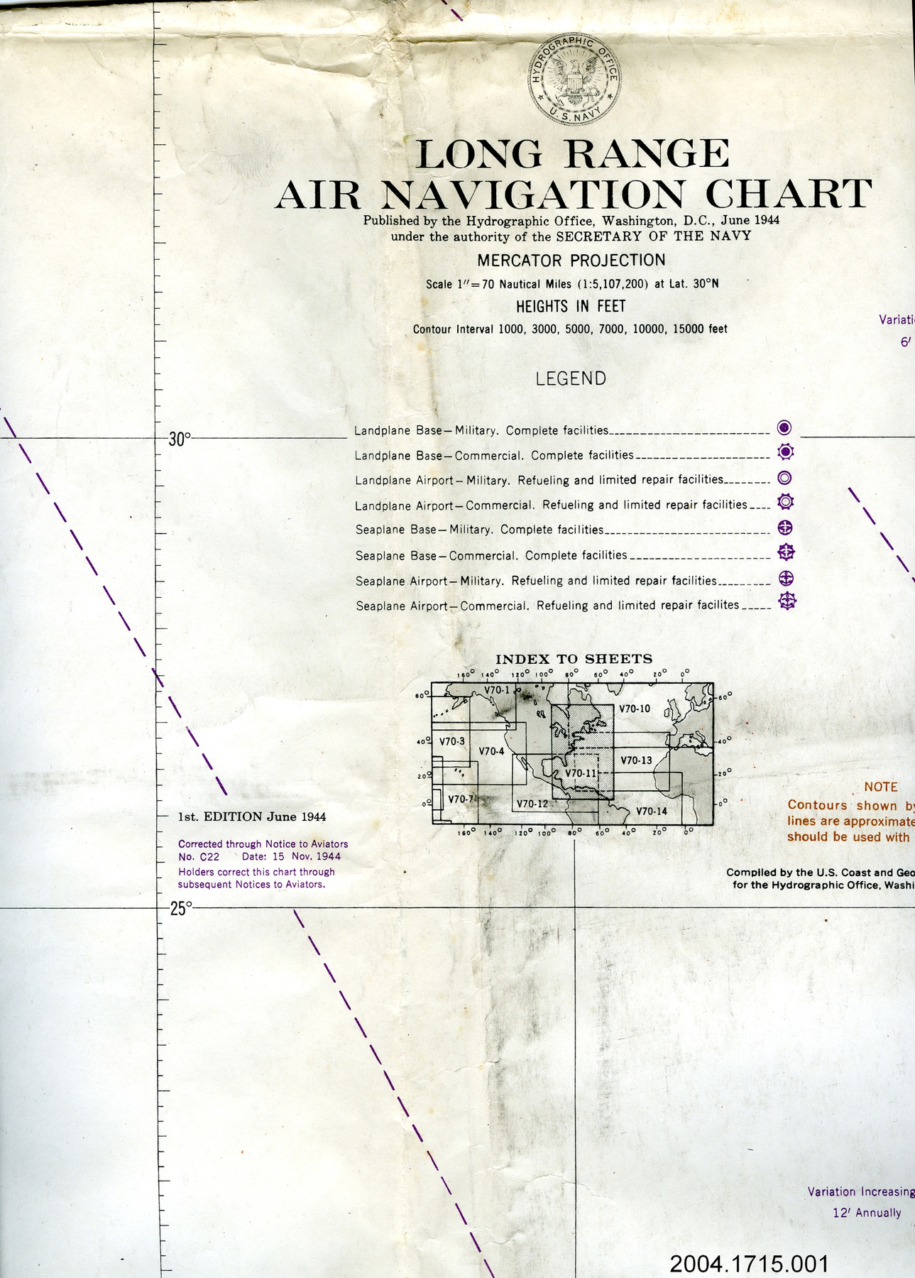
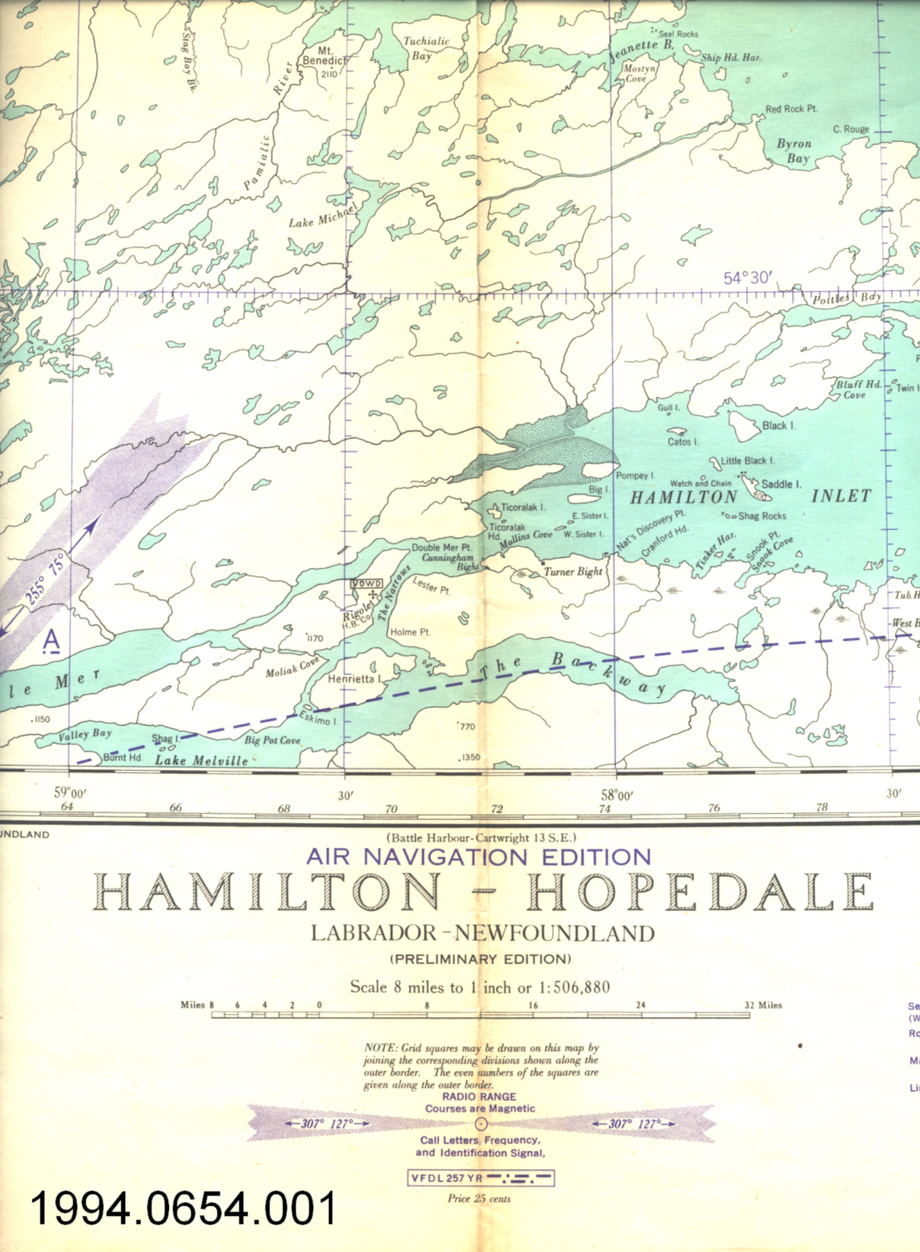
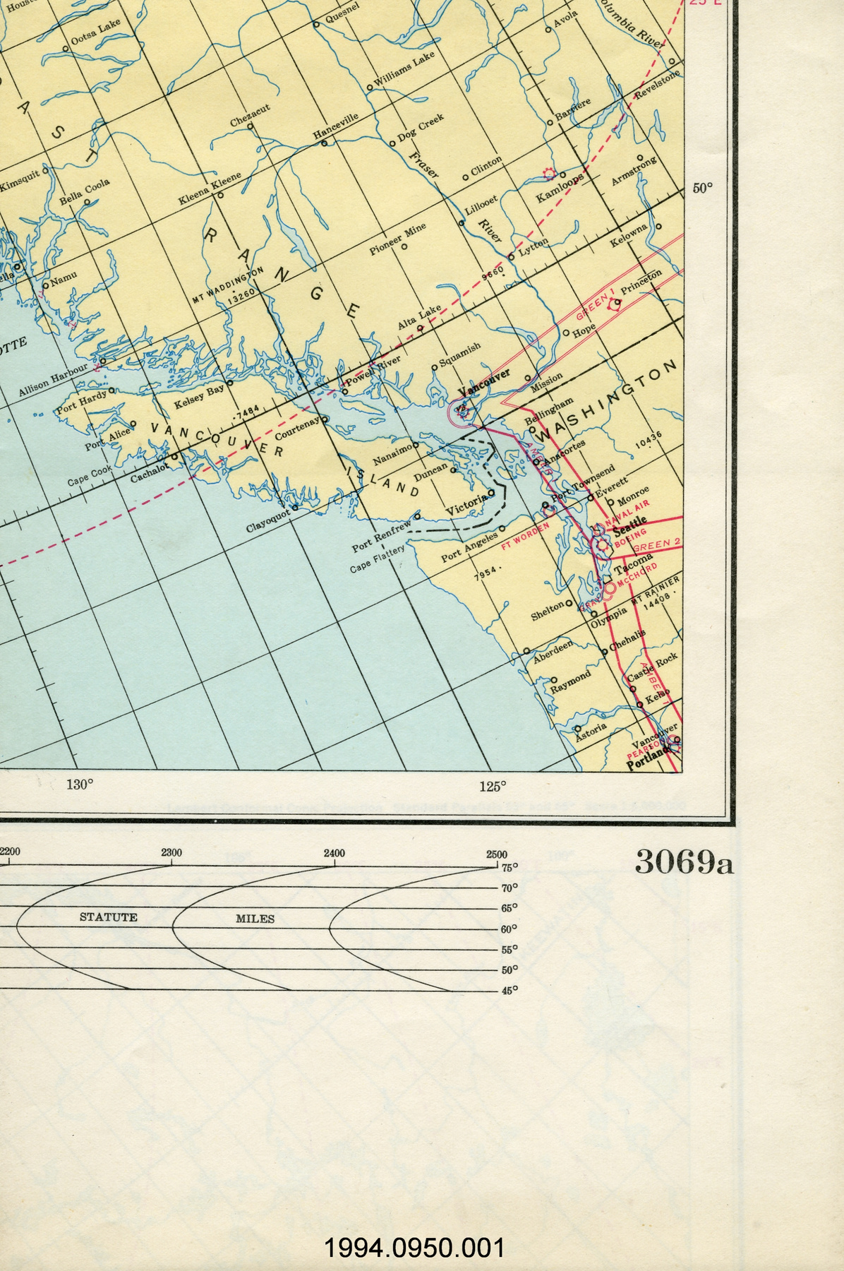
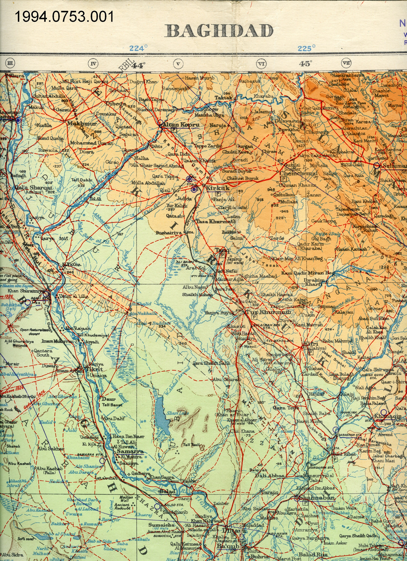
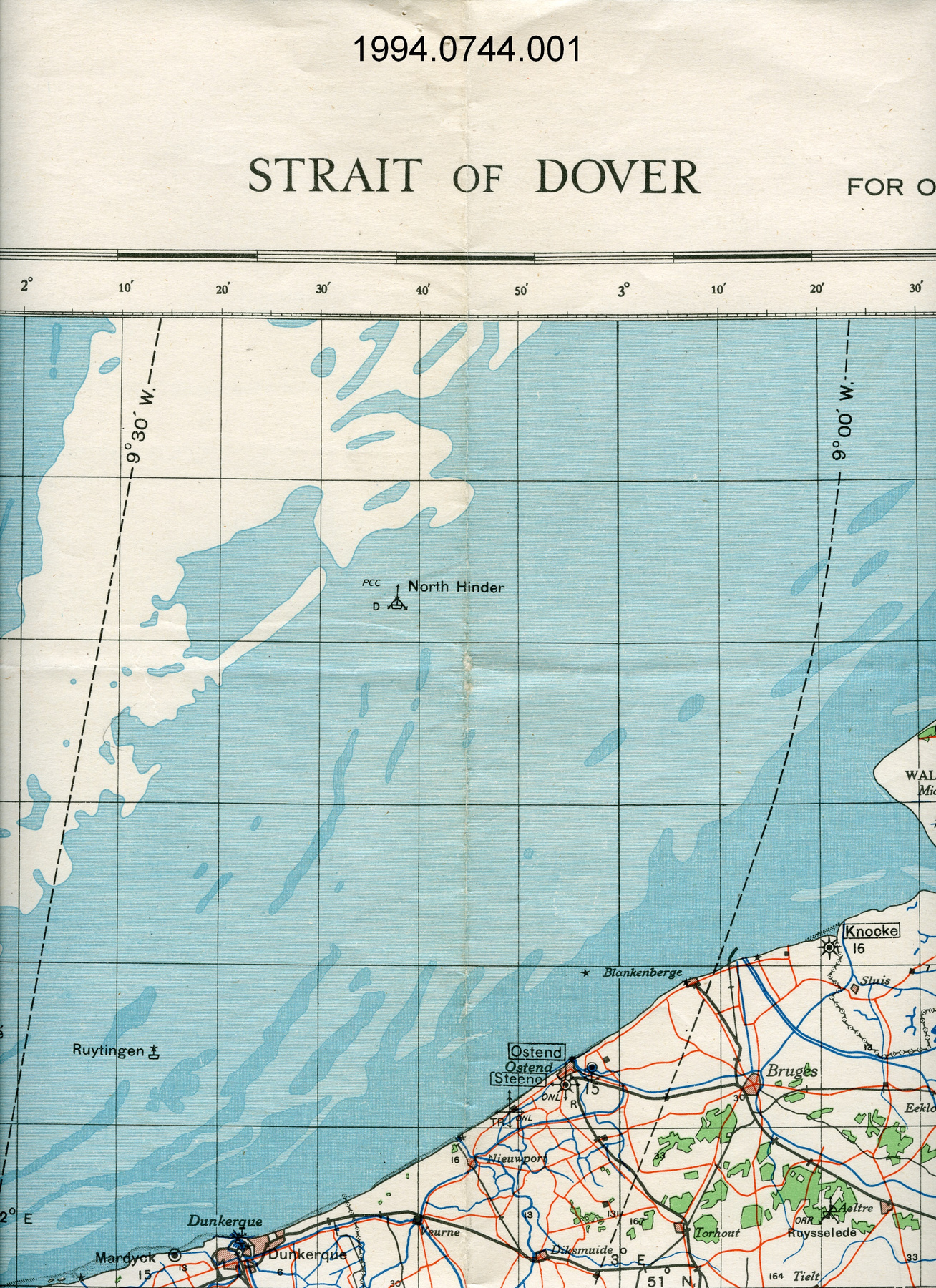
Map
Use this image
Can I reuse this image without permission? Yes
Object images on the Ingenium Collection’s portal have the following Creative Commons license:
Copyright Ingenium / CC BY-NC-ND (Attribution-NonCommercial 4.0 International (CC BY-NC 4.0)
ATTRIBUTE THIS IMAGE
Ingenium,
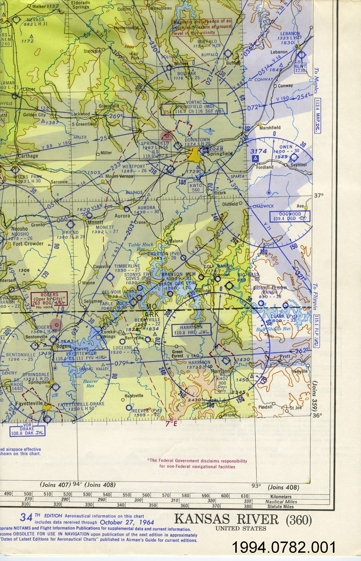
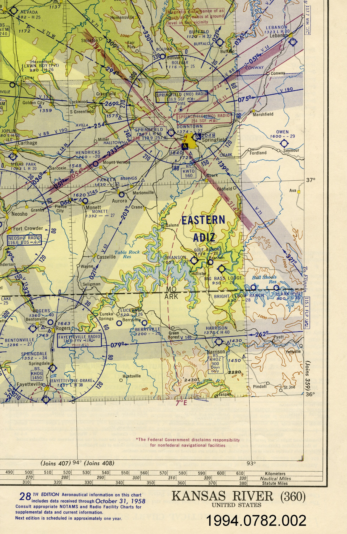
1994.0782.001
Permalink:
Ingenium is releasing this image under the Creative Commons licensing framework, and encourages downloading and reuse for non-commercial purposes. Please acknowledge Ingenium and cite the artifact number.
DOWNLOAD IMAGEPURCHASE THIS IMAGE
This image is free for non-commercial use.
For commercial use, please consult our Reproduction Fees and contact us to purchase the image.
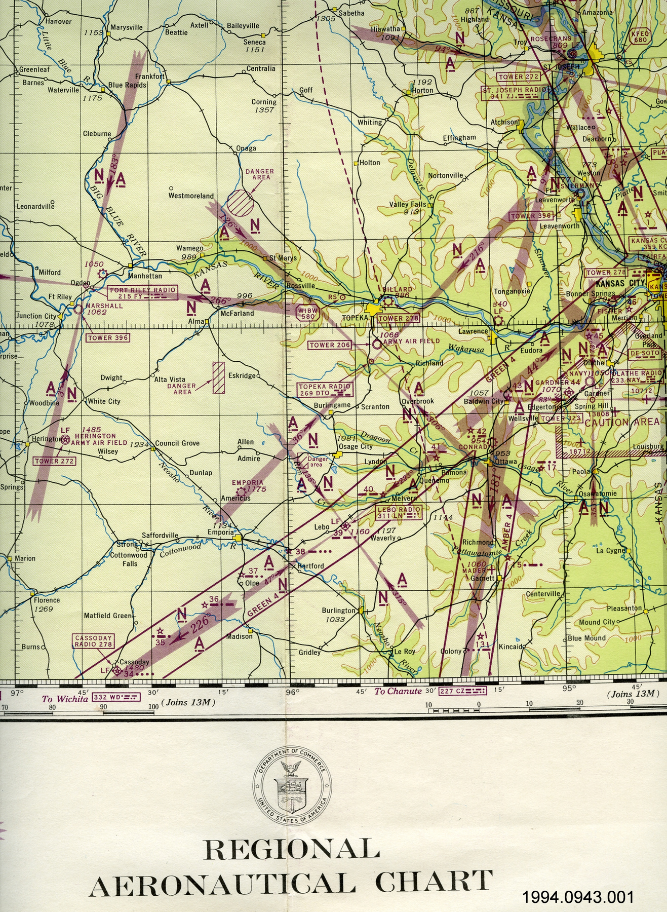
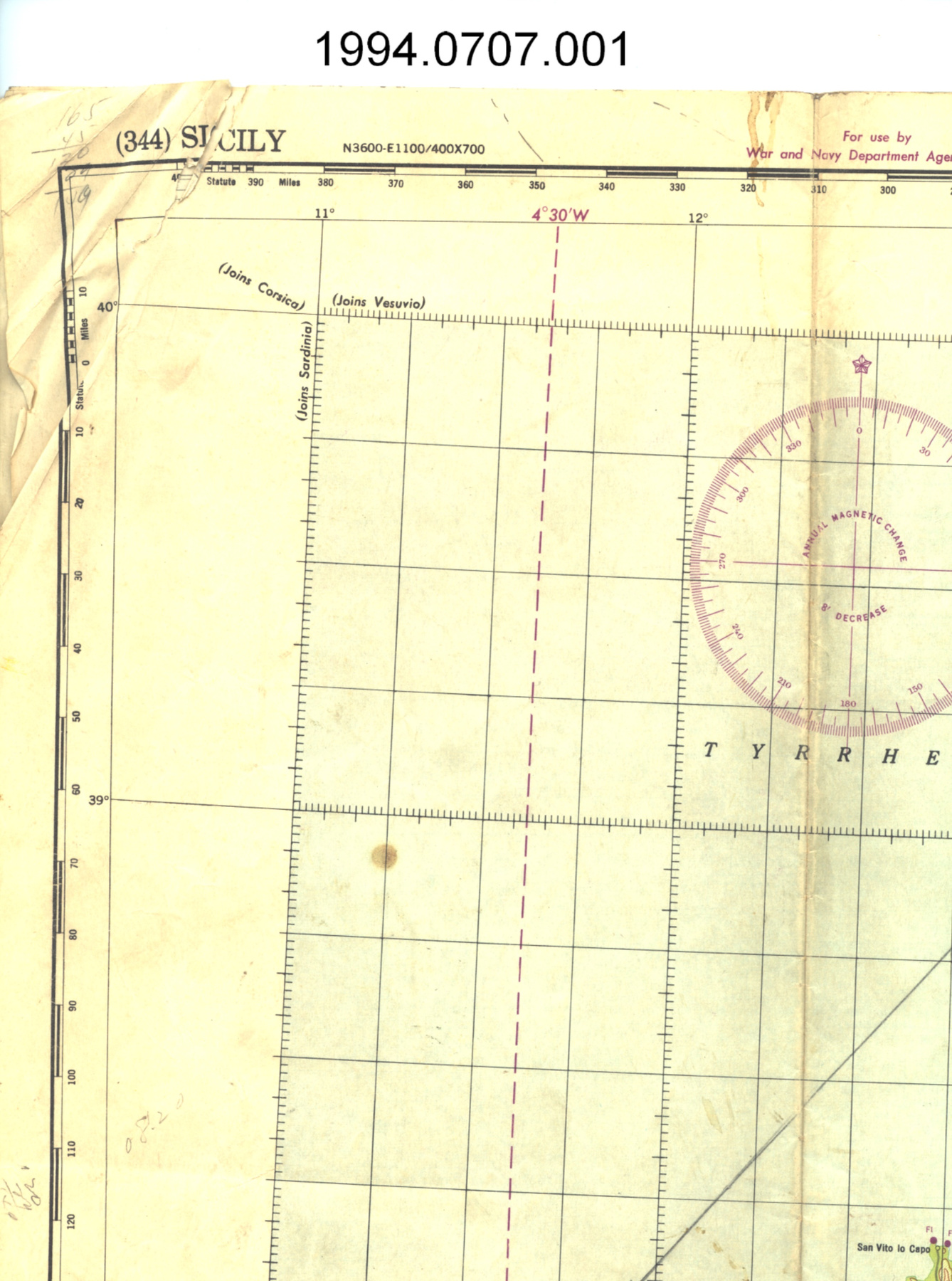
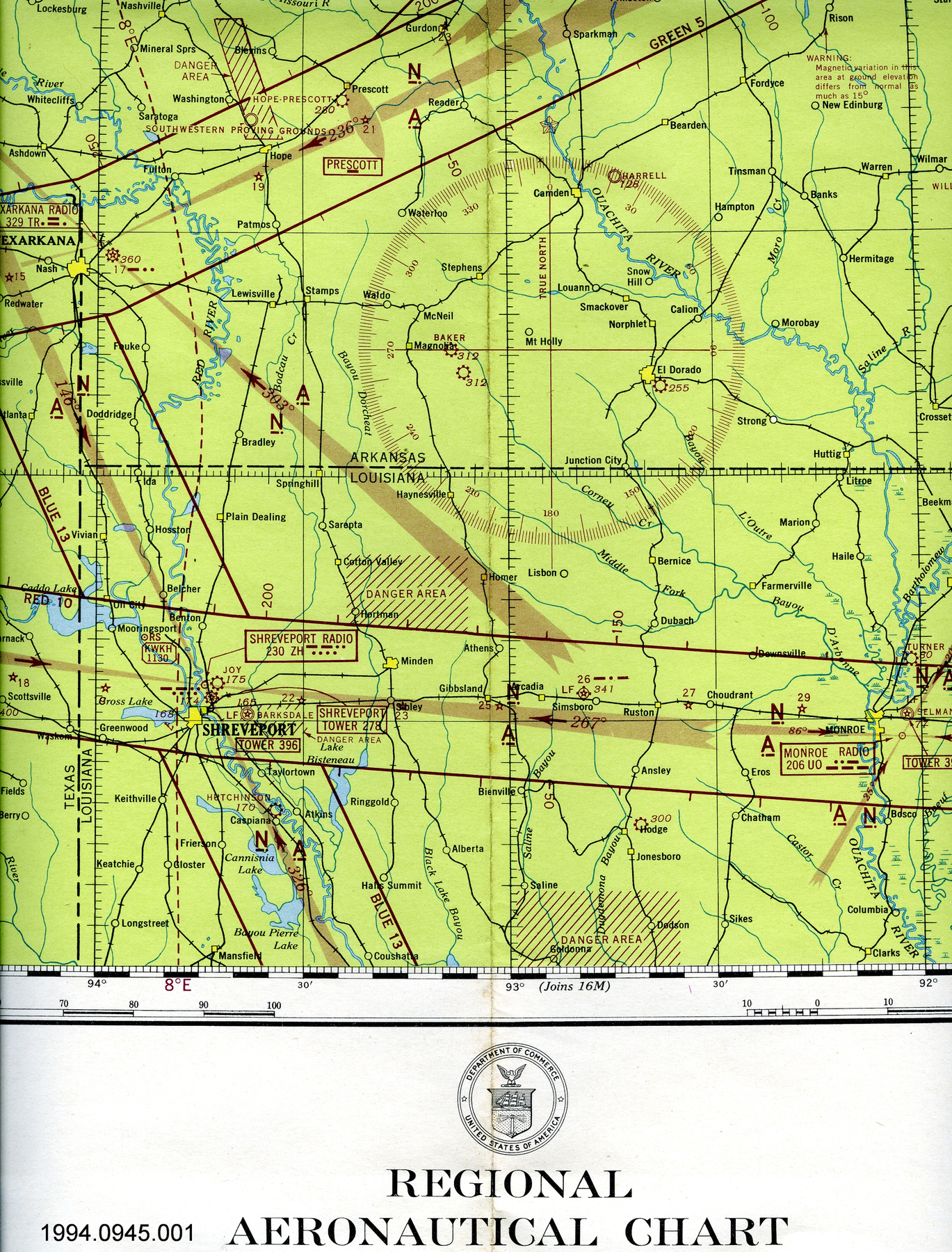
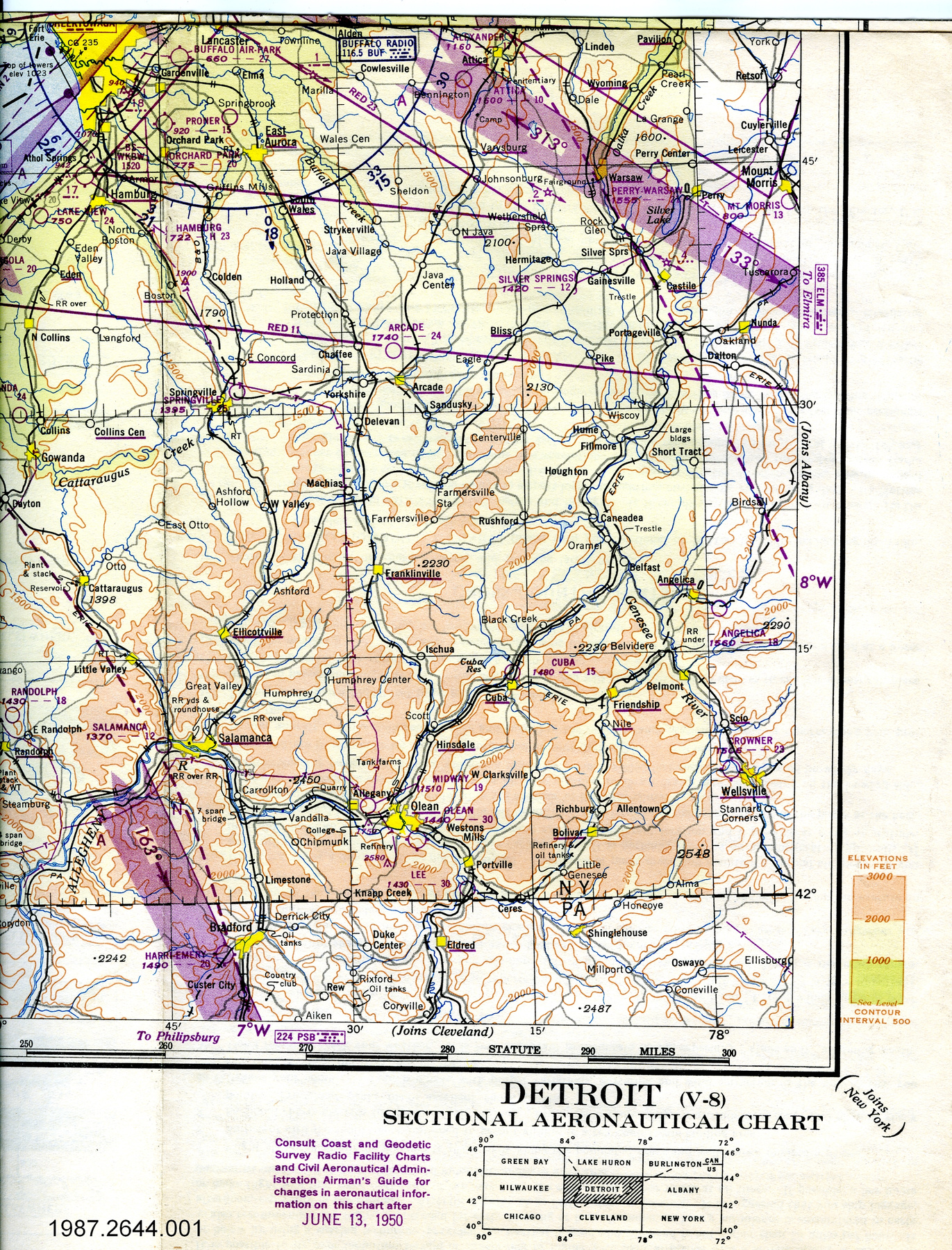
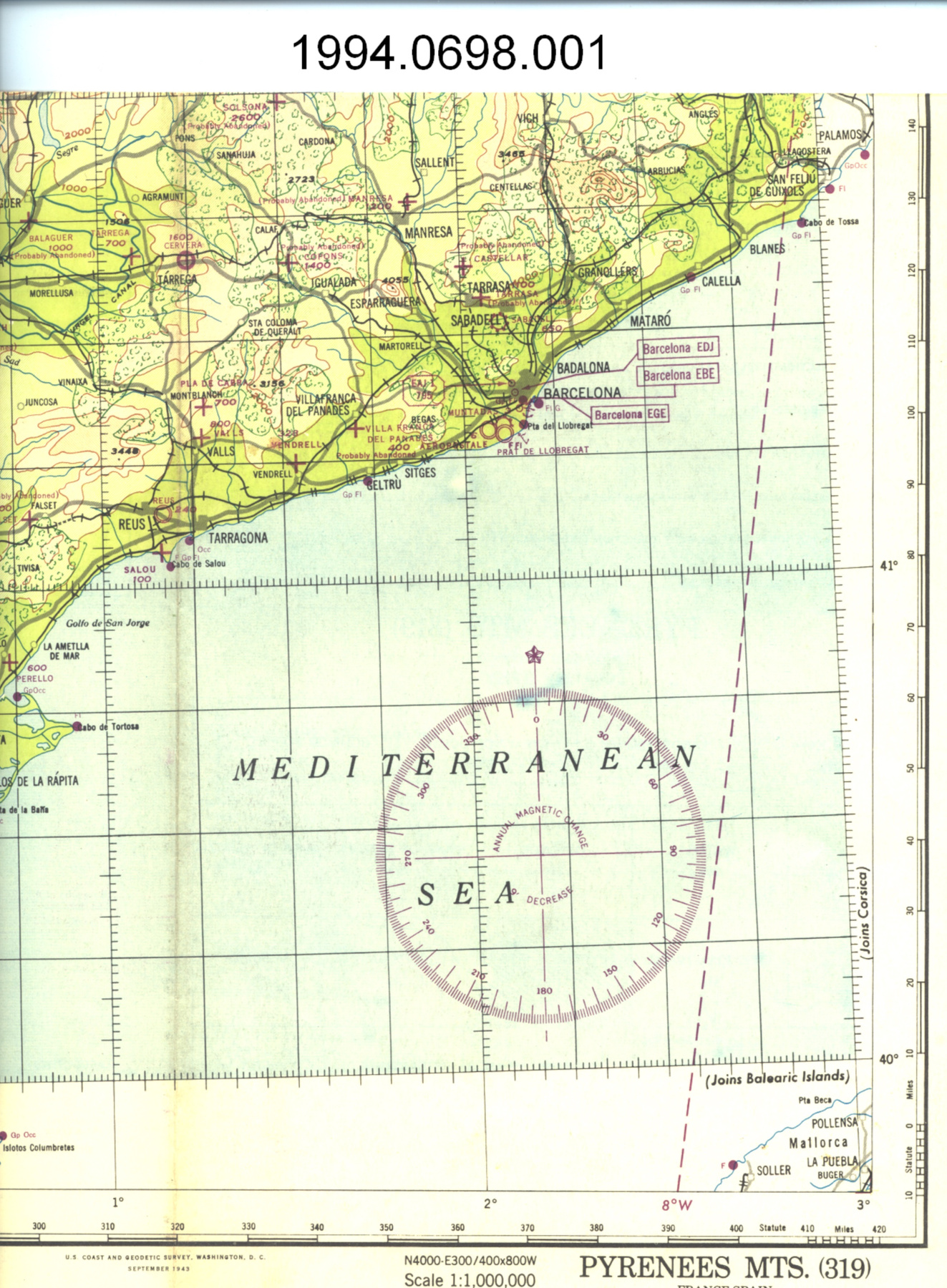
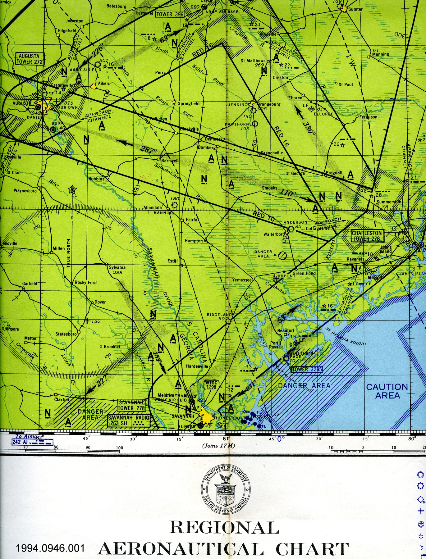
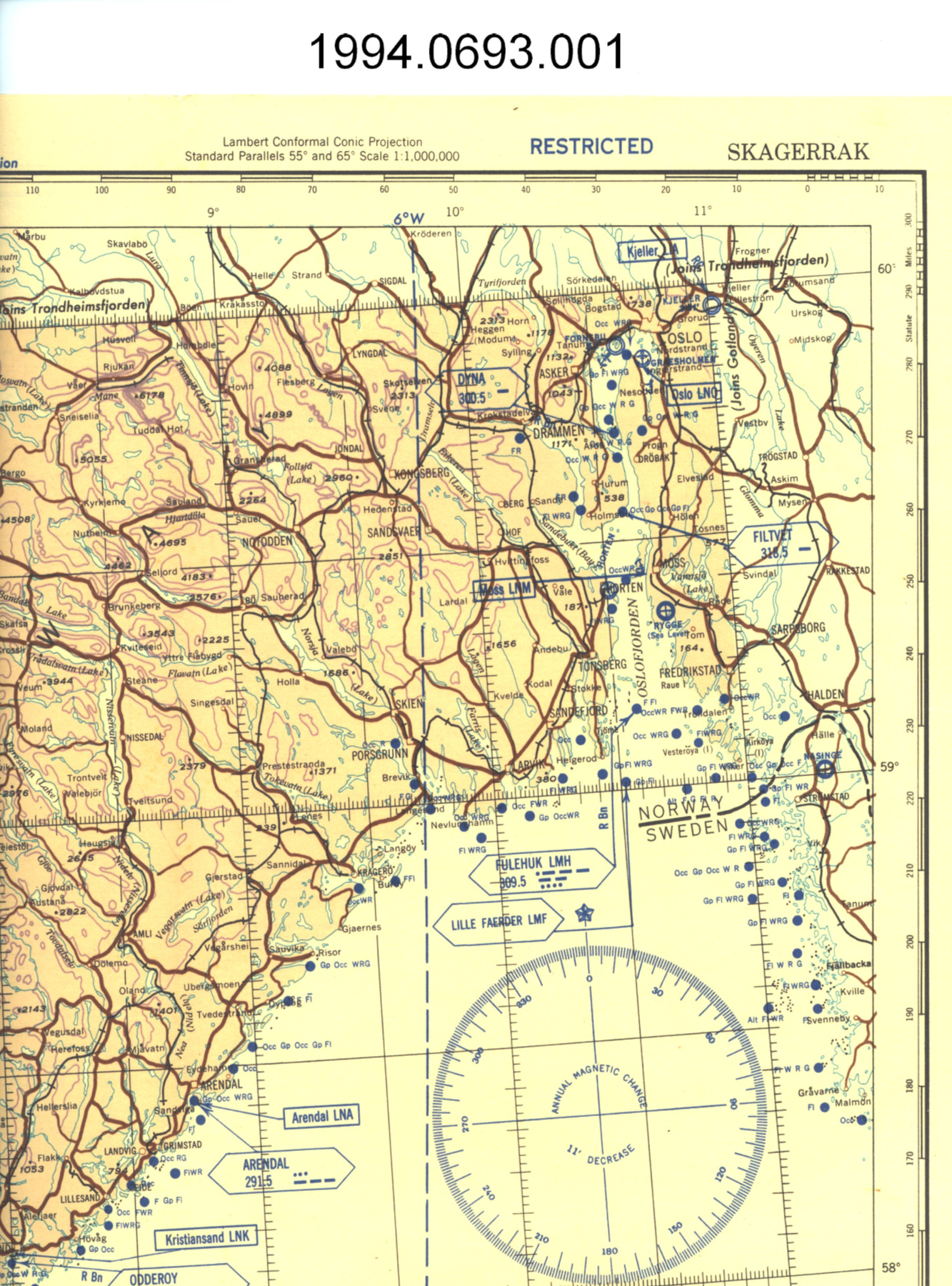
- OBJECT TYPE
- topographical/aeronautical
- DATE
- 1964
- ARTIFACT NUMBER
- 1994.0782.001
- MANUFACTURER
- U.S. Coast & Geodetic Survey
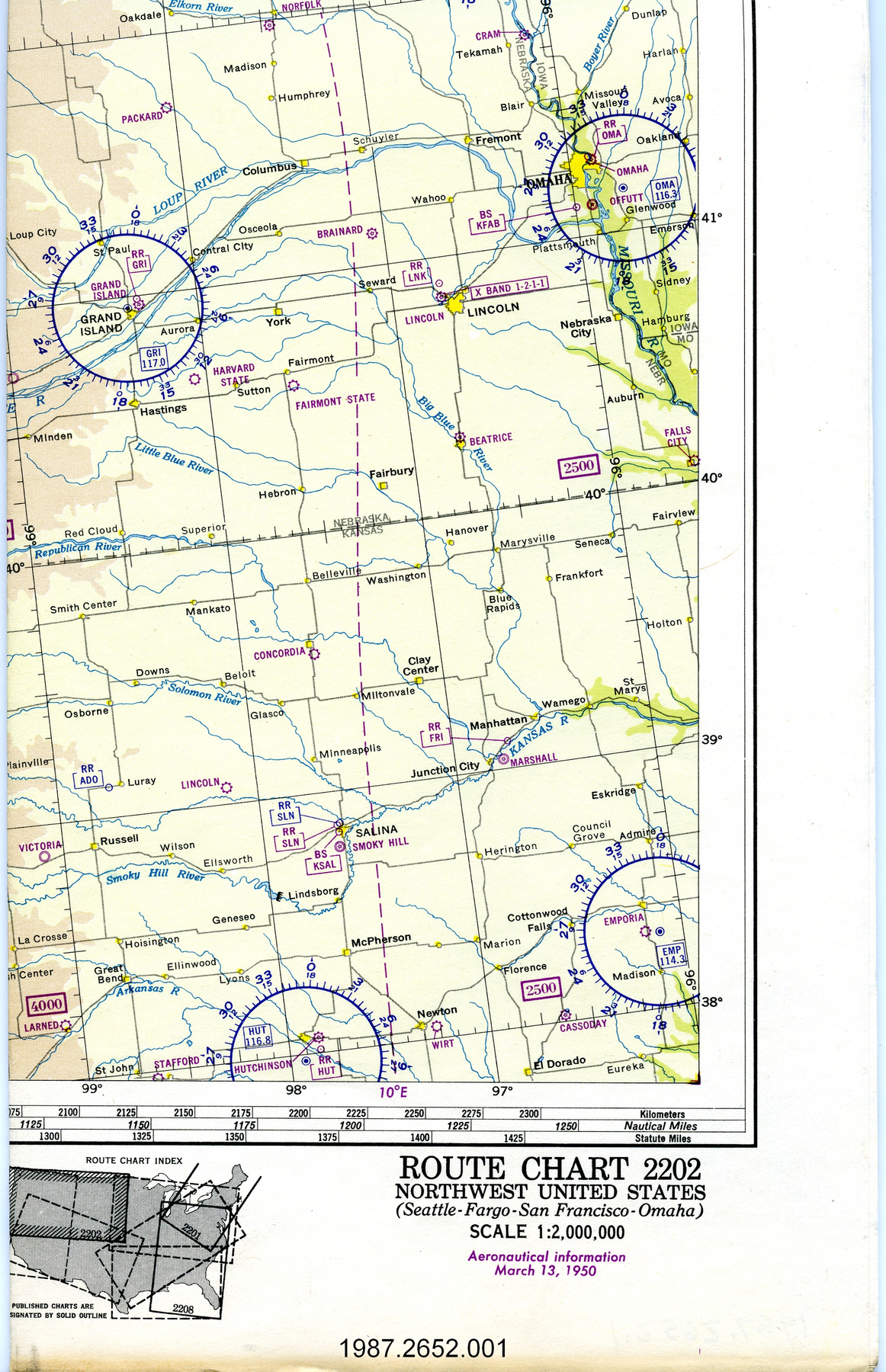
- MODEL
- Kansas River
- LOCATION
- Washington, District of Columbia, United States of America
More Information
General Information
- Serial #
- N/A
- Part Number
- 1
- Total Parts
- 2
- AKA
- N/A
- Patents
- N/A
- General Description
- paper
Dimensions
Note: These reflect the general size for storage and are not necessarily representative of the object's true dimensions.
- Length
- 74.0 cm
- Width
- 56.1 cm
- Height
- N/A
- Thickness
- N/A
- Weight
- N/A
- Diameter
- N/A
- Volume
- N/A
Lexicon
- Group
- Aviation
- Category
- Navigation instruments & equipment
- Sub-Category
- N/A
Manufacturer
- AKA
- Survey US
- Country
- United States of America
- State/Province
- District of Columbia
- City
- Washington
Context
- Country
- United States of America
- State/Province
- Unknown
- Period
- Cold War/ this map is a revised 34th edition published in November 1964 of an original first published in Feb. 1945
- Canada
-
Unknown - Function
-
two dimensional graphic representation of a section of the earth's surface/used for aerial navigation - Technical
-
Unknown - Area Notes
-
Unknown
Details
- Markings
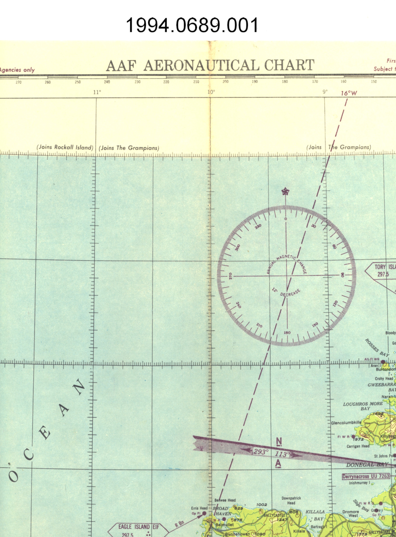
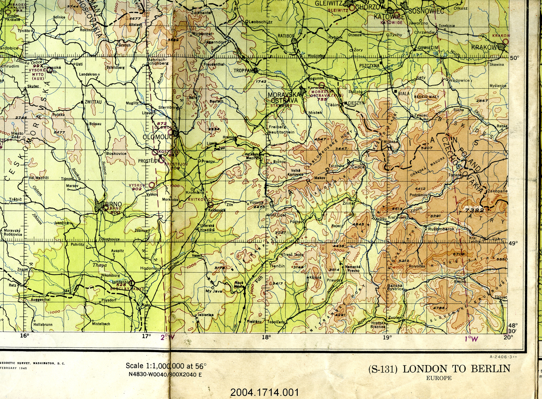
- lettering printed on border above map reads: "(360) KANSAS RIVER/ELEVATIONS IN FEET/WORLD AERONAUTICAL CHART/Compiled to ICAO Standards/for ICAO number add 2000 to the chart number./Lambert Conformal Conic Projection/Standard Parallels 33 [degrees] and 45 [degrees] Scale 1:1,000,000/(360)"; lettering printed on border below map reads: "(360)/PRICE 25 CENTS/Principal Sources: U.S. Geological Survey, U.S. Air Force,/U.S. Army Corps of Engineers, U.S. Dept. of Agriculture,/Federal Aviation Agency, and Coast and Geodetic Survey./Compiled and printed at Washington, D.C. by/U.S. DEPARTMENT OF COMMERCE/COAST AND GEODETIC SURVEY/FEBRUARY 1945 Revised NOVEMBER 1964 BASE NO 5R2/[logo]/NOTICE TO USERS OF THIS CHART/You are urgently requested to inform us of corrections and additions that come to your/attention while using this chart. When practicable, such information should be indicated/clearly and accurately on the chart (a replacement copy will be returned), Mail to:/THE DIRECTOR, U.S. COAST AND GEODETIC SURVEY, WASHINGTON, D.C. 20230./SCALE 1:1,000,000/34TH EDITION Aeronautical information on this chart/includes data received through October 27, 1964/Consult appropriate NOTAMS and Flight Information Publications for supplemental data and current information./This chart will become OBSELETE FOR USE IN NAVIGATION upon publication of the next edition in approximately/one year. Check Dates if Katest Editions for Aeronautical Charts published in Airman's Guide for current editions./KANSAS RIVER (360)/UNITED STATES"
- Missing
- N/A
- Finish
- colour map on white background
- Decoration
- U.S. Dept. of Commerce logo on border centre below map
CITE THIS OBJECT
If you choose to share our information about this collection object, please cite:
U.S. Coast & Geodetic Survey, Map, 1964, Artifact no. 1994.0782, Ingenium – Canada’s Museums of Science and Innovation, http://collection.ingeniumcanada.org/en/item/1994.0782.001/
FEEDBACK
Submit a question or comment about this artifact.
More Like This

1994.0782.001