Carte
Utiliser cette image
Puis-je réutiliser cette image sans autorisation? Oui
Les images sur le portail de la collection d’Ingenium ont la licence Creative Commons suivante :
Copyright Ingenium / CC BY-NC-ND (Attribution-NonCommercial 4.0 International (CC BY-NC 4.0)
ATTRIBUER CETTE IMAGE
Ingenium,
2009.0134.001
Permalien:
Ingenium diffuse cette image sous le cadre de licence Creative Commons et encourage son téléchargement et sa réutilisation à des fins non commerciales. Veuillez mentionner Ingenium et citer le numéro de l’artefact.
TÉLÉCHARGER L’IMAGEACHETER CETTE IMAGE
Cette image peut être utilisée gratuitement pour des fins non commerciales.
Pour un usage commercial, veuillez consulter nos frais de reproduction et communiquer avec nous pour acheter l’image.
- TYPE D’OBJET
- weather/machine plotted/hand analysed
- DATE
- 1980
- NUMÉRO DE L’ARTEFACT
- 2009.0134.001
- FABRICANT
- EC Atmospheric Environment Service
- MODÈLE
- Ontario Weather Centre
- EMPLACEMENT
- Canada
Plus d’information
Renseignements généraux
- Nº de série
- S/O
- Nº de partie
- 1
- Nombre total de parties
- 4
- Ou
- S/O
- Brevets
- S/O
- Description générale
- Paper
Dimensions
Remarque : Cette information reflète la taille générale pour l’entreposage et ne représente pas nécessairement les véritables dimensions de l’objet.
- Longueur
- 60,5 cm
- Largeur
- 47,3 cm
- Hauteur
- S/O
- Épaisseur
- S/O
- Poids
- S/O
- Diamètre
- S/O
- Volume
- S/O
Lexique
- Groupe
- Météorologie
- Catégorie
- Archives
- Sous-catégorie
- S/O
Fabricant
- Ou
- Environment CA
- Pays
- Canada
- État/province
- Inconnu
- Ville
- Inconnu
Contexte
- Pays
- Canada
- État/province
- Inconnu
- Période
- 1980
- Canada
-
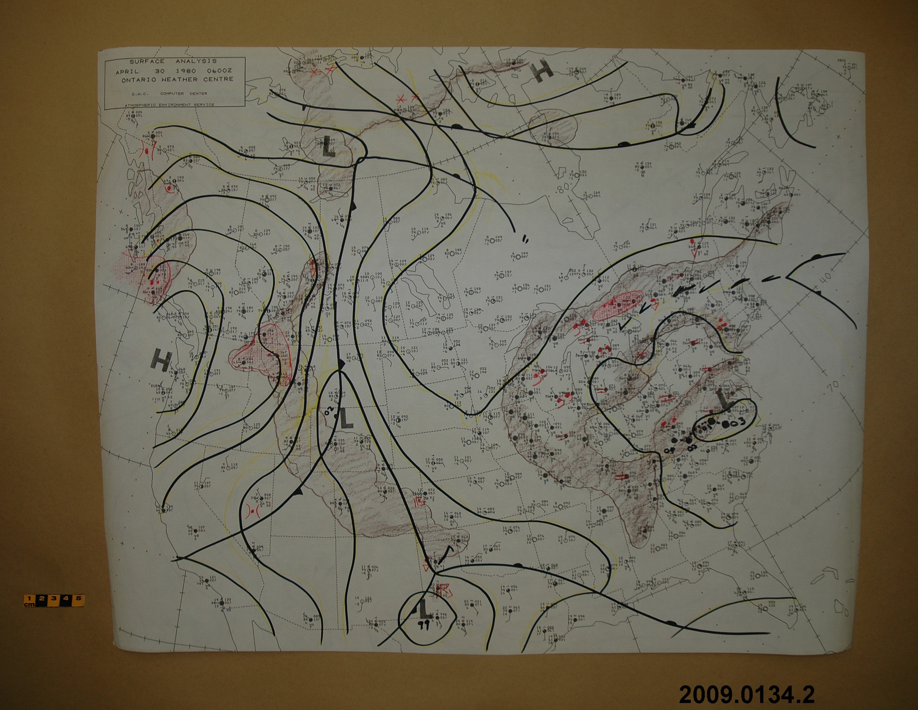
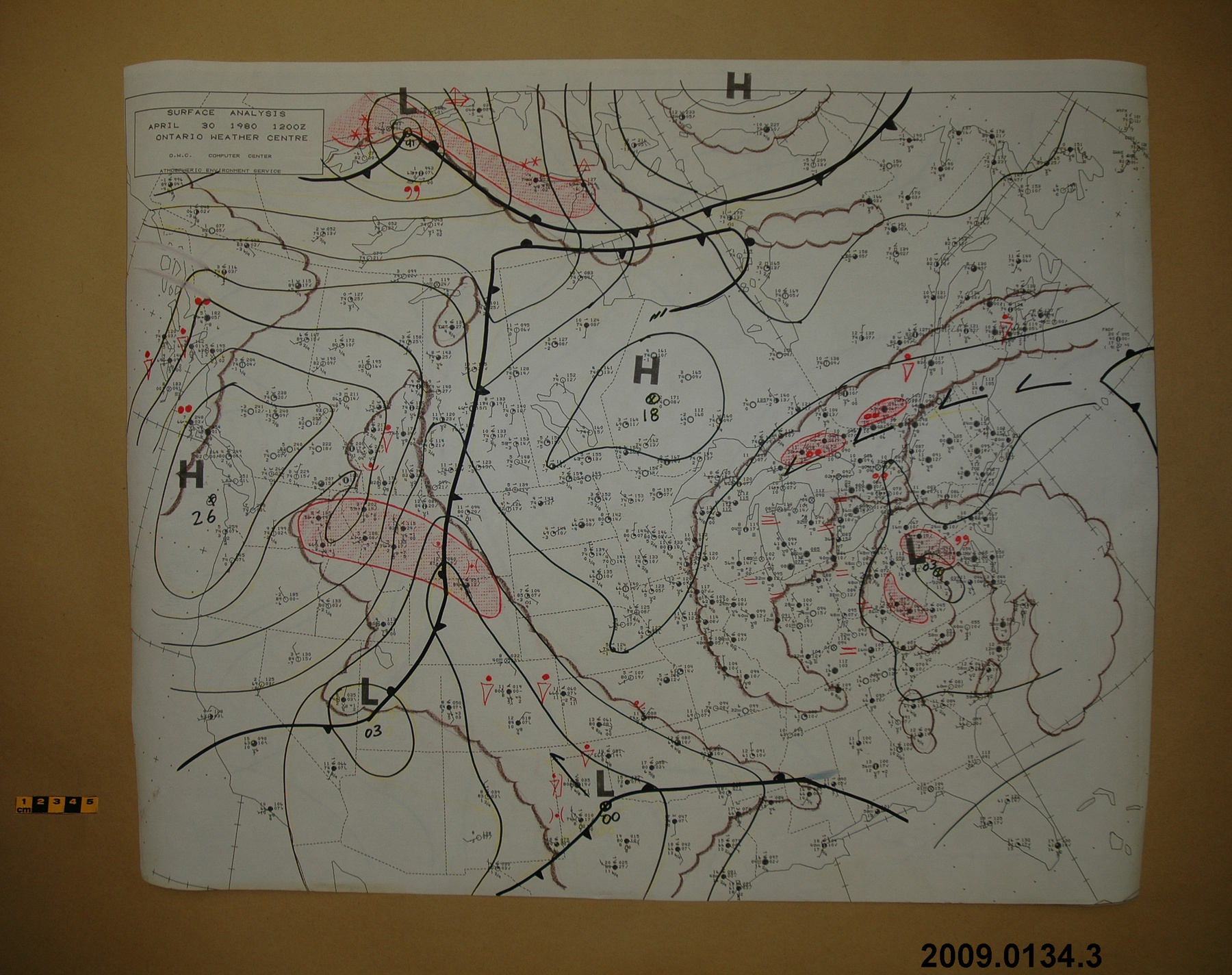
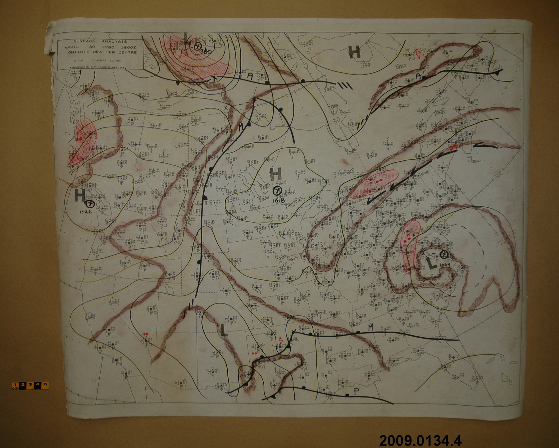
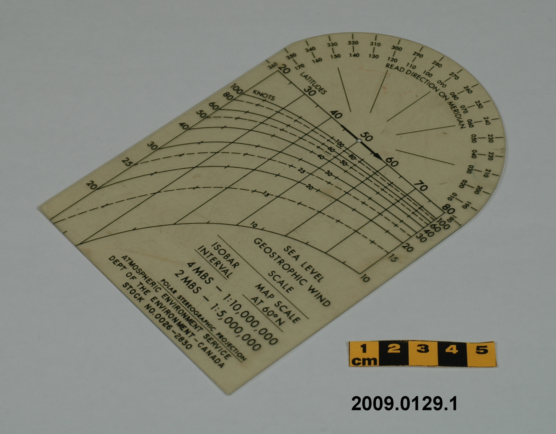
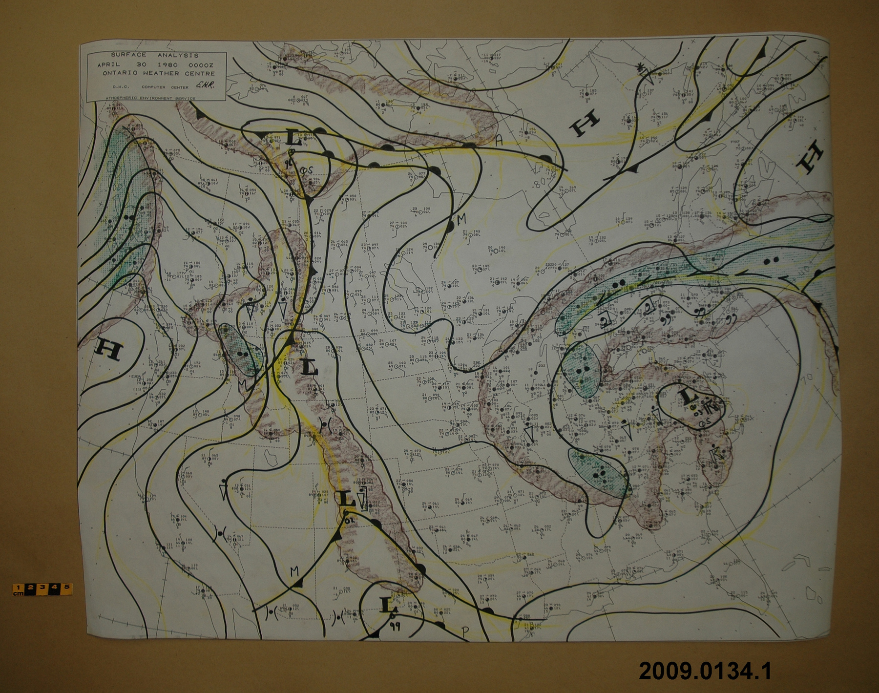
An example of a weather map used at the Ontario Weather Centre. An item from a large collection of meteorological instruments used by the Meteorological Service of Canada (previously Atmospheric Environment Service) and acquired by the CSTM since 1967. MSC is the government agency responsible for collecting and disseminating meteorological data and forecasts in Canada. It was founded in 1871 in Toronto where it is still headquartered. The MSC was originally on the University of Toronto downtown campus but moved to Downsview in 1971 on land owned by UofT. The headquarters houses laboratories, research facilities and calibration and instrument maintenance facilities (now largely contracted out). - Fonction
-
A hand-coloured map showing observations made of surface weather conditions in Canada. - Technique
-
Since weather is three dimensional, there are both surface and upper-air weather maps. This map shows observations for surface weather. Surface weather maps are plotted on a constant altitude surface so that air-pressure readings taken at stations at different elevations can be compared. Often, meteorologists shows air-pressure readings at sea level. The maps show low and high pressure centres through isobars. They also show fronts and weather observing station information, such as temperature, dewpoint temperature, wind speed, and direction on wind barbs and air pressure. See also wind scale 2009.0129. Machine plotted maps replaced hand-plotted maps in major forecast centres before the 1980s. Hand analysed maps, like this one, were replaced by machine analysed ones not long after. - Notes sur la région
-
Inconnu
Détails
- Marques
- Black lettering reading 'SURFACE ANALYSIS/ APRIL 30 1980 0000Z/ ONTARIO WEATHER CENTRE/ O.W.C. COMPUTER CENTRE/ ATMOSPHERIC ENVIRONMENT SERVICE' with handwritten initials 'E.H.R.'
- Manque
- Appears complete
- Fini
- White with black printed map of Canada and hand inscribed weather notations
- Décoration
- S/O
FAIRE RÉFÉRENCE À CET OBJET
Si vous souhaitez publier de l’information sur cet objet de collection, veuillez indiquer ce qui suit :
EC Atmospheric Environment Service, Carte, 1980, Numéro de l'artefact 2009.0134, Ingenium - Musées des sciences et de l'innovation du Canada, http://collection.ingeniumcanada.org/fr/id/2009.0134.001/
RÉTROACTION
Envoyer une question ou un commentaire sur cet artefact.
Plus comme ceci
