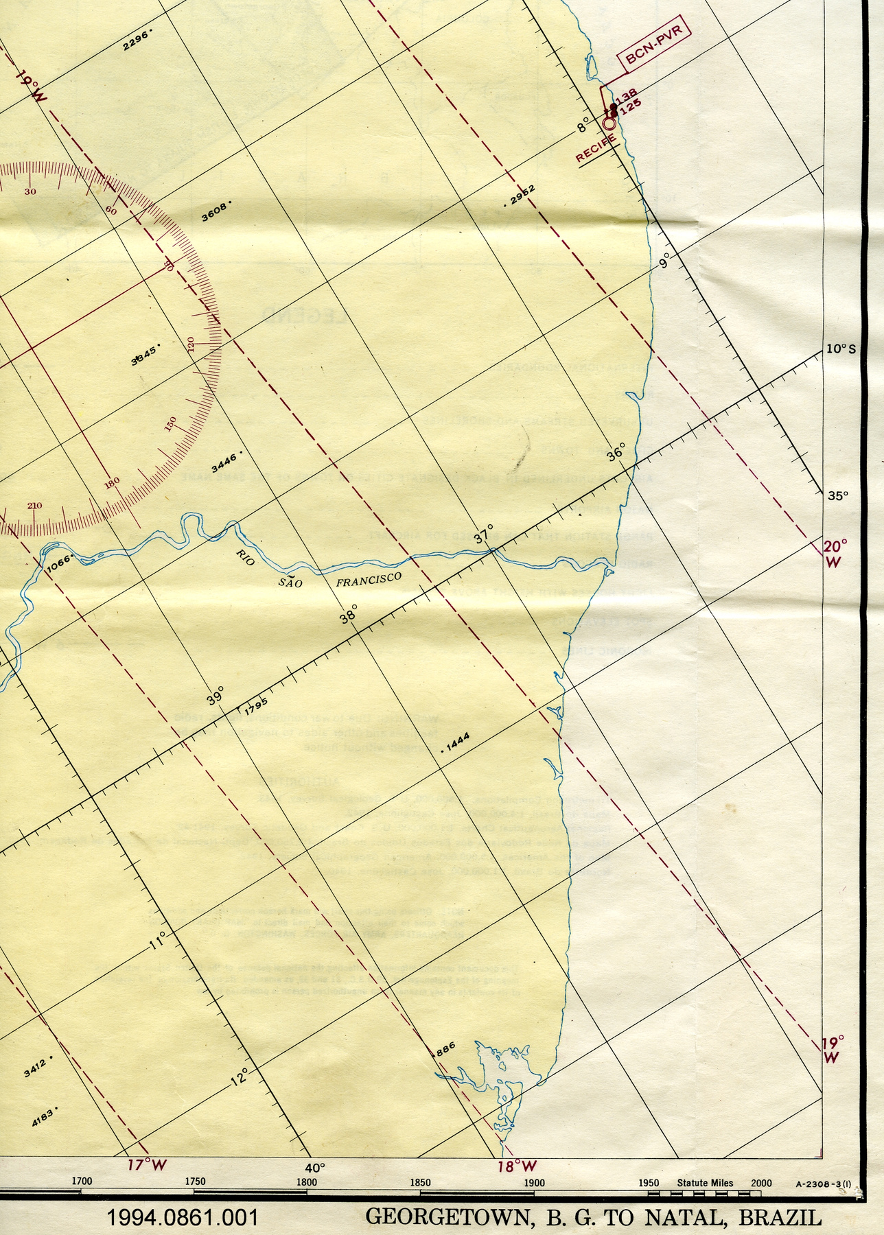
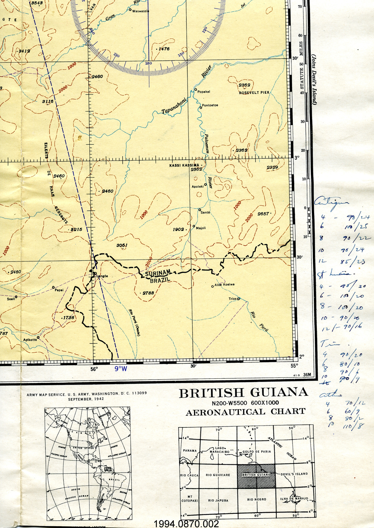
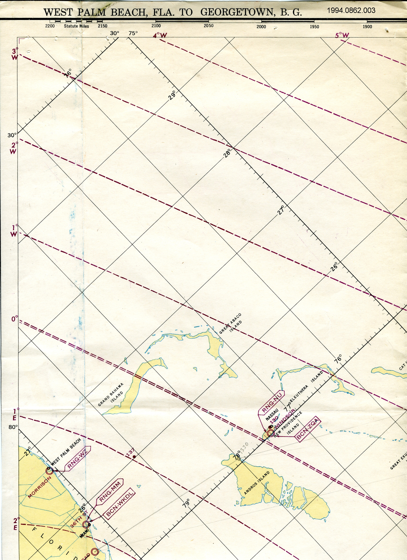
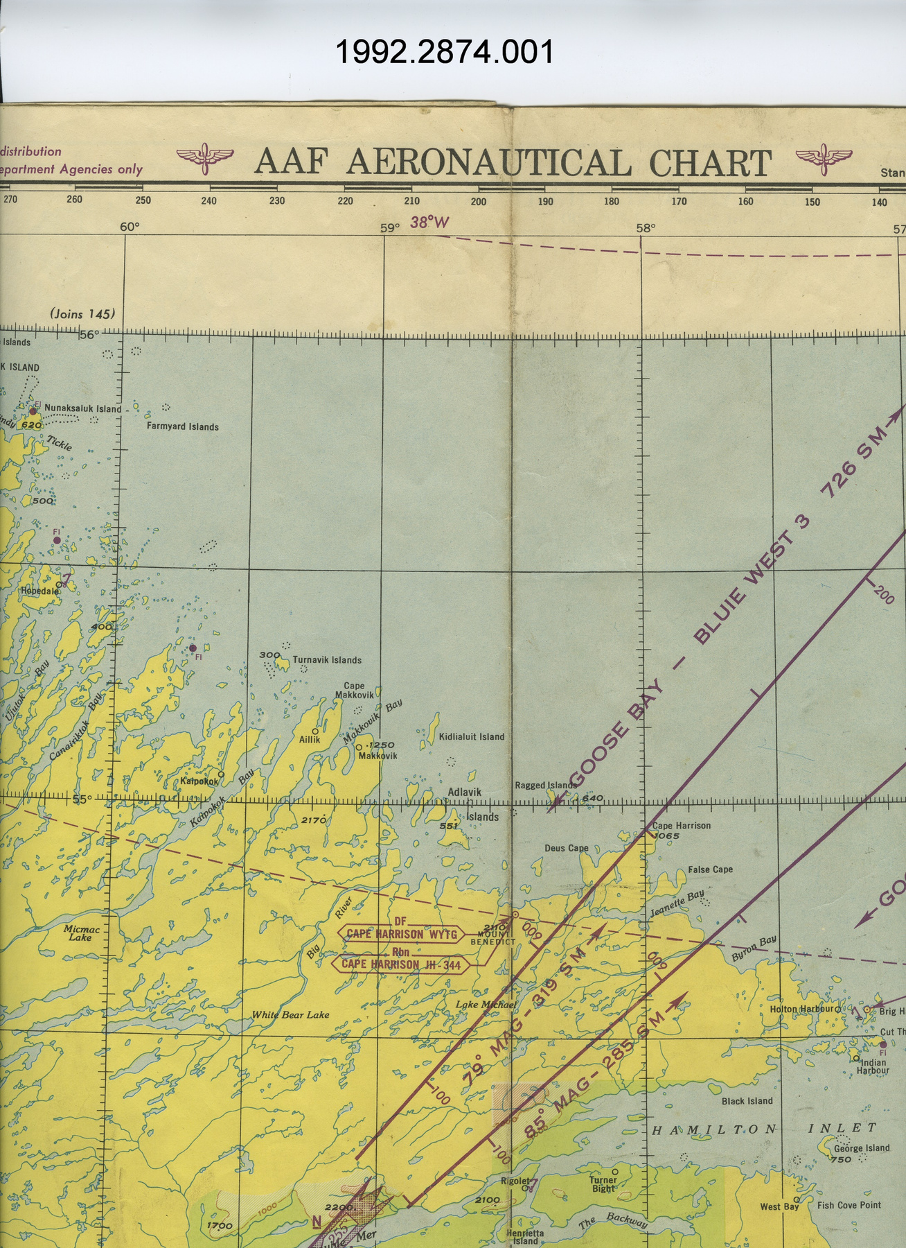
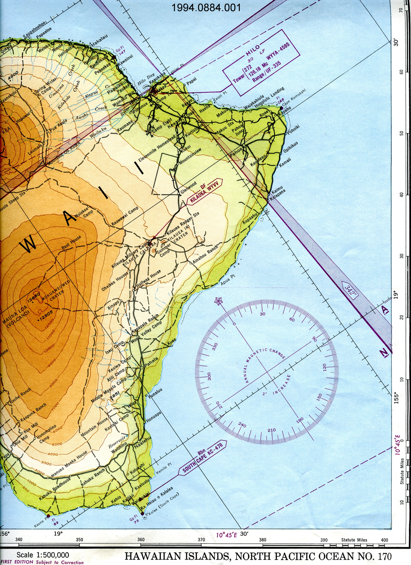
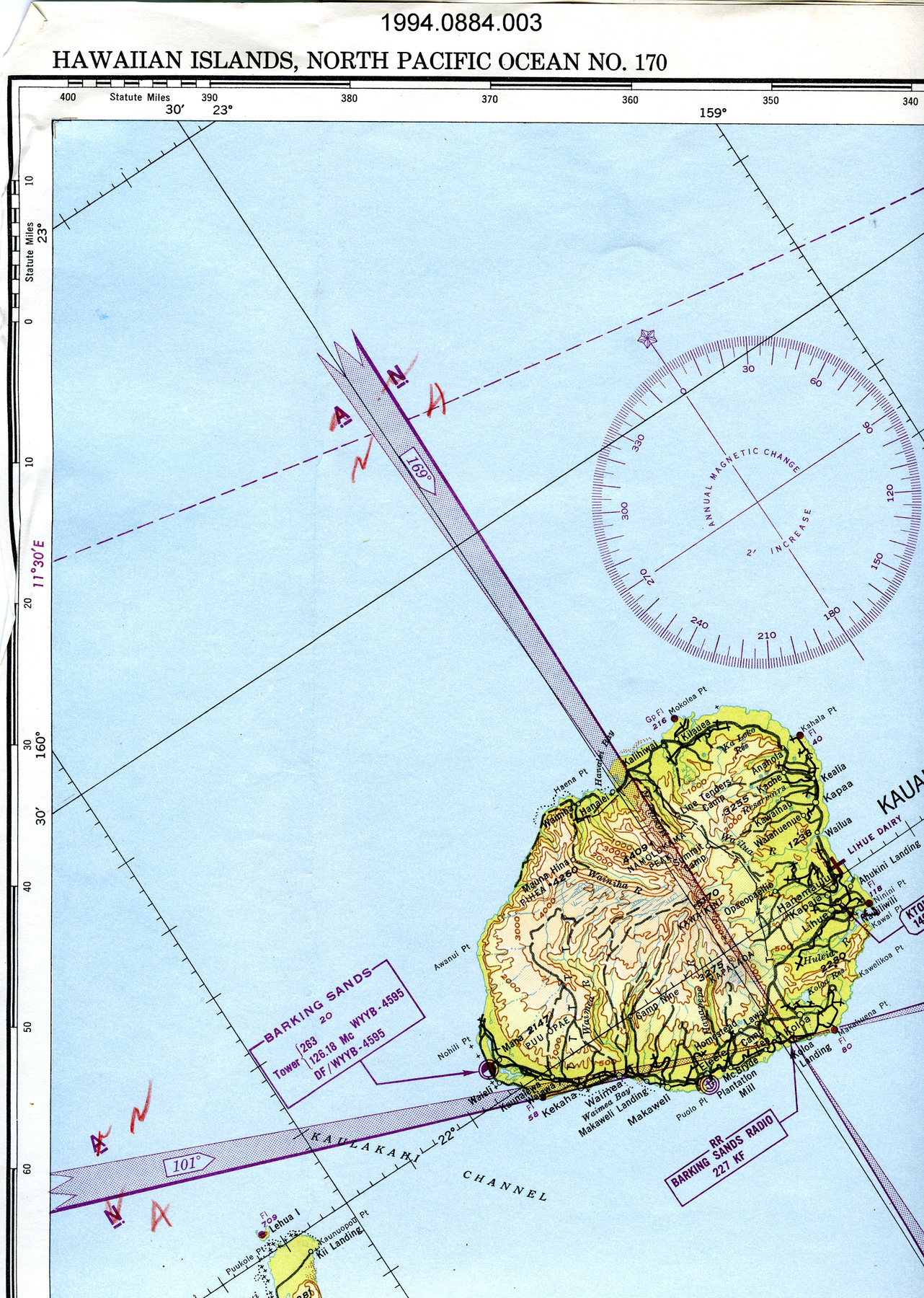
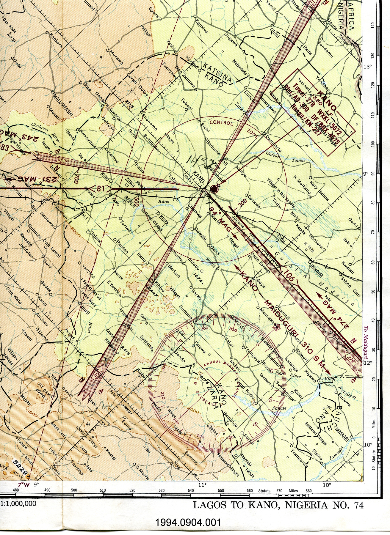
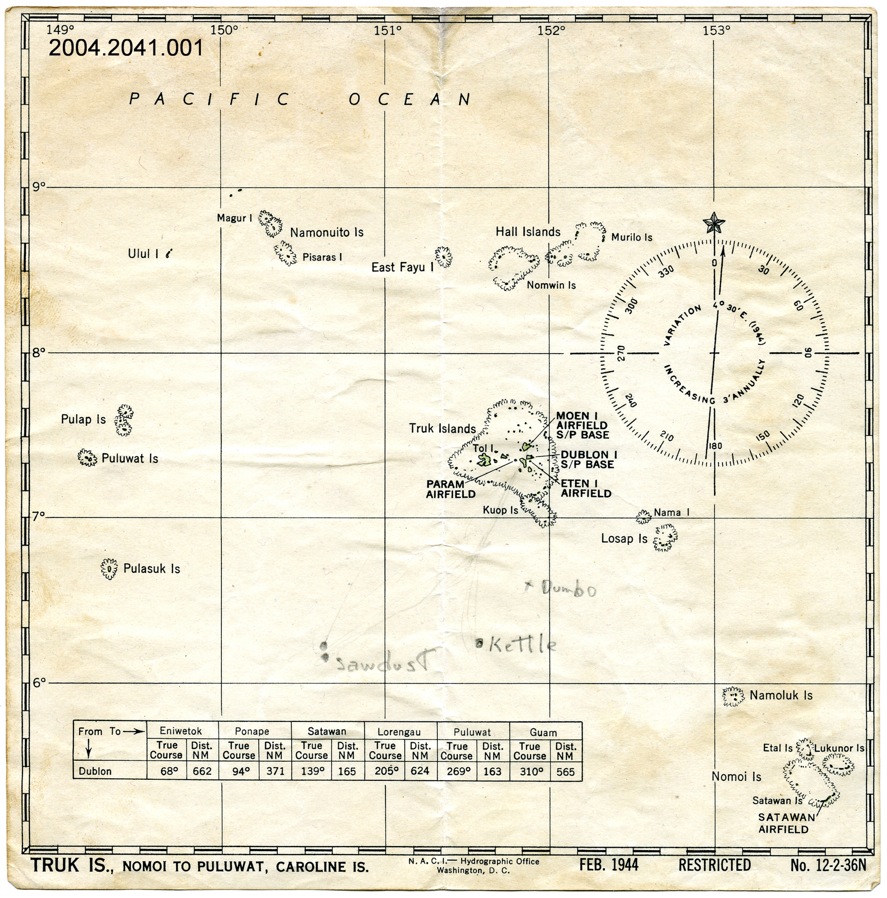
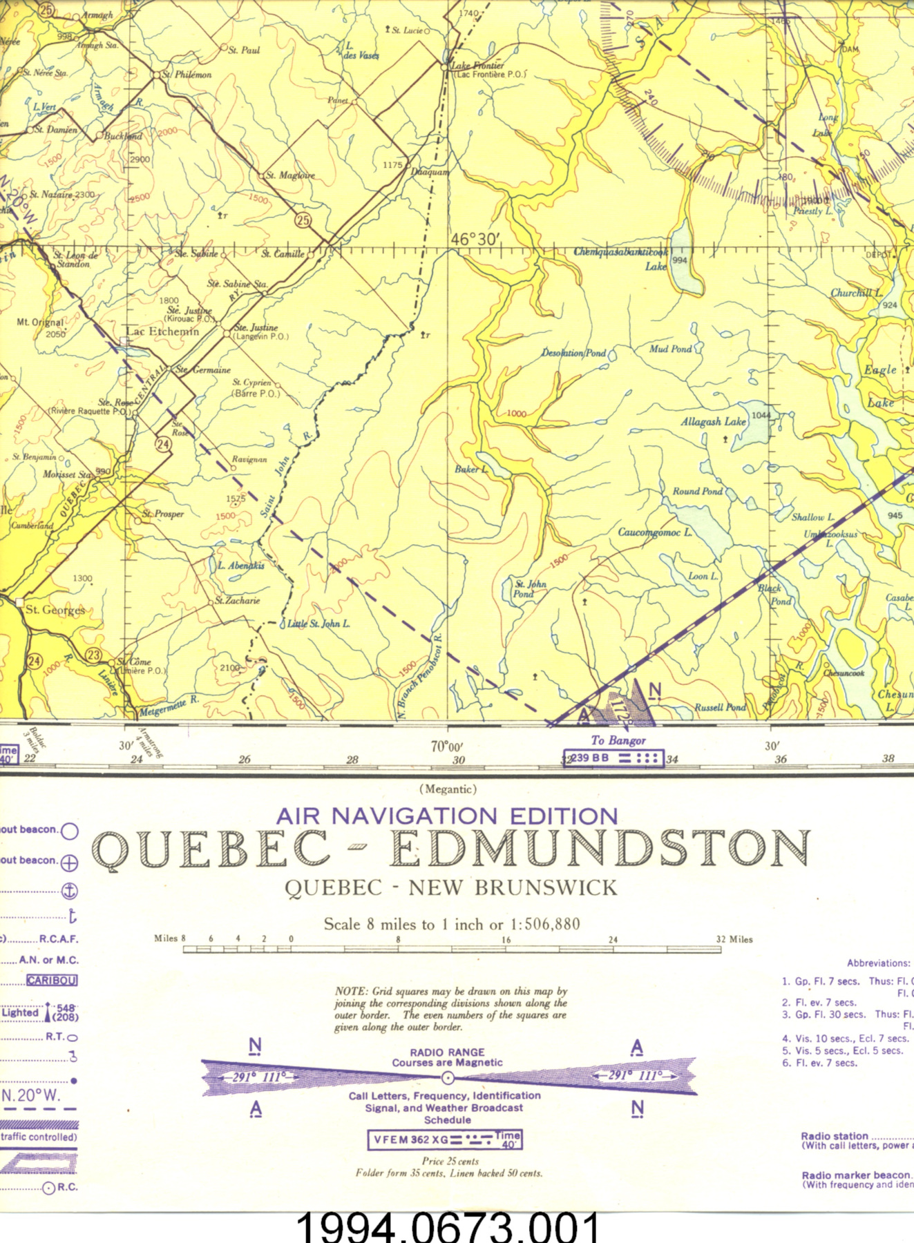
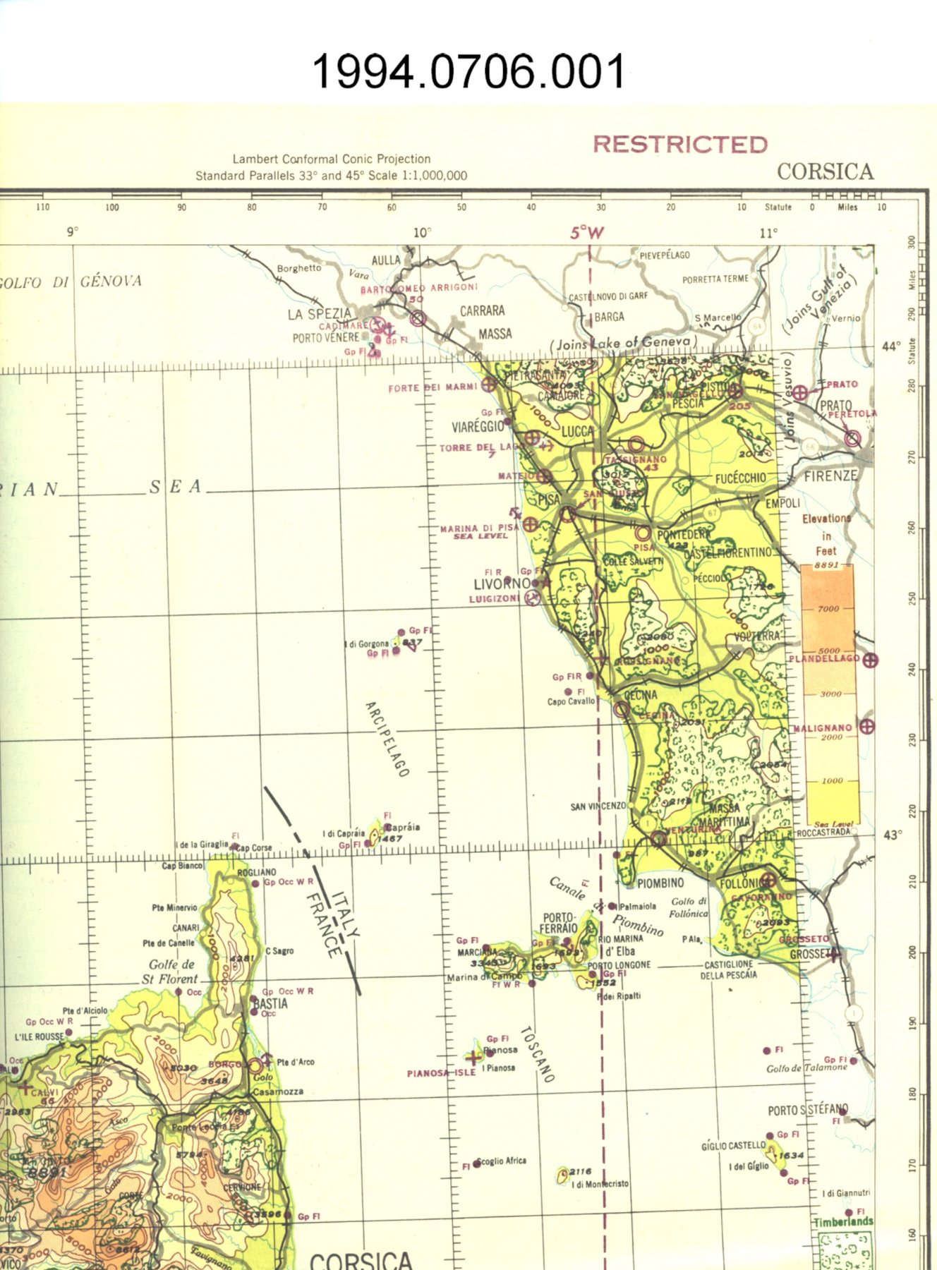
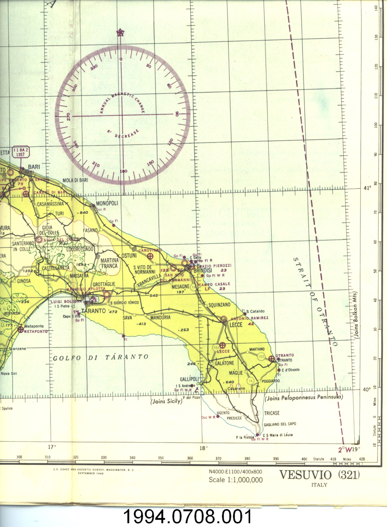
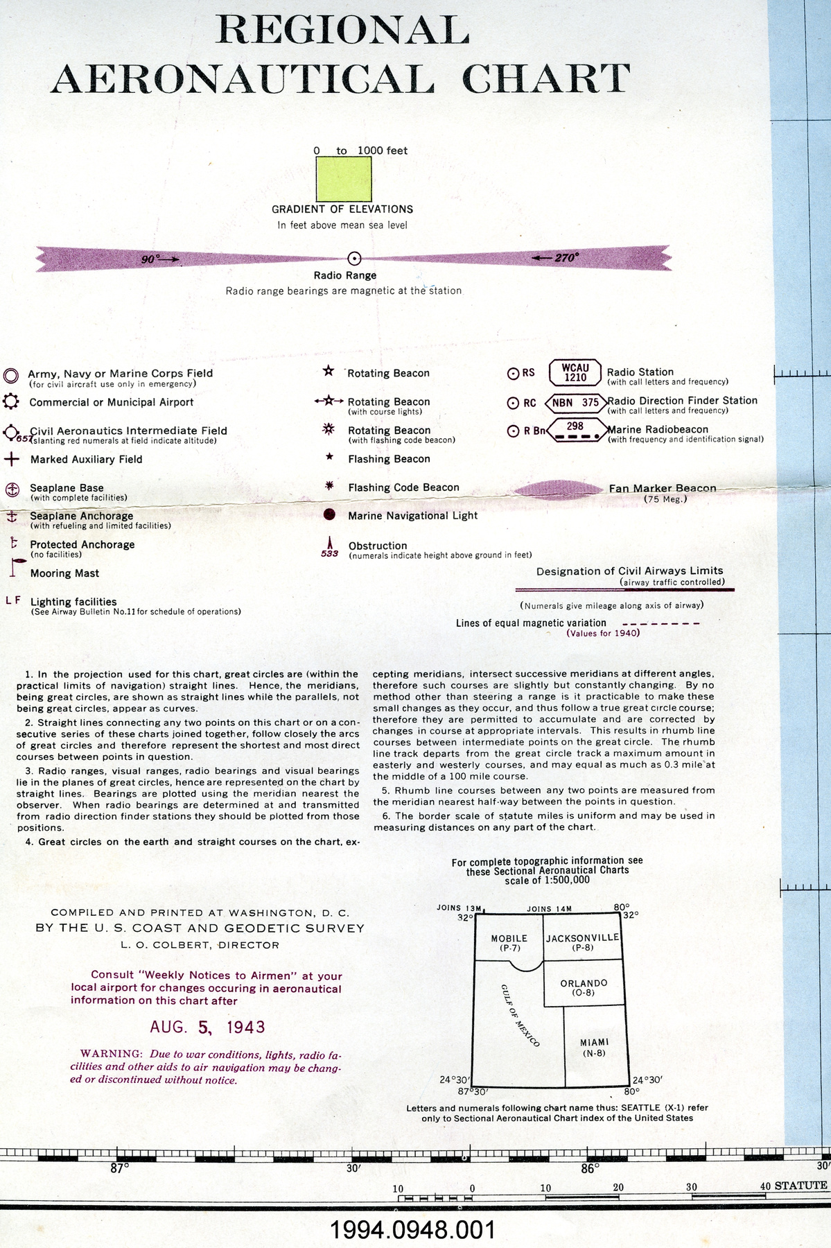
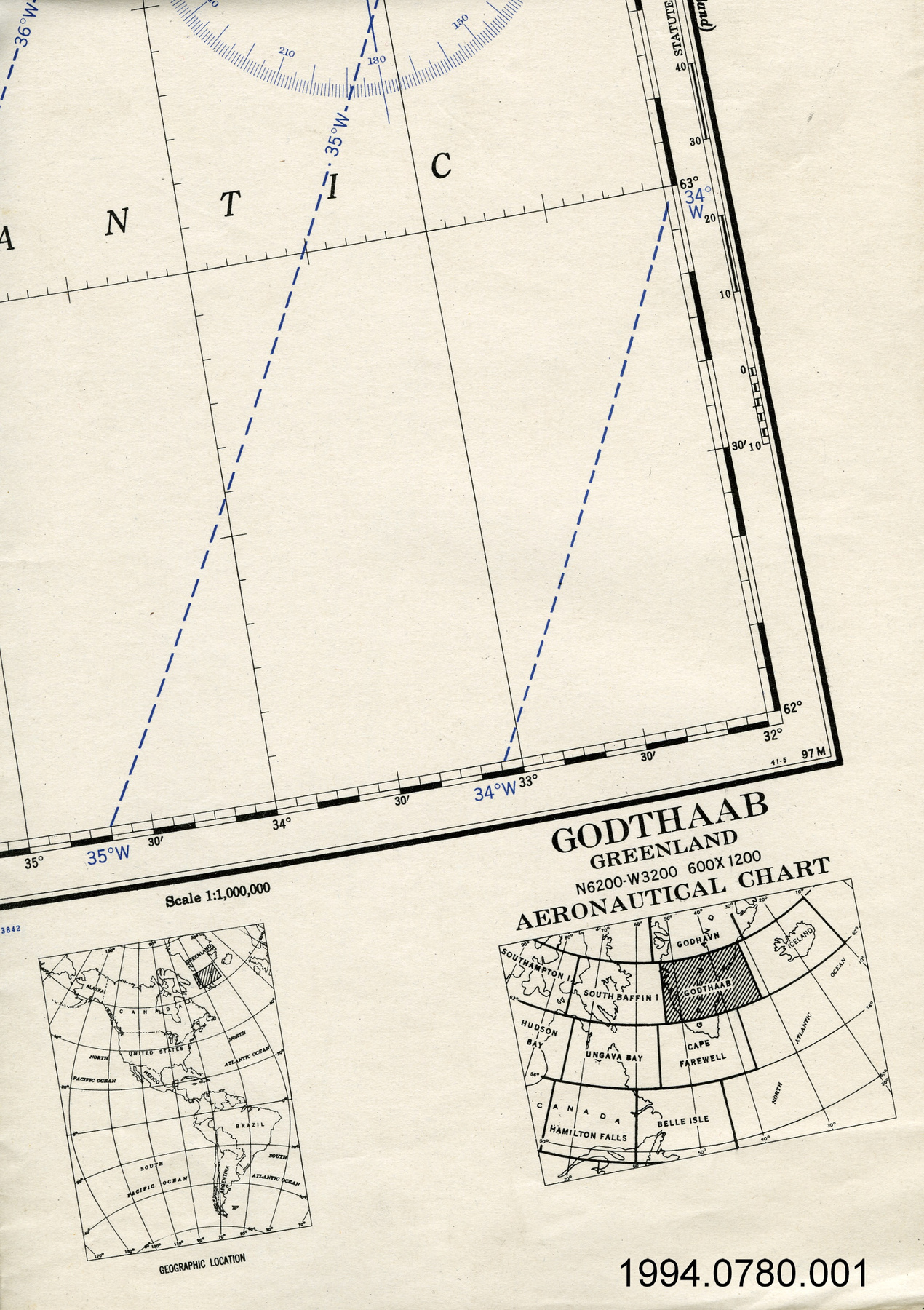
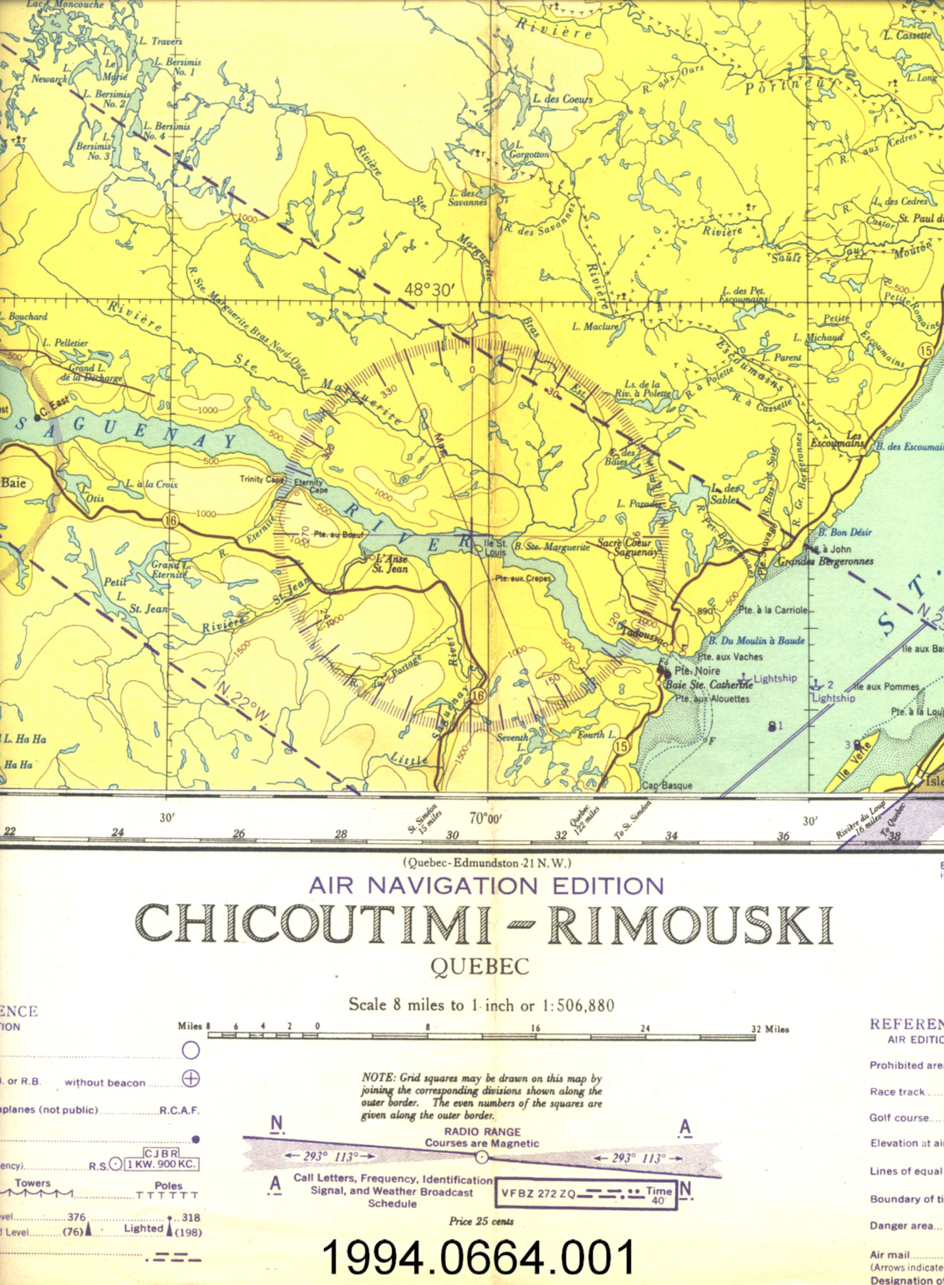
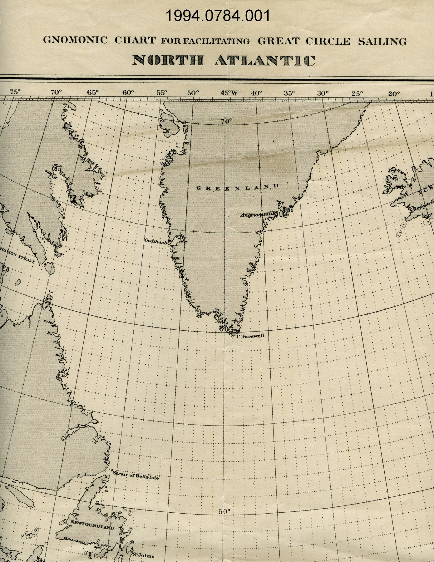
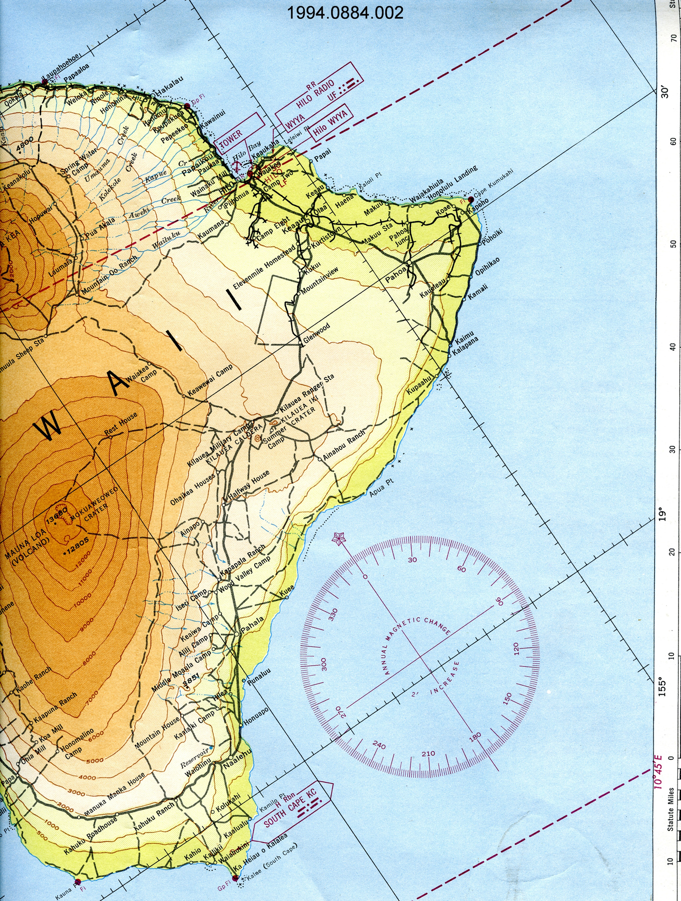
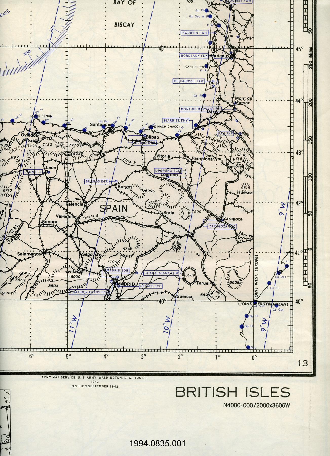
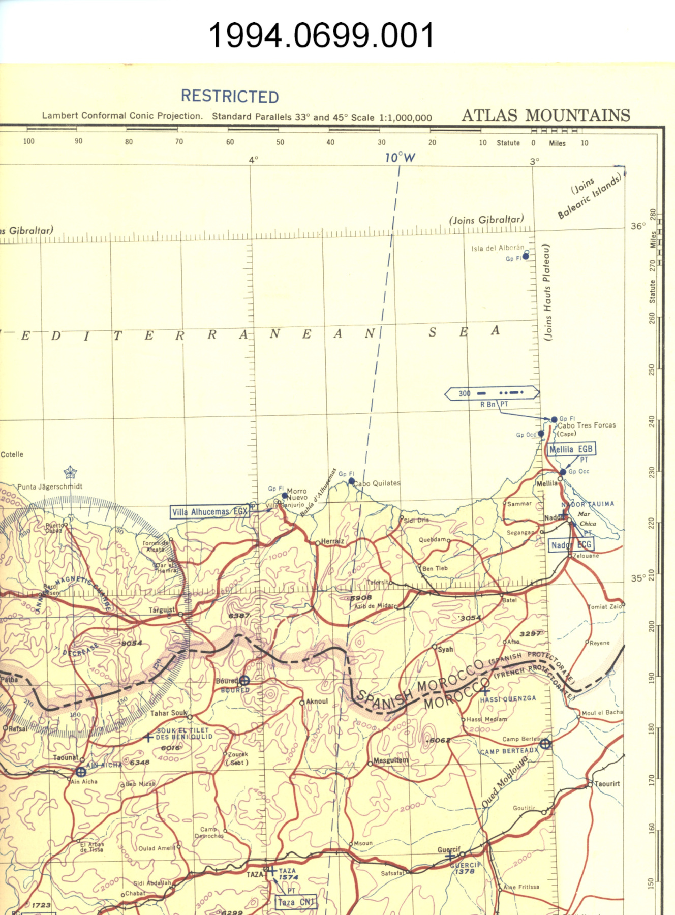
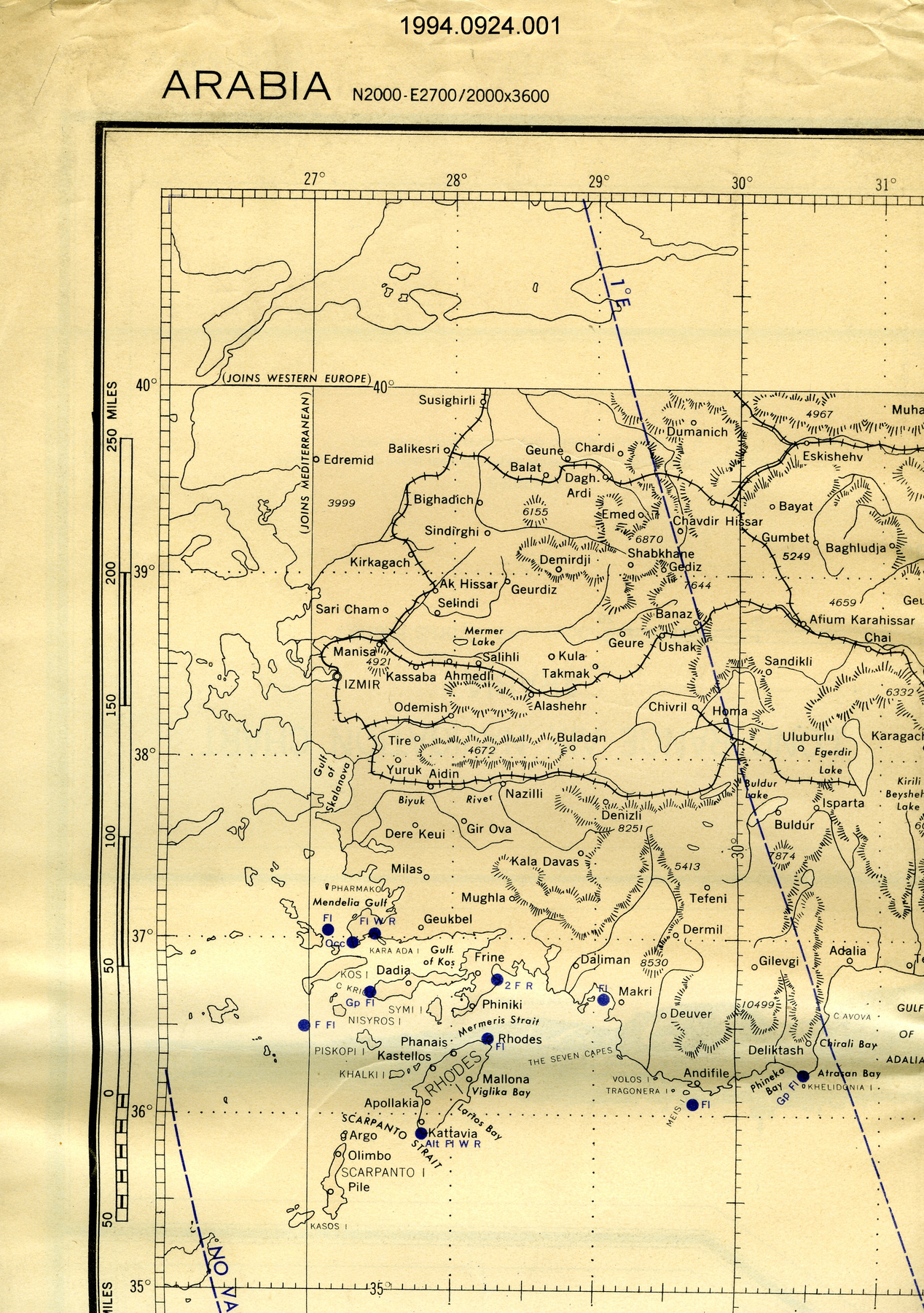
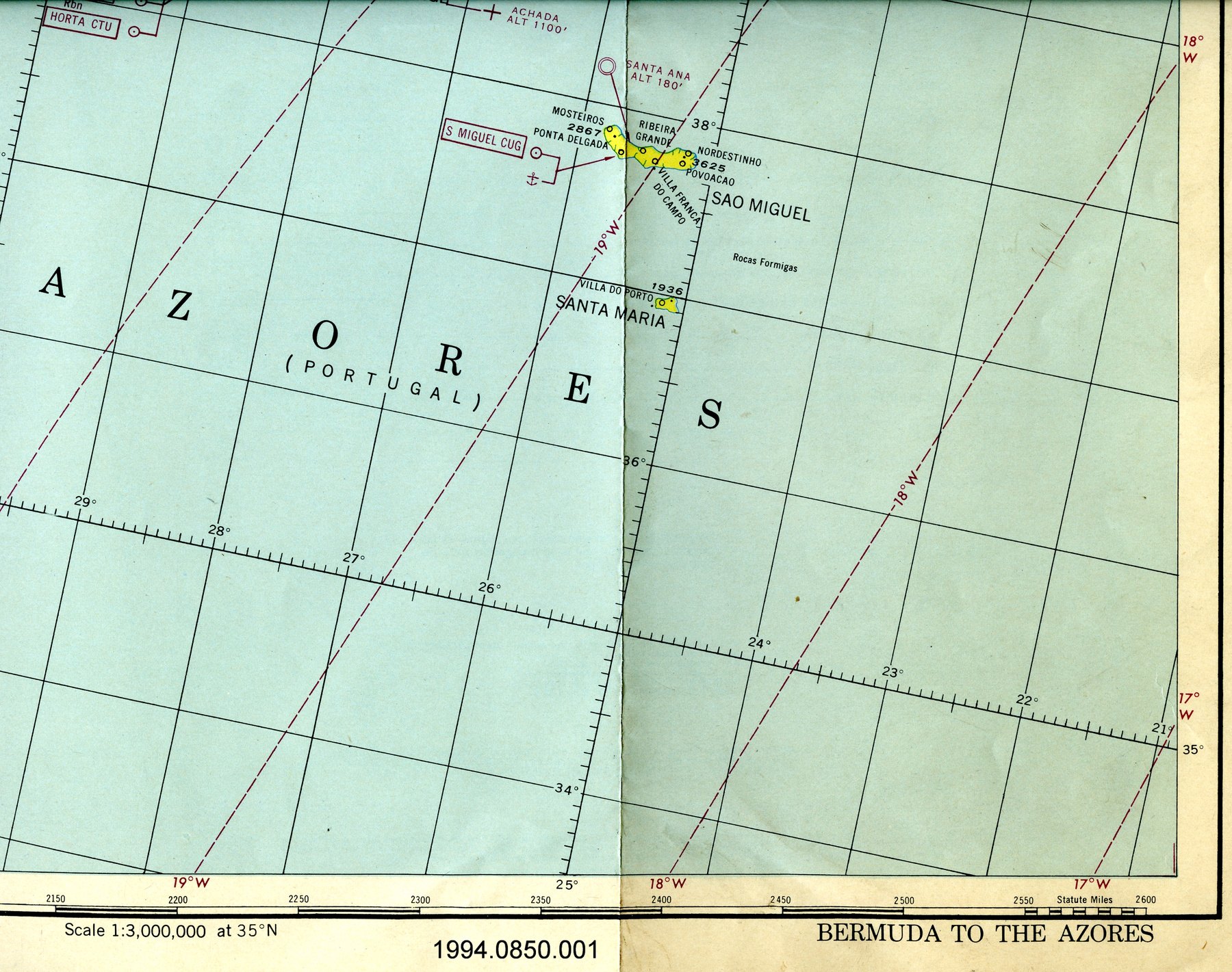
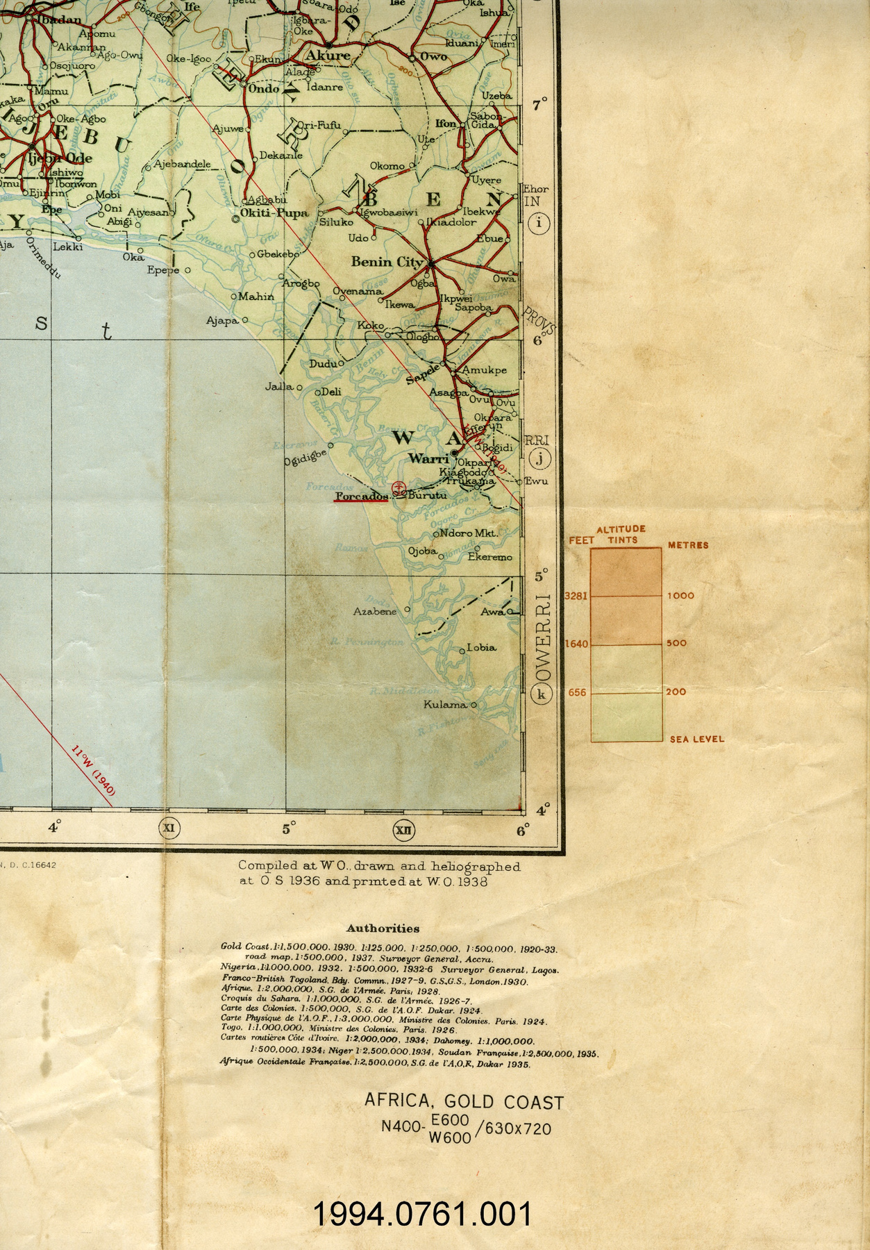
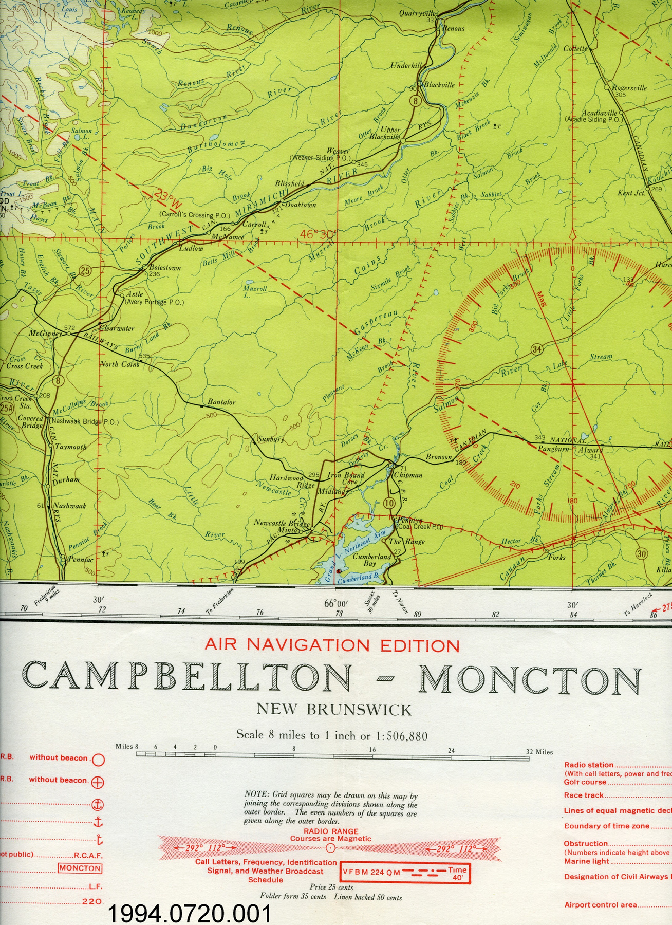
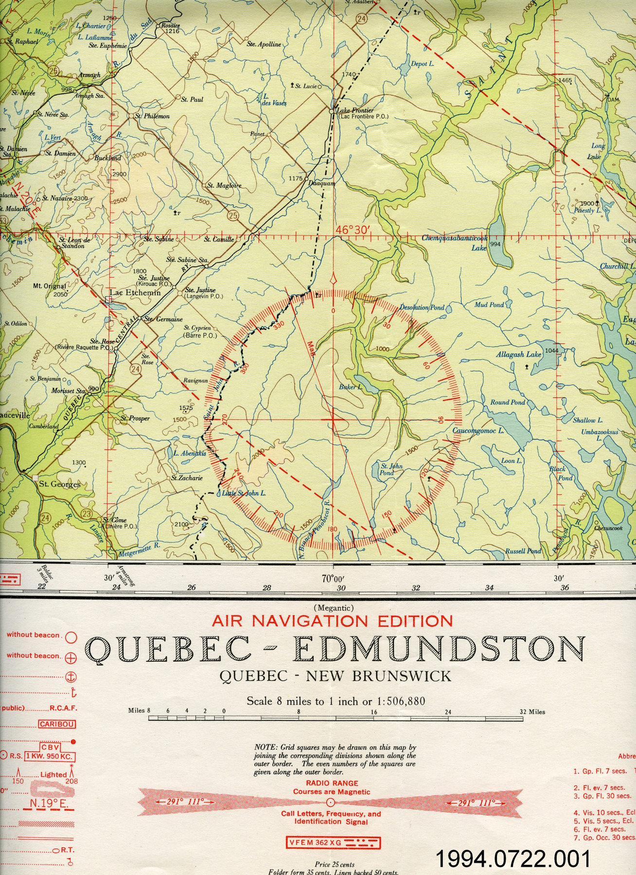
Map
Use this image
Can I reuse this image without permission? Yes
Object images on the Ingenium Collection’s portal have the following Creative Commons license:
Copyright Ingenium / CC BY-NC-ND (Attribution-NonCommercial 4.0 International (CC BY-NC 4.0)
ATTRIBUTE THIS IMAGE
Ingenium,
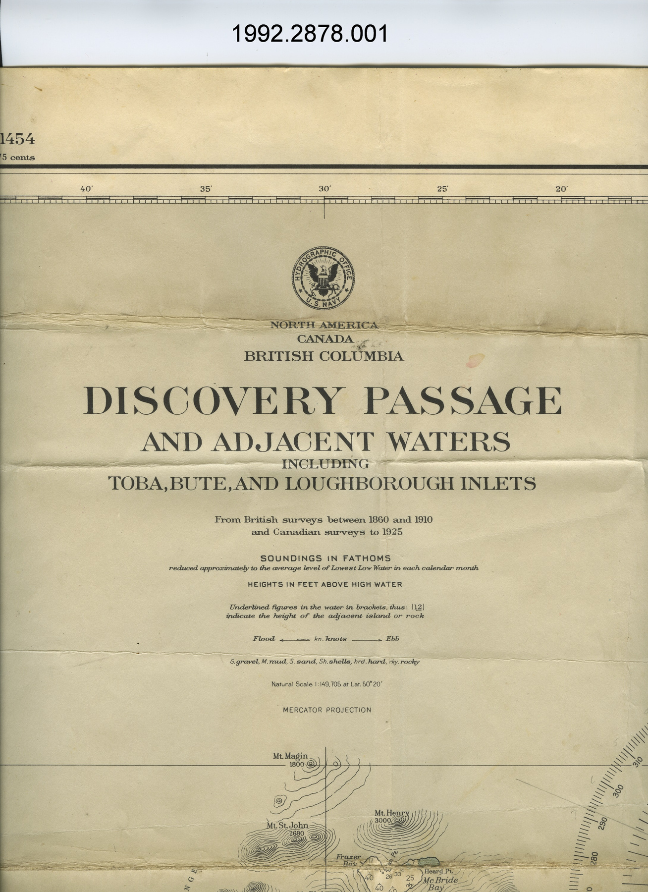
1992.2878.001
Permalink:
Ingenium is releasing this image under the Creative Commons licensing framework, and encourages downloading and reuse for non-commercial purposes. Please acknowledge Ingenium and cite the artifact number.
DOWNLOAD IMAGEPURCHASE THIS IMAGE
This image is free for non-commercial use.
For commercial use, please consult our Reproduction Fees and contact us to purchase the image.
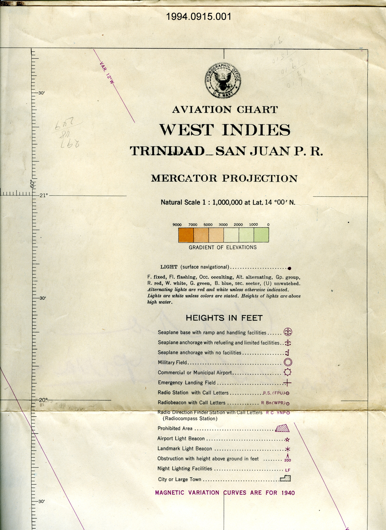
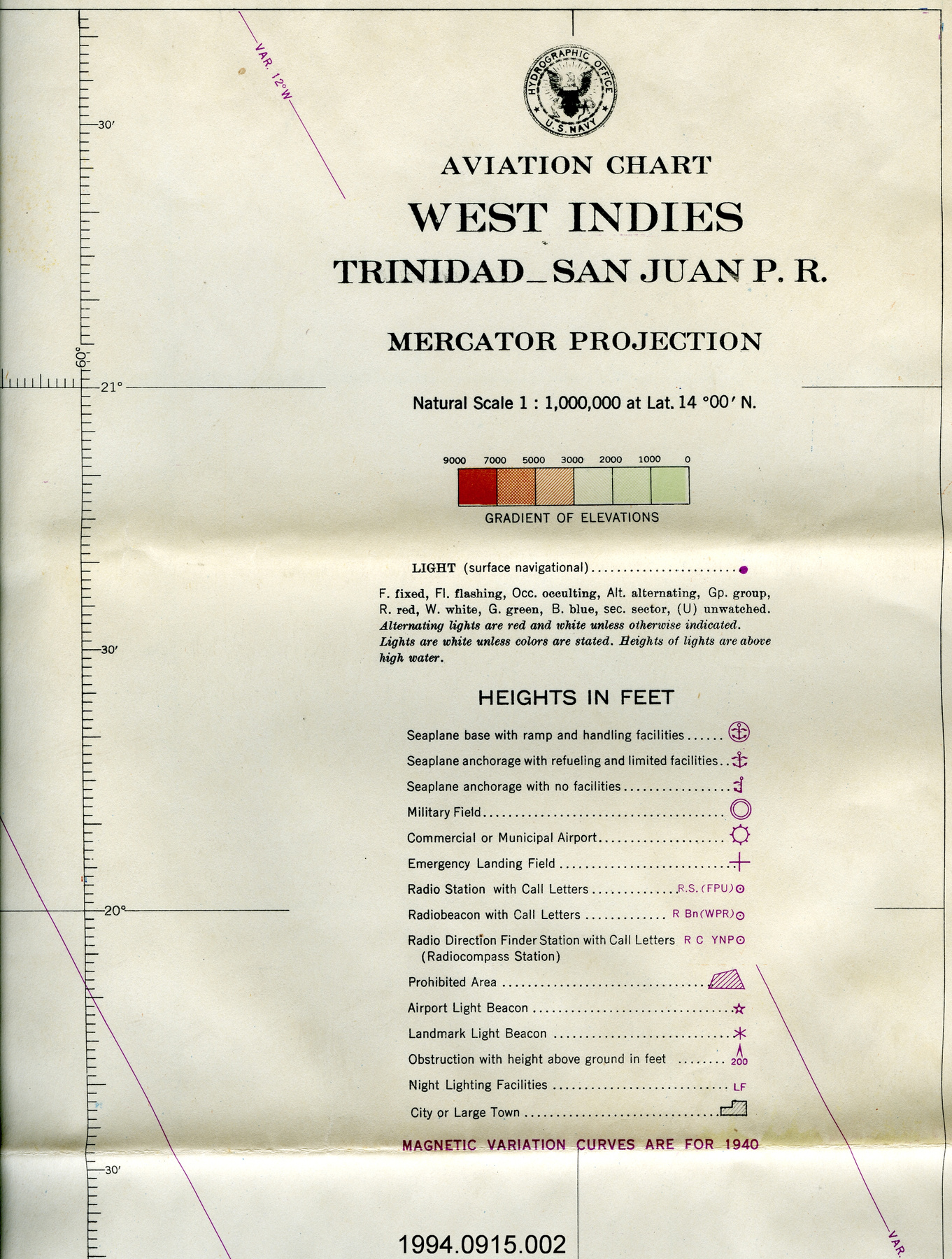
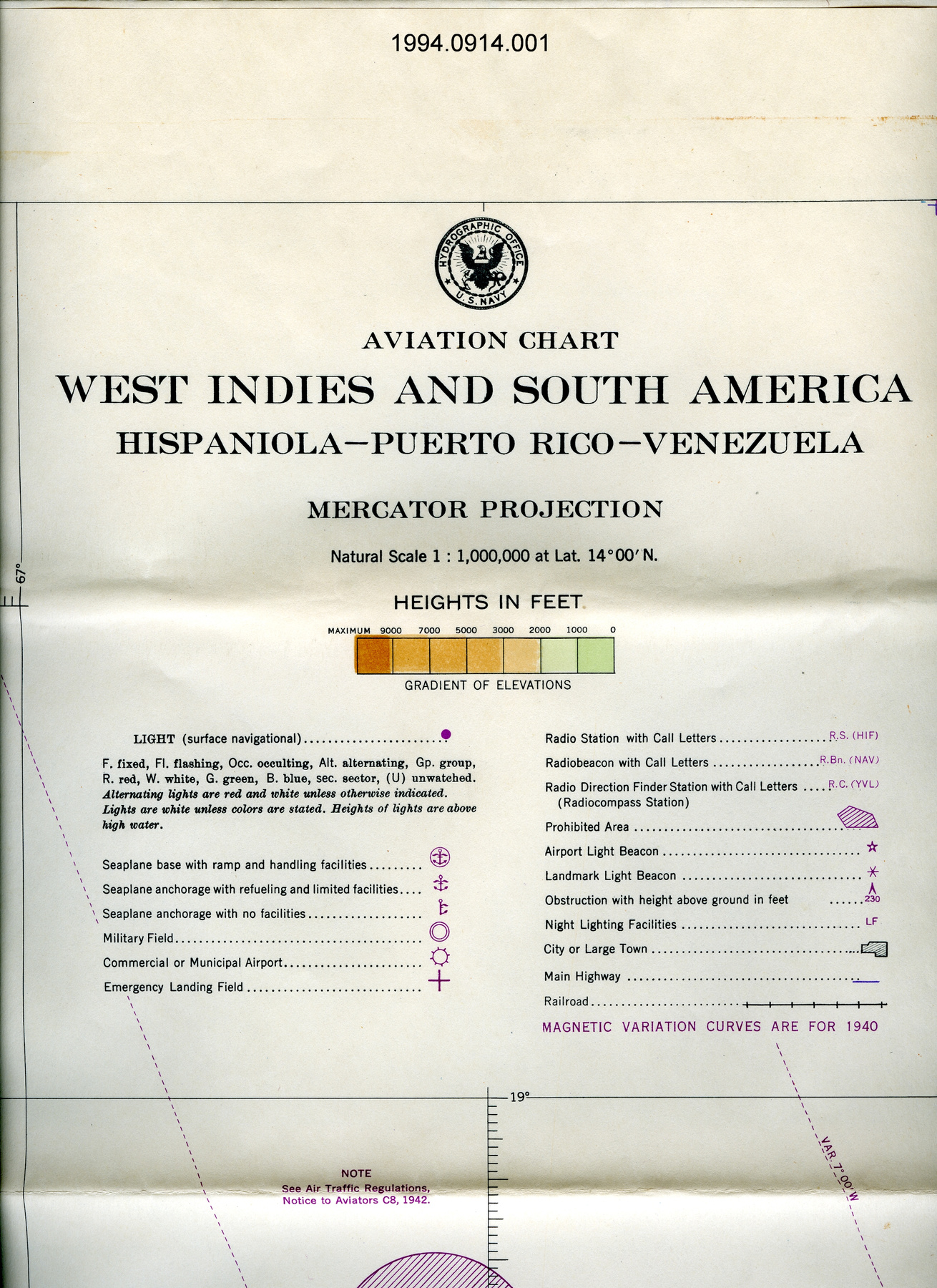
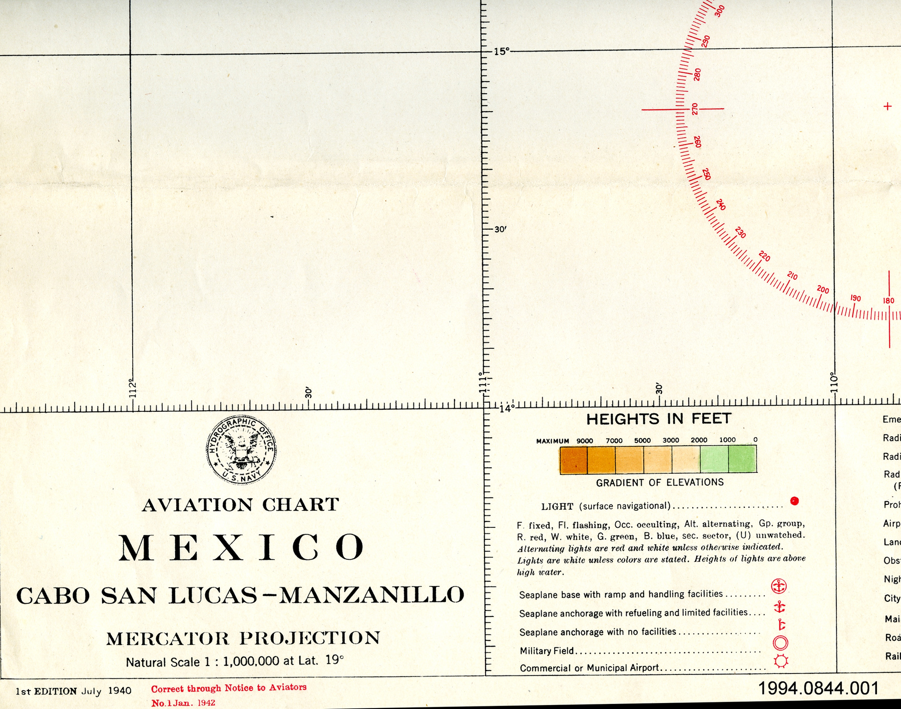
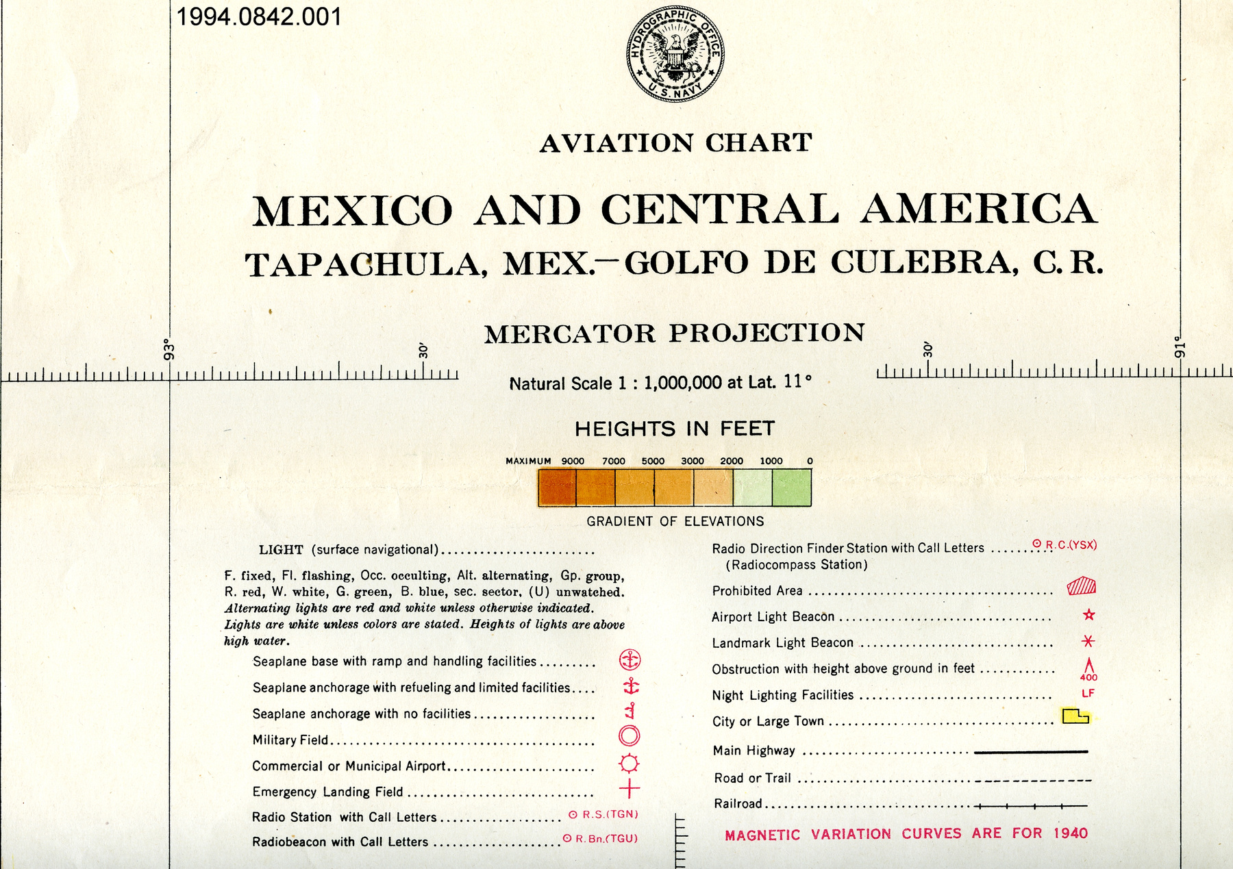
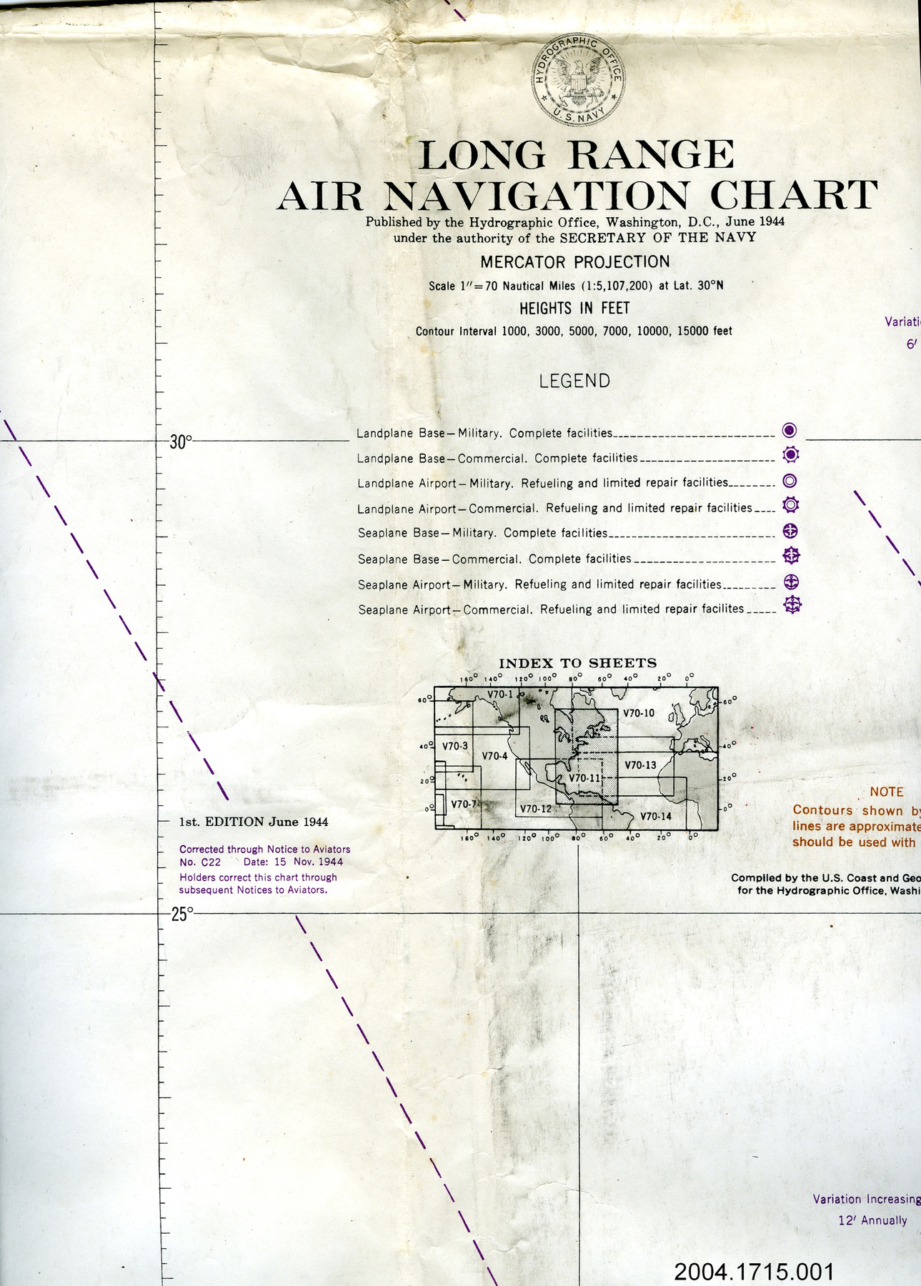
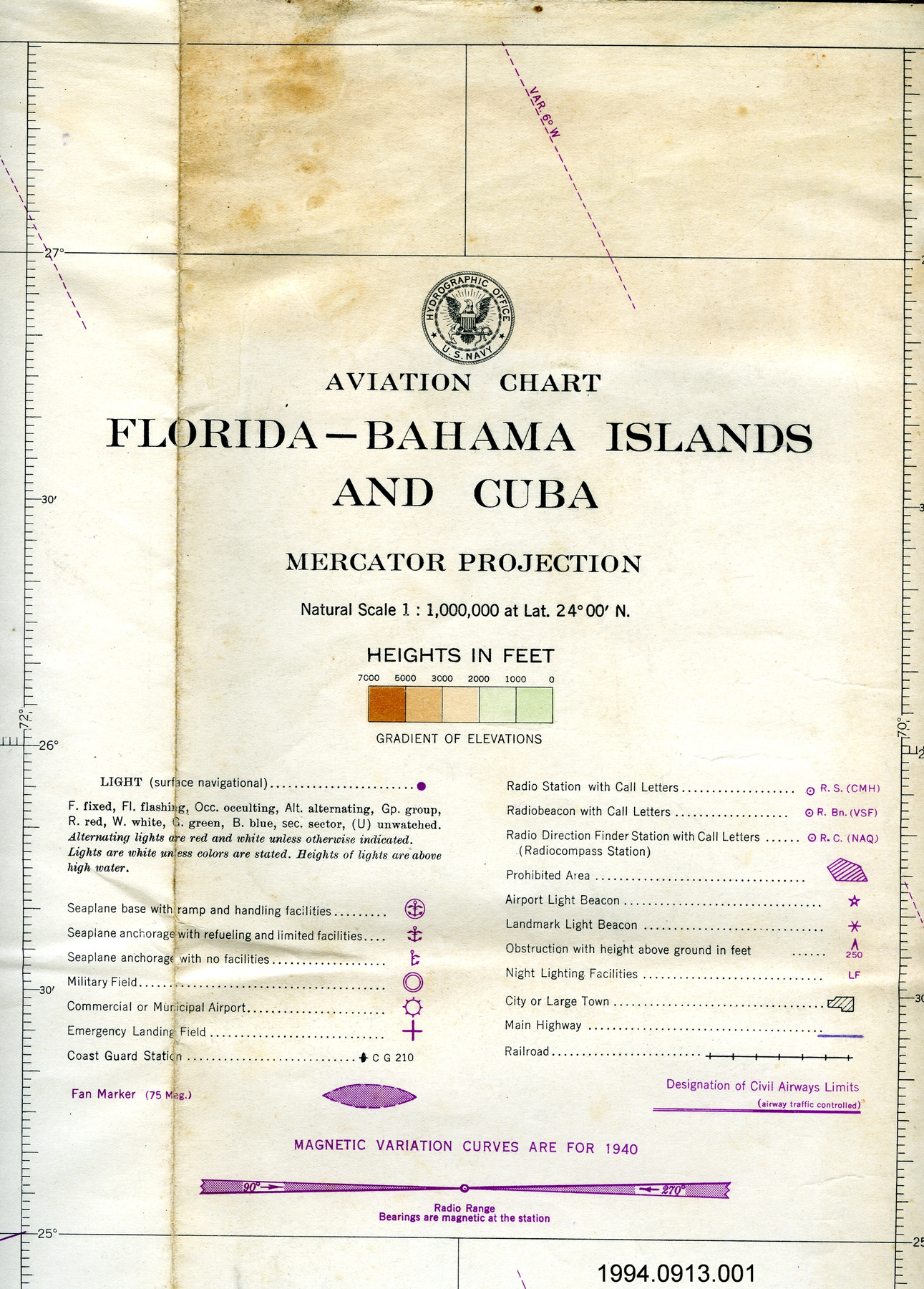
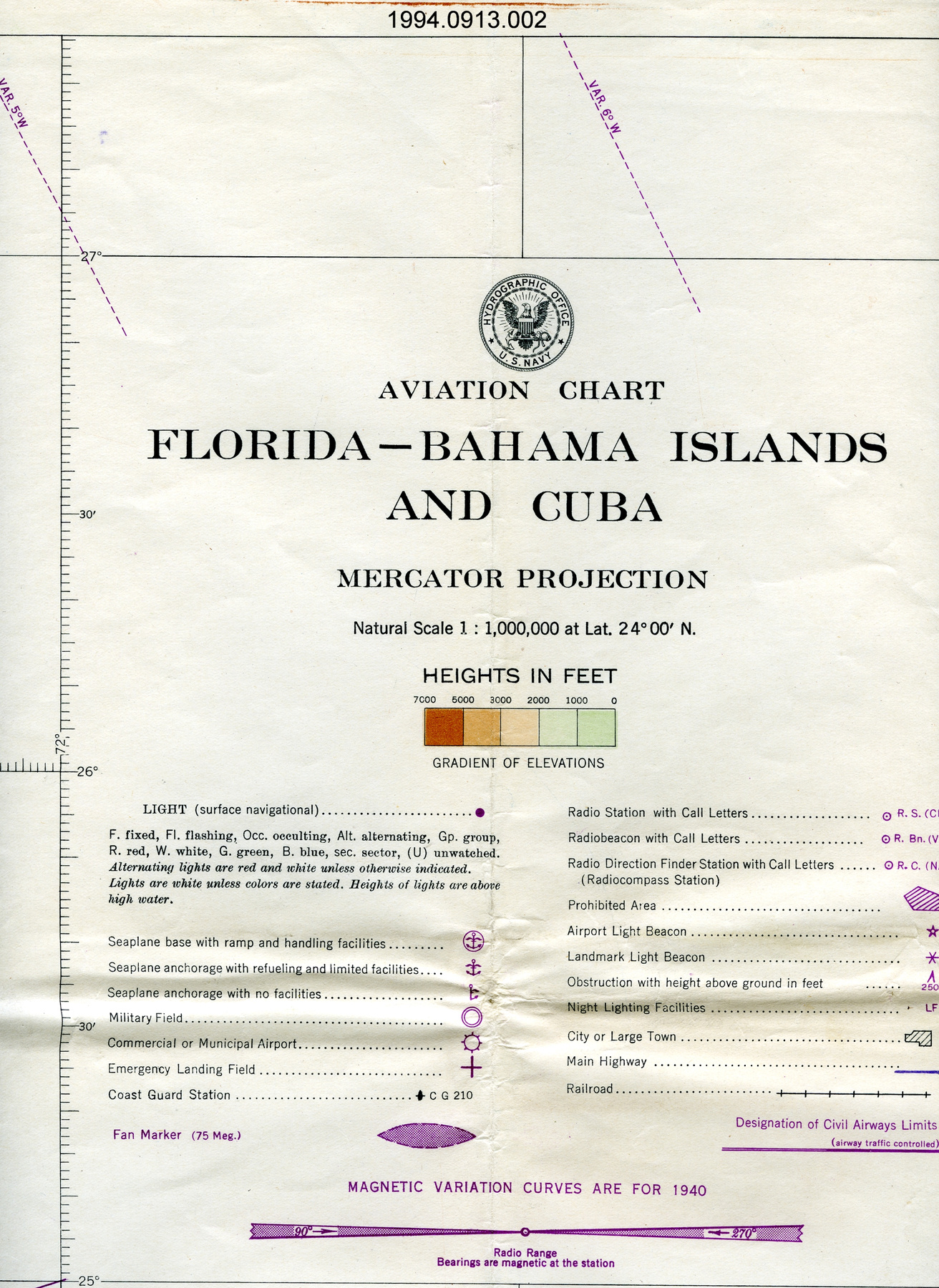
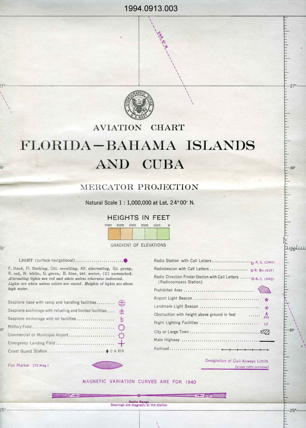
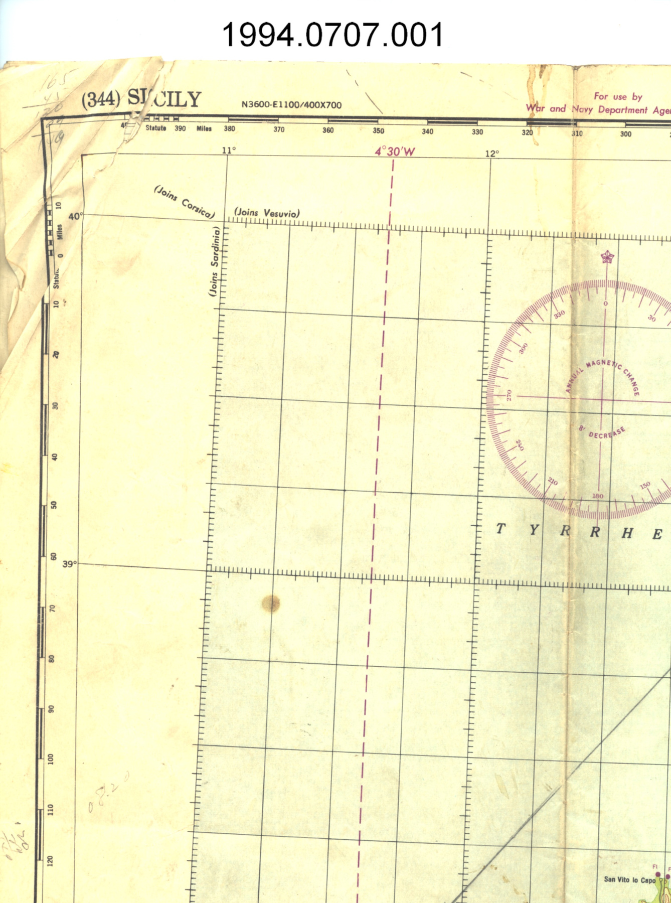
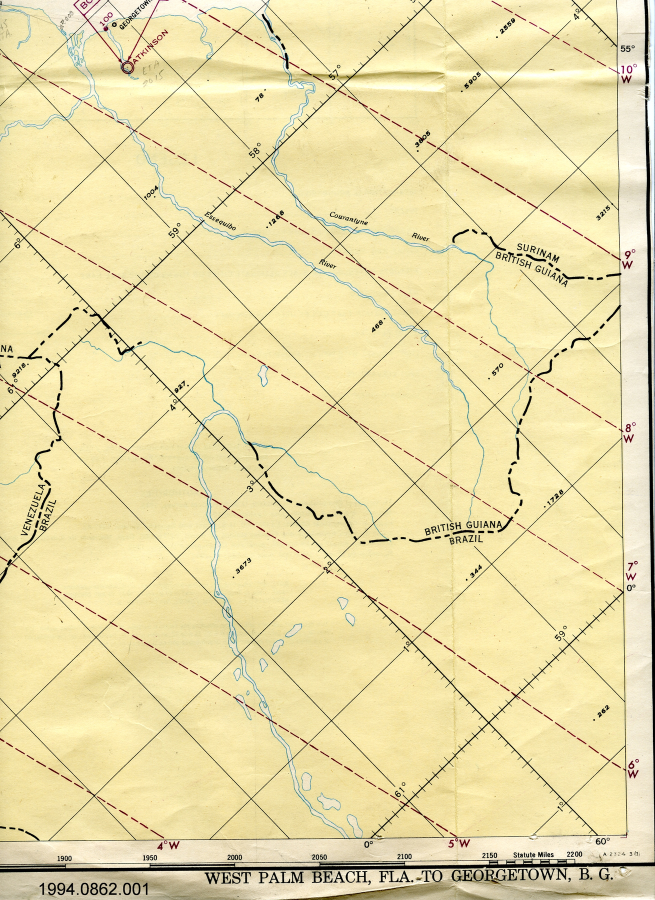
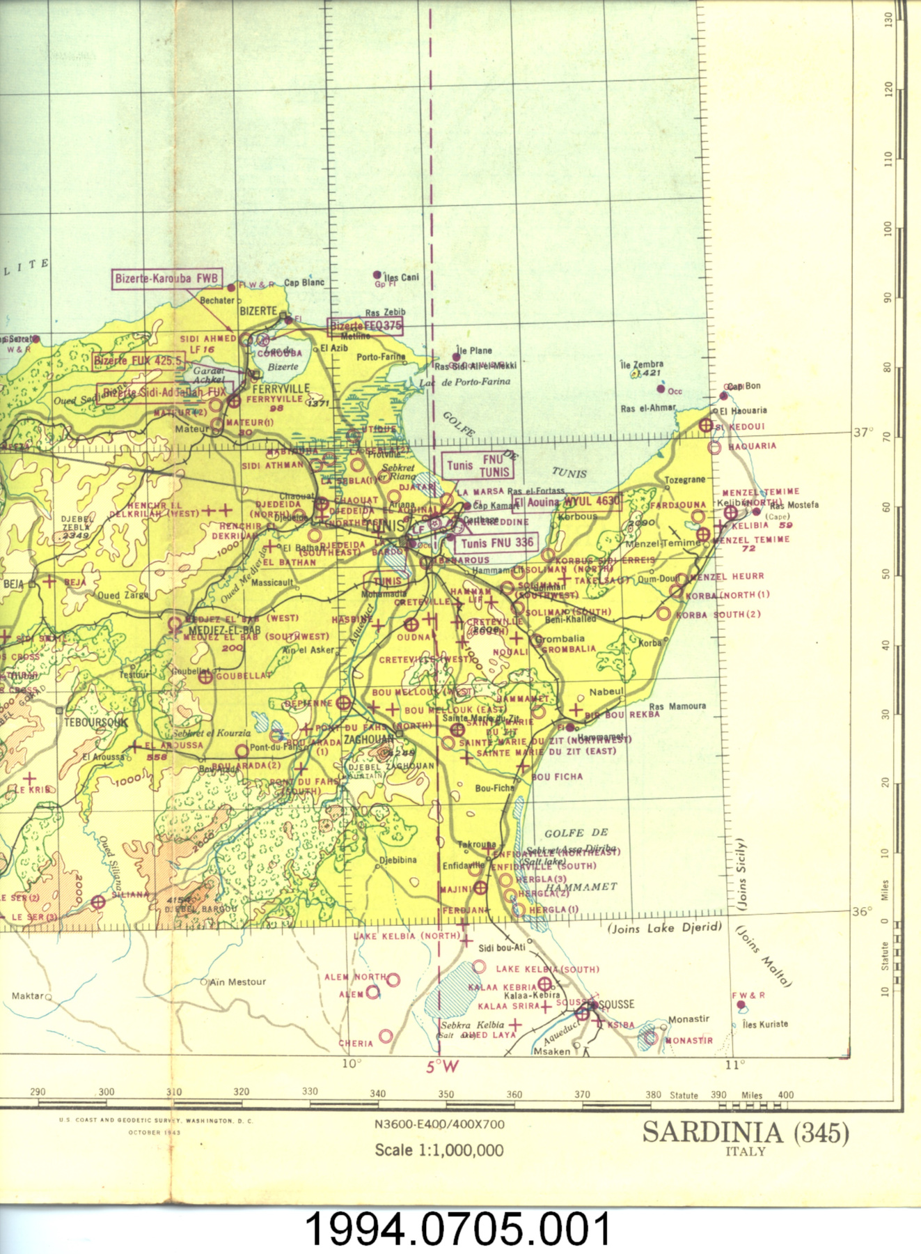
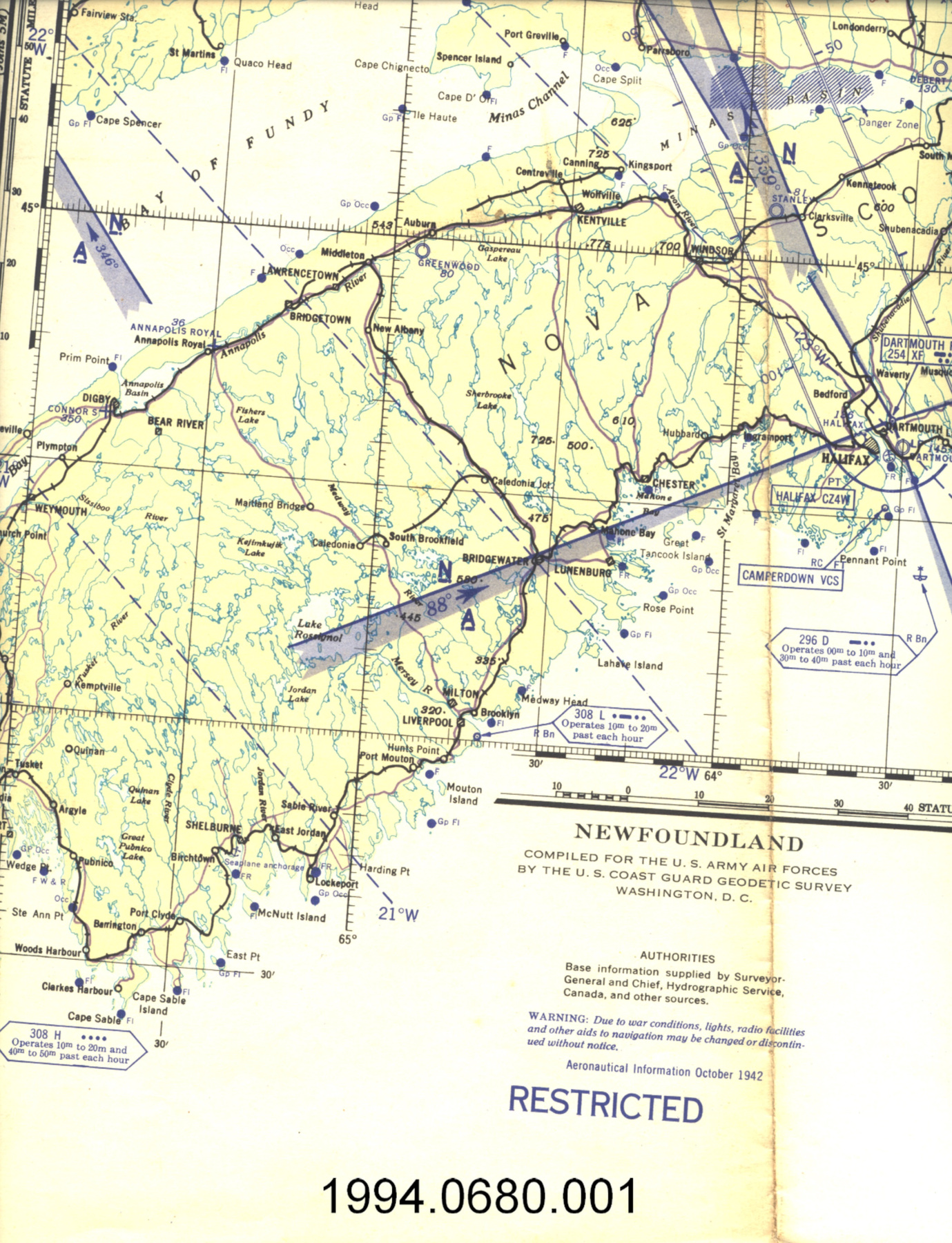
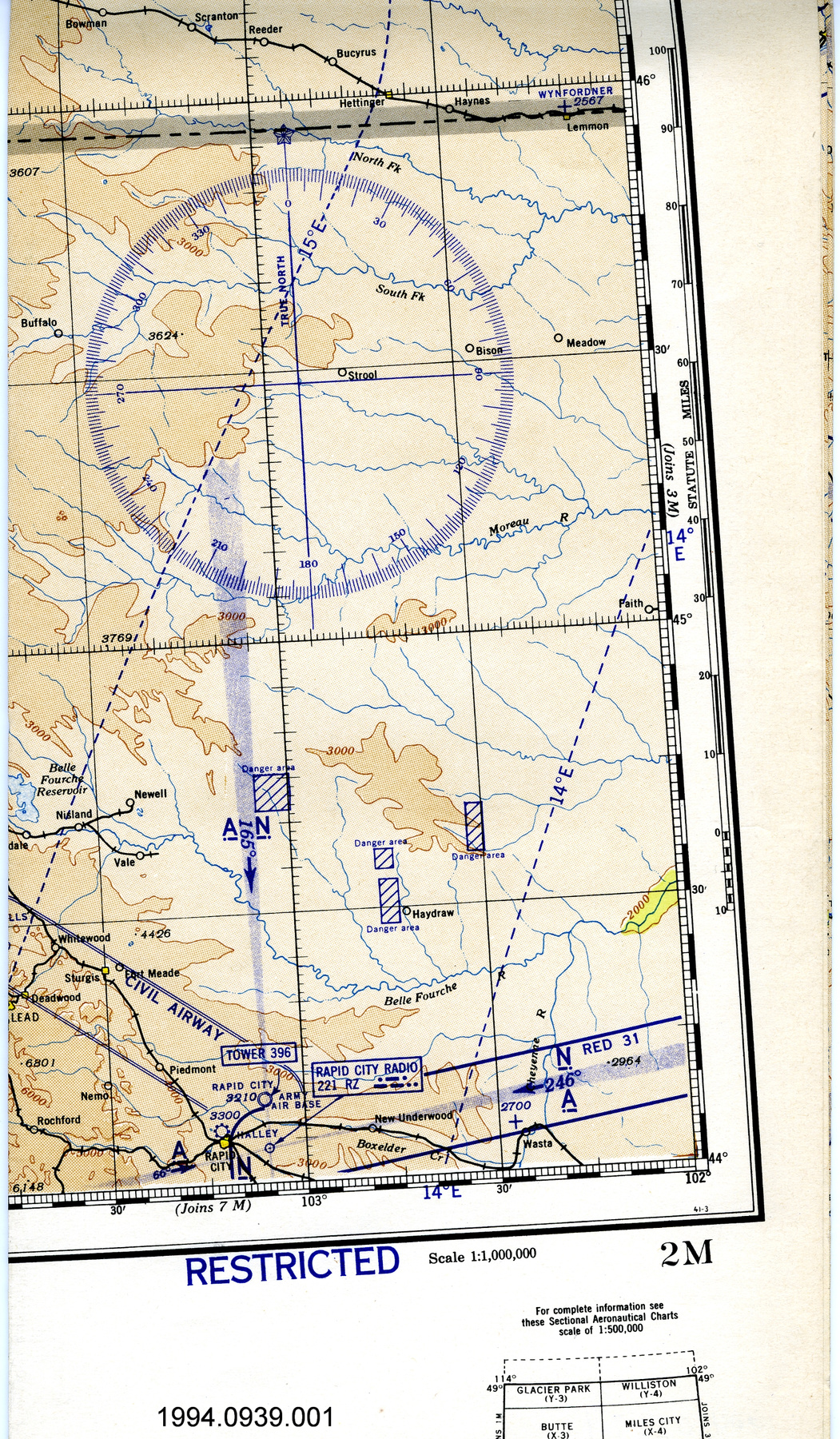
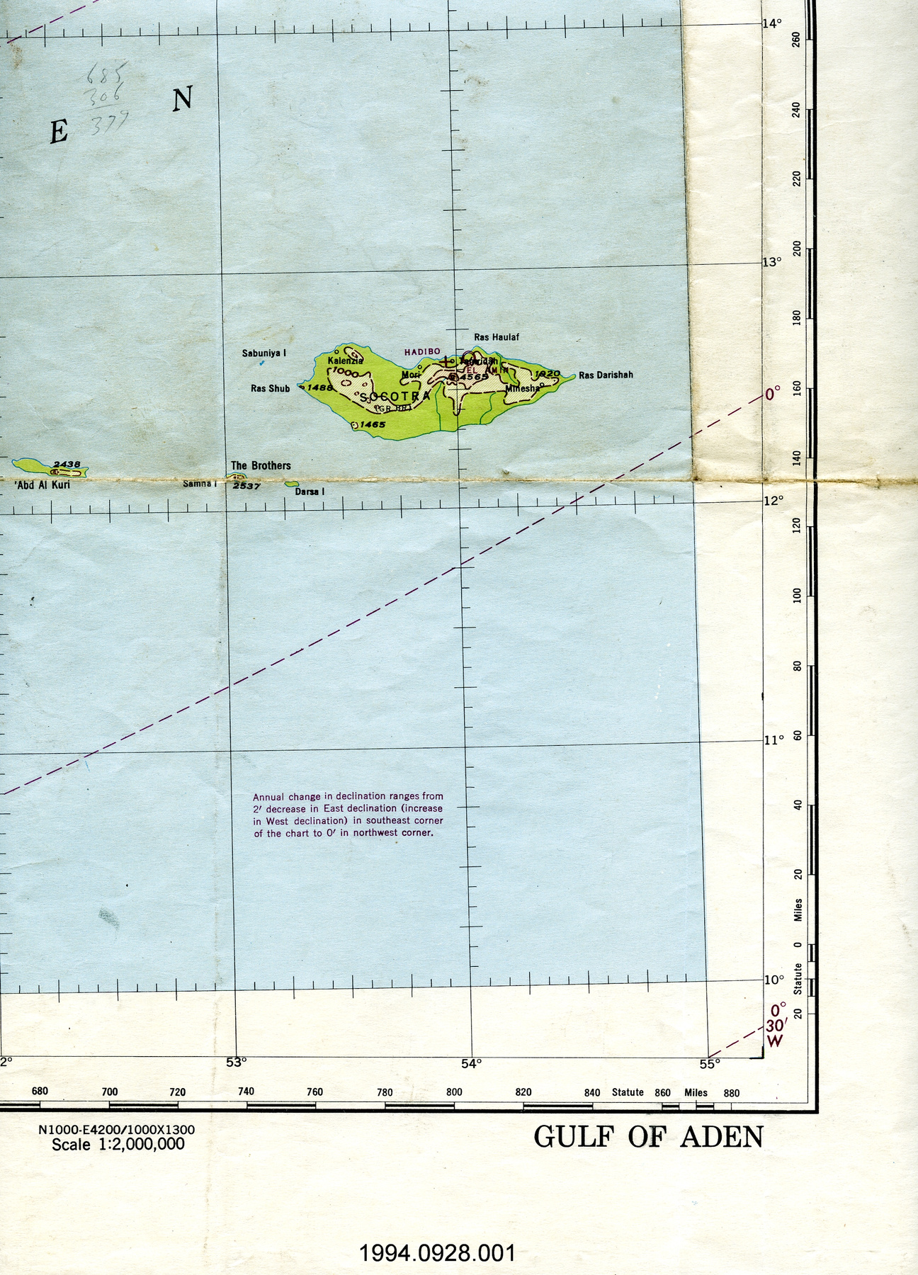
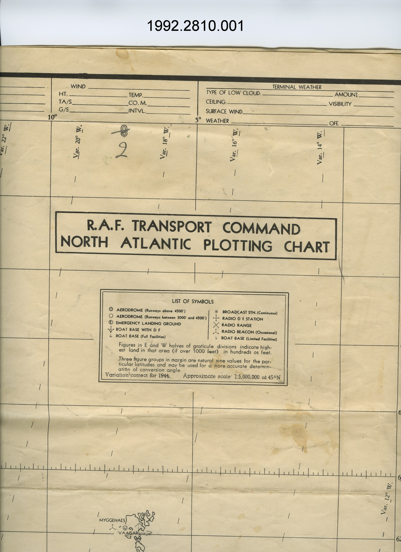
- OBJECT TYPE
- Marine navigational
- DATE
- 1951
- ARTIFACT NUMBER
- 1992.2878.001
- MANUFACTURER
- U.S. Navy Hydrographic Office
- MODEL
- Discovery Passage & Adjacent Waters
- LOCATION
- Washington, District of Columbia, United States of America
More Information
General Information
- Serial #
- N/A
- Part Number
- 1
- Total Parts
- 1
- AKA
- N/A
- Patents
- N/A
- General Description
- paper
Dimensions
Note: These reflect the general size for storage and are not necessarily representative of the object's true dimensions.
- Length
- 107.0 cm
- Width
- 76.6 cm
- Height
- N/A
- Thickness
- N/A
- Weight
- N/A
- Diameter
- N/A
- Volume
- N/A
Lexicon
- Group
- Aviation
- Category
- Navigation instruments & equipment
- Sub-Category
- N/A
Manufacturer
- AKA
- Defense US
- Country
- United States of America
- State/Province
- District of Columbia
- City
- Washington
Context
- Country
- Canada
- State/Province
- Unknown
- Period
- post WWII; this map dated April 1951
- Canada
-
Unknown - Function
-
2 dimensional graphic representation of a section of the earth's surface/ designed for marine navigation but likely used for aerial navigation - Technical
-
Unknown - Area Notes
-
Unknown
Details
- Markings
- lettering on logo reads: "HYDROGRAPHIC OFFICE/U.S. NAVY"; lettering on legend reads: "[logo]/NORTH AMERICA/CANADA/BRITISH COLUMBIA/DISCOVERY PASSAGE/AND ADJACENT WATERS/INCLUDING/TOBA, BUTE, AND LOUGHBOROUGH INLETS/From British surveys between 1860 and 1910/and Canadian surveys to 1925/SOUNDINGS IN FATHOMS/reduced approximately to the average level of Lowest Low Water in each calendar month/HEIGHTS IN FEET ABOVE HIGH WATER.....Natural Scale 1:149,705 at Lat. 50 [degrees] 20'/MERCATOR PROJECTION"; lettering along bottom below edge of map reads: "Small corrections/from Notices to Mariners:/from other sources.....Apr. '51/'50-48,52/Washington, D.C., published Feb. 1895 at the Hydrographic Office,/under the authority of the SECRETARY OF THE NAVY./New Publication: 36th Ed. Apr. 1931 36th EDITION, April 1931"; lettering ink stamped on border below map reads: "R.F. BOVEY LTD/530 Burrard St. - MA nne 0271/VANCOUVER, B.C."
- Missing
- N/A
- Finish
- b + w; gray; shallow water in light blue
- Decoration
- U.S. Navy Hydrographic Office logo at top of legend
CITE THIS OBJECT
If you choose to share our information about this collection object, please cite:
U.S. Navy Hydrographic Office, Map, 1951, Artifact no. 1992.2878, Ingenium – Canada’s Museums of Science and Innovation, http://collection.ingeniumcanada.org/en/id/1992.2878.001/
FEEDBACK
Submit a question or comment about this artifact.
More Like This

1992.2878.001