Map
Use this image
Can I reuse this image without permission? Yes
Object images on the Ingenium Collection’s portal have the following Creative Commons license:
Copyright Ingenium / CC BY-NC-ND (Attribution-NonCommercial 4.0 International (CC BY-NC 4.0)
ATTRIBUTE THIS IMAGE
Ingenium,
2014.0383.001
Permalink:
Ingenium is releasing this image under the Creative Commons licensing framework, and encourages downloading and reuse for non-commercial purposes. Please acknowledge Ingenium and cite the artifact number.
DOWNLOAD IMAGEPURCHASE THIS IMAGE
This image is free for non-commercial use.
For commercial use, please consult our Reproduction Fees and contact us to purchase the image.
- OBJECT TYPE
- N/A
- DATE
- Unknown
- ARTIFACT NUMBER
- 2014.0383.001
- MANUFACTURER
- National Film Board of Canada
- MODEL
- Canada - Western
- LOCATION
- Canada
More Information
General Information
- Serial #
- N/A
- Part Number
- 1
- Total Parts
- 1
- AKA
- N/A
- Patents
- N/A
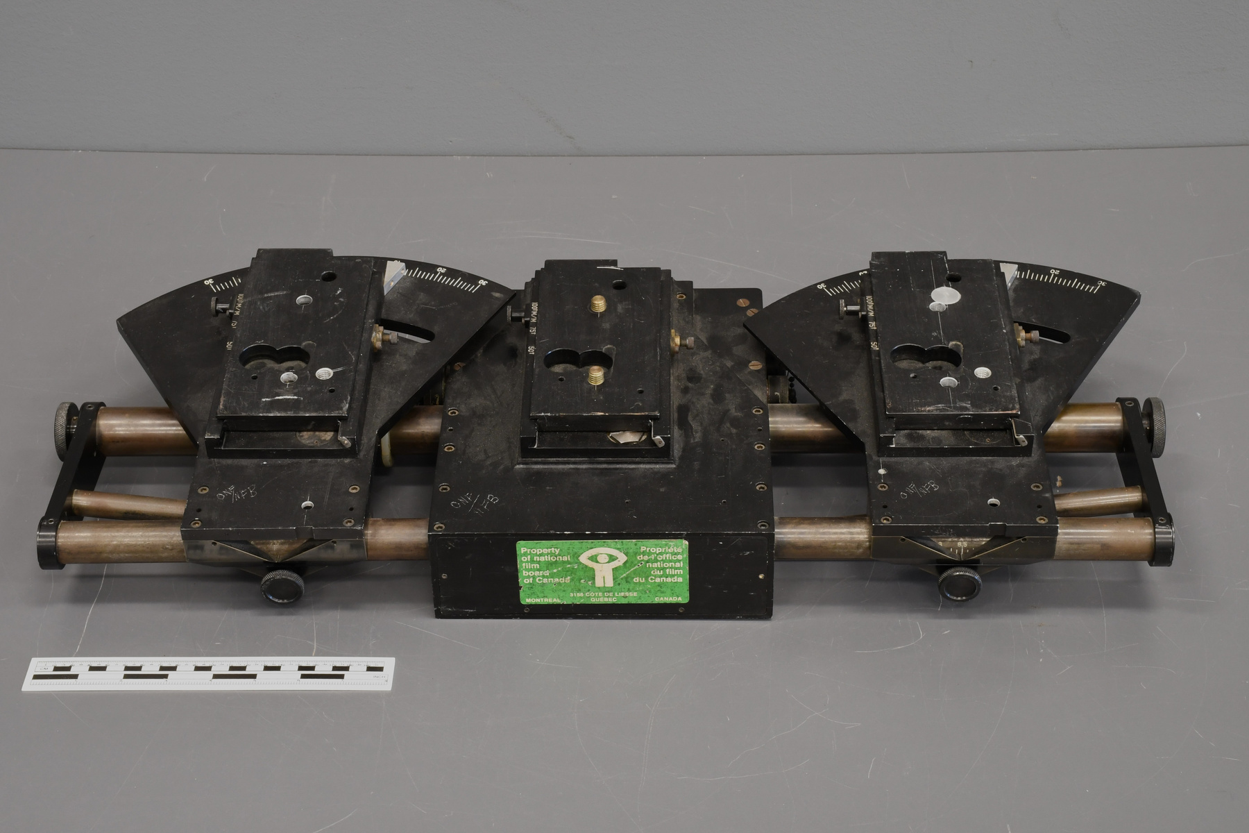
- General Description
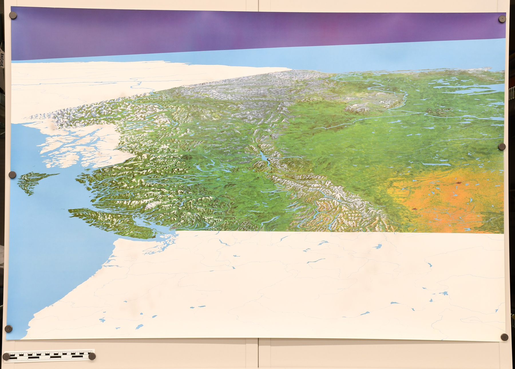
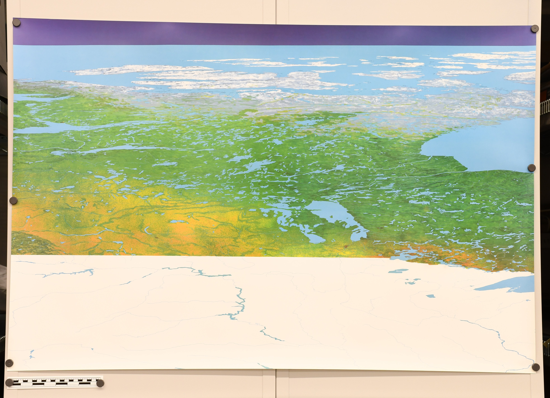
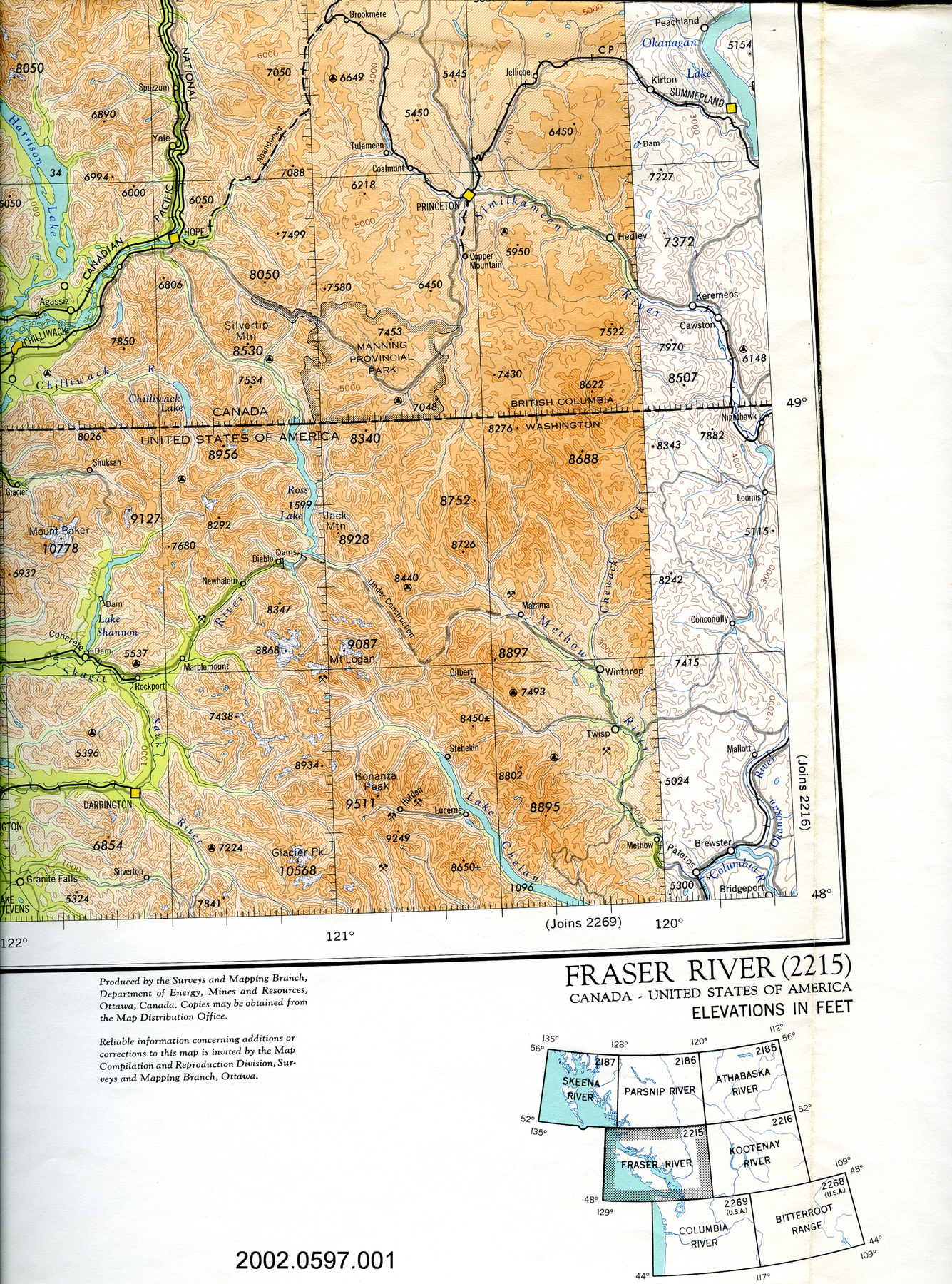
- Large paper map of Canada used as a teaching tool.
Dimensions
Note: These reflect the general size for storage and are not necessarily representative of the object's true dimensions.
- Length
- 76.0 cm
- Width
- 88.0 cm
- Height
- N/A
- Thickness
- N/A
- Weight
- N/A
- Diameter
- N/A
- Volume
- N/A
Lexicon
- Group
- Exploration and Survey
- Category
- Miscellaneous
- Sub-Category
- N/A
Manufacturer
- AKA
- NFB
- Country
- Canada
- State/Province
- Unknown
- City
- Unknown
Context
- Country
- Unknown
- State/Province
- Unknown
- Period
- Unused
- Canada
-
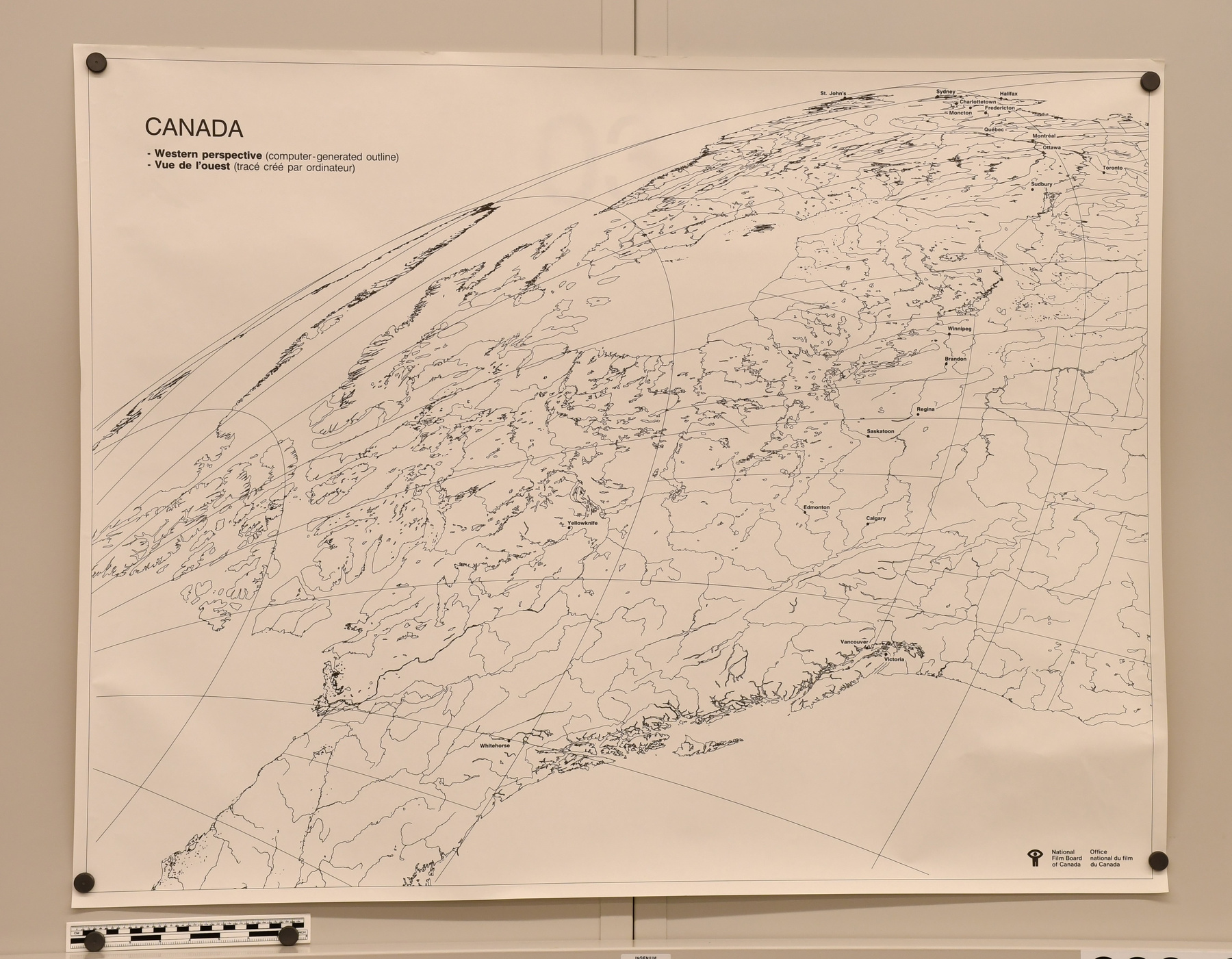
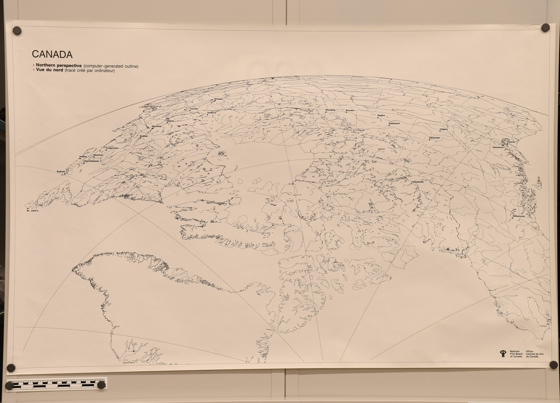
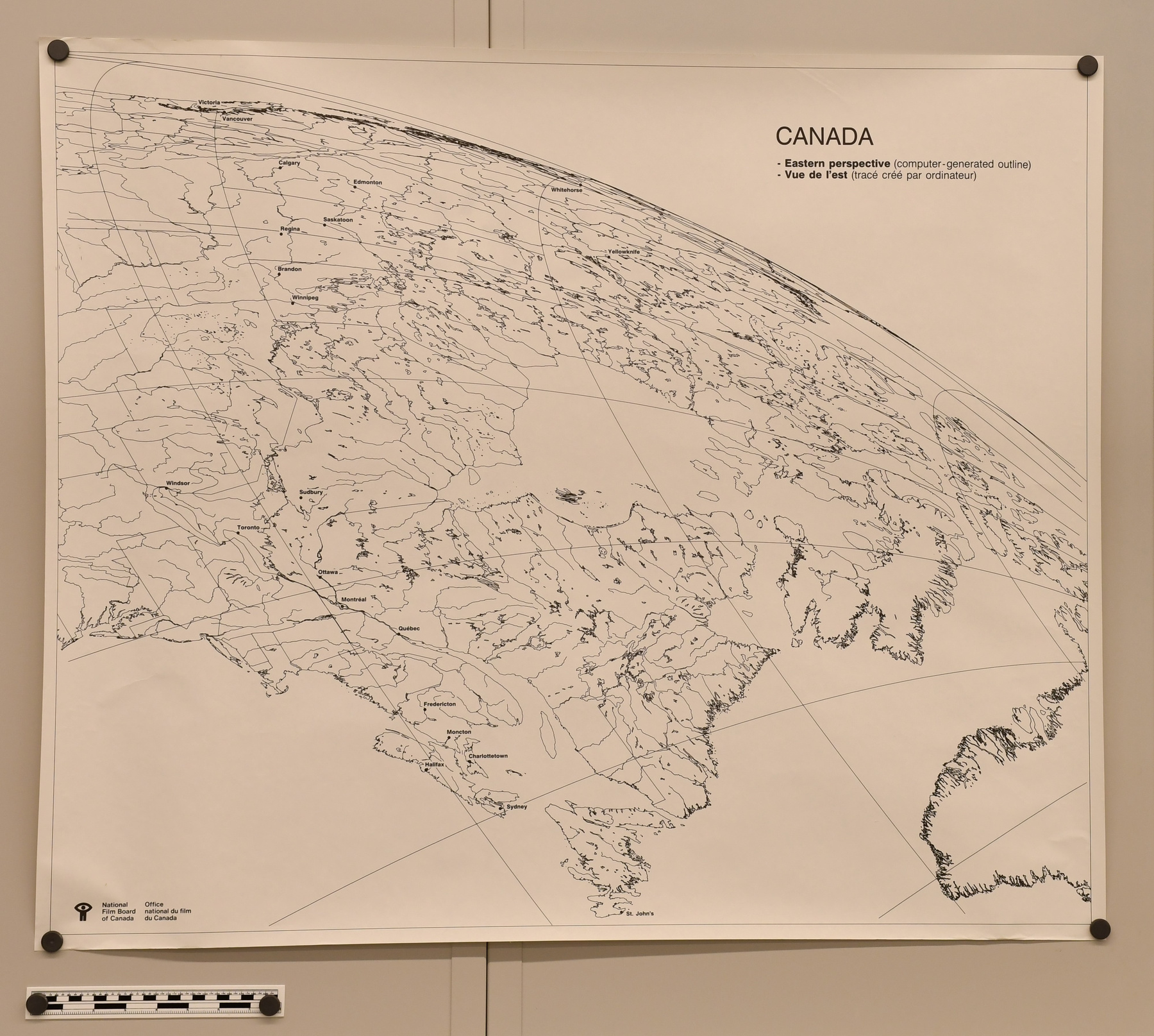
In 1978, Geoff Goodship, a teacher with the Campbell River School District in B.C., noticed that students found it difficult to imagine Canada’s size. Goodship believed that students would benefit from a map that was a photo-like image of the country as it would appear from outer space. He explained this idea to West Coast graphic artists Lorne and Ann Kask and together they produced the first design of the NFB map. The map was tested with students in the Campbell River School District and received favourable and positive responses. As a result, Goodship showed the map to Bruce Pilgrim and Mark Slade of the National Film Board Pacific Region and suggested that, “because of the NFB’s experience in producing visual material for educators, it would be fitting that the Board produce the map to complement use of NFB audiovisual products already widely used in schools.” (ref.1) The NFB Canada Map project was underway by 1978. The NFB asked Dr. T.K Poiker of Simon Fraser University, an authority on computerized cartography, to produce an outline of the map. With the support of Wayne Luscombe, a former SFU graduate student, the two plotted the map using two sets of computerized data containing over 700 000 points of reference for Canada’s coastlines, rivers, lakes and borders. En 1978, Geoff Goodship, un enseignant à l’école Campbell River en Colombie-Britannique remarque que ses étudiants avaient de la difficulté à imaginer l’immensité du Canada. Goodship croyait que ses élèves pourraient profiter d’une carte qui ressemblait à une image du pays capturé de l’espace. Il explique cette idée à l’artiste graphique Lorne et Ann Kask et ils ont rédigé la première version de cette carte. La carte a été introduite aux élèves de l’école Campbell River et a reçue des commentaires positifs. Par conséquent, Goodship a montré la carte à Bruce Pilgrim et Mark Slade qui travaillaient à l’Office national du film du Canada division pacifique. Il suggère qu’étant donné que l’Office a de l’expérience en production de matériel visuel pour les éducateurs, il serait raisonnable de penser que l’Office pourrait produire la carte pour complémenter les produits audio-visuels déjà utilisés dans les écoles. Le projet de la carte du Canada de l’ONF étant en démarche en 1978. L’ONF a demandé à Dr TK Poiker de l’université Simon Fraser, une autorité en matière de cartographie informatisée, pour produire la bordure de la carte. Avec l’appuie de Wayne Luscombe, un ancien étudiant à SFU, les deux ont conçu la carte en utilisant deux ensembles de données informatisées contenant plus de 700 000 points de référence pour les côtes, rivières, lacs et frontières canadiennes. - Function
-
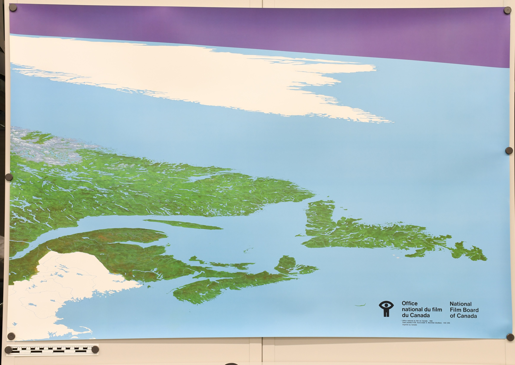
The NFB Canada Map is a teaching tool. Unlike conventional maps which emphasize borders, cities and relief, the NFB Canada Map depicts only the landforms, bodies of water, and vegetation of the country. Cette carte du Canada, produit par l'Office national du film du Canada est un outil d'apprentissage. Contrairement aux cartes conventionnelles qui met l'accent sur des frontières, des villes et relief, cette carte illustre seulement des éléments topographiques, des étendues d'eau et la végétation du pays. - Technical
-
“In plotting the NFB Canada Map, Dr. T. K. Poiker and his graduate student Waybe Luscombe of Simon Fraser University took advance of computer-ready data obtained from the U.S. government. The satellite data provided over 700 000 points of reference of Canada’s rivers, lakes, borders and coastlines. In the words of Poiker and Luscombe: “In order to represent all of Canada in a frame of 480 cm by 75 cm, we decided to create a special projection. This meant breaking traditional cartographic rules but this was done in a controlled way. A base projection was chosen, one by Mollweide, a German cartographer. Our main reason for this selection was that the Mollweide projection can be drawn with simple mathematical transformations of the coordinates. This is important with so many points to compute. Another reason was that the parallels are all horizontal and the scale along these parallels does not change. That makes it easy for users to do simple distance and location exercises. The scale of the map along east-west latitudes deviates from the Mollweide projection only slightly from the top of the map to the bottom. To calculate approximate distances in an east-west direction, one can use the scale of 1 cm of map distance being equivalent to 15 km of the earth’s surface. Because of the projective transformation, which causes north-south distances to diminish with increasing latitude, it is not possible to derive a constant scale factor applicable between all points on the map in the north-south direction.”(ref.1) Lors de la conception de la carte d’ONF, Dr T.K Poiker et son étudiant Wayne Luscombe de l’université Simon Fraser ont profités des données disponibles provenant du gouvernement américain. Les données satellite donnait 700 000 points de référence pour les côtes, rivières, lacs et frontière canadiennes. D’après Poiker et Luscombe : « Pour faire en sorte de représenter le Canada entier sur une toile de 480cm par 75 cm, ont a décidés de créer une projection spéciale. Ceci impliquait enfreindre les règles traditionnelles cartographiques mais ceci a été faite de façon contrôlée. La projection de base a été choisi par Mollweide, un cartographe allemand. La raison pour ce choix est que la projection Mollweide est désigné par de simple transformations des coordonnés. Ceci est important lorsqu’il y a plusieurs points à calculer. Ceci est aussi important étant donné que les parallèles sont tous horizontaux et l’échelle ne change pas. Par conséquent, cela fait en sorte que c’est plus facile pour des utilisateurs de faire des exercices d’emplacement de manière facile et simplifié. L’échelle de la carte sur la latitude est-ouest dévie moindrement de la projection Mollweide du haut de la carte au bas. Pour calculer certaines distances d’est en ouest, on peut utiliser l’échelle du un centimètre étant équivalent à 15 kilomètres de surface terrestre. Avec cette transformation de projection, qui fait en sorte que les distances nord-sud diminue avec plus de latitude, ce n’est pas possible pour dériver un facteur d’échelle constant applicable entre tous les points de la carte dans la direction nord-sud. » - Area Notes
-
Unknown
Details
- Markings
- On the top left corner of the map: " CANADA /. WESTERN PERSPECTIVE (COMPUTER-GENERATED OUTLINE) /. VUE DE L'OUEST (TRACÉ CRÉE PAR ORDINATEUR) " On the bottom right corner of the map: " NATIONAL /. FILM BOARD /. OF CANADA /. OFFICE /. NATIONAL DU FILM /. DU CANADA. "
- Missing
- Appears complete
- Finish
- White paper map with black lines and outlines. Carte en papier en noir et blanc.
- Decoration
- N/A
CITE THIS OBJECT
If you choose to share our information about this collection object, please cite:
National Film Board of Canada, Map, Unknown Date, Artifact no. 2014.0383, Ingenium – Canada’s Museums of Science and Innovation, http://collection.ingeniumcanada.org/en/id/2014.0383.001/
FEEDBACK
Submit a question or comment about this artifact.
More Like This


2014.0383.001